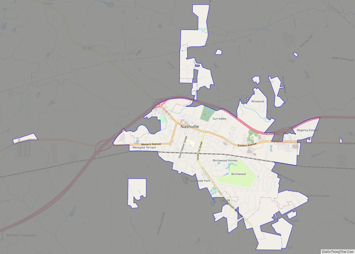
Nashville is a town in Nash County, North Carolina, United States. The town was founded in 1780 and features Victorian and Queen Anne style homes. It is part of the Rocky Mount, North Carolina Metropolitan Statistical Area. The population of Nashville was 5,632 in 2020. It is the county seat of Nash County. The town and its county were named for Francis Nash, an officer of the North Carolina militia who died in the American Revolutionary War.
| Name: | Nashville town |
|---|---|
| LSAD Code: | 43 |
| LSAD Description: | town (suffix) |
| State: | North Carolina |
| County: | Nash County |
| Elevation: | 187 ft (57 m) |
| Total Area: | 4.70 sq mi (12.17 km²) |
| Land Area: | 4.70 sq mi (12.16 km²) |
| Water Area: | 0.00 sq mi (0.01 km²) |
| Total Population: | 5,632 |
| Population Density: | 1,199.57/sq mi (463.12/km²) |
| ZIP code: | 27856 |
| Area code: | 252 |
| FIPS code: | 3746000 |
| GNISfeature ID: | 1021605 |
| Website: | www.townofnashville.com |
Online Interactive Map
Click on ![]() to view map in "full screen" mode.
to view map in "full screen" mode.
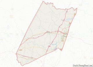
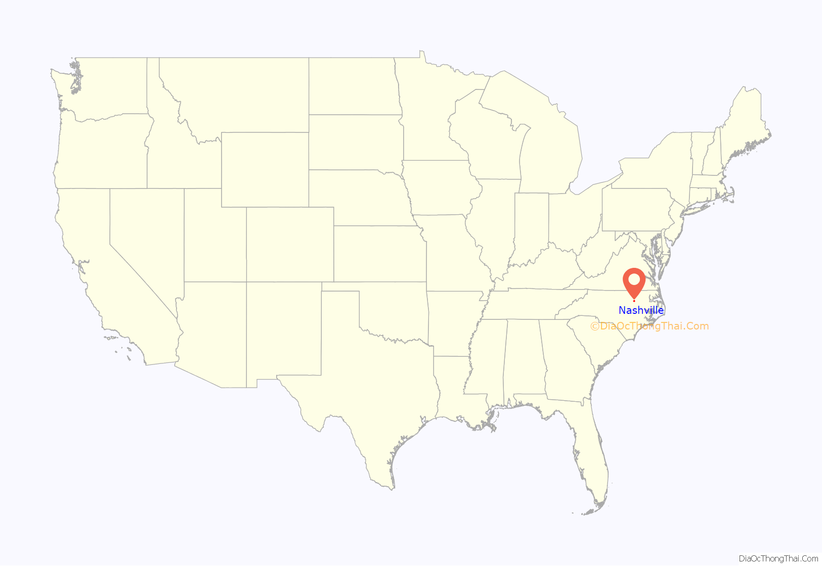
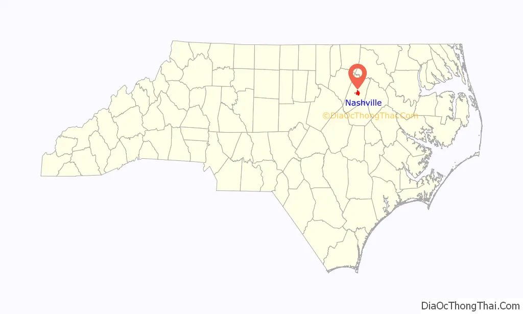
Nashville location map. Where is Nashville town?
History
The Bissette-Cooley House, Nash County Courthouse, Nashville Historic District, and Rose Hill are listed on the National Register of Historic Places.
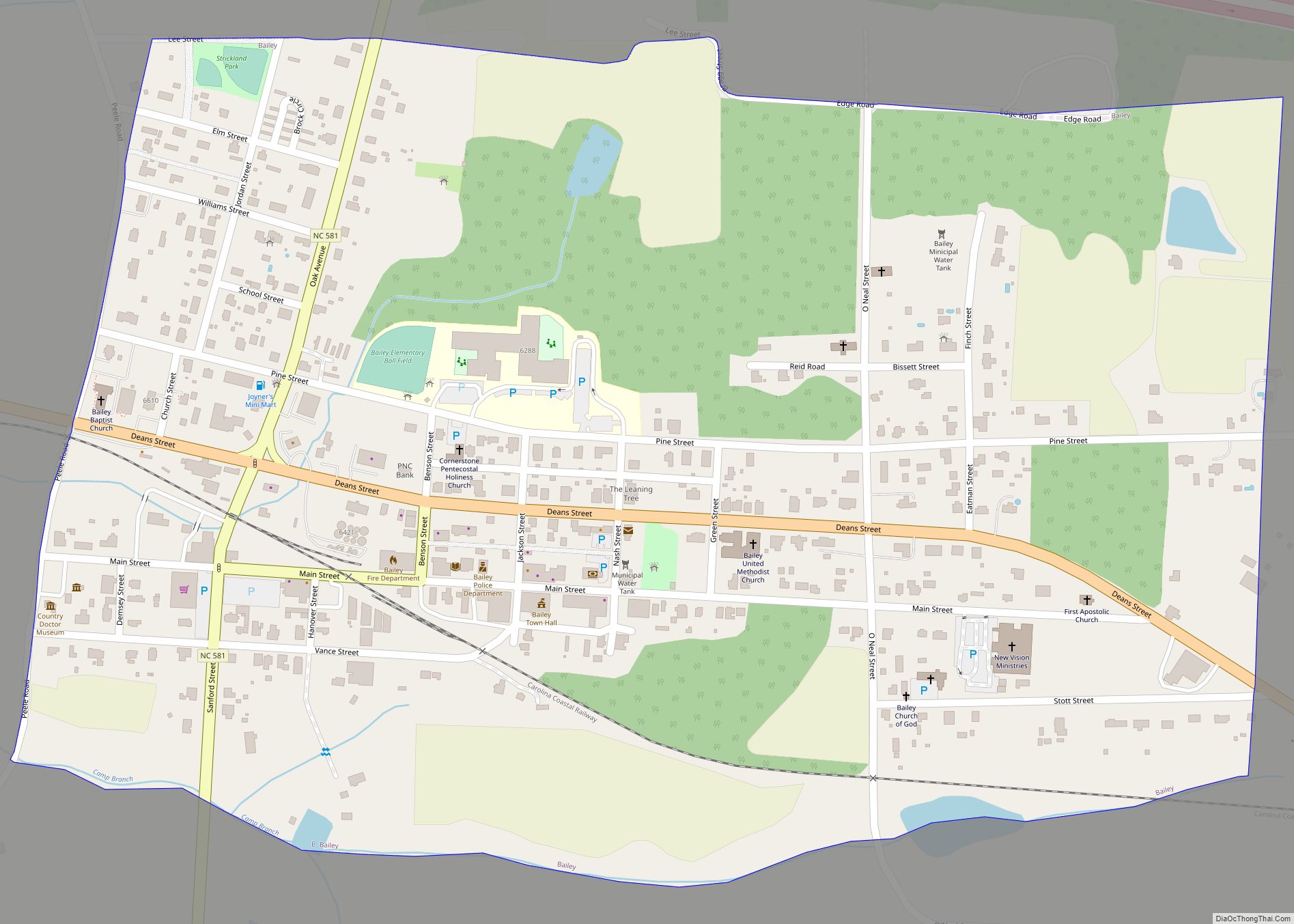
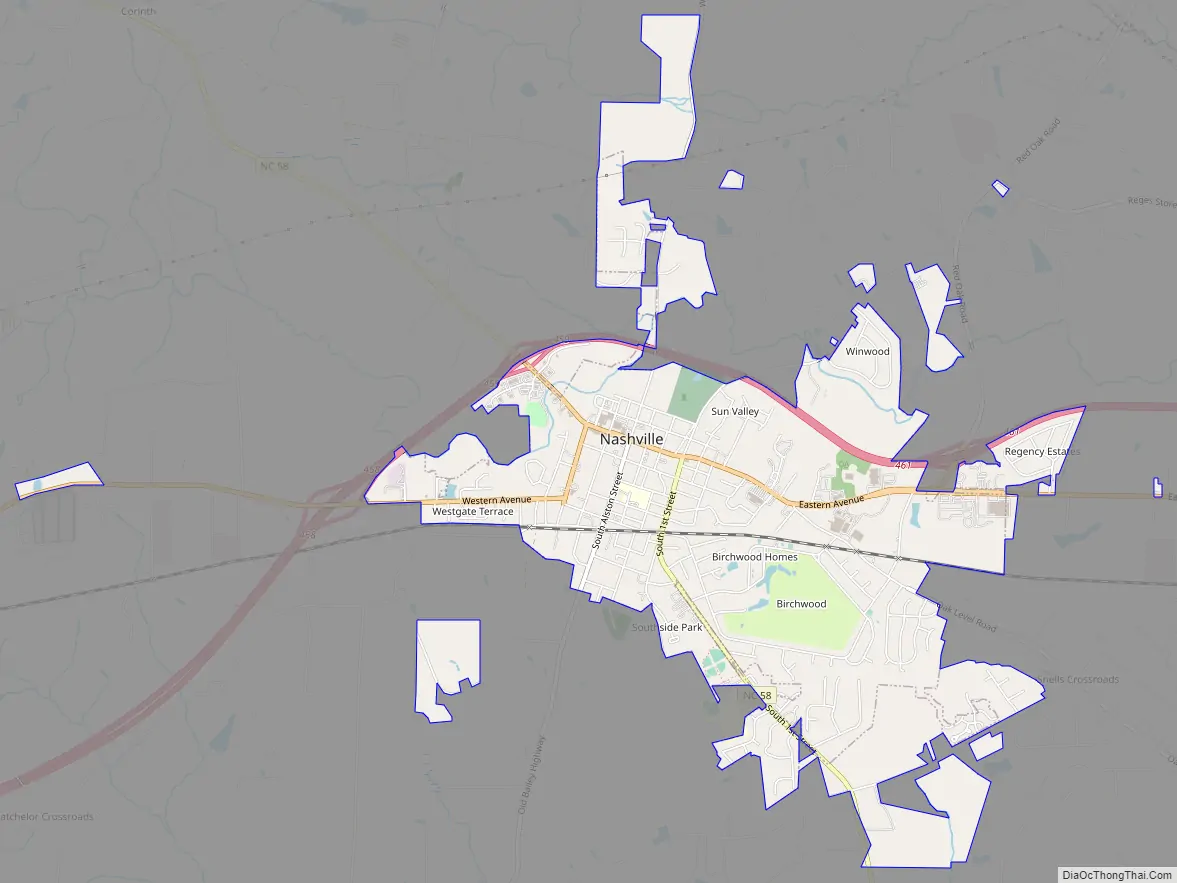
Nashville Road Map
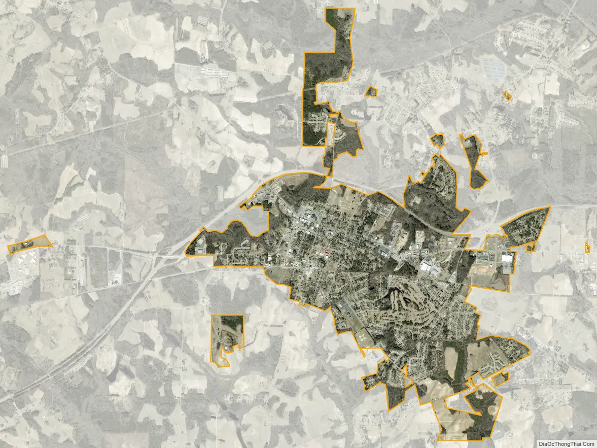
Nashville city Satellite Map
Geography
According to the United States Census Bureau, the town has a total area of 3.0 square miles (7.8 km), all of it land.
See also
Map of North Carolina State and its subdivision:- Alamance
- Alexander
- Alleghany
- Anson
- Ashe
- Avery
- Beaufort
- Bertie
- Bladen
- Brunswick
- Buncombe
- Burke
- Cabarrus
- Caldwell
- Camden
- Carteret
- Caswell
- Catawba
- Chatham
- Cherokee
- Chowan
- Clay
- Cleveland
- Columbus
- Craven
- Cumberland
- Currituck
- Dare
- Davidson
- Davie
- Duplin
- Durham
- Edgecombe
- Forsyth
- Franklin
- Gaston
- Gates
- Graham
- Granville
- Greene
- Guilford
- Halifax
- Harnett
- Haywood
- Henderson
- Hertford
- Hoke
- Hyde
- Iredell
- Jackson
- Johnston
- Jones
- Lee
- Lenoir
- Lincoln
- Macon
- Madison
- Martin
- McDowell
- Mecklenburg
- Mitchell
- Montgomery
- Moore
- Nash
- New Hanover
- Northampton
- Onslow
- Orange
- Pamlico
- Pasquotank
- Pender
- Perquimans
- Person
- Pitt
- Polk
- Randolph
- Richmond
- Robeson
- Rockingham
- Rowan
- Rutherford
- Sampson
- Scotland
- Stanly
- Stokes
- Surry
- Swain
- Transylvania
- Tyrrell
- Union
- Vance
- Wake
- Warren
- Washington
- Watauga
- Wayne
- Wilkes
- Wilson
- Yadkin
- Yancey
- Alabama
- Alaska
- Arizona
- Arkansas
- California
- Colorado
- Connecticut
- Delaware
- District of Columbia
- Florida
- Georgia
- Hawaii
- Idaho
- Illinois
- Indiana
- Iowa
- Kansas
- Kentucky
- Louisiana
- Maine
- Maryland
- Massachusetts
- Michigan
- Minnesota
- Mississippi
- Missouri
- Montana
- Nebraska
- Nevada
- New Hampshire
- New Jersey
- New Mexico
- New York
- North Carolina
- North Dakota
- Ohio
- Oklahoma
- Oregon
- Pennsylvania
- Rhode Island
- South Carolina
- South Dakota
- Tennessee
- Texas
- Utah
- Vermont
- Virginia
- Washington
- West Virginia
- Wisconsin
- Wyoming