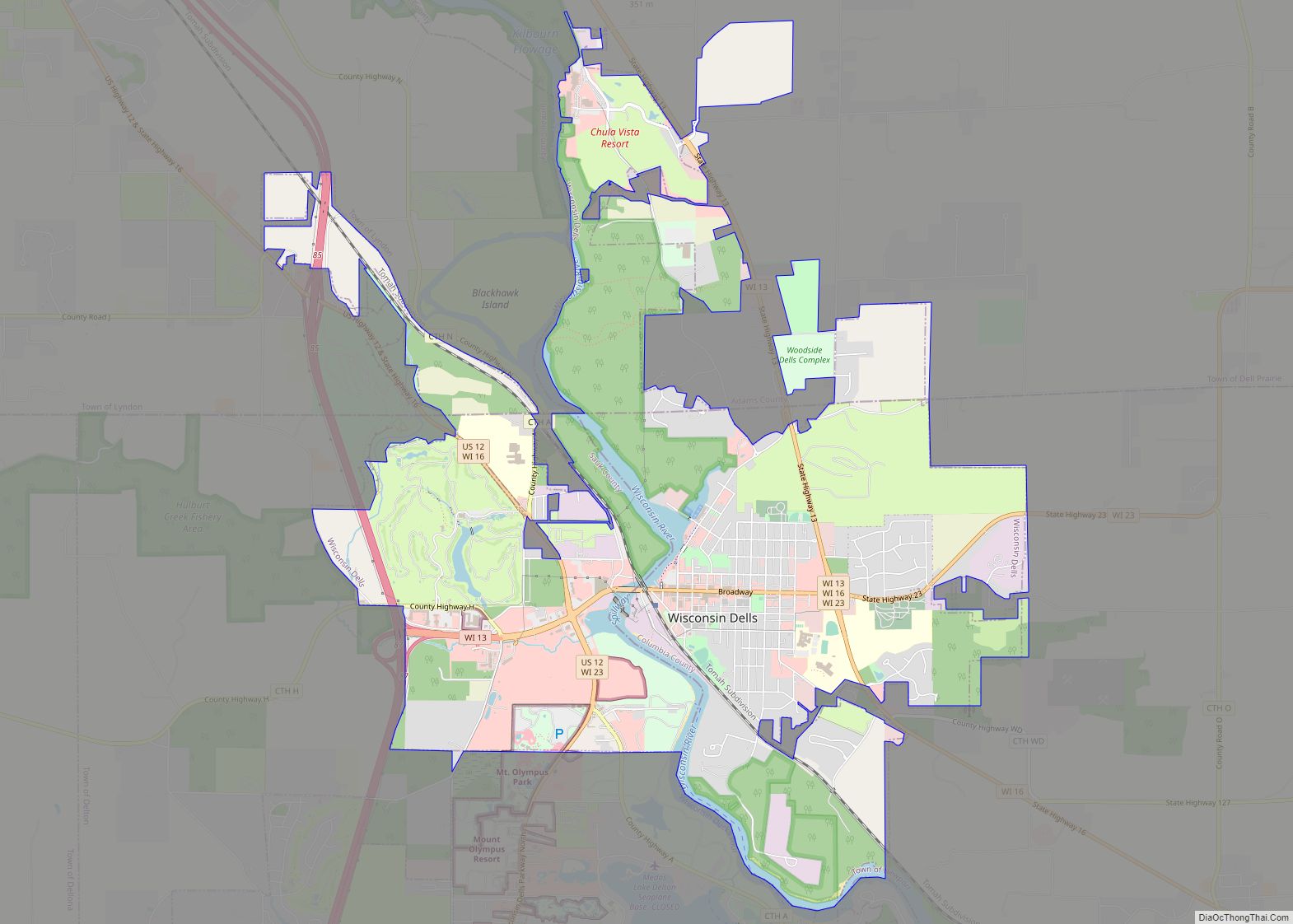
Map of Accoville CDP
Accoville is an unincorporated community and census-designated place (CDP) in Logan County, West Virginia, United States. The community lies along Buffalo Creek. As of the 2010 United States Census, its population was 574. Accoville CDP overview: Name: Accoville CDP LSAD Code: 57 LSAD Description: CDP (suffix) State: West Virginia County: Logan County Elevation: 830 ft (250 m) ... Read more
Map of Accoville CDP
Map of Aurora CDP, West Virginia
Aurora is an unincorporated community and census-designated place in southeastern Preston County, West Virginia, United States. As of the 2010 census, its population was 201. Aurora is located on U.S. Route 50 between the Maryland state line and the town of Rowlesburg. Cathedral State Park is located to the east of Aurora’s post office. Aurora ... Read more
Map of Aurora CDP, West Virginia
Map of Auburn town, West Virginia
Auburn is a town in Ritchie County, West Virginia, United States. The population was 80 at the 2020 census. Auburn town overview: Name: Auburn town LSAD Code: 43 LSAD Description: town (suffix) State: West Virginia County: Ritchie County Elevation: 827 ft (252 m) Total Area: 0.34 sq mi (0.87 km²) Land Area: 0.34 sq mi (0.87 km²) Water Area: 0.00 sq mi (0.00 km²) Total Population: ... Read more
Map of Auburn town, West Virginia
Map of Athens town, West Virginia
Athens is a town in Mercer County, West Virginia, United States. The population was 944 at the 2020 census. It is part of the Bluefield, WV-VA micropolitan area which has a population of 107,578. Athens is the home of Concord University. Athens town overview: Name: Athens town LSAD Code: 43 LSAD Description: town (suffix) State: ... Read more
Map of Athens town, West Virginia
Map of Ansted town
Ansted is a town in Fayette County in the U.S. state of West Virginia. The population was 1,404 at the 2010 census. It is situated on high bluffs along U.S. Route 60 on a portion of the Midland Trail a National Scenic Byway near Hawks Nest overlooking the New River far below. Ansted town overview: ... Read more
Map of Ansted town
Map of Anmoore town
Anmoore is a town in Harrison County, West Virginia, United States. It is located at the intersection of WV 58 and Interstate 79. The population was 514 at the 2020 census. The town derives its name from nearby Ann Moore Run. Anmoore town overview: Name: Anmoore town LSAD Code: 43 LSAD Description: town (suffix) State: ... Read more
Map of Anmoore town
Map of Anawalt town
Anawalt is a town in McDowell County, West Virginia, United States. At one time it was known as Jeanette. It is named in honor of James White Anawalt, who was then manager of Union Supply Company, a subsidiary of the United States Steel Company. The population was 186 at the 2020 census. Coal mining was ... Read more
Map of Anawalt town
Map of Amherstdale CDP
Amherstdale is a census-designated place (CDP) in Logan County, West Virginia, United States, situated along Buffalo Creek. The CDP includes the unincorporated communities of Amherstdale, Becco, Fanco, and Braeholm. The CDP population was 350 as of the 2010 census. Prior to 2010, Amherstdale was part of the Amherstdale-Robinette CDP. Amherstdale has a post office with ... Read more
Map of Amherstdale CDP
Map of Alum Creek CDP
Alum Creek is a census-designated place (CDP) in Kanawha and Lincoln counties along the Coal River in the U.S. state of West Virginia. It includes the unincorporated communities of Alum Creek, Forks of Coal, and Priestley. The CDP had a population of 1,749 at the 2010 census, down from 1,839 at the 2000 census. The ... Read more
Map of Alum Creek CDP
Map of Bartley CDP, West Virginia
Bartley is a census-designated place (CDP) located in McDowell County, West Virginia, United States. It lies along the Norfolk and Western Railroad on the Dry Fork. As of the 2010 census, its population was 224. According to the Geographic Names Information System, Bartley has also been known as Bartlett and Peeryville. Bartley CDP overview: Name: ... Read more
Map of Bartley CDP, West Virginia
Map of Barrackville town
Barrackville is a town in Marion County, West Virginia, United States. The population was 1,211 at the 2020 census. Barrackville was settled beginning in 1767 by William Galloway “Indian Billy” Ice. The town was named in honor of John Barrack, an early settler. It was incorporated January 25, 1968. Barrackville town overview: Name: Barrackville town ... Read more
Map of Barrackville town
Map of Berwind CDP
Berwind is a town on the Dry Fork in McDowell County, West Virginia, United States. As of the 2010 census, its population is 278. The town is named for Edward Julius Berwind, owner of the Berwind Company, and was originally a company town. It was later incorporated in 1905. Berwind is the hometown of Vern ... Read more
Map of Berwind CDP