Beverly is a town in Randolph County, West Virginia, United States. Founded in 1787, it is the oldest settlement in the Tygart River Valley. It had a population of 628 at the 2020 census. Beverly was the county seat of Randolph County for over a century—from 1790 until 1899—after which the nearby settlement of Elkins assumed that role following an intense local political “war”.
| Name: | Beverly town |
|---|---|
| LSAD Code: | 43 |
| LSAD Description: | town (suffix) |
| State: | West Virginia |
| County: | Randolph County |
| Elevation: | 1,962 ft (598 m) |
| Total Area: | 0.44 sq mi (1.14 km²) |
| Land Area: | 0.44 sq mi (1.14 km²) |
| Water Area: | 0.00 sq mi (0.00 km²) |
| Total Population: | 628 |
| Population Density: | 1,517.08/sq mi (585.65/km²) |
| ZIP code: | 26253 |
| Area code: | 304 |
| FIPS code: | 5406988 |
| GNISfeature ID: | 1553884 |
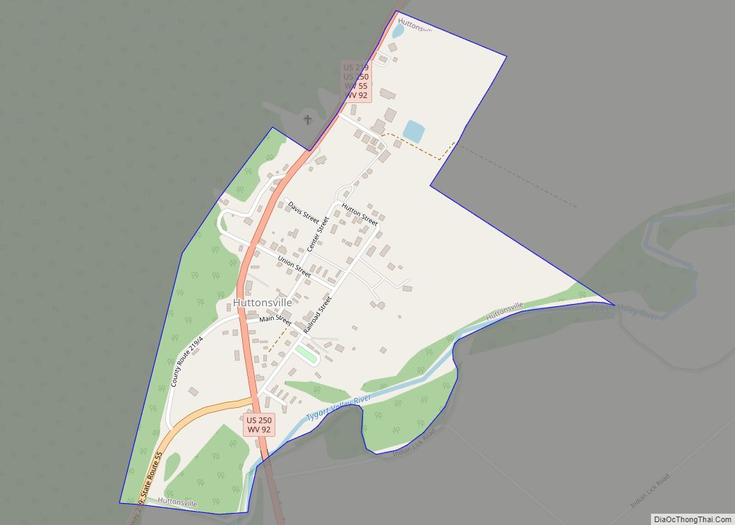
Online Interactive Map
Click on ![]() to view map in "full screen" mode.
to view map in "full screen" mode.
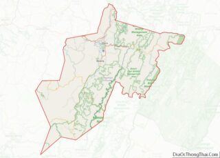
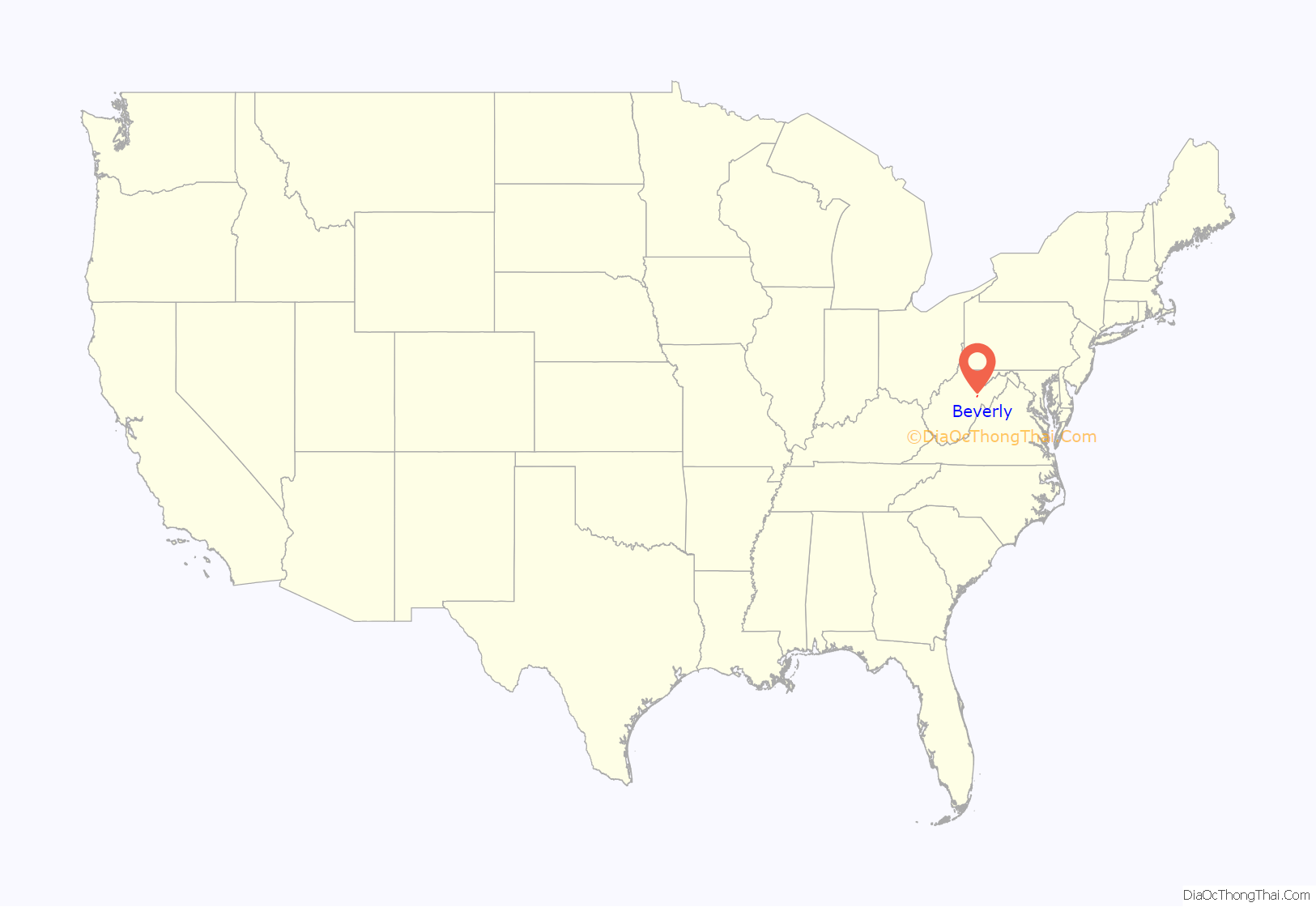
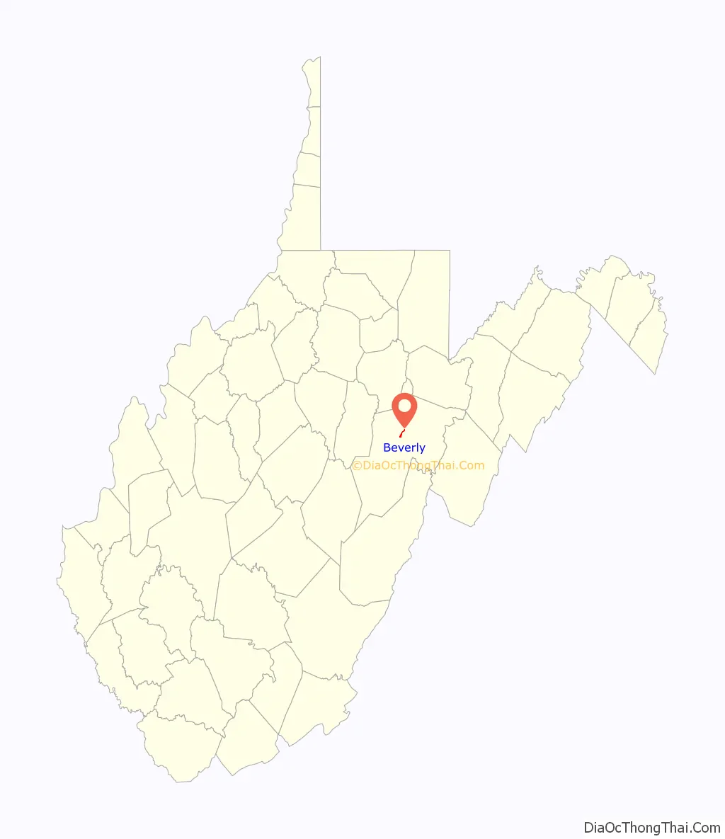
Beverly location map. Where is Beverly town?
History
The first white settlers in the area that would become Beverly (and in fact in the whole of the Tygart Valley) arrived in 1753 when David Tygart (for whom the valley and river are named) and Robert Files (or Foyle) established cabins at separate choice spots. Although there had been no recent history of conflicts between whites and Indians in that immediate area, that summer a party of Indians traveling the Shawnee Trail discovered the Files cabin and killed seven members of the family. One son escaped and alerted the Tygart family, allowing all to escape. Thereafter, no other white settlement was attempted in present Randolph County until 1772.
On May 29, 1787, officers of the newly established Randolph County authorized local settler and landowner James Westfall, Sr (1747–1800) to plat out a town to accommodate a new county seat. The settlement was at first named Edmundton to further honor the namesake of the new county—Virginia Governor Edmund Randolph. In December 1790, however, the Virginia General Assembly officially established the town as “Beverley”. By this time, Randolph’s first cousin (once removed), Beverley Randolph, was governor and the town was accordingly renamed for him. (Apparently, without discussion, the third “e” was soon dropped from the name, and “Beverly” has been the conventional spelling ever since.)
The Assembly directed the citizens to erect “a dwelling house sixteen feet square with a brick or stone chimney.” The first houses, along with a courthouse, jail, and school, were all of the characteristic single-pen log structure. Randolph County was at this time much larger than today, encompassing all of present-day Tucker County, and parts of present-day Preston, Barbour, Upshur, Lewis, Braxton, Nicholas, Webster, and Pocahontas Counties.
Jacob Westfall (1761–1801), first cousin once removed of James Westfall, received permission in 1794 to erect a sawmill near the town. Soon frame houses had joined the original log structures. After the Staunton-Parkersburg Turnpike arrived (1841), the town developed rapidly as a regional center for transportation and trading. Both sides occupied Beverly at various times during the American Civil War (1861–65) and various buildings were pressed into service as hospitals or quarters. In January 1865 Confederate General Thomas L. Rosser took 300 men, crossed the Allegheny Mountains to Beverly in deep snow and bitter cold and surprised and captured two Union infantry regiments in their works there. Some 580 prisoners were taken. (Most of the men in Rosser’s command were recruits from [West] Virginia.) Rosser’s troops partially burnt the Beverly Covered Bridge (built 1846–47), the earliest of Lemuel Chenoweth’s celebrated wooden covered bridges, but Chenoweth rebuilt it in 1872 and ’73.
Beverly lost its preeminence as county seat in 1899 to the rapidly developing railroad and timbering center of Elkins. In 1980 the entire town was entered on the National Register of Historic Places as a historic district. Today, a number of Beverly’s more historic structures have been restored.
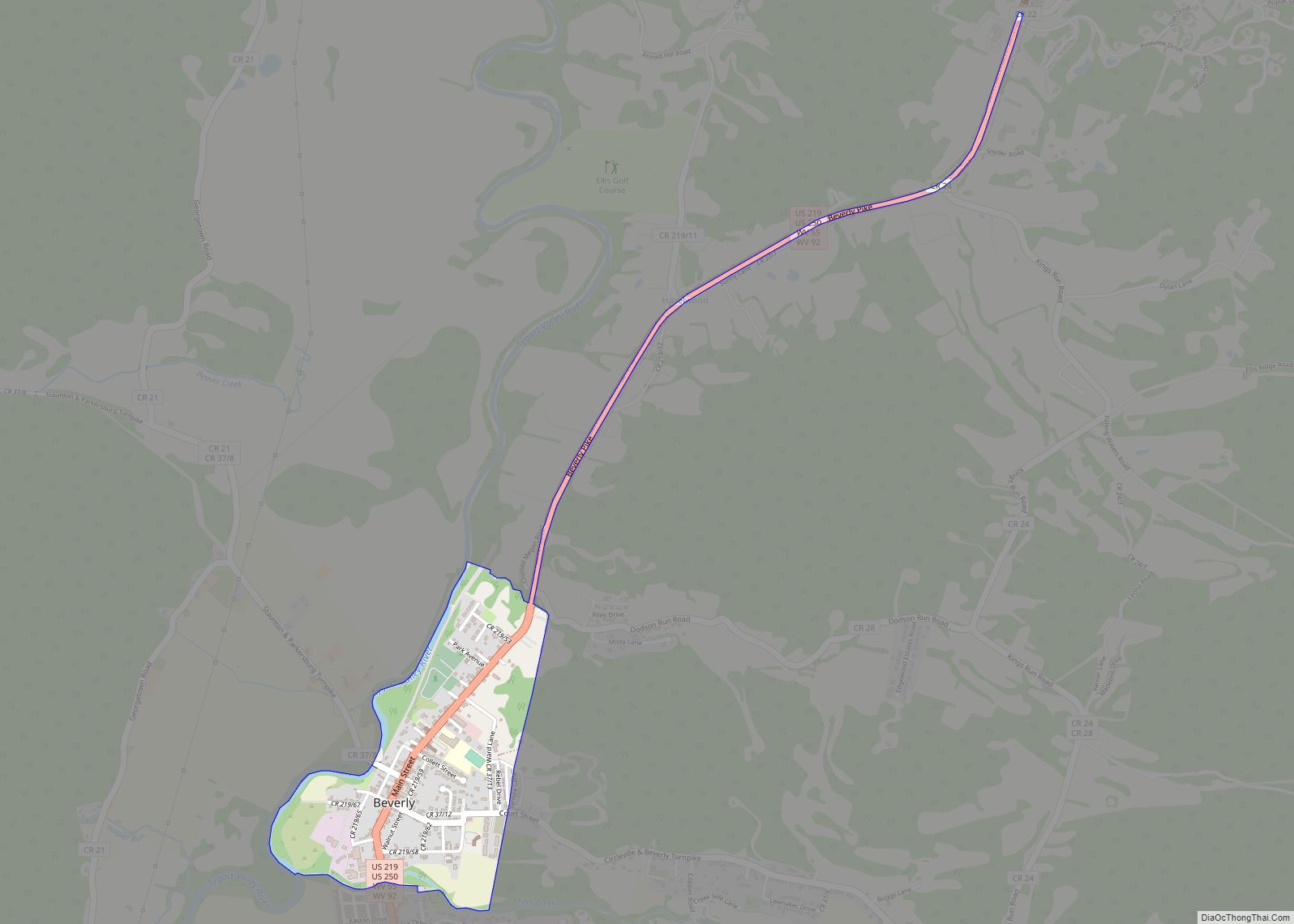
Beverly Road Map
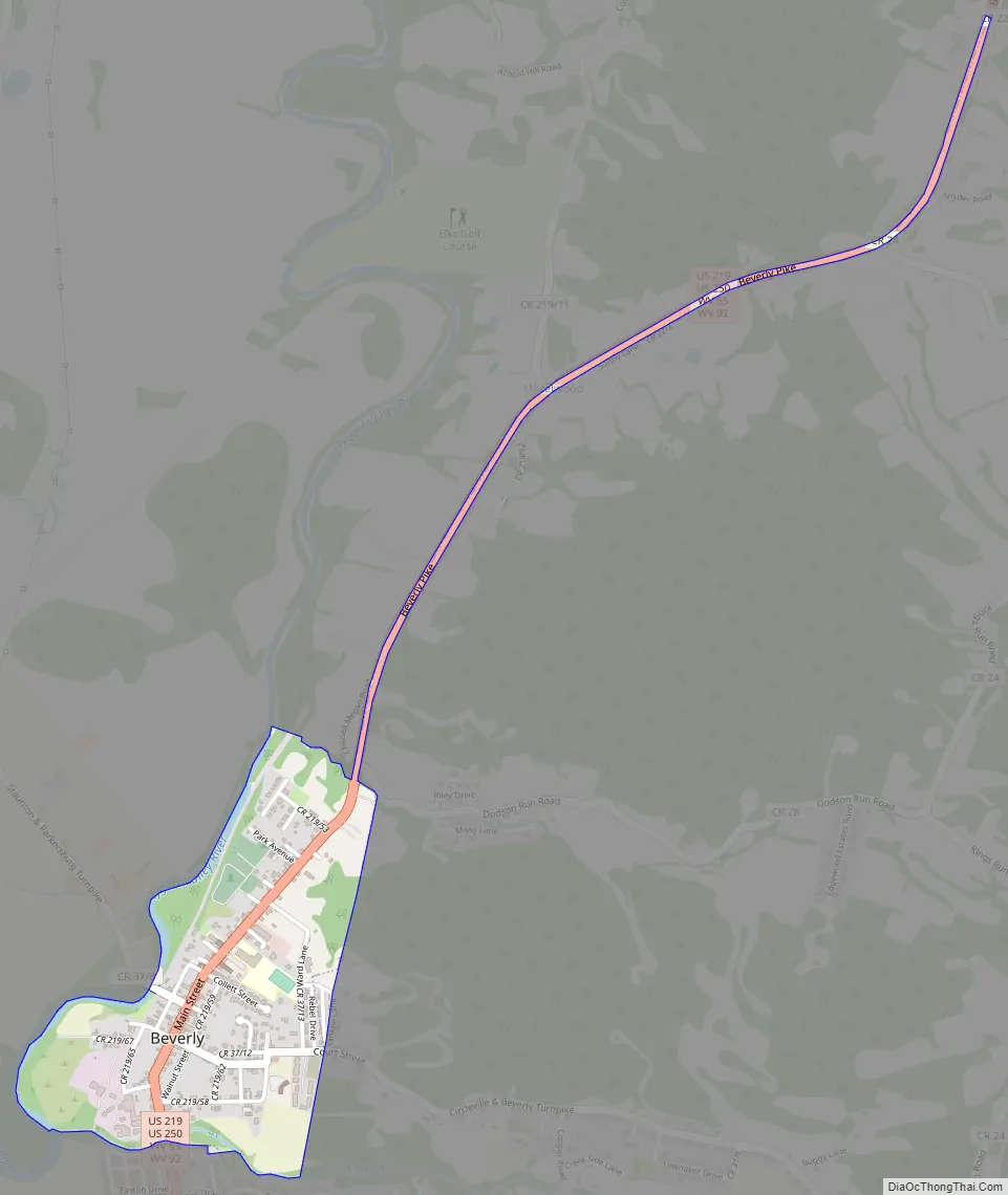
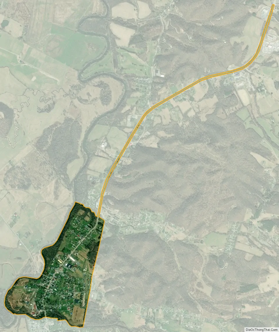
Beverly city Satellite Map
Geography
Beverly is located at 38°51′2″N 79°52′3″W / 38.85056°N 79.86750°W / 38.85056; -79.86750 (38.850600, -79.867444).
According to the United States Census Bureau, the town has a total area of 0.45 square miles (1.17 km), all land.
Climate
This climatic region is typified by large seasonal temperature differences, with warm to hot (and often humid) summers and cold (sometimes severely cold) winters. According to the Köppen Climate Classification system, Beverly has a humid continental climate, abbreviated “Dfb” on climate maps.
See also
Map of West Virginia State and its subdivision:- Barbour
- Berkeley
- Boone
- Braxton
- Brooke
- Cabell
- Calhoun
- Clay
- Doddridge
- Fayette
- Gilmer
- Grant
- Greenbrier
- Hampshire
- Hancock
- Hardy
- Harrison
- Jackson
- Jefferson
- Kanawha
- Lewis
- Lincoln
- Logan
- Marion
- Marshall
- Mason
- McDowell
- Mercer
- Mineral
- Mingo
- Monongalia
- Monroe
- Morgan
- Nicholas
- Ohio
- Pendleton
- Pleasants
- Pocahontas
- Preston
- Putnam
- Raleigh
- Randolph
- Ritchie
- Roane
- Summers
- Taylor
- Tucker
- Tyler
- Upshur
- Wayne
- Webster
- Wetzel
- Wirt
- Wood
- Wyoming
- Alabama
- Alaska
- Arizona
- Arkansas
- California
- Colorado
- Connecticut
- Delaware
- District of Columbia
- Florida
- Georgia
- Hawaii
- Idaho
- Illinois
- Indiana
- Iowa
- Kansas
- Kentucky
- Louisiana
- Maine
- Maryland
- Massachusetts
- Michigan
- Minnesota
- Mississippi
- Missouri
- Montana
- Nebraska
- Nevada
- New Hampshire
- New Jersey
- New Mexico
- New York
- North Carolina
- North Dakota
- Ohio
- Oklahoma
- Oregon
- Pennsylvania
- Rhode Island
- South Carolina
- South Dakota
- Tennessee
- Texas
- Utah
- Vermont
- Virginia
- Washington
- West Virginia
- Wisconsin
- Wyoming