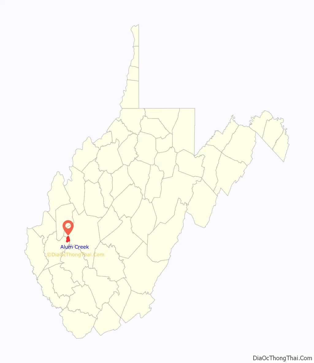
Alum Creek is a census-designated place (CDP) in Kanawha and Lincoln counties along the Coal River in the U.S. state of West Virginia. It includes the unincorporated communities of Alum Creek, Forks of Coal, and Priestley. The CDP had a population of 1,749 at the 2010 census, down from 1,839 at the 2000 census.
The community was named after nearby Alum Creek, a tributary of the Coal River.
| Name: | Alum Creek CDP |
|---|---|
| LSAD Code: | 57 |
| LSAD Description: | CDP (suffix) |
| State: | West Virginia |
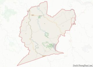
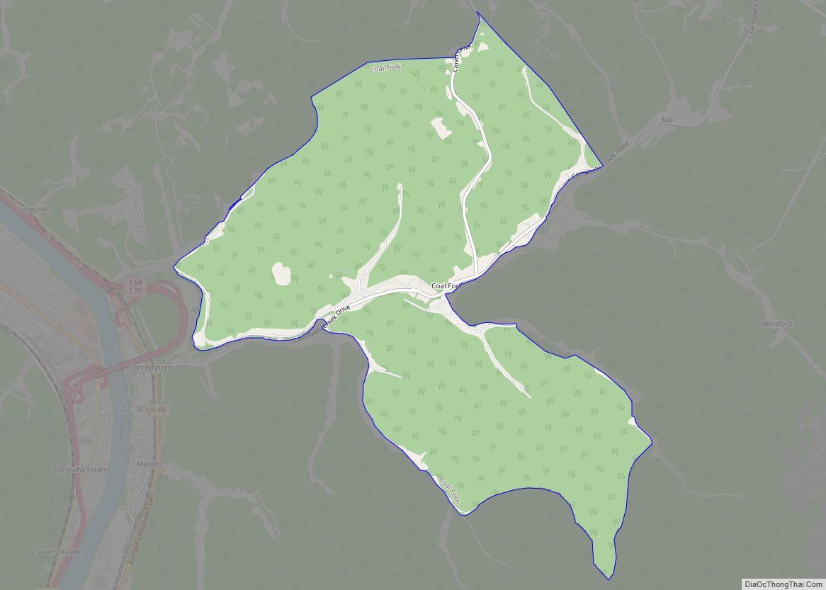
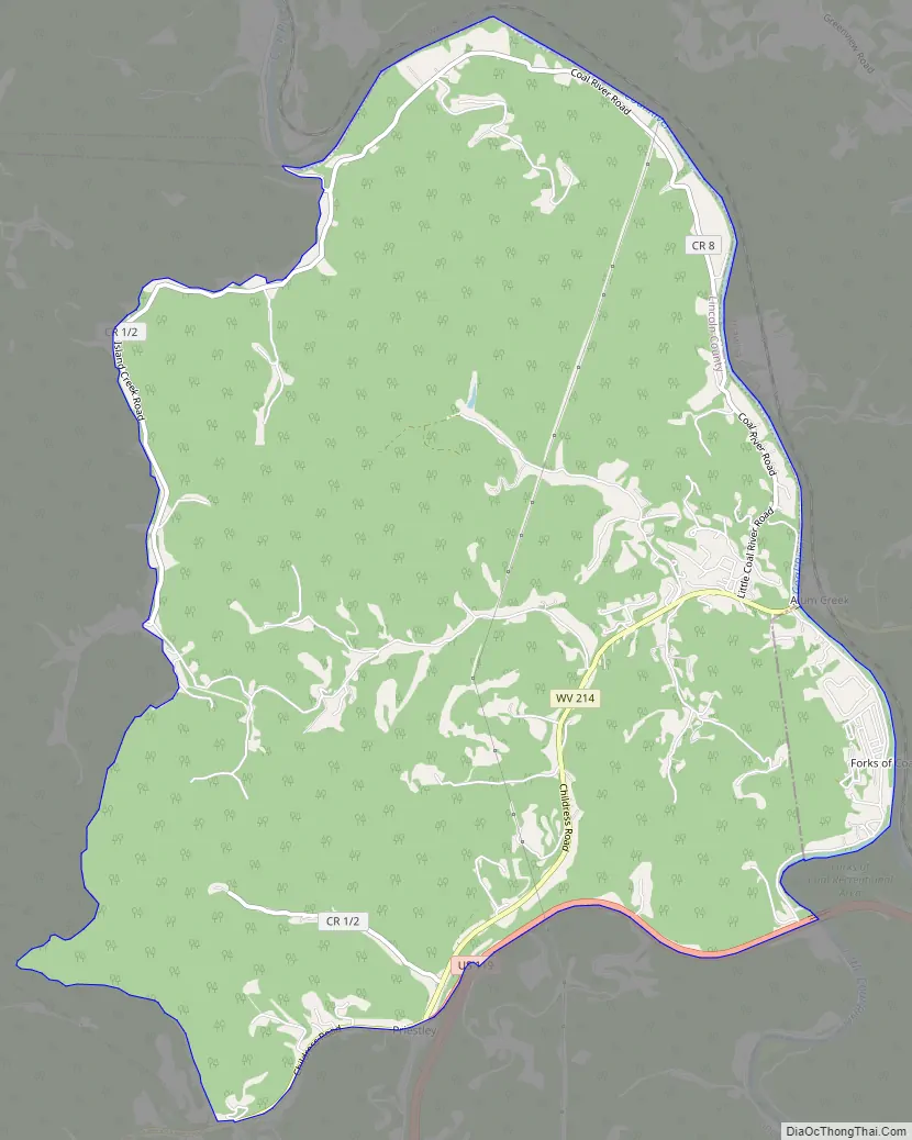
| County: | Kanawha County, Lincoln County |
| Elevation: | 620 ft (189 m) |
| Total Area: | 10.28 sq mi (26.62 km²) |
| Land Area: | 10.21 sq mi (26.44 km²) |
| Water Area: | 0.07 sq mi (0.18 km²) |
| Total Population: | 1,749 |
| Population Density: | 171/sq mi (66.2/km²) |
| ZIP code: | 25003 |
| Area code: | 304 |
| FIPS code: | 5401396 |
| GNISfeature ID: | 1549563 |
Online Interactive Map
Click on ![]() to view map in "full screen" mode.
to view map in "full screen" mode.
Alum Creek location map. Where is Alum Creek CDP?

History
The town of Rome was founded at the junction of the Little and Big Coal rivers in the 1890s by the Childress family. Soon the Chesapeake and Ohio Railway built a line along the Coal River to transport coal from the coal fields in Boone and Logan counties into the hub in nearby town of St. Albans. The town grew and a town council was formed. The town officially changed its name to “Alum Creek” in 1910. A constable policed the town, although without a vehicle he relied on the generosity of locals to transport him from place to place. In 1922 a set of bridges were constructed across the Big and Little Coal rivers. It was also at approximately this time Union Carbide built Cliffside, a summer camp on the banks of the Coal River. The town flourished for the next half century with most of its residents working in either the mining industries or in chemicals. Two elementary schools were founded in the town, Alum Creek Elementary on the Kanawha County side and Midway Elementary on the Lincoln County side. A high school was also built in the 1930s, named Washington District High School, after the tax district. WDHS was closed in 1980 due to school consolidation. In the mid-1980s U.S. Route 119 was constructed through Alum Creek and brought a host of businesses into Alum Creek; however, this did not help the town out of poverty due to a decline in the coal mining and chemical industries. The town is seeing a comeback due to the expansion of business along Rt 119. Median income is on the rise, and the town has grown to encompass an area of over 17 miles (27 km).
Holley Hills Estate is a historic home near Alum Creek that was listed on the National Register of Historic Places in 1980.
Alum Creek Road Map
Alum Creek city Satellite Map

Geography
Alum Creek is primarily in northeastern Lincoln County, with a portion extending across the Coal River into Kanawha County. The center of the CDP, in a rural area between the villages of Alum Creek and Priestley, is at 38°16′45″N 81°49′32″W / 38.27917°N 81.82556°W / 38.27917; -81.82556 (38.279034, -81.825657).
According to the United States Census Bureau, the CDP has a total area of 10.3 square miles (26.6 km), of which 10.2 square miles (26.4 km) are land and 0.1 square miles (0.2 km), or 0.69%, are water. Via the Coal River, Alum Creek is part of the Kanawha River watershed.
See also
Map of West Virginia State and its subdivision:- Barbour
- Berkeley
- Boone
- Braxton
- Brooke
- Cabell
- Calhoun
- Clay
- Doddridge
- Fayette
- Gilmer
- Grant
- Greenbrier
- Hampshire
- Hancock
- Hardy
- Harrison
- Jackson
- Jefferson
- Kanawha
- Lewis
- Lincoln
- Logan
- Marion
- Marshall
- Mason
- McDowell
- Mercer
- Mineral
- Mingo
- Monongalia
- Monroe
- Morgan
- Nicholas
- Ohio
- Pendleton
- Pleasants
- Pocahontas
- Preston
- Putnam
- Raleigh
- Randolph
- Ritchie
- Roane
- Summers
- Taylor
- Tucker
- Tyler
- Upshur
- Wayne
- Webster
- Wetzel
- Wirt
- Wood
- Wyoming
- Alabama
- Alaska
- Arizona
- Arkansas
- California
- Colorado
- Connecticut
- Delaware
- District of Columbia
- Florida
- Georgia
- Hawaii
- Idaho
- Illinois
- Indiana
- Iowa
- Kansas
- Kentucky
- Louisiana
- Maine
- Maryland
- Massachusetts
- Michigan
- Minnesota
- Mississippi
- Missouri
- Montana
- Nebraska
- Nevada
- New Hampshire
- New Jersey
- New Mexico
- New York
- North Carolina
- North Dakota
- Ohio
- Oklahoma
- Oregon
- Pennsylvania
- Rhode Island
- South Carolina
- South Dakota
- Tennessee
- Texas
- Utah
- Vermont
- Virginia
- Washington
- West Virginia
- Wisconsin
- Wyoming