Silt is a Statutory Town in Garfield County, Colorado, United States. The population was 3,536 at the 2020 census, up from 2,930 at the 2010 census.
| Name: | Silt town |
|---|---|
| LSAD Code: | 43 |
| LSAD Description: | town (suffix) |
| State: | Colorado |
| County: | Garfield County |
| Incorporated: | May, 1915 |
| Elevation: | 5,456 ft (1,663 m) |
| Total Area: | 1.73 sq mi (4.47 km²) |
| Land Area: | 1.66 sq mi (4.29 km²) |
| Water Area: | 0.07 sq mi (0.18 km²) |
| Total Population: | 3,536 |
| Population Density: | 2,000/sq mi (790/km²) |
| ZIP code: | 81652 |
| Area code: | 970 |
| FIPS code: | 0870195 |
| GNISfeature ID: | 204657 |
| Website: | www.townofsilt.org |
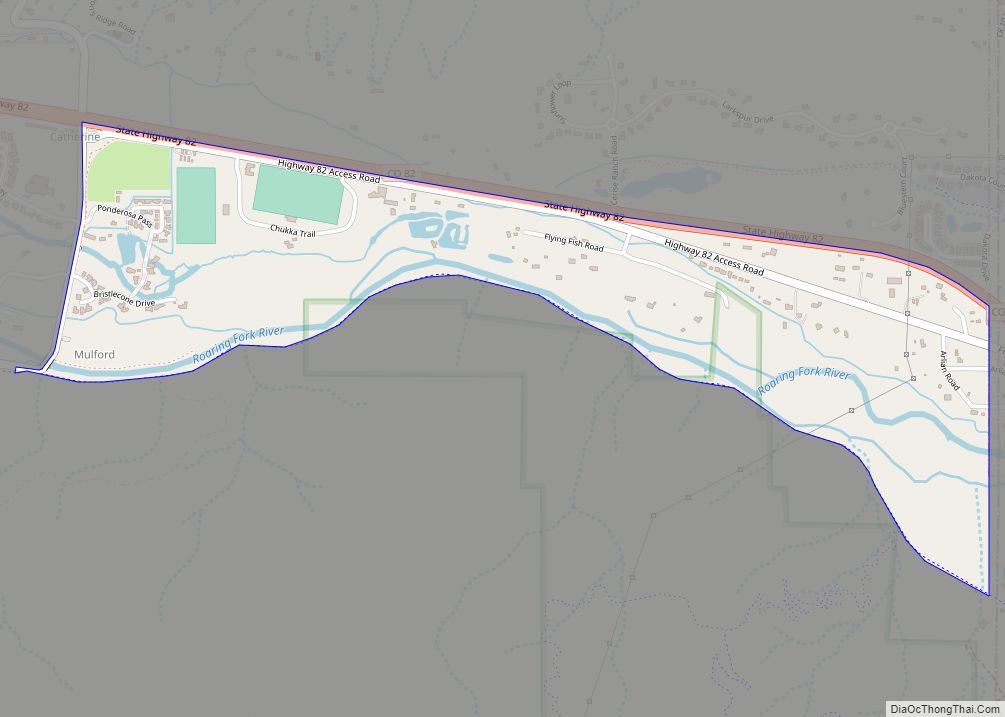
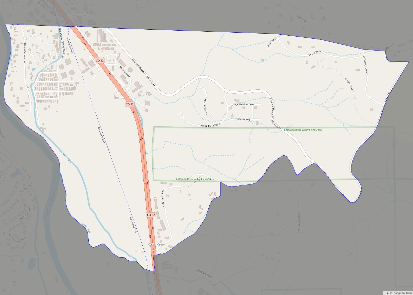
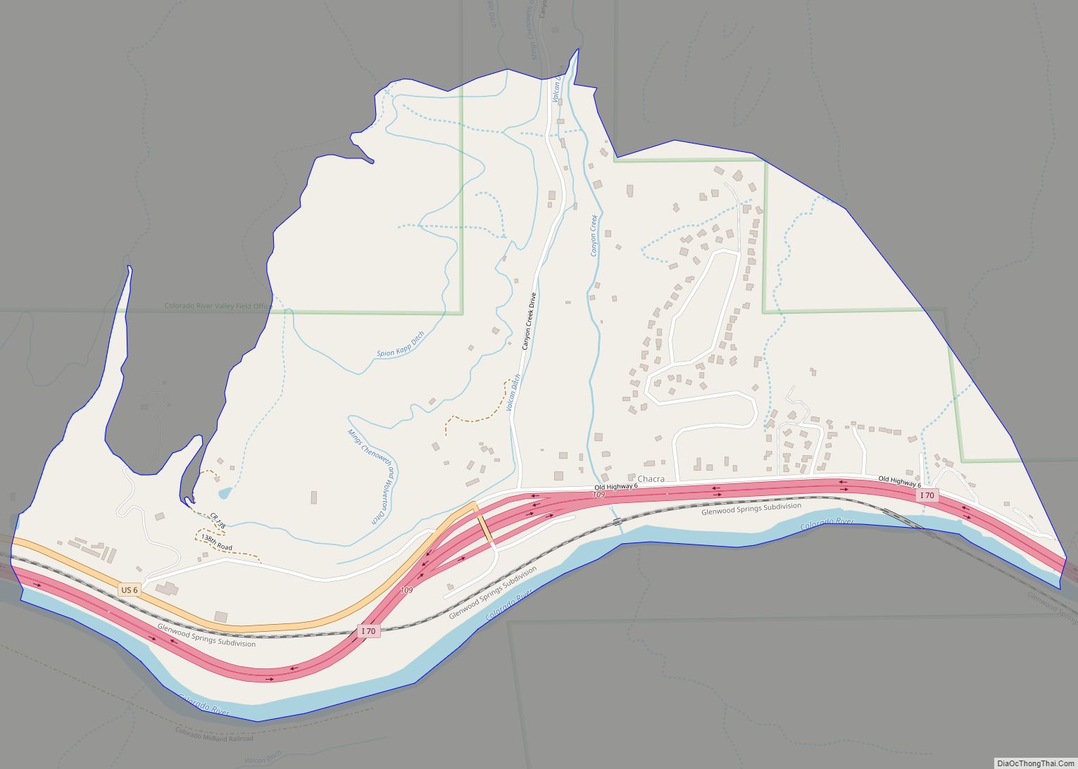
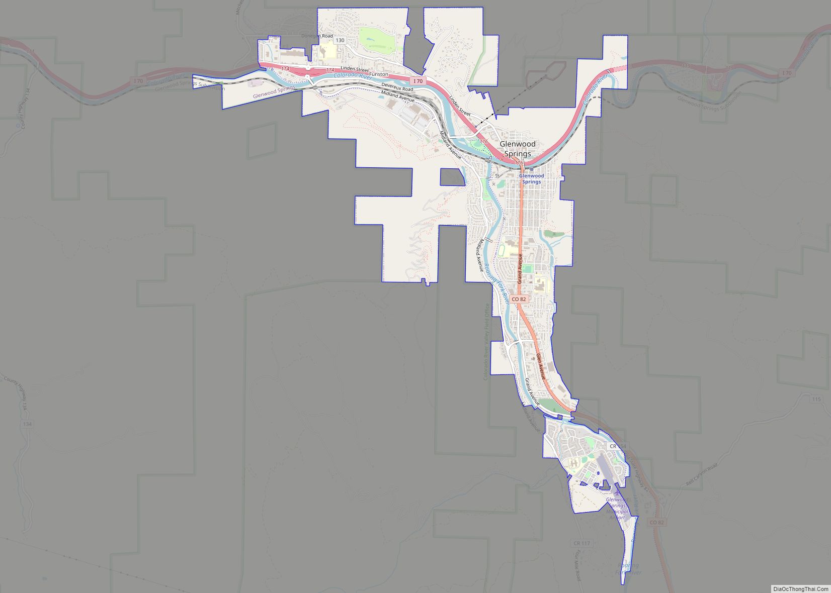
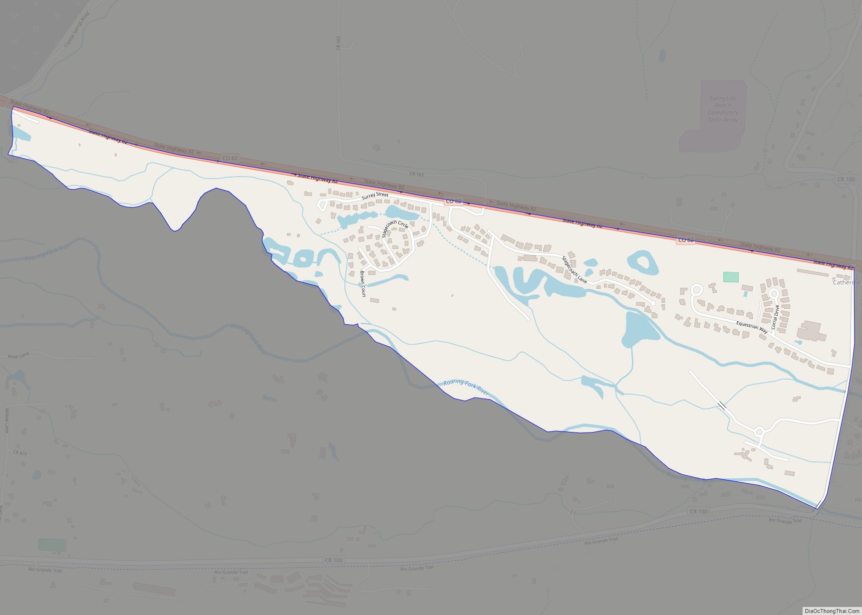
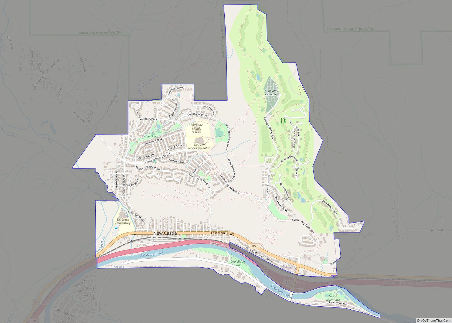
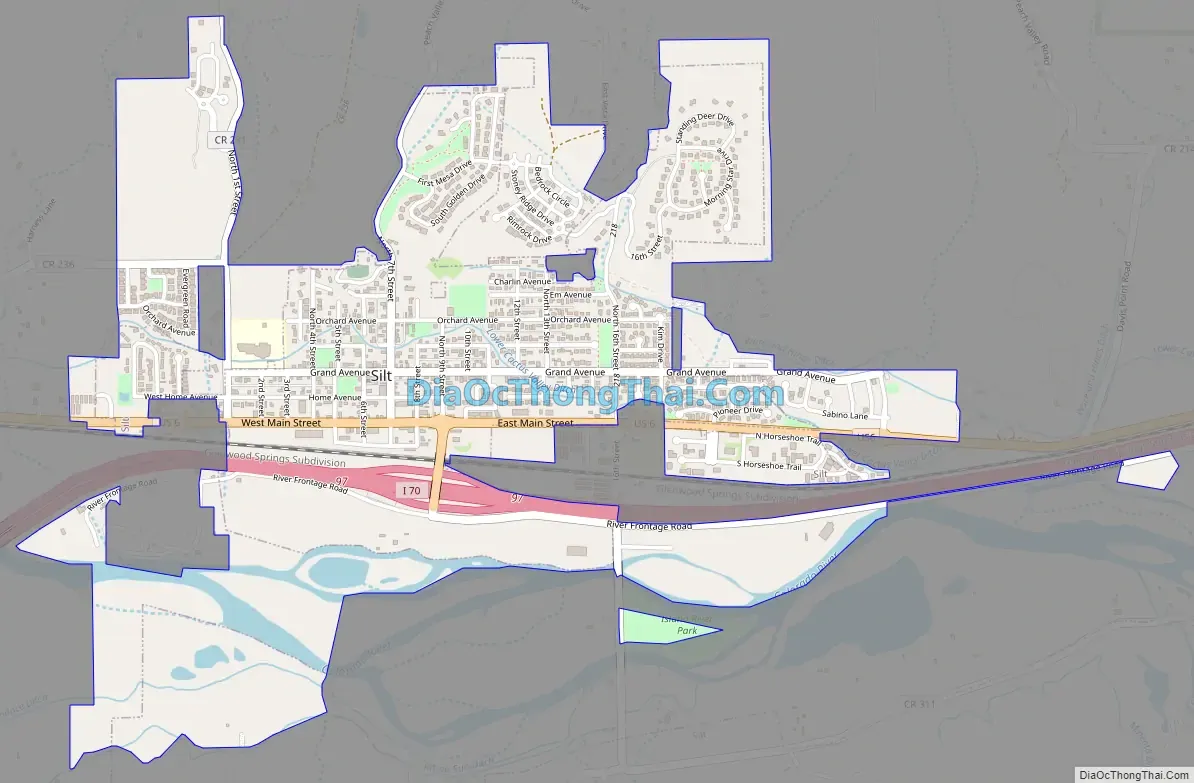
Online Interactive Map
Click on ![]() to view map in "full screen" mode.
to view map in "full screen" mode.
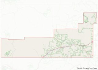
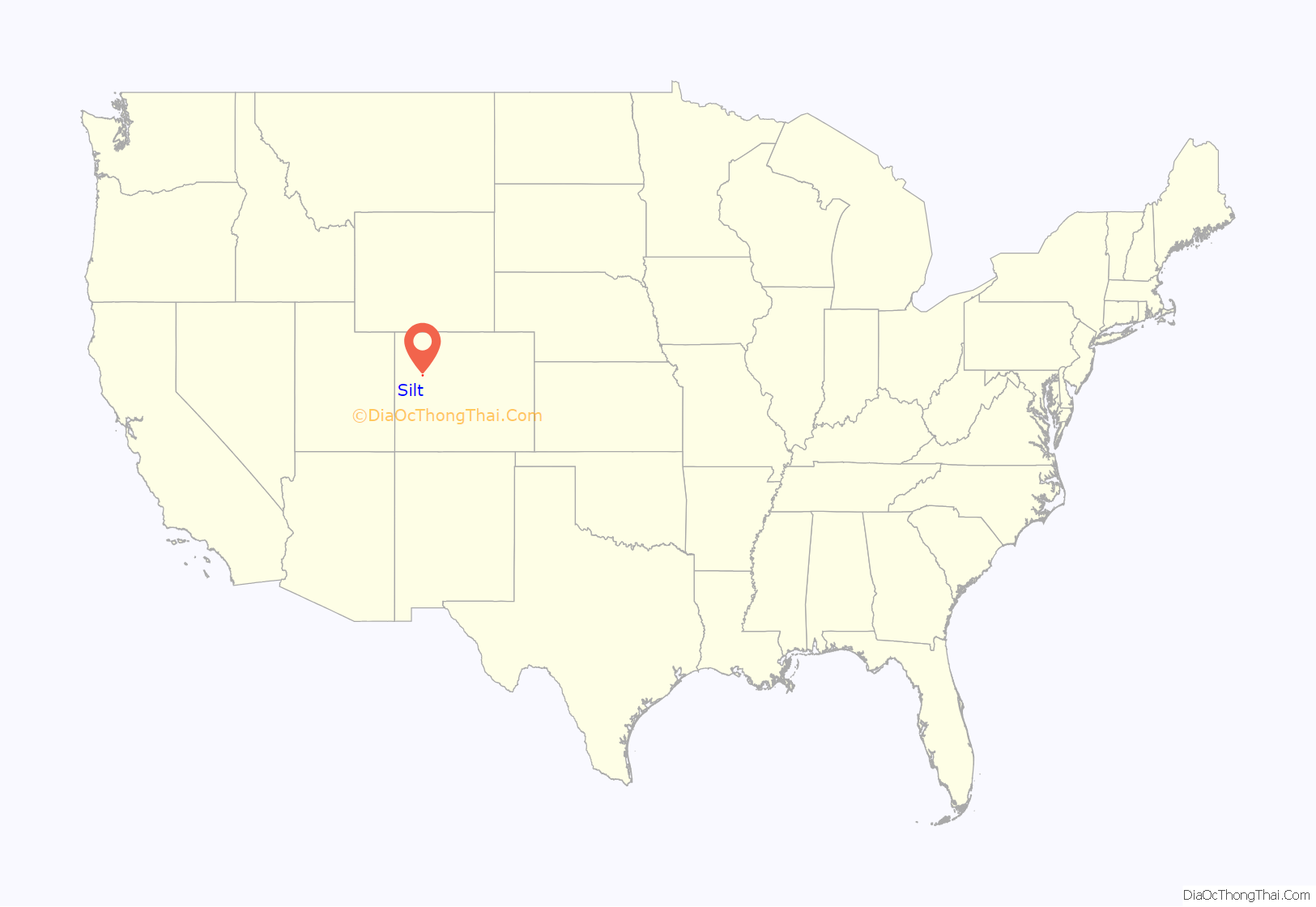
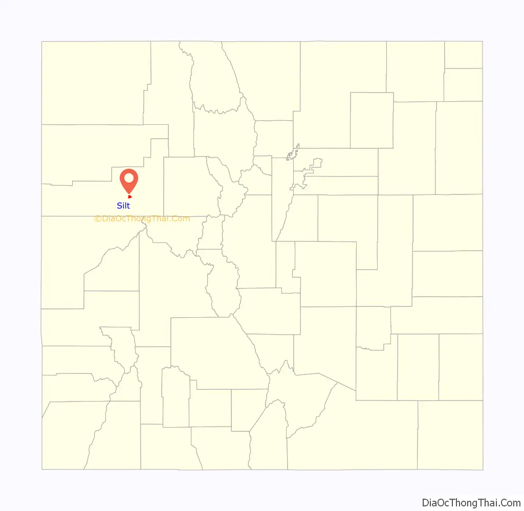
Silt location map. Where is Silt town?
History
A post office called “Silt” has been in operation since 1898. The community was named for the silt deposits at the original town site.
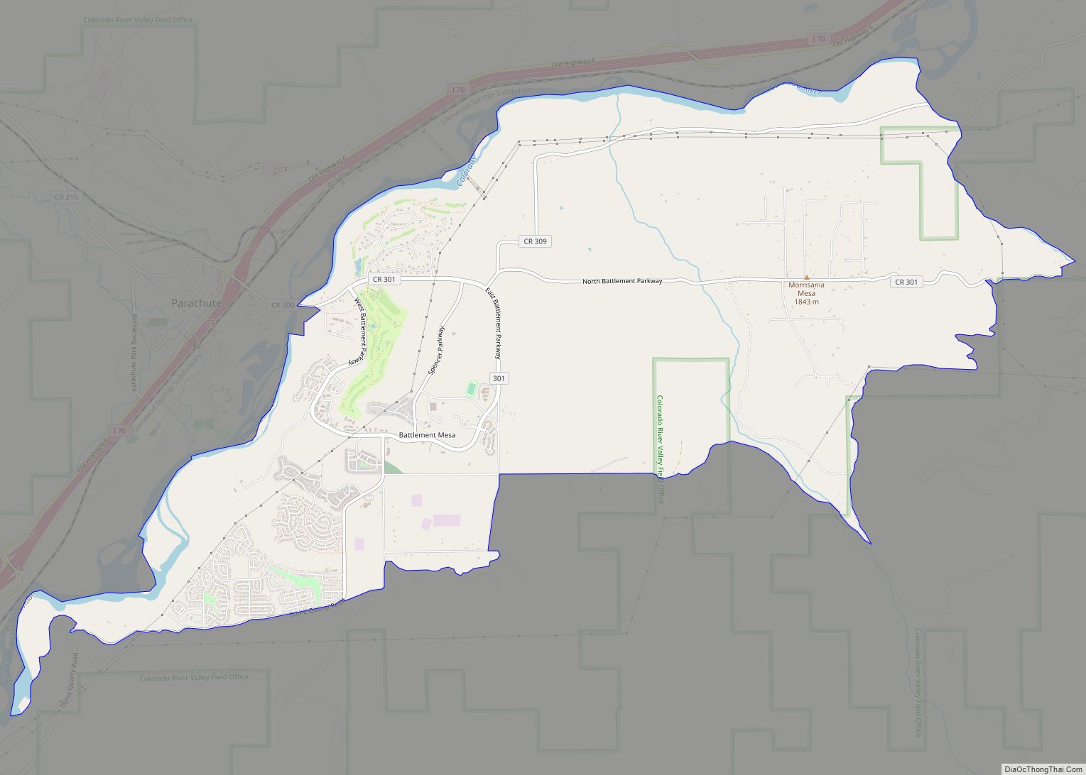
Silt Road Map
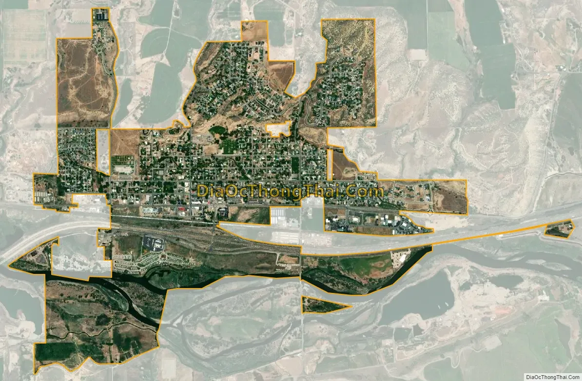
Silt city Satellite Map
Geography
Silt is located on the north side of the Colorado River about 175 miles (282 km) west of Denver. Interstate 70 passes through the town as it follows the river, with access from Exit 97. Glenwood Springs, the county seat, is 19 miles (31 km) to the east, and Rifle is 7 miles (11 km) to the west. U.S. Route 6 is Main Street in Silt, and provides a local route parallel to I-70.
According to the United States Census Bureau, the town has a total area of 1.5 square miles (3.8 km), of which 0.023 square miles (0.06 km), or 1.46%, is water.
Climate
This climatic region is typified by large seasonal temperature differences, with warm to hot (and often humid) summers and cold (sometimes severely cold) winters. According to the Köppen Climate Classification system, Silt has a humid continental climate, abbreviated “Dfb” on climate maps.
See also
Map of Colorado State and its subdivision:- Adams
- Alamosa
- Arapahoe
- Archuleta
- Baca
- Bent
- Boulder
- Broomfield
- Chaffee
- Cheyenne
- Clear Creek
- Conejos
- Costilla
- Crowley
- Custer
- Delta
- Denver
- Dolores
- Douglas
- Eagle
- El Paso
- Elbert
- Fremont
- Garfield
- Gilpin
- Grand
- Gunnison
- Hinsdale
- Huerfano
- Jackson
- Jefferson
- Kiowa
- Kit Carson
- La Plata
- Lake
- Larimer
- Las Animas
- Lincoln
- Logan
- Mesa
- Mineral
- Moffat
- Montezuma
- Montrose
- Morgan
- Otero
- Ouray
- Park
- Phillips
- Pitkin
- Prowers
- Pueblo
- Rio Blanco
- Rio Grande
- Routt
- Saguache
- San Juan
- San Miguel
- Sedgwick
- Summit
- Teller
- Washington
- Weld
- Yuma
- Alabama
- Alaska
- Arizona
- Arkansas
- California
- Colorado
- Connecticut
- Delaware
- District of Columbia
- Florida
- Georgia
- Hawaii
- Idaho
- Illinois
- Indiana
- Iowa
- Kansas
- Kentucky
- Louisiana
- Maine
- Maryland
- Massachusetts
- Michigan
- Minnesota
- Mississippi
- Missouri
- Montana
- Nebraska
- Nevada
- New Hampshire
- New Jersey
- New Mexico
- New York
- North Carolina
- North Dakota
- Ohio
- Oklahoma
- Oregon
- Pennsylvania
- Rhode Island
- South Carolina
- South Dakota
- Tennessee
- Texas
- Utah
- Vermont
- Virginia
- Washington
- West Virginia
- Wisconsin
- Wyoming