Silverton is a statutory town that is the county seat, the most populous community, and the only incorporated municipality in San Juan County, Colorado, United States. The town is located in a remote part of the western San Juan Mountains, a range of the Rocky Mountains. The first mining claims were made in mountains above the Silverton in 1860, near the end of the Colorado Gold Rush and when the land was still controlled by the Utes. Silverton was established shortly after the Utes ceded the region in the 1873 Brunot Agreement, and the town boomed from silver mining until the Panic of 1893 led to a collapse of the silver market, and boomed again from gold mining until the recession caused by the Panic of 1907. The entire town is included as a federally designated National Historic Landmark District, the Silverton Historic District.
Originally called “Bakers Park”, Silverton sits in a flat area of the Animas River valley and is surrounded by steep peaks. Most of the peaks surrounding Silverton are thirteeners, the highest being Storm Peak, at 13,487 feet. The town is less than 15 miles from 7 of Colorado’s 53 fourteeners, and is known as one of the premier gateways into the Colorado backcountry.
Silverton’s last operating mine closed in 1992, and the community now depends primarily on tourism and government remediation and preservation projects. Silverton is well known because of the Durango and Silverton Narrow Gauge Railroad, a former mine train that is now a National Historic Landmark, and internationally recognized events such as the Hardrock Hundred Mile Endurance Run. The town population was 622 at the 2020 census.
| Name: | Silverton town |
|---|---|
| LSAD Code: | 43 |
| LSAD Description: | town (suffix) |
| State: | Colorado |
| County: | San Juan County |
| Incorporated: | November 15, 1885 |
| Elevation: | 9,318 ft (2,840 m) |
| Total Area: | 0.83 sq mi (2.16 km²) |
| Land Area: | 0.83 sq mi (2.16 km²) |
| Water Area: | 0.00 sq mi (0.00 km²) |
| Total Population: | 622 |
| Population Density: | 750/sq mi (290/km²) |
| ZIP code: | 81433 (PO Box) |
| Area code: | 970 |
| FIPS code: | 0870580 |
| GNISfeature ID: | 0204750 |
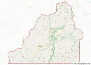
Online Interactive Map
Click on ![]() to view map in "full screen" mode.
to view map in "full screen" mode.
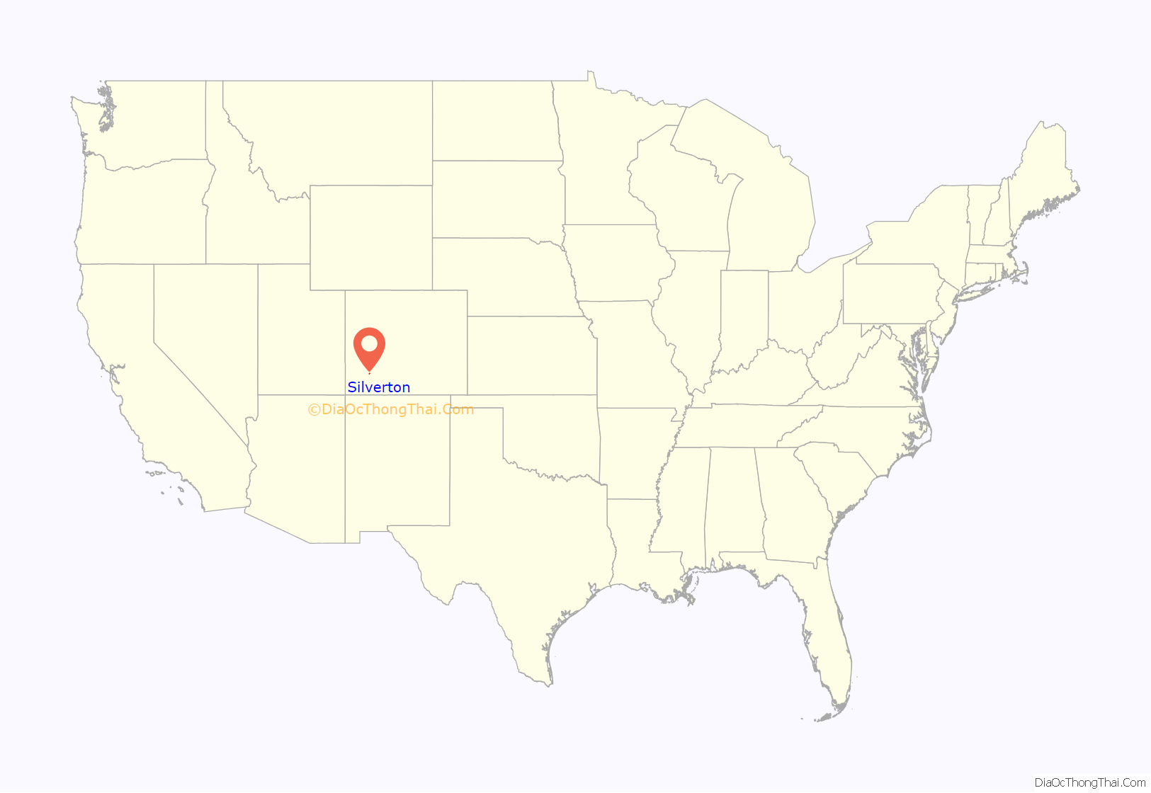
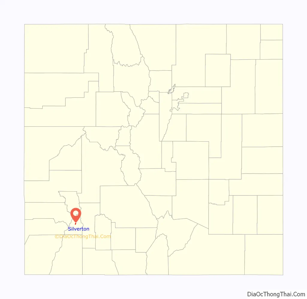
Silverton location map. Where is Silverton town?
History
Mining era
Settlements in the area surrounding present-day Silverton began in 1860 after a group of prospectors lead by Charles Baker made their way into the San Juan Mountains searching for gold. The area was soon referred to as “Baker’s Park”, and the group found traces of placer gold nearby.
Long before settlement, the area was regularly explored by the Anasazi, and later the Utes, who hunted and lived in the San Juans during the summer. There is also speculation that Spanish explorers and fur traders ventured into the area before Baker’s 1860 expedition.
After the Brunot Agreement with the Utes in 1873, which exchanged four million acres (6,200 sq mi; 16,000 km) for the Southern Ute Indian Reservation and $25,000 per year, several mining camps were constructed. These would later become the communities of Howardsville, Eureka, and Silverton.
Silverton was founded by mining entrepreneurs William Kearnes, Dempsey Reese, and Thomas Blair in 1874. The region boomed after George Howard and R. J. McNutt discovered the Sunnyside silver vein along Hurricane Peak. Gold was then discovered in 1882, which helped the region weather the Panic of 1893 far better than other mining communities, such as Aspen or Creede. The Sunnyside Mine would become one of Colorado’s longest running and most productive mines. The mine was shut down after the 1929 stock market crash, but was acquired by Standard Metals Corp. in 1959, and reopened, finding gold in 1973 with the Little Mary vein. The region’s economy was dealt a devastating blow in 1992 when the mine and the corresponding Shenandoah-Dives mill, the last operating in the region, permanently closed. The closure meant the end of jobs for over one third of Silverton’s workforce.
Tourism era
The town has a long history of tourism and efforts to market tourism by the Silverton Commercial Club (now the Chamber of Commerce) dates back as early as 1913. By the 1930s, interest in the “Old West” was already attracting tourists from around the world, for which the newly constructed U.S. Route 550 further enabled access. Following World War II, the town’s railroad, originally operated by the Denver & Rio Grande Western for the purpose of shipping ore to Durango, became a major tourist attraction after it was featured in several popular western films. By the 1970s, with almost all mining operations in the region shuttered, the train was almost entirely operated for the purpose of tourism.
Tourism continued to increase in the latter part of the 20th century, but Silverton’s harsh winters and isolation made it a summer-only attraction. Following the closure of Sunnyside, Silverton lost much of its tax base as the town’s population dwindled to just over 500, a quarter of its peak population one hundred years earlier.
The town’s population, buoyed by strong summer tourism and an emerging winter economy, has since recovered. The construction of the expert-level ski area Silverton Mountain in 2002 marked the beginning of Silverton’s year-round tourism. Another ski area, the Purgatory Resort, is marketed as being within the Durango Metropolitan Area but is actually closer to Silverton than it is to Durango. Winter festivals such as Skijoring have brought crowds that rival those in the summer, and the potential for new winter activities such as the expansion of the town-operated ski hill could permanently improve Silverton’s winter tourism. The town has also become well known for its winter backcountry activities such as snowmobiling, ice climbing, and backcountry skiing.
Both the town and the Durango and Silverton Narrow Gauge Railroad were designated a National Historic Landmark in 1961. In 1966, the entire town was placed on the National Register of Historic Places. These boundaries were expanded in 1997 with the addition of the Shenandoah-Dives mill and other historical structures.
Notable disasters
The area surrounding Silverton has been the scene of several well-documented disasters, many of them due to avalanches and mining accidents.
Five miners perished in a slide at the Sunnyside mine in January 1906. Only a few months later, twelve miners were killed in another slide at the Shenandoah Mine, making it one of the most deadly slides in the history of Colorado.
The Spanish Flu arrived in Silverton near the end of October, 1918, and quickly devastated the community. In a single week, 125 people, more than 5% of the town’s population, perished from flu complications. By the time the pandemic waned the following March, 246 people had died, accounting to more than 10% of the population. This gave Silverton the dubious honor of having the highest mortality rate for the Spanish Flu in the entire nation.
On 4 June 1978, when the water from Lake Emma collapsed into Sunnyside mine, shooting out of a portal with a force that toppled a 20-ton locomotive. Fortunately, no injuries were reported as disaster occurred on a Sunday when nobody was present in the mine.
In 2015, the EPA and its contractors caused an environmental catastrophe when they accidentally destroyed the plug holding water trapped inside the Gold King Mine, which caused three million US gallons (eleven thousand cubic meters) of mine waste water and tailings, to flow into a tributary of the Animas River.
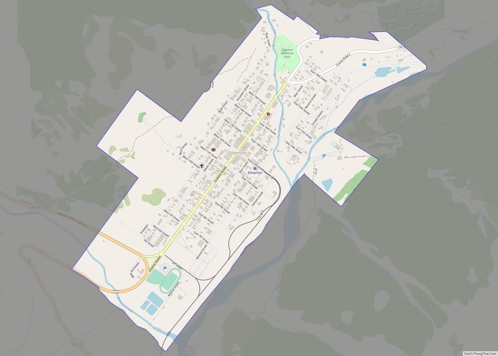
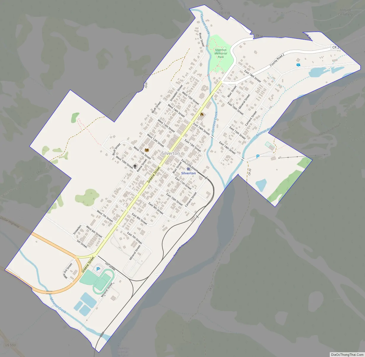
Silverton Road Map
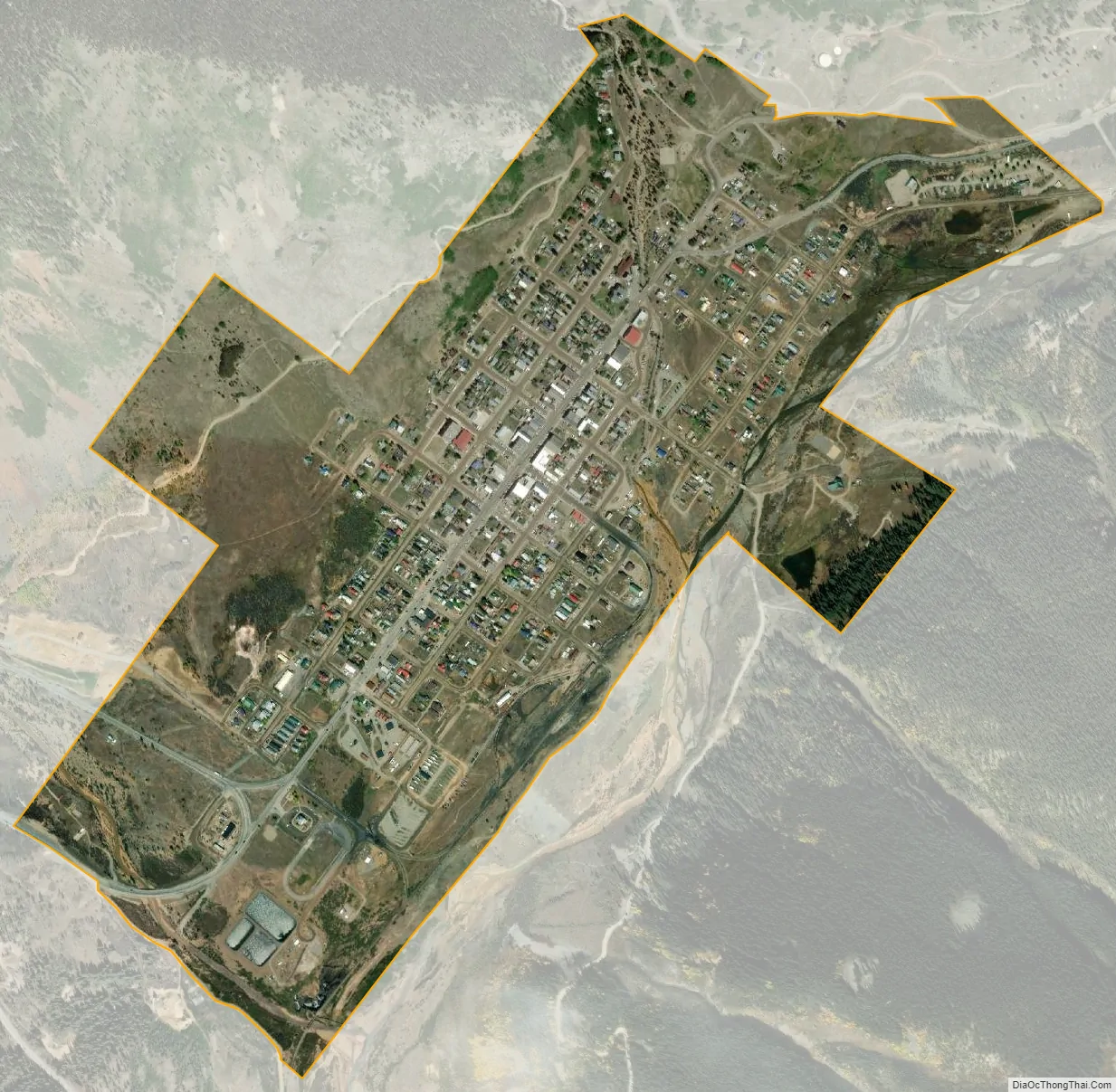
Silverton city Satellite Map
Geography
According to the United States Census Bureau, the town has a total area of 0.8 square miles (2.1 km), all of it land. Silverton is one of the highest towns in the United States, at 9,318 feet (2,840 m) above sea level. The town is located in San Juan County, the highest county in the United States, with a mean elevation of 11,240 feet (3,430 meters). Silverton sits in a flat area of the Animas River valley and is surrounded by several thirteeners, the highest being Storm Peak, at 13,487 feet. The town is less than 15 miles from seven of Colorado’s 53 “fourteeners”, i.e., mountain peaks with a summit elevation of at least 14,000 feet (4,300 meters).
See also
Map of Colorado State and its subdivision:- Adams
- Alamosa
- Arapahoe
- Archuleta
- Baca
- Bent
- Boulder
- Broomfield
- Chaffee
- Cheyenne
- Clear Creek
- Conejos
- Costilla
- Crowley
- Custer
- Delta
- Denver
- Dolores
- Douglas
- Eagle
- El Paso
- Elbert
- Fremont
- Garfield
- Gilpin
- Grand
- Gunnison
- Hinsdale
- Huerfano
- Jackson
- Jefferson
- Kiowa
- Kit Carson
- La Plata
- Lake
- Larimer
- Las Animas
- Lincoln
- Logan
- Mesa
- Mineral
- Moffat
- Montezuma
- Montrose
- Morgan
- Otero
- Ouray
- Park
- Phillips
- Pitkin
- Prowers
- Pueblo
- Rio Blanco
- Rio Grande
- Routt
- Saguache
- San Juan
- San Miguel
- Sedgwick
- Summit
- Teller
- Washington
- Weld
- Yuma
- Alabama
- Alaska
- Arizona
- Arkansas
- California
- Colorado
- Connecticut
- Delaware
- District of Columbia
- Florida
- Georgia
- Hawaii
- Idaho
- Illinois
- Indiana
- Iowa
- Kansas
- Kentucky
- Louisiana
- Maine
- Maryland
- Massachusetts
- Michigan
- Minnesota
- Mississippi
- Missouri
- Montana
- Nebraska
- Nevada
- New Hampshire
- New Jersey
- New Mexico
- New York
- North Carolina
- North Dakota
- Ohio
- Oklahoma
- Oregon
- Pennsylvania
- Rhode Island
- South Carolina
- South Dakota
- Tennessee
- Texas
- Utah
- Vermont
- Virginia
- Washington
- West Virginia
- Wisconsin
- Wyoming