Map of Grand Ridge town, Florida
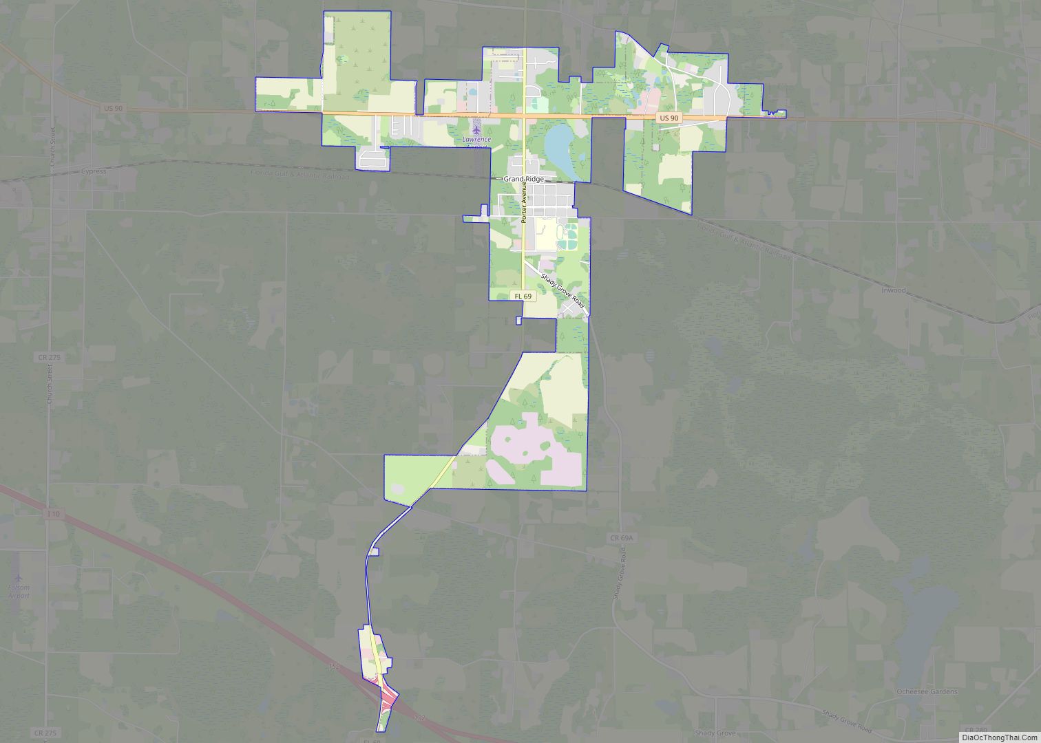
Grand Ridge is a town in Jackson County, Florida, United States. The population was 892 at the 2010 census, up from 792 at the 2000 census. Grand Ridge town overview: Name: Grand Ridge town LSAD Code: 43 LSAD Description: town (suffix) State: Florida County: Jackson County Elevation: 128 ft (39 m) Total Area: 4.52 sq mi (11.71 km²) Land Area: ... Read more
Map of Grand Ridge town, Florida
Map of Graceville city, Florida
Graceville is a city in Jackson County, Florida, United States. It is near the Alabama state line. The population was 2,278 at the 2010 census. A large portion of Graceville’s rural acreage is located in Holmes County, Florida, United States. Graceville city overview: Name: Graceville city LSAD Code: 25 LSAD Description: city (suffix) State: Florida ... Read more
Map of Graceville city, Florida
Map of Greenbriar CDP, Florida
Greenbriar is an unincorporated community and census-designated place (CDP) in Pinellas County, Florida, United States. The population was 2,502 at the 2010 census. Greenbriar CDP overview: Name: Greenbriar CDP LSAD Code: 57 LSAD Description: CDP (suffix) State: Florida County: Pinellas County Elevation: 55 ft (17 m) Total Area: 0.64 sq mi (1.65 km²) Land Area: 0.60 sq mi (1.55 km²) Water Area: 0.04 sq mi ... Read more
Map of Greenbriar CDP, Florida
Map of Greenacres city, Florida
Greenacres is a city in Palm Beach County, Florida, United States. Situated in the east-central portion of the county, Greenacres is located northwest of Atlantis, east of Wellington, and borders Palm Springs to its east. As of the 2010 United States census, the city had a population of 37,573 people, up from 27,569 at the 2000 ... Read more
Map of Greenacres city, Florida
Map of Green Cove Springs city
Green Cove Springs is a city in and the county seat of Clay County, Florida, United States. The population was 9,555 at the 2020 census. In 2021, the population increased to 9,784. Green Cove Springs is a part of the Jacksonville Metropolitan Area, home to 1,637,666 residents. The city is named after the portion of ... Read more
Map of Green Cove Springs city
Map of Greenwood town, Florida
Greenwood is a town in Jackson County, Florida, United States. The population was 686 at the 2010 census. Greenwood town overview: Name: Greenwood town LSAD Code: 43 LSAD Description: town (suffix) State: Florida County: Jackson County Elevation: 115 ft (35 m) Total Area: 4.56 sq mi (11.82 km²) Land Area: 4.56 sq mi (11.82 km²) Water Area: 0.00 sq mi (0.00 km²) Total Population: 539 Population ... Read more
Map of Greenwood town, Florida
Map of Greenville town, Florida
Greenville is a town in Madison County, Florida, United States. The population was 746 at the 2020 census, down from 843 at the 2010 census. Greenville town overview: Name: Greenville town LSAD Code: 43 LSAD Description: town (suffix) State: Florida County: Madison County Elevation: 98 ft (30 m) Total Area: 1.32 sq mi (3.41 km²) Land Area: 1.32 sq mi (3.41 km²) Water ... Read more
Map of Greenville town, Florida
Map of Greensboro town, Florida
Greensboro is a town in Gadsden County, Florida, United States. The population was 602 at the 2010 census. Greensboro is part of the Tallahassee, Florida Metropolitan Statistical Area. Greensboro town overview: Name: Greensboro town LSAD Code: 43 LSAD Description: town (suffix) State: Florida County: Gadsden County Elevation: 269 ft (82 m) Total Area: 2.30 sq mi (5.97 km²) Land Area: ... Read more
Map of Greensboro town, Florida
Map of Grove City CDP, Florida
Grove City is an unincorporated community and census-designated place (CDP) in Charlotte County, Florida, United States. The population was 2,174 at the 2020 census. It is part of the Sarasota-Bradenton-Punta Gorda Combined Statistical Area. Grove City CDP overview: Name: Grove City CDP LSAD Code: 57 LSAD Description: CDP (suffix) State: Florida County: Charlotte County Elevation: ... Read more
Map of Grove City CDP, Florida
Map of Gretna city, Florida
Gretna is a city in Gadsden County, Florida, United States. The population was 1,460 as of the 2010 census, down from 1,709 at the 2000 census. It is on U.S. 90 approximately 8 miles (13 km) south of the Florida-Georgia border. Gretna is part of the Tallahassee, Florida Metropolitan Statistical Area. Gretna city overview: Name: Gretna ... Read more
Map of Gretna city, Florida
Map of Grenelefe CDP
Grenelefe is an unincorporated community and census-designated place located in Polk County, Florida, United States. Its population was 2,495 as of the 2020 census. Grenelefe CDP overview: Name: Grenelefe CDP LSAD Code: 57 LSAD Description: CDP (suffix) State: Florida County: Polk County Elevation: 79 ft (24 m) Total Area: 4.33 sq mi (11.22 km²) Land Area: 4.25 sq mi (11.01 km²) Water Area: ... Read more
Map of Grenelefe CDP
Map of Gulf Gate Estates CDP
Gulf Gate Estates CDP overview: Name: Gulf Gate Estates CDP LSAD Code: 57 LSAD Description: CDP (suffix) State: Florida County: Sarasota County FIPS code: 1228050 Online Interactive Map Gulf Gate Estates online map. Source: Basemap layers from Google Map, Open Street Map (OSM), Arcgisonline, Wmflabs. Boundary Data from Database of Global Administrative Areas. Gulf Gate ... Read more
Map of Gulf Gate Estates CDP