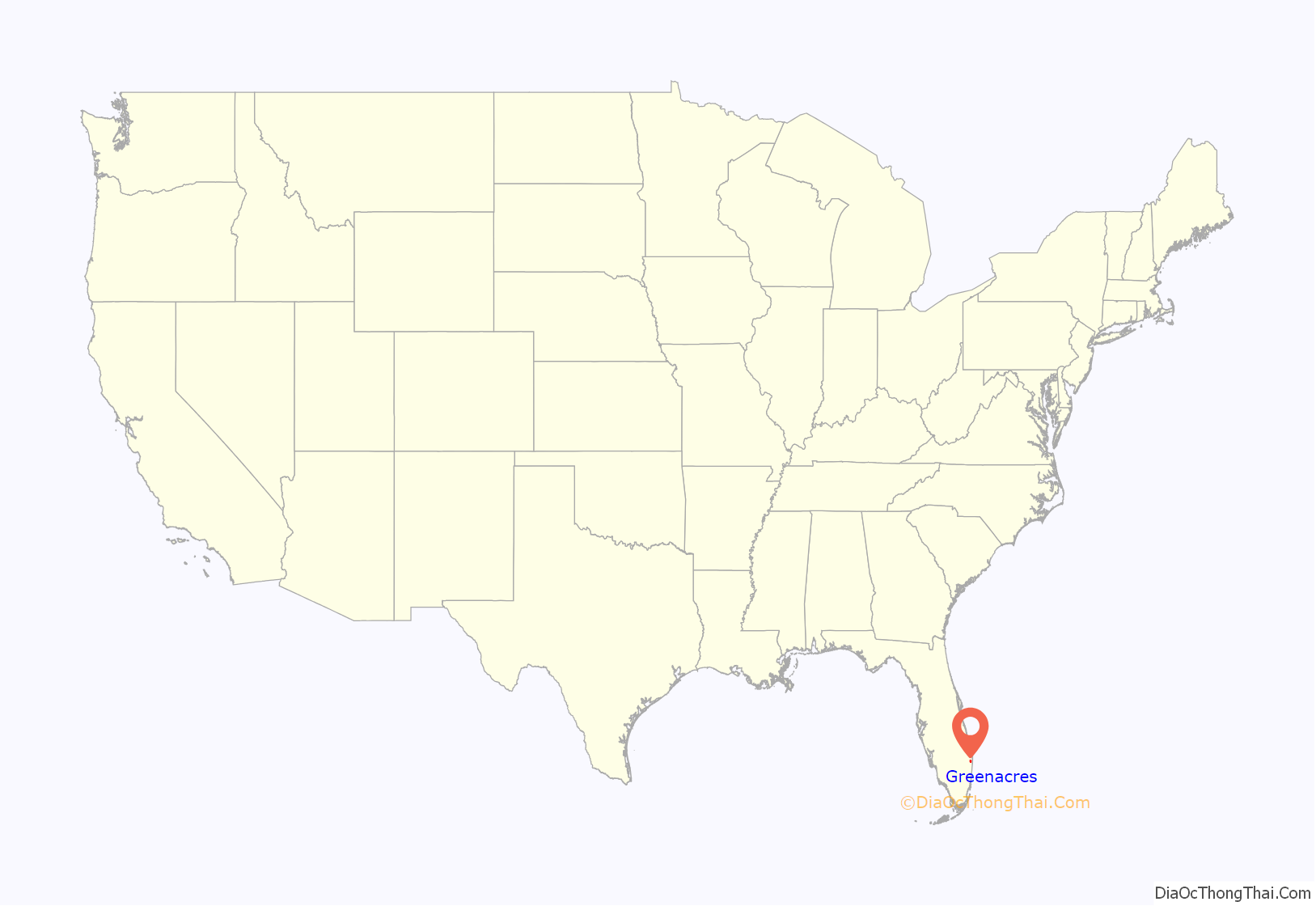
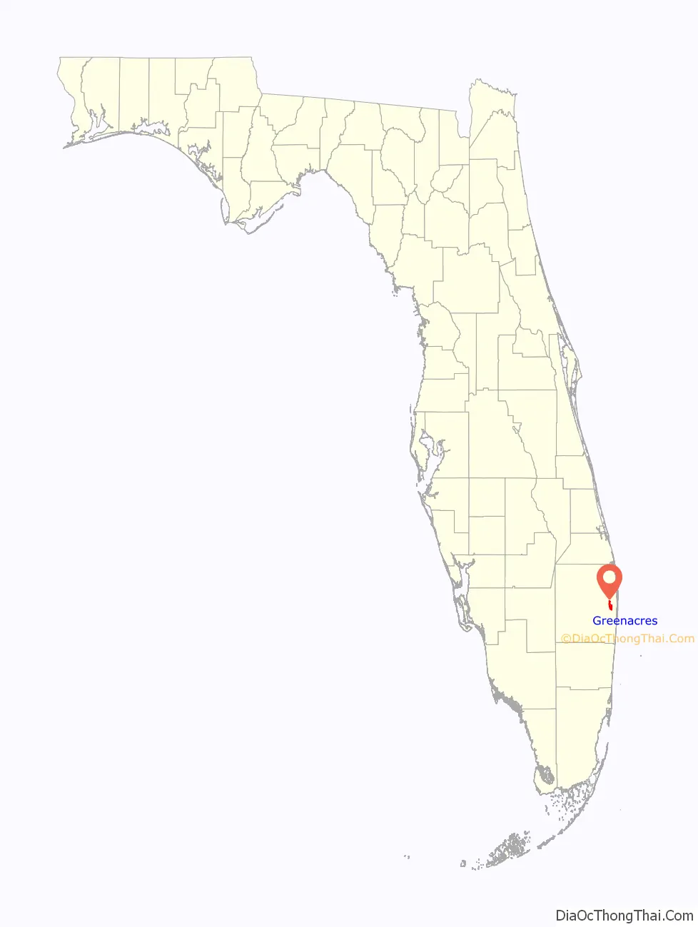
Greenacres is a city in Palm Beach County, Florida, United States. Situated in the east-central portion of the county, Greenacres is located northwest of Atlantis, east of Wellington, and borders Palm Springs to its east. As of the 2010 United States census, the city had a population of 37,573 people, up from 27,569 at the 2000 census. The Census Bureau estimated that 41,117 people reside in Greenacres as of 2019. It is a city within the Miami metropolitan area, which was home to an estimated 6,012,331 people as of 2015.
Frederick E. Bryant, Harold J. Bryant, and William Greenwood of the Palm Beach Farms Company began buying and selling thousands of acres of land in the area by 1909. However, difficulties with farming in wetland conditions left the land mostly unused until the 1920s land boom. Lawrence Carter “L. C.” Swain then platted the original section of Greenacres beginning in 1923. The community was incorporated as Greenacres City on May 24, 1926, with the name being drawn out of a hat. The city was dis-incorporated under controversial circumstances in 1945, before being officially re-incorporated in 1947. The city’s population remained small until rapid growth began in the 1970s. Residents voted to rename the community Greenacres in 1990.
Today, Greenacres is a diverse and relatively large community in terms of population. John I. Leonard High School, the largest high school in Palm Beach County and one of the largest in Florida, has been located in Greenacres since the city annexed the property in 1994.
| Name: | Greenacres city |
|---|---|
| LSAD Code: | 25 |
| LSAD Description: | city (suffix) |
| State: | Florida |
| County: | Palm Beach County |
| Incorporated: | May 24, 1926 |
| Elevation: | 16 ft (5 m) |
| Total Area: | 6.04 sq mi (15.64 km²) |
| Land Area: | 6.00 sq mi (15.54 km²) |
| Water Area: | 0.04 sq mi (0.10 km²) |
| Total Population: | 43,990 |
| Population Density: | 7,331.67/sq mi (2,830.85/km²) |
| ZIP code: | 33400-33499 |
| Area code: | 561 |
| FIPS code: | 1227322 |
| GNISfeature ID: | 283408 |
| Website: | http://greenacresfl.gov/ |
Online Interactive Map
Click on ![]() to view map in "full screen" mode.
to view map in "full screen" mode.
Greenacres location map. Where is Greenacres city?
History
In 1909, Frederick E. Bryant—a British agriculturalist—Harold J. Bryant, and William Greenwood of the Palm Beach Farms Company in Colorado, bought thousands of acres of land in the Everglades and later along the coast of Lake Worth in 1910. The men sold the land to buyers throughout the United States and Canada, offering 5 acres (2.0 ha) plots for $250, with a $10 down payment and a $10 per month charge, which also included a 25 by 25 ft (7.6 by 7.6 m) parcel on the shore of Lake Worth. However, difficulties involved with farming in the Everglades forced 308 buyers to settle at their properties along Lake Worth, an area that would later become the city of Lake Worth. Until the land boom of the 1920s, these lots were effectively abandoned. Around that time, Lawrence Carter “L. C.” Swain of Massachusetts acquired 320 acres (130 ha) of land, with the intention of creating a community for the working class. He initially platted approximately half of the land in 1923, with a plat just west of Military Trail becoming the original section of the city. By 1925, Swain began selling lots for $225.
The town was originally incorporated as Greenacres City on May 24, 1926. The name Greenacres was the winning entry in a local naming contest. Upon incorporating, the town had an estimated 1,250 residents. Swain also became honorary mayor, before the first officials were elected, which included J. H. Southard as mayor, G. W. Simpson as clerk, A. P. Lane as marshal, and S. R. Allen, A. E. Fernell, Robert Hansen, C. Martin, I. E. Shivers, and F. L. Woods as aldermen. Additionally, G. W. Fleenor of Lake Worth became acting attorney. In September of that year, a hurricane destroyed the civic building and community hall, but did not cause much other significant damage. Two years later, Greenacres City was devastated by the 1928 Okeechobee hurricane, which damaged “practically every building” substantially, according to The Lake Worth Herald.
Swain died in 1944; Swain Boulevard and L. C. Swain Middle School are named in his honor. In 1945, about 125 residents petitioned for the Florida Legislature to abolish Greenacres City as a municipality. The legislature passed a bill to dis-incorporate Greenacres City in April of that year, which became a law on April 24, 1945, without the signature of Governor Millard Caldwell. Then-Mayor Charles A. Grabowski actively fought the new law, as no referendum to forfeit the town’s charter had been held. Additionally, Grabowski accused a resident of starting the dissolution movement out of spite after being denied a homestead exemption and claimed that many of the signatories did not actually own property in Greenacres City. Grabowski also asserted that the pleas of city officials and a large number of residents in favor of remaining a town were ignored. On December 4, 1945, a meeting was held to reincorporate Greenacres City. A total of 86 out of 120 registered voters turned out, more than the two-thirds of voters quorum required. The 86 voters unanimously decided to reincorporate. The area’s rights as a city were restored, while Greenacres City was officially reincorporated in 1947. Over the subsequent decades, Greenacres City eventually expanded to 6 sq mi (16 km) through annexation.
In the 1960s, a city hall complex was constructed at the intersection of Perry Avenue and Fourth Street, while a community center was built nearby. The city hall complex originally included a public library and all other city departments, except for the fire and public works departments. By the 1970s, full-time police and fire departments were established. In response to concerns about future growth, residents approved a bond referendum in 1984 to fund construction of a new city hall, a public safety complex, and recreational facilities. In 1990, about 60% of voters chose to drop the word “city” from the official name, thus renaming the municipality Greenacres. After the 1990 census indicated a population of 18,638, city council authorized a special census in 1993, which added more than 3,000 additional residents to the official population count, making Greenacres eligible for funds from the state government of Florida. To commemorate the city’s 80th anniversary, the Greenacres Historical Society was formed in 2006, with a museum established two years later. In July 2007, construction was completed on a new city hall and public works facility on Melaleuca Lane.
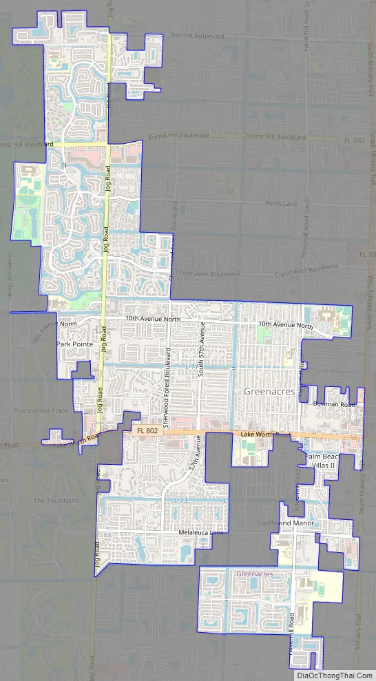
Greenacres Road Map
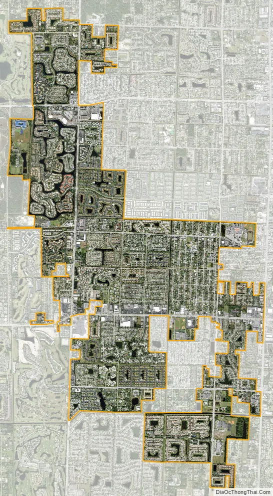
Greenacres city Satellite Map
Geography
Greenacres is located at 26°37′41″N 80°8′7″W / 26.62806°N 80.13528°W / 26.62806; -80.13528 (26.628045, –80.135389).
According to the United States Census Bureau, the city has a total area of 5.79 square miles (15.0 km), all land.
See also
Map of Florida State and its subdivision:- Alachua
- Baker
- Bay
- Bradford
- Brevard
- Broward
- Calhoun
- Charlotte
- Citrus
- Clay
- Collier
- Columbia
- Desoto
- Dixie
- Duval
- Escambia
- Flagler
- Franklin
- Gadsden
- Gilchrist
- Glades
- Gulf
- Hamilton
- Hardee
- Hendry
- Hernando
- Highlands
- Hillsborough
- Holmes
- Indian River
- Jackson
- Jefferson
- Lafayette
- Lake
- Lee
- Leon
- Levy
- Liberty
- Madison
- Manatee
- Marion
- Martin
- Miami-Dade
- Monroe
- Nassau
- Okaloosa
- Okeechobee
- Orange
- Osceola
- Palm Beach
- Pasco
- Pinellas
- Polk
- Putnam
- Saint Johns
- Saint Lucie
- Santa Rosa
- Sarasota
- Seminole
- Sumter
- Suwannee
- Taylor
- Union
- Volusia
- Wakulla
- Walton
- Washington
- Alabama
- Alaska
- Arizona
- Arkansas
- California
- Colorado
- Connecticut
- Delaware
- District of Columbia
- Florida
- Georgia
- Hawaii
- Idaho
- Illinois
- Indiana
- Iowa
- Kansas
- Kentucky
- Louisiana
- Maine
- Maryland
- Massachusetts
- Michigan
- Minnesota
- Mississippi
- Missouri
- Montana
- Nebraska
- Nevada
- New Hampshire
- New Jersey
- New Mexico
- New York
- North Carolina
- North Dakota
- Ohio
- Oklahoma
- Oregon
- Pennsylvania
- Rhode Island
- South Carolina
- South Dakota
- Tennessee
- Texas
- Utah
- Vermont
- Virginia
- Washington
- West Virginia
- Wisconsin
- Wyoming


