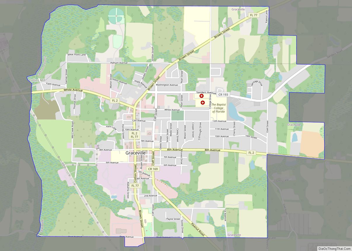
Graceville is a city in Jackson County, Florida, United States. It is near the Alabama state line. The population was 2,278 at the 2010 census. A large portion of Graceville’s rural acreage is located in Holmes County, Florida, United States.
| Name: | Graceville city |
|---|---|
| LSAD Code: | 25 |
| LSAD Description: | city (suffix) |
| State: | Florida |
| County: | Jackson County |
| Elevation: | 151 ft (46 m) |
| Total Area: | 4.44 sq mi (11.49 km²) |
| Land Area: | 4.33 sq mi (11.21 km²) |
| Water Area: | 0.11 sq mi (0.28 km²) |
| Total Population: | 2,153 |
| Population Density: | 497.46/sq mi (192.05/km²) |
| ZIP code: | 32440 |
| Area code: | 850 |
| FIPS code: | 1227000 |
| GNISfeature ID: | 0283260 |
Online Interactive Map
Click on ![]() to view map in "full screen" mode.
to view map in "full screen" mode.
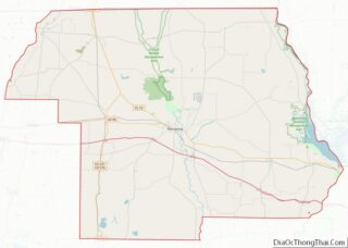
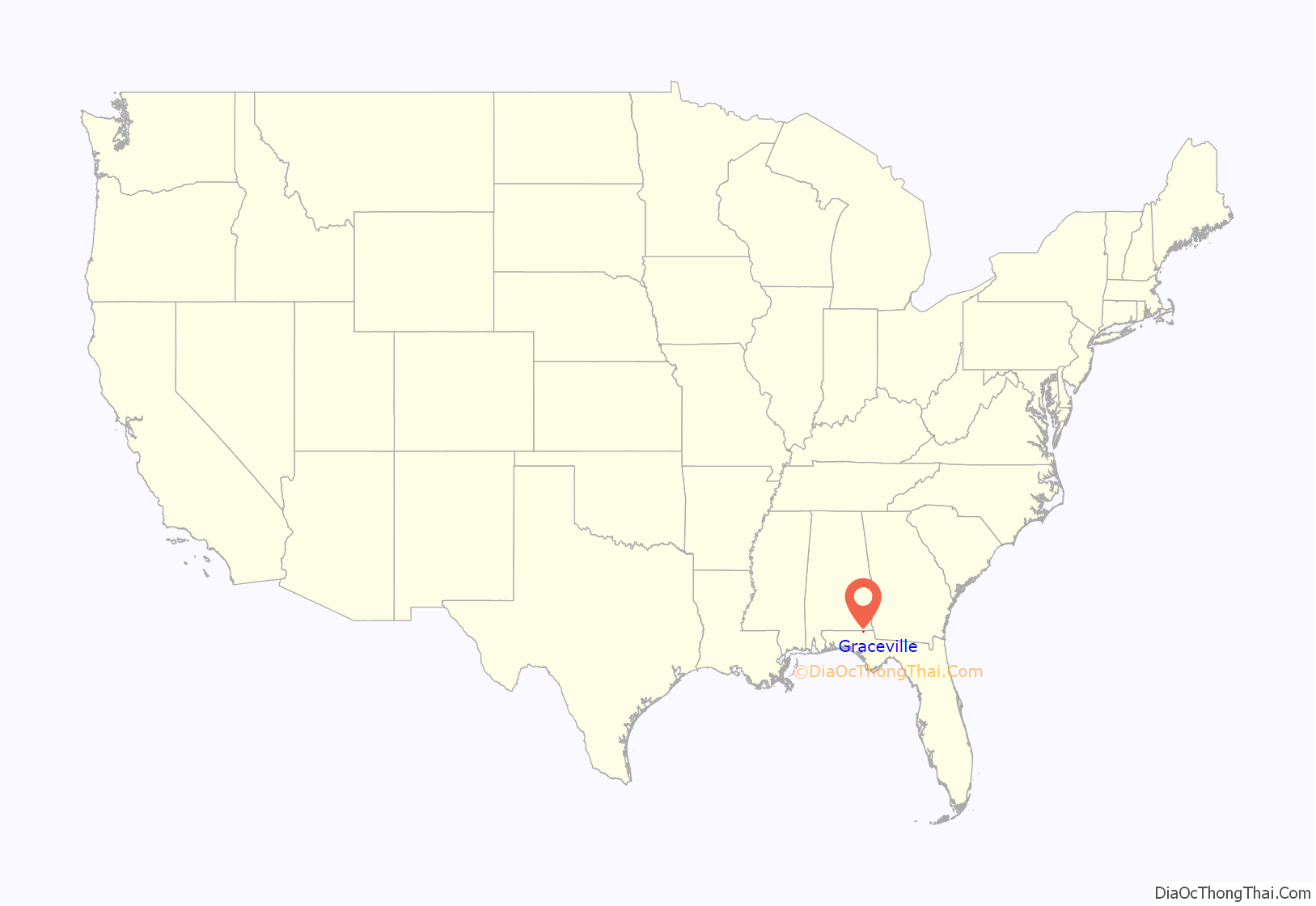
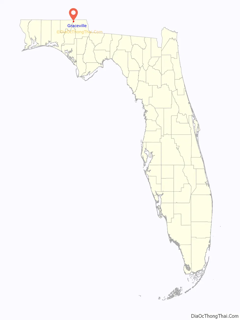
Graceville location map. Where is Graceville city?
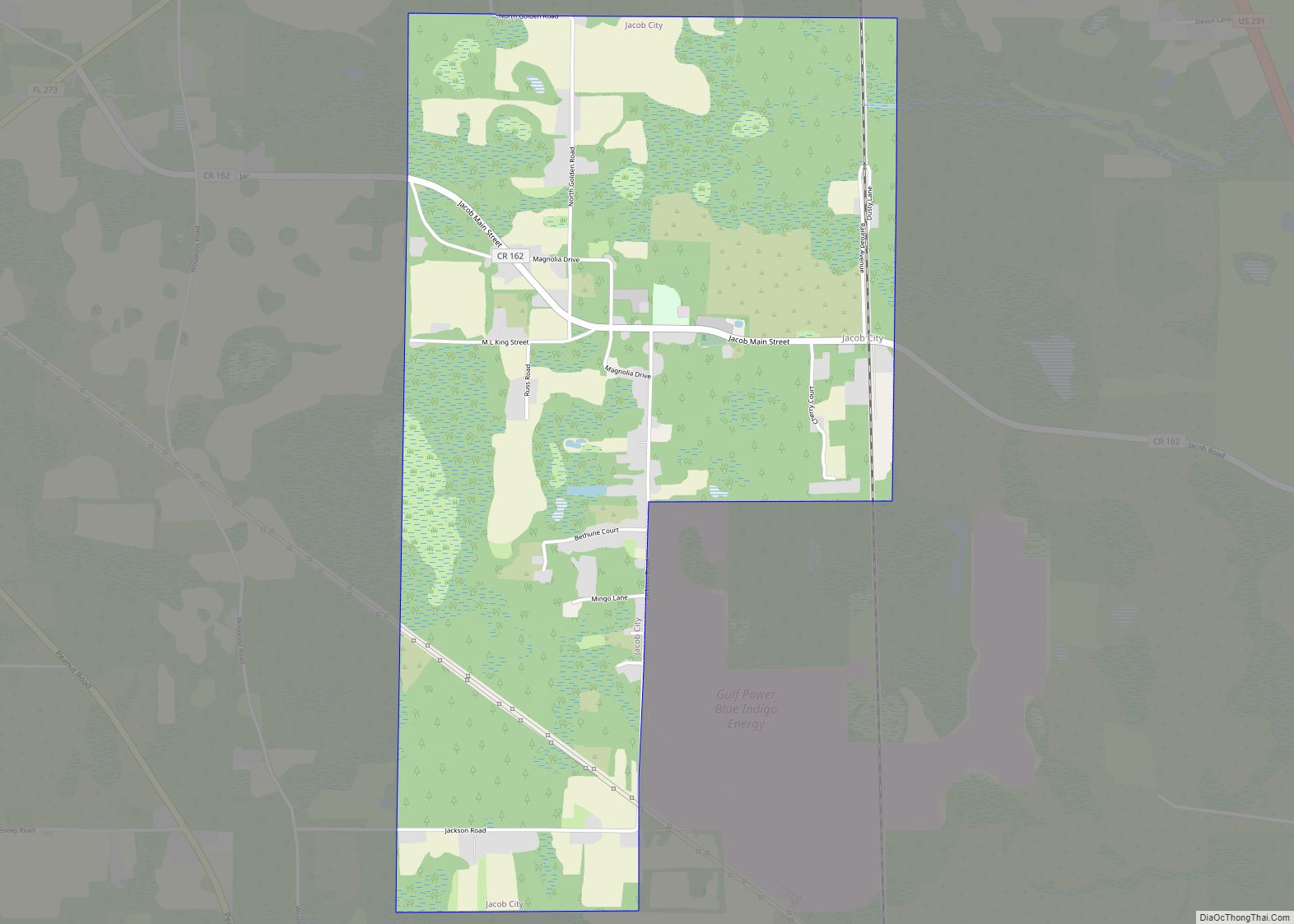
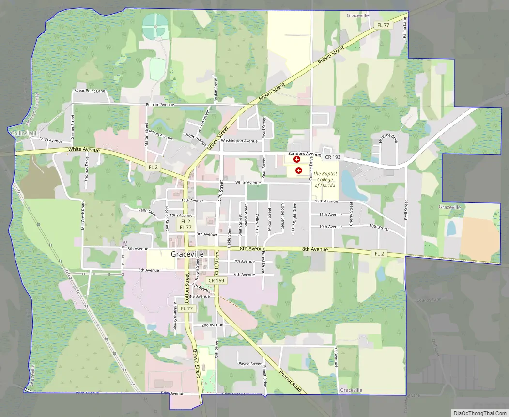
Graceville Road Map
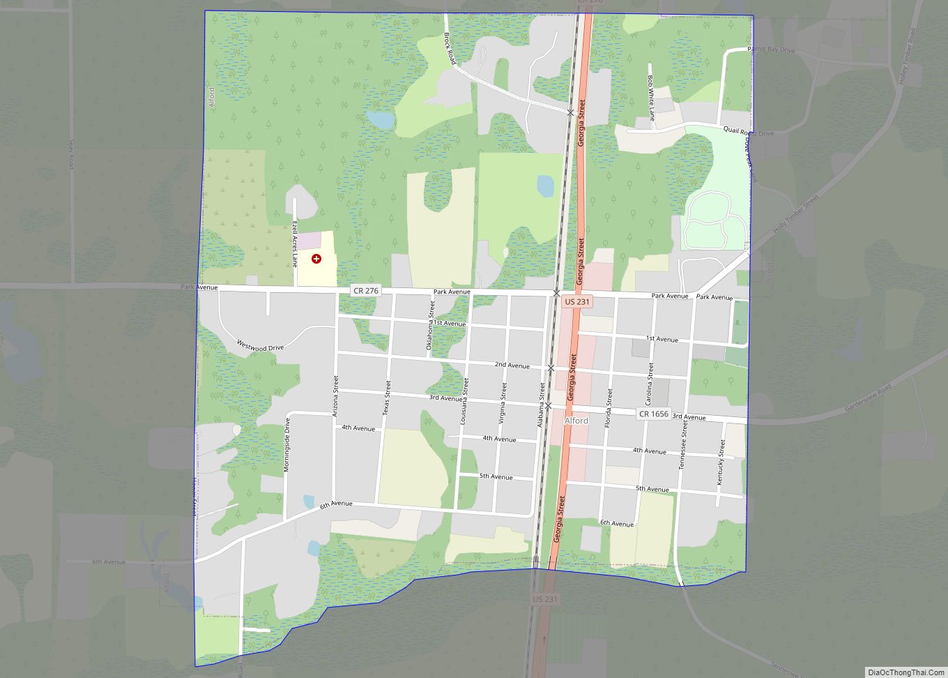
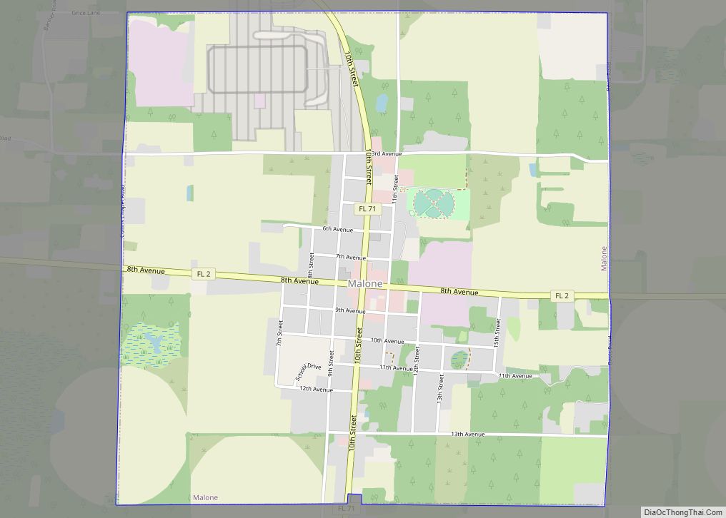
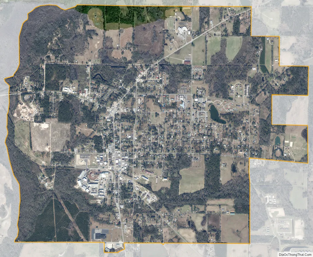
Graceville city Satellite Map
Geography
The City of Graceville is located at 30°57′33″N 85°30′48″W / 30.95917°N 85.51333°W / 30.95917; -85.51333 (30.959044, −85.513280).
Land area: 916 sq mi (2,370 km). Region of the country: Southeast Average temperature: 67.2 Average high temperature: 79.0 Average low temperature: 55.0 Annual rain: 66.0 inches Annual snowfall: 0.0 inches Earthquake index: 0.0
Graceville is one of the only areas in the state of Florida that is divided into two counties. The city limits are located inside Jackson County while a majority of its rural acreage is located inside Holmes County.
Florida State Roads 2 and 77 are the two main highways through the city. FL-2 runs from west to east through the center of town, leading east 7 mi (11 km) to Campbellton and west 10 mi (16 km) to Esto. FL-77 runs from south to north through the center of town, leading northeast 22 mi (35 km) to Dothan, Alabama via a connection with Alabama State Route 109, and south 12 mi (19 km) to Chipley.
Jackson County is a rural community primarily composed of business in agriculture, manufacturing, service, and retail trade. In addition, many government facilities are located within the county, including a federal prison and three state correctional institutions. Elevation ranges from 50 to 330 feet (100 m) above sea level. Marianna is 185 feet (56 m) above sea level.
Soil composition ranges from sandy to clay base. The most typical soil is sandy loam. Jackson County has a vast deposit of nearly pure limestone. The county abounds in lakes including Lake Seminole, Compass Lake, Merritt’s Mill Pond and Ocheessee Pond. The Chattahoochee River-Apalachicola River, which is navigable and has a nine-foot channel depth, forms the county’s eastern border. The Chipola River flows south through the center of the county.
According to the U.S. Census Bureau, Holmes County has a total area of 489 square miles (1,270 km), of which 479 square miles (1,240 km) is land and 10 square miles (26 km) (2.1%) is water. It is the fifth-smallest county in Florida by total area.
See also
Map of Florida State and its subdivision:- Alachua
- Baker
- Bay
- Bradford
- Brevard
- Broward
- Calhoun
- Charlotte
- Citrus
- Clay
- Collier
- Columbia
- Desoto
- Dixie
- Duval
- Escambia
- Flagler
- Franklin
- Gadsden
- Gilchrist
- Glades
- Gulf
- Hamilton
- Hardee
- Hendry
- Hernando
- Highlands
- Hillsborough
- Holmes
- Indian River
- Jackson
- Jefferson
- Lafayette
- Lake
- Lee
- Leon
- Levy
- Liberty
- Madison
- Manatee
- Marion
- Martin
- Miami-Dade
- Monroe
- Nassau
- Okaloosa
- Okeechobee
- Orange
- Osceola
- Palm Beach
- Pasco
- Pinellas
- Polk
- Putnam
- Saint Johns
- Saint Lucie
- Santa Rosa
- Sarasota
- Seminole
- Sumter
- Suwannee
- Taylor
- Union
- Volusia
- Wakulla
- Walton
- Washington
- Alabama
- Alaska
- Arizona
- Arkansas
- California
- Colorado
- Connecticut
- Delaware
- District of Columbia
- Florida
- Georgia
- Hawaii
- Idaho
- Illinois
- Indiana
- Iowa
- Kansas
- Kentucky
- Louisiana
- Maine
- Maryland
- Massachusetts
- Michigan
- Minnesota
- Mississippi
- Missouri
- Montana
- Nebraska
- Nevada
- New Hampshire
- New Jersey
- New Mexico
- New York
- North Carolina
- North Dakota
- Ohio
- Oklahoma
- Oregon
- Pennsylvania
- Rhode Island
- South Carolina
- South Dakota
- Tennessee
- Texas
- Utah
- Vermont
- Virginia
- Washington
- West Virginia
- Wisconsin
- Wyoming