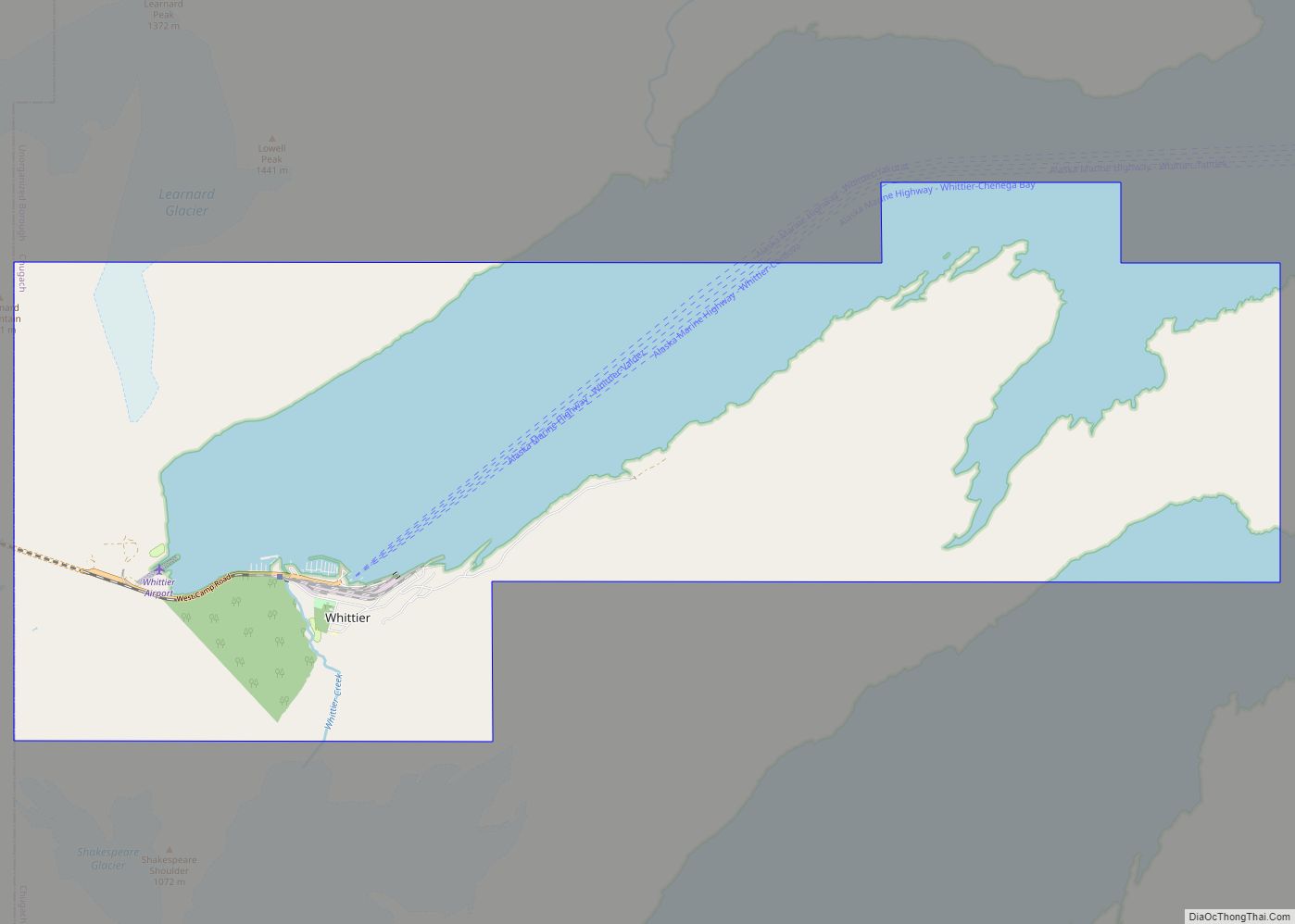
Map of Whitestone CDP

Map of Whitestone CDP

Whitestone is an unincorporated community and census-designated place in Southeast Fairbanks Census Area, Alaska, United States. Its population was 71 as of the 2020 census. This is not to be confused with Whitestone Logging Camp CDP in the Alaskan panhandle. Whitestone CDP overview: Name: Whitestone CDP LSAD Code: 57 LSAD Description: CDP (suffix) State: Alaska … Read more

Map of Whitestone Logging Camp CDP

Map of Whitestone Logging Camp CDP

Whitestone Logging Camp (Lingít: Yan Kashada Tináa) is a census-designated place (CDP) on Chichagof Island in Hoonah-Angoon Census Area, Alaska, United States. In 2010, the population was 17, down from 116 in 2000. It is not to be confused with Whitestone, another CDP in Southeast Fairbanks Census Area. Whitestone Logging Camp CDP overview: Name: Whitestone … Read more

Map of Wiseman CDP

Map of Wiseman CDP

Wiseman is a census-designated place (CDP) in Yukon-Koyukuk Census Area, Alaska, United States. The full time resident population is 12 as of 2022. Wiseman is a small mining community along the Middle Fork Koyukuk River in the Brooks Range. It was founded by gold miners who abandoned the Slate Creek (later Coldfoot) settlement around 1908. … Read more

Map of Willow CDP

Map of Willow CDP, Alaska

Willow is a census-designated place (CDP) in the Matanuska-Susitna Borough in the U.S. state of Alaska. Located 26 miles northwest from Wasilla along the George Parks Highway, it is part of the Anchorage, Alaska Metropolitan Statistical Area. At the 2020 census the population was 2,196, up from 2,102 in 2010. Willow CDP overview: Name: Willow … Read more

Map of Willow Creek CDP

Map of Willow Creek CDP, Alaska

Willow Creek is a census-designated place (CDP) in Copper River Census Area, Alaska, United States. At the 2020 census the population was 190, down from 191 in 2010. Willow Creek CDP overview: Name: Willow Creek CDP LSAD Code: 57 LSAD Description: CDP (suffix) State: Alaska County: Valdez-Cordova Census Area Total Area: 37.91 sq mi (98.18 km²) Land Area: … Read more

Map of Abanda CDP

Map of Abanda CDP

Abanda is a census-designated place and unincorporated community in Chambers County, Alabama, United States. Its population was 133 as of the 2020 census. Abanda CDP overview: Name: Abanda CDP LSAD Code: 57 LSAD Description: CDP (suffix) State: Alabama County: Chambers County Elevation: 646 ft (197 m) Total Area: 3.01 sq mi (7.80 km²) Land Area: 3.00 sq mi (7.76 km²) Water Area: 0.01 sq mi … Read more

Map of Yakutat CDP

Map of Yakutat CDP

The City and Borough of Yakutat (/ˈjækətæt/, YAK-ə-tat; Tlingit: Yaakwdáat; Russian: Якутат) is a borough in the state of Alaska and the name of a former city within the borough. The name in Tlingit is Yaakwdáat (meaning “the place where canoes rest”). It is derived from an Eyak name, diyaʼqudaʼt, and was influenced by the … Read more

Map of Womens Bay CDP

Map of Womens Bay CDP

Womens Bay is a census-designated place (CDP) in Kodiak Island Borough, Alaska, United States. At the 2020 census the population was 743, up from 719 in 2010. The name is correctly spelled “Womens”, without an apostrophe. Womens Bay CDP overview: Name: Womens Bay CDP LSAD Code: 57 LSAD Description: CDP (suffix) State: Alaska County: Kodiak … Read more

Map of Addison town

Map of Addison town, Alabama

Addison is a town in Winston County, Alabama, United States. It incorporated in December 1949. At the 2020 U.S. Census, it had a population of 659, down from 758 in 2010. Addison town overview: Name: Addison town LSAD Code: 43 LSAD Description: town (suffix) State: Alabama County: Winston County Elevation: 784 ft (239 m) Total Area: 3.80 sq mi … Read more

Map of Adamsville city

Map of Adamsville city, Alabama

Adamsville is a city in western Jefferson County, Alabama. It is north from the Birmingham suburb of Pleasant Grove. It initially incorporated in 1901 (although the 1910 U.S. Census stated 1900), but disincorporated in 1915. It later reincorporated in 1953. According to the 2010 census, this town had a population of 4,522, down from its … Read more

Map of Abbeville city

Map of Abbeville city, Alabama

Abbeville is a city in and the county seat of Henry County, in the southeast part of Alabama, United States. It is part of the Dothan, Alabama Metropolitan Statistical Area. At the 2020 census, the population was 2,358. It is the first city alphabetically, both by city and state, in the Rand McNally Road Atlas. … Read more

Map of Albertville city

Map of Albertville city, Alabama

Albertville is a city in Marshall County, Alabama, United States, and is included in the Huntsville-Decatur Combined Statistical Area. As of the 2020 census, the population of the city was 22,386. It is the largest city in Marshall County. Albertville city overview: Name: Albertville city LSAD Code: 25 LSAD Description: city (suffix) State: Alabama County: … Read more