Albertville is a city in Marshall County, Alabama, United States, and is included in the Huntsville-Decatur Combined Statistical Area. As of the 2020 census, the population of the city was 22,386. It is the largest city in Marshall County.
| Name: | Albertville city |
|---|---|
| LSAD Code: | 25 |
| LSAD Description: | city (suffix) |
| State: | Alabama |
| County: | Marshall County |
| Incorporated: | February 18, 1891 |
| Elevation: | 1,024 ft (312 m) |
| Total Area: | 27.04 sq mi (70.0 km²) |
| Land Area: | 26.94 sq mi (69.8 km²) |
| Water Area: | 0.10 sq mi (0.3 km²) |
| Total Population: | 22,386 |
| Population Density: | 830.99/sq mi (320.85/km²) |
| ZIP code: | 35950-35951 |
| FIPS code: | 0100988 |
| GNISfeature ID: | 2403074 |
| Website: | www.cityofalbertville.com |
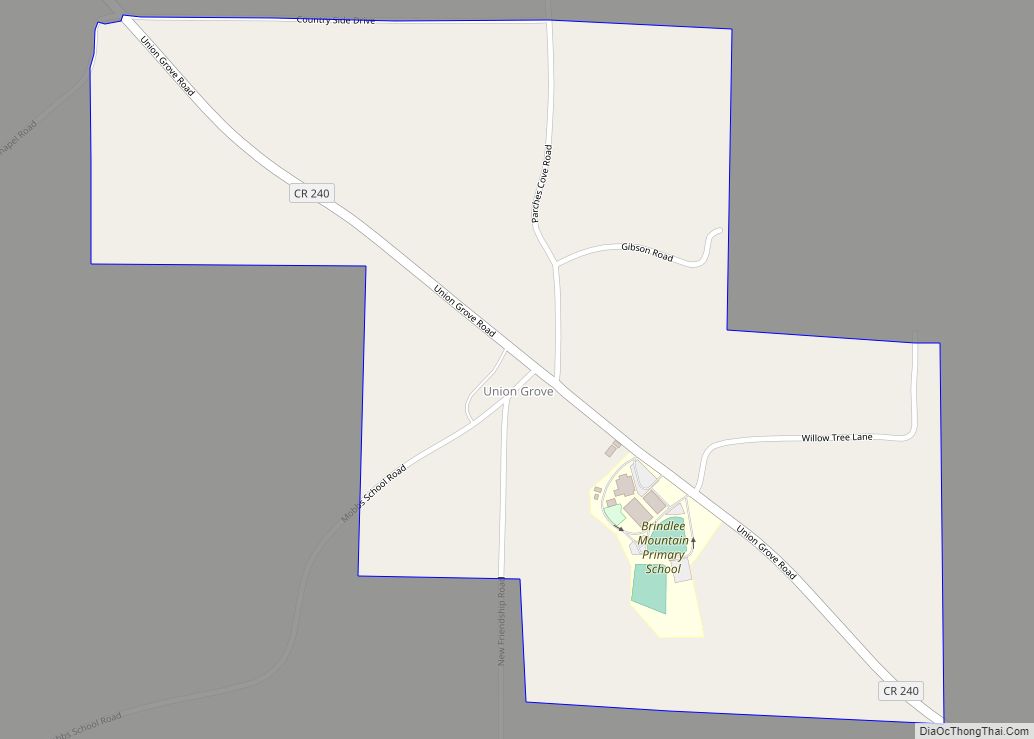
Online Interactive Map
Click on ![]() to view map in "full screen" mode.
to view map in "full screen" mode.
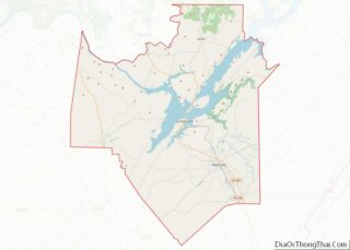
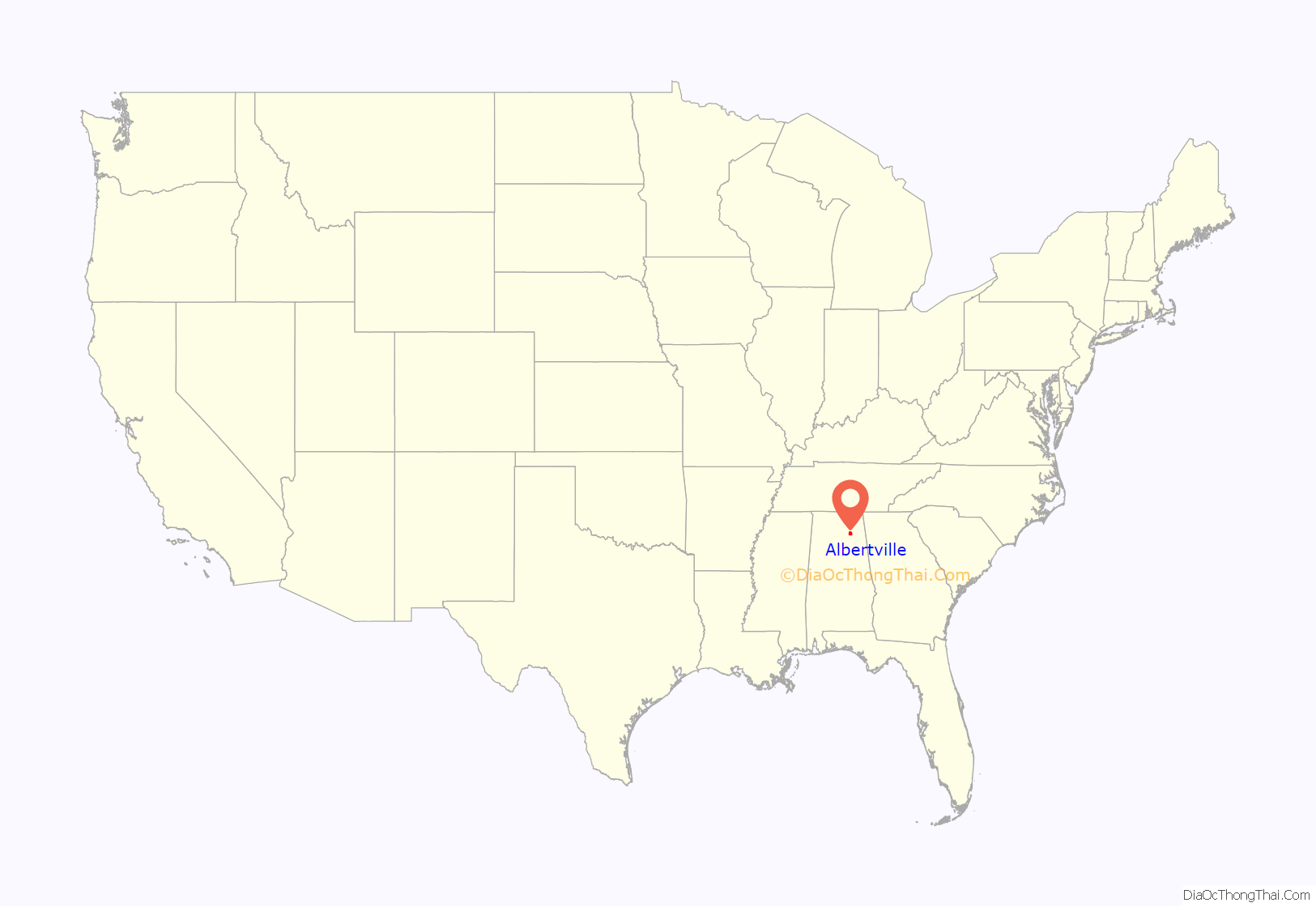
Albertville location map. Where is Albertville city?

History
The area which today includes Albertville was inhabited by the indigenous Cherokee, until their removal to Oklahoma in the 1830s. It was near the territory of the Creek nation, and several major trails which afforded communication (or military action) between the two nations crossed the area. It is believed to have been crossed by Spanish explorer Hernando de Soto during his expeditions in 1540.
During the American Civil War, the area around Albertville was the scene of several mid-level clashes between Union and Confederate forces.
The first non-indigenous settlement in what is today Albertville began in the 1850s. It was named for Thomas A. Albert, an early settler who moved from Georgia and was a town leader until his death in 1876. The city was incorporated in 1891. A post office was established in 1910.
At about 4:10 p.m. on April 24, 1908, the city was virtually wiped out by a tornado that became commonly called “The Great Cyclone”, or “The Cyclone of 1908”. The storm is believed to have killed 35 people across northeastern Alabama, including 15 in Albertville. Relief was largely delivered by railroad, particularly from the nearby city of Gadsden. Trains from Gadsden transported doctors, nurses, and the Queen City Guards, the Alabama militia company based in Gadsden. The commander of the latter, future Gadsden mayor and Col. R.A. Mitchell, reported in a dispatch to Governor B.B. Comer:
In 1893, the Alabama Legislature passed an act for the erection of an agricultural college in each of the state’s congressional districts. After some competition, Albertville was awarded the school for the Seventh District. This is the school that evolved into today’s Albertville High School, whose sports teams are still known as the “Aggies”.
In 1910, Albertville had a population of 1,544, becoming the largest community in Marshall County.
Before the New Deal, when the Tennessee Valley Authority built Guntersville Dam, flooding on the Tennessee River would frequently leave the county courthouse in Guntersville inaccessible for residents of Albertville and other areas atop Sand Mountain. In 1919, the Alabama Legislature responded by requiring the erection of a courthouse at Albertville, in which cases arising in that part of the county would be heard.
In 1950, Albertville had a population of 5,397, and reclaimed the title (from Guntersville) of the largest city in the county, and has held the distinction ever since.
On June 1, 2009, the city council voted to establish English as the town’s official language.
On April 24, 2010, an EF-3 tornado ripped through downtown Albertville. The storm resulted in no deaths. The high school was severely damaged, nearly every home had some type of damage, and many were destroyed beyond repair.
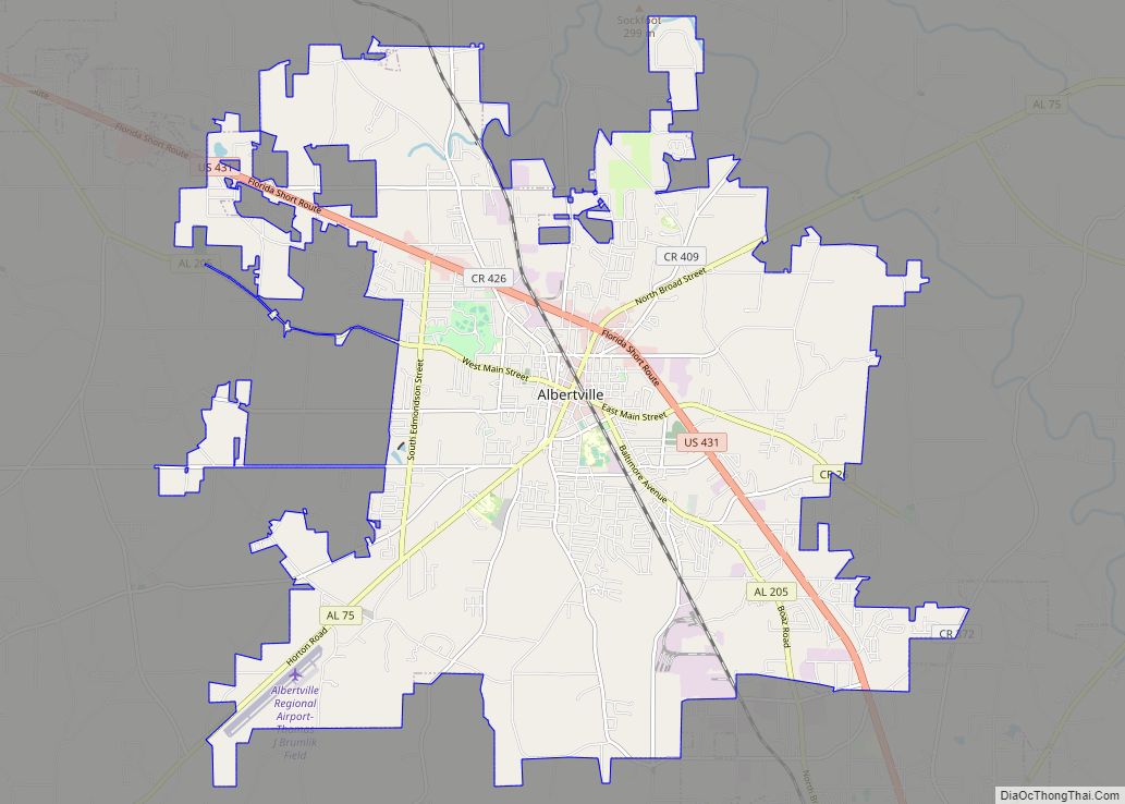
Albertville Road Map
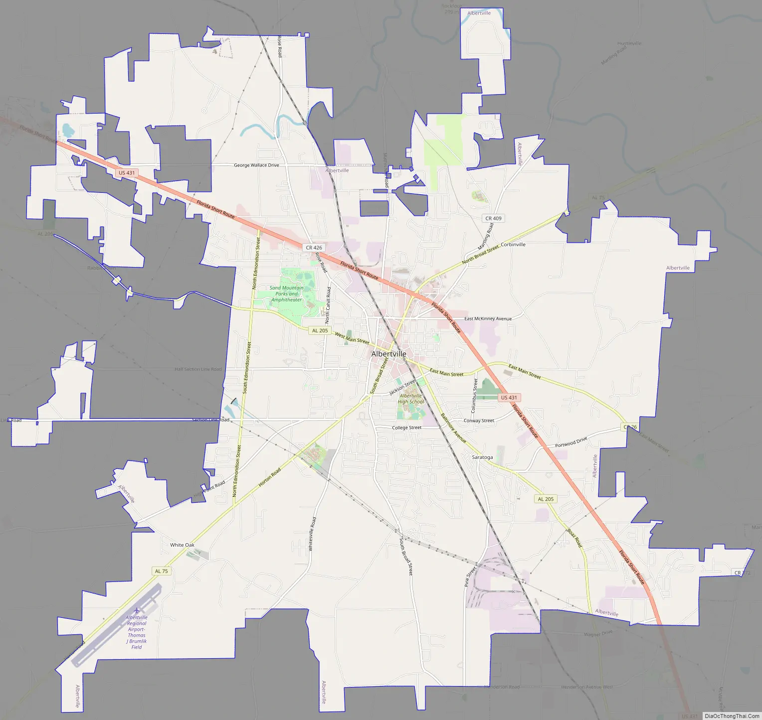
Albertville city Satellite Map

Geography
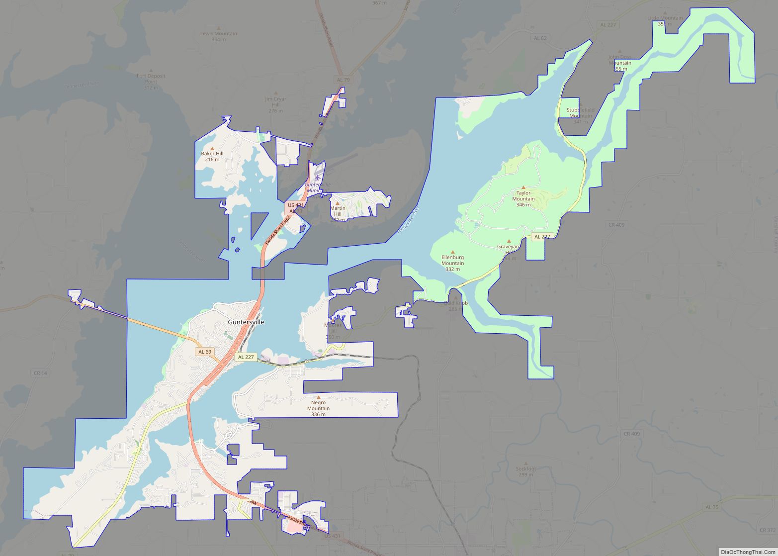
Albertville is located in southeastern Marshall County at 34°15′55″N 86°12′41″W / 34.26528°N 86.21139°W / 34.26528; -86.21139 (34.265362, -86.211261). It is bordered to the southeast by the city of Boaz and to the northwest by the city of Guntersville.
According to the U.S. Census Bureau, Albertville has a total area of 27.0 square miles (69.9 km), of which 0.1 square miles (0.3 km), or 0.37%, are water. The city sits at an elevation of 1,060 feet (320 m) atop Sand Mountain, a plateau that in this area is about 15 miles (24 km) wide. The Tennessee Valley Divide passes through the southern part of the city. The majority of the city drains north to Short Creek, a tributary of the Tennessee River, while the southern part drains to Slab Creek, a west-flowing tributary of the Locust Fork of the Black Warrior River. The current slogan of Albertville is “The Heart of Sand Mountain”, which can be seen on the welcome sign coming into the city.
See also
Map of Alabama State and its subdivision:- Autauga
- Baldwin
- Barbour
- Bibb
- Blount
- Bullock
- Butler
- Calhoun
- Chambers
- Cherokee
- Chilton
- Choctaw
- Clarke
- Clay
- Cleburne
- Coffee
- Colbert
- Conecuh
- Coosa
- Covington
- Crenshaw
- Cullman
- Dale
- Dallas
- De Kalb
- Elmore
- Escambia
- Etowah
- Fayette
- Franklin
- Geneva
- Greene
- Hale
- Henry
- Houston
- Jackson
- Jefferson
- Lamar
- Lauderdale
- Lawrence
- Lee
- Limestone
- Lowndes
- Macon
- Madison
- Marengo
- Marion
- Marshall
- Mobile
- Monroe
- Montgomery
- Morgan
- Perry
- Pickens
- Pike
- Randolph
- Russell
- Saint Clair
- Shelby
- Sumter
- Talladega
- Tallapoosa
- Tuscaloosa
- Walker
- Washington
- Wilcox
- Winston
- Alabama
- Alaska
- Arizona
- Arkansas
- California
- Colorado
- Connecticut
- Delaware
- District of Columbia
- Florida
- Georgia
- Hawaii
- Idaho
- Illinois
- Indiana
- Iowa
- Kansas
- Kentucky
- Louisiana
- Maine
- Maryland
- Massachusetts
- Michigan
- Minnesota
- Mississippi
- Missouri
- Montana
- Nebraska
- Nevada
- New Hampshire
- New Jersey
- New Mexico
- New York
- North Carolina
- North Dakota
- Ohio
- Oklahoma
- Oregon
- Pennsylvania
- Rhode Island
- South Carolina
- South Dakota
- Tennessee
- Texas
- Utah
- Vermont
- Virginia
- Washington
- West Virginia
- Wisconsin
- Wyoming