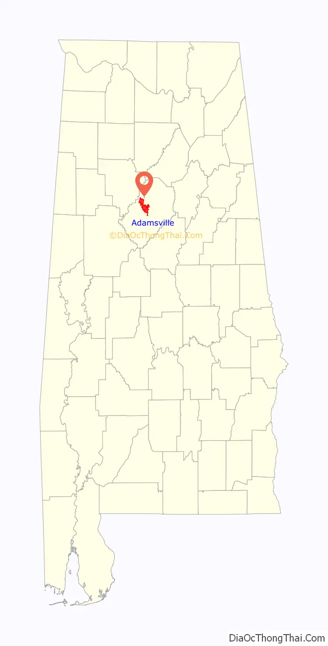
Adamsville is a city in western Jefferson County, Alabama. It is north from the Birmingham suburb of Pleasant Grove. It initially incorporated in 1901 (although the 1910 U.S. Census stated 1900), but disincorporated in 1915. It later reincorporated in 1953. According to the 2010 census, this town had a population of 4,522, down from its peak population of 4,965 in 2000.
| Name: | Adamsville city |
|---|---|
| LSAD Code: | 25 |
| LSAD Description: | city (suffix) |
| State: | Alabama |
| County: | Jefferson County |
| Elevation: | 574 ft (175 m) |
| Total Area: | 26.42 sq mi (68.44 km²) |
| Land Area: | 26.21 sq mi (67.90 km²) |
| Water Area: | 0.21 sq mi (0.54 km²) 0.05% |
| Total Population: | 4,366 |
| Population Density: | 166.55/sq mi (64.30/km²) |
| ZIP code: | 35005 |
| FIPS code: | 0100460 |
| GNISfeature ID: | 112930 |
| Website: | www.cityofadamsville.org |
Online Interactive Map
Click on ![]() to view map in "full screen" mode.
to view map in "full screen" mode.
Adamsville location map. Where is Adamsville city?

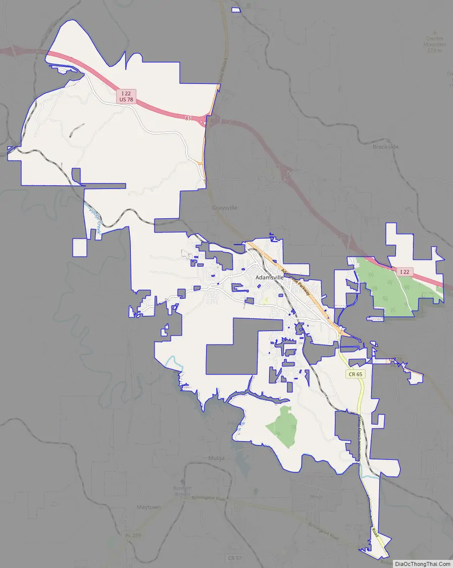
Adamsville Road Map
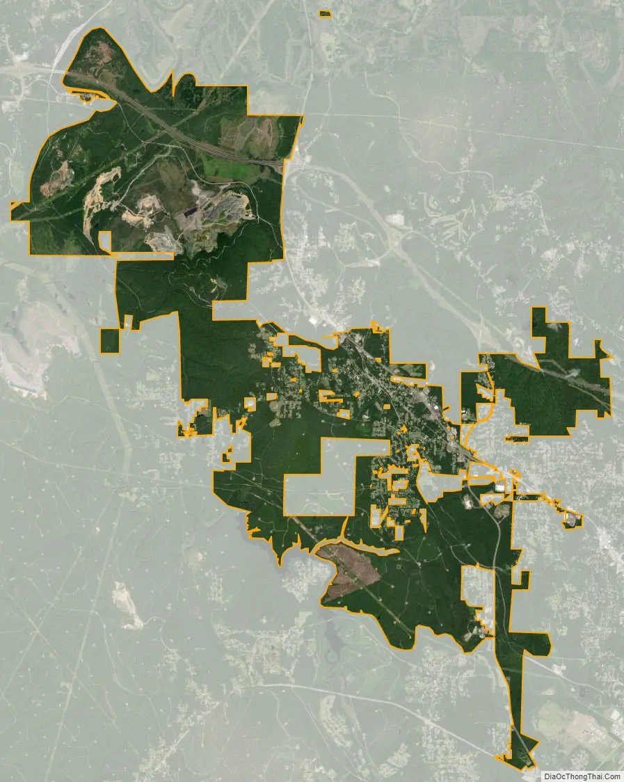
Adamsville city Satellite Map
Geography
Adamsville is located at 33°35′25″N 86°56′57″W / 33.59028°N 86.94917°W / 33.59028; -86.94917 (33.590411, -86.949166).
According to the United States Census Bureau, the town has a total area of 19.6 square miles (51 km), of which 19.6 square miles (51 km) is land and 0.05% is water.
See also
Map of Alabama State and its subdivision:- Autauga
- Baldwin
- Barbour
- Bibb
- Blount
- Bullock
- Butler
- Calhoun
- Chambers
- Cherokee
- Chilton
- Choctaw
- Clarke
- Clay
- Cleburne
- Coffee
- Colbert
- Conecuh
- Coosa
- Covington
- Crenshaw
- Cullman
- Dale
- Dallas
- De Kalb
- Elmore
- Escambia
- Etowah
- Fayette
- Franklin
- Geneva
- Greene
- Hale
- Henry
- Houston
- Jackson
- Jefferson
- Lamar
- Lauderdale
- Lawrence
- Lee
- Limestone
- Lowndes
- Macon
- Madison
- Marengo
- Marion
- Marshall
- Mobile
- Monroe
- Montgomery
- Morgan
- Perry
- Pickens
- Pike
- Randolph
- Russell
- Saint Clair
- Shelby
- Sumter
- Talladega
- Tallapoosa
- Tuscaloosa
- Walker
- Washington
- Wilcox
- Winston
- Alabama
- Alaska
- Arizona
- Arkansas
- California
- Colorado
- Connecticut
- Delaware
- District of Columbia
- Florida
- Georgia
- Hawaii
- Idaho
- Illinois
- Indiana
- Iowa
- Kansas
- Kentucky
- Louisiana
- Maine
- Maryland
- Massachusetts
- Michigan
- Minnesota
- Mississippi
- Missouri
- Montana
- Nebraska
- Nevada
- New Hampshire
- New Jersey
- New Mexico
- New York
- North Carolina
- North Dakota
- Ohio
- Oklahoma
- Oregon
- Pennsylvania
- Rhode Island
- South Carolina
- South Dakota
- Tennessee
- Texas
- Utah
- Vermont
- Virginia
- Washington
- West Virginia
- Wisconsin
- Wyoming


