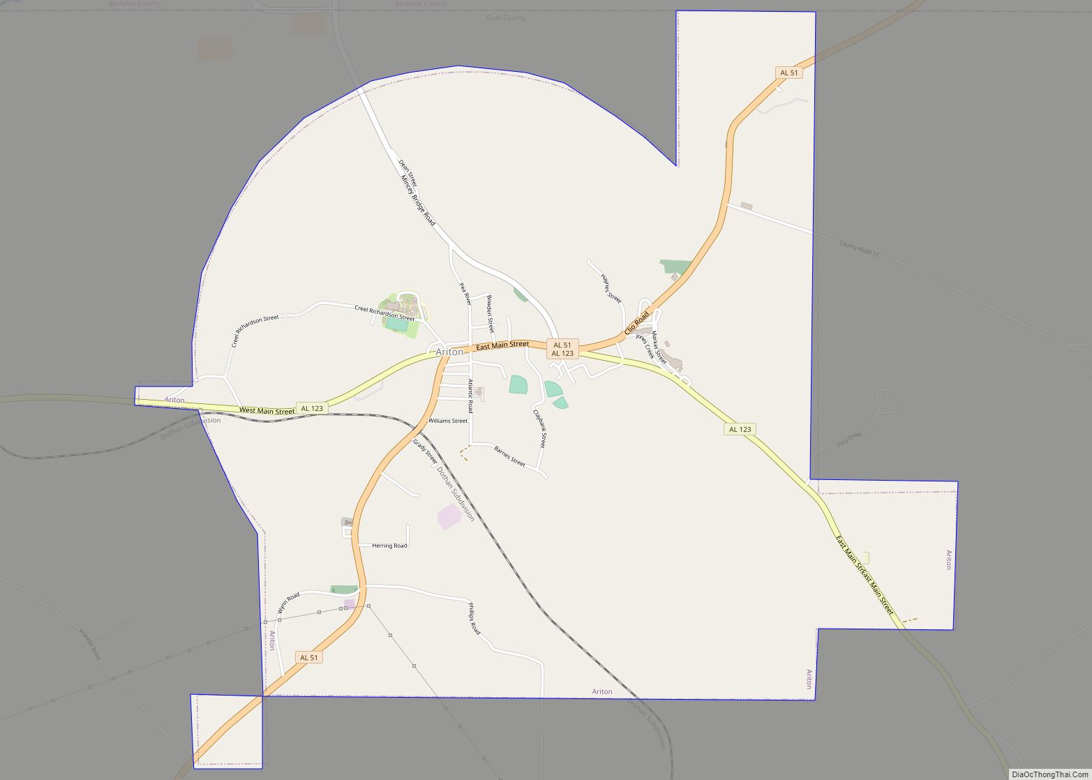
Map of Argo town

Map of Argo town

Argo is a town in Jefferson and St. Clair counties, Alabama, United States. It incorporated in 1987. At the 2020 census, the population was 4,368. Argo town overview: Name: Argo town LSAD Code: 43 LSAD Description: town (suffix) State: Alabama County: Jefferson County, St. Clair County Elevation: 814 ft (248 m) Total Area: 10.70 sq mi (27.72 km²) Land Area: … Read more

Map of Ardmore town

Map of Ardmore town, Alabama

Ardmore is a town in Limestone County, Alabama, United States, and is included in the Huntsville-Decatur Metro Area. It is home to the Saturn IB rocket at the Alabama Welcome Center, just south of the Tennessee border, on Interstate 65. As of the 2010 census, the population of the town is 1,194. It borders its … Read more

Map of Ashland town

Map of Ashland town, Alabama

Ashland is a city in Clay County, Alabama, United States. The population was 2,037 at the 2010 census. The city is the county seat of Clay County. Ashland town overview: Name: Ashland town LSAD Code: 43 LSAD Description: town (suffix) State: Alabama County: Clay County Incorporated: 1871 Elevation: 1,119 ft (341 m) Total Area: 7.38 sq mi (19.11 km²) Land … Read more

Map of Ashford town

Map of Ashford town, Alabama

Ashford is a town in Houston County, Alabama, United States. It is part of the Dothan, Alabama Metropolitan Statistical Area. The town was incorporated in June 1891. For most of its history, it was a center for naval stores production, pulpwood harvesting, and cotton agriculture. The population was 2,148 at the 2010 census, up from … Read more

Map of Arley town

Map of Arley town

Arley is a town in Winston County, Alabama, United States. It incorporated on December 18, 1965. At the 2020 census the population was 330, down from 357 in 2010. Arley town overview: Name: Arley town LSAD Code: 43 LSAD Description: town (suffix) State: Alabama County: Winston County Elevation: 778 ft (237 m) Total Area: 3.77 sq mi (9.77 km²) Land … Read more

Map of Atmore city

Map of Atmore city

Atmore is a city in Escambia County, Alabama, United States. It was incorporated in 1907. As of the 2020 census, it has a population of 8,391. Atmore is in the planning stages to increase its economic base with additions in its new Rivercane development along the I-65 corridor. Atmore has completed requirements to be recognized … Read more

Map of Athens city

Map of Athens city, Alabama

Athens is a city in and the county seat of Limestone County, in the U.S. state of Alabama; it is included in the Huntsville-Decatur-Albertville, AL Combined Statistical Area. As of the 2020 census, the population of the city is 25,406. Athens city overview: Name: Athens city LSAD Code: 25 LSAD Description: city (suffix) State: Alabama … Read more

Map of Ashville city

Map of Ashville city, Alabama

Ashville is a city in and one of the county seats of St. Clair County, Alabama, United States, other seat being Pell City. Its population was 2,212 at the 2010 census, down from 2,260, at which time it was a town. It incorporated in 1822. Ashville city overview: Name: Ashville city LSAD Code: 25 LSAD … Read more

Map of Autaugaville town

Map of Autaugaville town

Autaugaville is a town in Autauga County, Alabama, United States. At the 2020 census, the population was 795. It is part of the Montgomery Metropolitan Statistical Area. Autaugaville town overview: Name: Autaugaville town LSAD Code: 43 LSAD Description: town (suffix) State: Alabama County: Autauga County Elevation: 161 ft (49 m) Total Area: 8.04 sq mi (20.82 km²) Land Area: 7.83 sq mi … Read more

Map of Auburn city

Map of Auburn city, Alabama

Auburn is a city in Lee County, Alabama, United States. It is the largest city in eastern Alabama, with a 2020 population of 76,143. It is a principal city of the Auburn-Opelika Metropolitan Area. The Auburn-Opelika, AL MSA with a population of 158,991, along with the Columbus, GA-AL MSA and Tuskegee, Alabama, comprises the greater … Read more

Map of Attalla city

Map of Attalla city

Attalla is a city in Etowah County, Alabama, United States. As of the 2010 census, the population was 6,048. Attalla city overview: Name: Attalla city LSAD Code: 25 LSAD Description: city (suffix) State: Alabama County: Etowah County Elevation: 558 ft (170 m) Total Area: 7.00 sq mi (18.13 km²) Land Area: 7.00 sq mi (18.13 km²) Water Area: 0.00 sq mi (0.00 km²) Total Population: 5,827 … Read more

Map of Babbie town

Map of Babbie town

Babbie is a town in Covington County, Alabama, United States. At the 2020 census, the population was 625. It incorporated in 1957. Babbie town overview: Name: Babbie town LSAD Code: 43 LSAD Description: town (suffix) State: Alabama County: Covington County Elevation: 259 ft (79 m) Total Area: 11.59 sq mi (30.01 km²) Land Area: 11.47 sq mi (29.71 km²) Water Area: 0.12 sq mi (0.30 km²) … Read more