Map of Brazil city
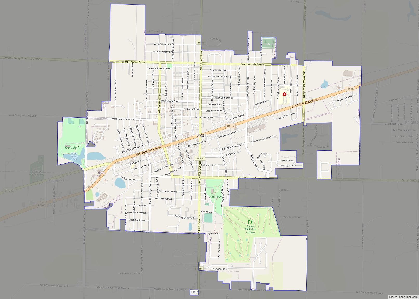
Brazil is a city in Clay County, Indiana, United States. The population was 7,912 at the 2010 census. The city is the county seat of Clay County. It is part of the Terre Haute Metropolitan Statistical Area. The current chief executive of Brazil is Mayor Brian Wyndham (Democrat). Brazil city overview: Name: Brazil city LSAD ... Read more
Map of Brazil city
Map of Bourbon town, Indiana
Bourbon is a town in Bourbon Township, Marshall County, Indiana, United States. The population was 1,698 at the 2020 census. Bourbon town overview: Name: Bourbon town LSAD Code: 43 LSAD Description: town (suffix) State: Indiana County: Marshall County Elevation: 843 ft (257 m) Total Area: 1.16 sq mi (2.99 km²) Land Area: 1.15 sq mi (2.98 km²) Water Area: 0.00 sq mi (0.01 km²) Total Population: ... Read more
Map of Bourbon town, Indiana
Map of Boswell town, Indiana
Boswell is a town in Grant Township, Benton County, Indiana, United States. The population was 778 at the 2010 census. It is part of the Lafayette, Indiana Metropolitan Statistical Area. Boswell town overview: Name: Boswell town LSAD Code: 43 LSAD Description: town (suffix) State: Indiana County: Benton County Founded: 1872 Elevation: 755 ft (230 m) Total Area: ... Read more
Map of Boswell town, Indiana
Map of Bristol town, Indiana
Bristol is a town in Washington Township, Elkhart County, Indiana, United States. The population was 1,602 at the 2010 census. Bristol town overview: Name: Bristol town LSAD Code: 43 LSAD Description: town (suffix) State: Indiana County: Elkhart County Elevation: 748 ft (228 m) Total Area: 4.16 sq mi (10.78 km²) Land Area: 4.02 sq mi (10.41 km²) Water Area: 0.14 sq mi (0.37 km²) Total Population: ... Read more
Map of Bristol town, Indiana
Map of Bright CDP
Bright is an unincorporated community and census-designated place (CDP) in Dearborn County, Indiana, United States. The population was 5,814 at the 2020 census. Bright CDP overview: Name: Bright CDP LSAD Code: 57 LSAD Description: CDP (suffix) State: Indiana County: Dearborn County Elevation: 922 ft (281 m) Total Area: 12.56 sq mi (32.53 km²) Land Area: 12.54 sq mi (32.48 km²) Water Area: 0.02 sq mi ... Read more
Map of Bright CDP
Map of Bremen town, Indiana
Bremen (/ˈbriːmən/ BREE-mən) is a town in German Township, Marshall County, Indiana, United States. The population was 4,696 at the 2020 census. Bremen town overview: Name: Bremen town LSAD Code: 43 LSAD Description: town (suffix) State: Indiana County: Marshall County Elevation: 853 ft (260 m) Total Area: 2.84 sq mi (7.35 km²) Land Area: 2.83 sq mi (7.34 km²) Water Area: 0.00 sq mi (0.01 km²) ... Read more
Map of Bremen town, Indiana
Map of Brooksburg town
Brooksburg is a town in Milton Township, Jefferson County, Indiana, United States. The population was 81 at the 2010 census. Brooksburg town overview: Name: Brooksburg town LSAD Code: 43 LSAD Description: town (suffix) State: Indiana County: Jefferson County Elevation: 472 ft (144 m) Total Area: 0.11 sq mi (0.29 km²) Land Area: 0.10 sq mi (0.26 km²) Water Area: 0.01 sq mi (0.02 km²) Total Population: ... Read more
Map of Brooksburg town
Map of Brooklyn town, Indiana
Brooklyn is a town in Clay and Brown townships, Morgan County, Indiana, United States. The population was 2,511 at the 2020 census, up from 1,598 in 2010. Brooklyn town overview: Name: Brooklyn town LSAD Code: 43 LSAD Description: town (suffix) State: Indiana County: Morgan County Elevation: 669 ft (204 m) Total Area: 1.00 sq mi (2.60 km²) Land Area: 0.99 sq mi ... Read more
Map of Brooklyn town, Indiana
Map of Brook town
Brook is a town in Iroquois Township, Newton County, in the U.S. state of Indiana. The population was 997 at the 2010 census. Brook town overview: Name: Brook town LSAD Code: 43 LSAD Description: town (suffix) State: Indiana County: Newton County Elevation: 653 ft (199 m) Total Area: 0.69 sq mi (1.78 km²) Land Area: 0.68 sq mi (1.75 km²) Water Area: 0.01 sq mi ... Read more
Map of Brook town
Map of Brownsburg town
Brownsburg is a town in Hendricks County, Indiana, United States. The population was recorded to be 21,285 residents at the 2010 Census. As of 2019 the estimated population was recorded to be 27,001 residents. In 2020 the population was recorded as 28,973 residents. Brownsburg town overview: Name: Brownsburg town LSAD Code: 43 LSAD Description: town ... Read more
Map of Brownsburg town
Map of Brookville town, Indiana
Brookville is a town in Brookville Township, Franklin County, Indiana, United States. The population was 2,596 at the 2010 census. The town is the county seat of and the largest community entirely within Franklin County. Brookville town overview: Name: Brookville town LSAD Code: 43 LSAD Description: town (suffix) State: Indiana County: Franklin County Elevation: 666 ft ... Read more
Map of Brookville town, Indiana
Map of Brookston town, Indiana
Brookston is a town in Prairie Township, White County, in the U.S. state of Indiana. The population was 1,554 as of the 2010 United States Census. Brookston town overview: Name: Brookston town LSAD Code: 43 LSAD Description: town (suffix) State: Indiana County: White County Elevation: 679 ft (207 m) Total Area: 0.66 sq mi (1.71 km²) Land Area: 0.66 sq mi (1.71 km²) ... Read more
Map of Brookston town, Indiana