Brazil is a city in Clay County, Indiana, United States. The population was 7,912 at the 2010 census. The city is the county seat of Clay County. It is part of the Terre Haute Metropolitan Statistical Area. The current chief executive of Brazil is Mayor Brian Wyndham (Democrat).
| Name: | Brazil city |
|---|---|
| LSAD Code: | 25 |
| LSAD Description: | city (suffix) |
| State: | Indiana |
| County: | Clay County |
| Elevation: | 656 ft (200 m) |
| Total Area: | 3.72 sq mi (9.63 km²) |
| Land Area: | 3.69 sq mi (9.55 km²) |
| Water Area: | 0.03 sq mi (0.08 km²) |
| Total Population: | 8,181 |
| Population Density: | 2,218.88/sq mi (856.72/km²) |
| ZIP code: | 47834 |
| Area code: | 812 |
| FIPS code: | 1807174 |
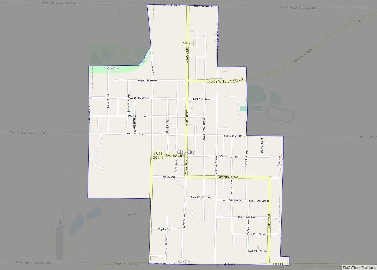
Online Interactive Map
Click on ![]() to view map in "full screen" mode.
to view map in "full screen" mode.
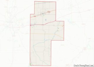
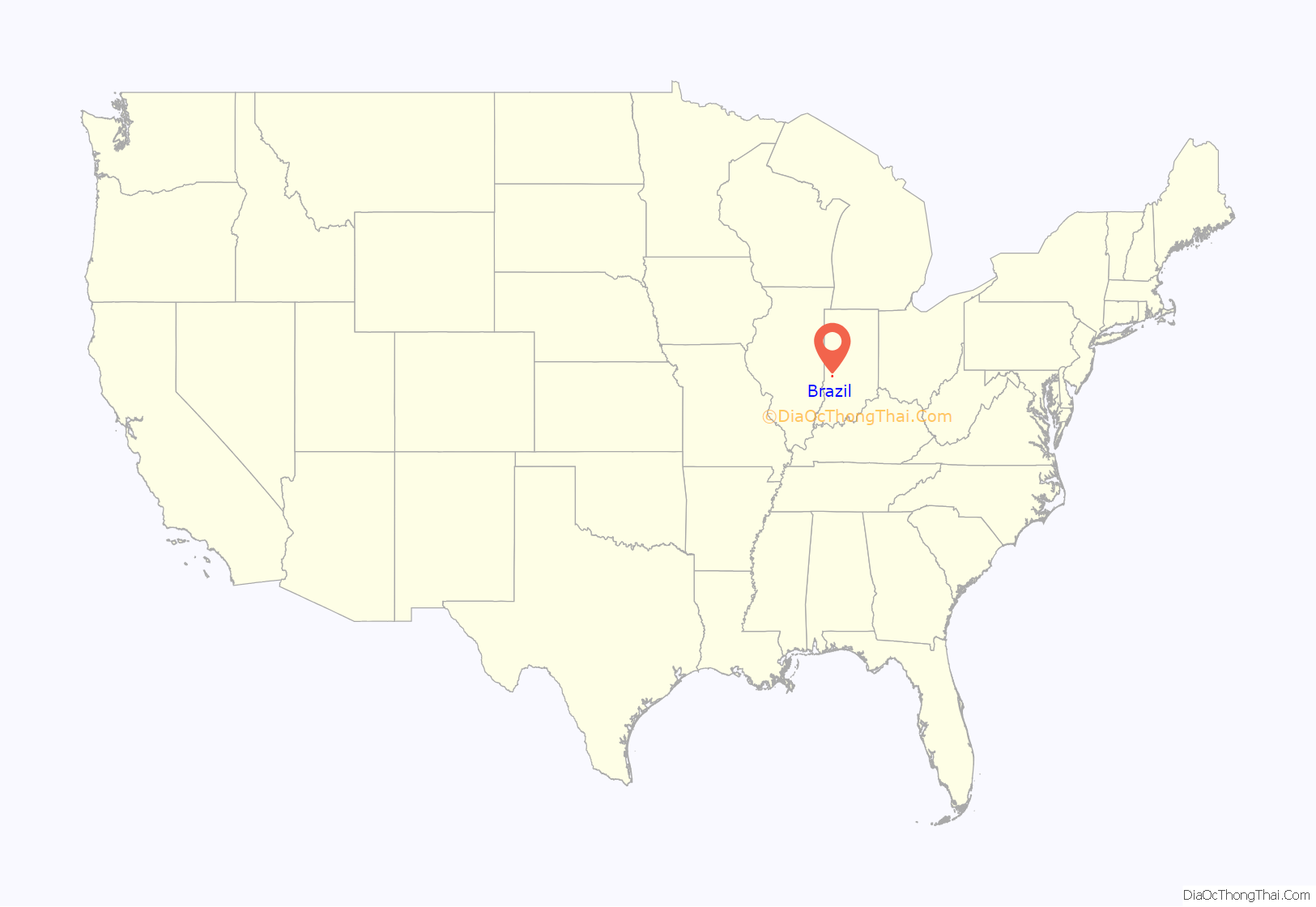
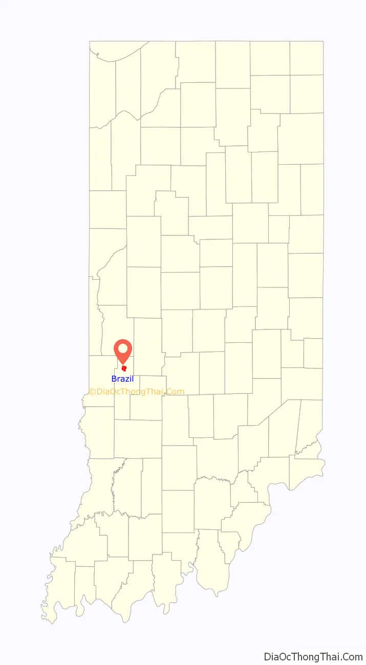
Brazil location map. Where is Brazil city?
History
In the 1840s, the owners of the farm which would later originate the city of Brazil decided to name their farm after the country of Brazil, because that country was often the subject of news at the time. The city was founded in 1866 under the name of that farm. As of now, Brazil is a part of the Terre Haute Metropolitan Statistical Area. Clay county, which was formed in 1825, originally had Bowling Green as its county seat; the county seat was relocated to Brazil in 1876, following the city’s incredible development.
The Chafariz dos Contos (from “contos de réis”, a former Brazilian currency) was given by the country of Brazil as a gift to the city, as a symbol of friendship, and was assembled in Forest Park in 1956. It is a replica of the original fountain located in Ouro Preto, State of Minas Gerais, Brazil, built in 1745.
In 2010, Brazil gained national attention for having accepted money from Kentucky Fried Chicken for the rights to display the KFC and Fiery Grilled Wings logos on city fire hydrants.
The Brazil Downtown Historic District, Clay County Courthouse, Clay County Hospital, Meridian-Forest Historic District, and US Post Office-Brazil are listed on the National Register of Historic Places.
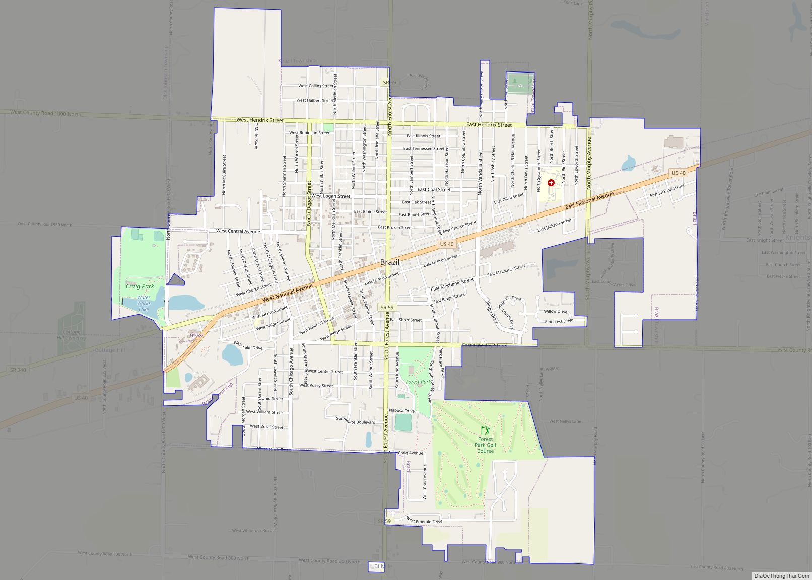
Brazil Road Map
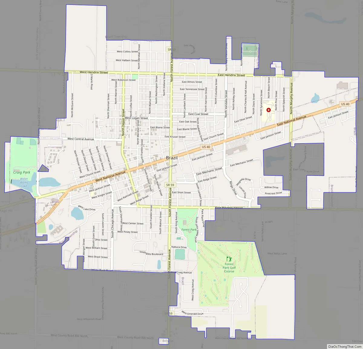
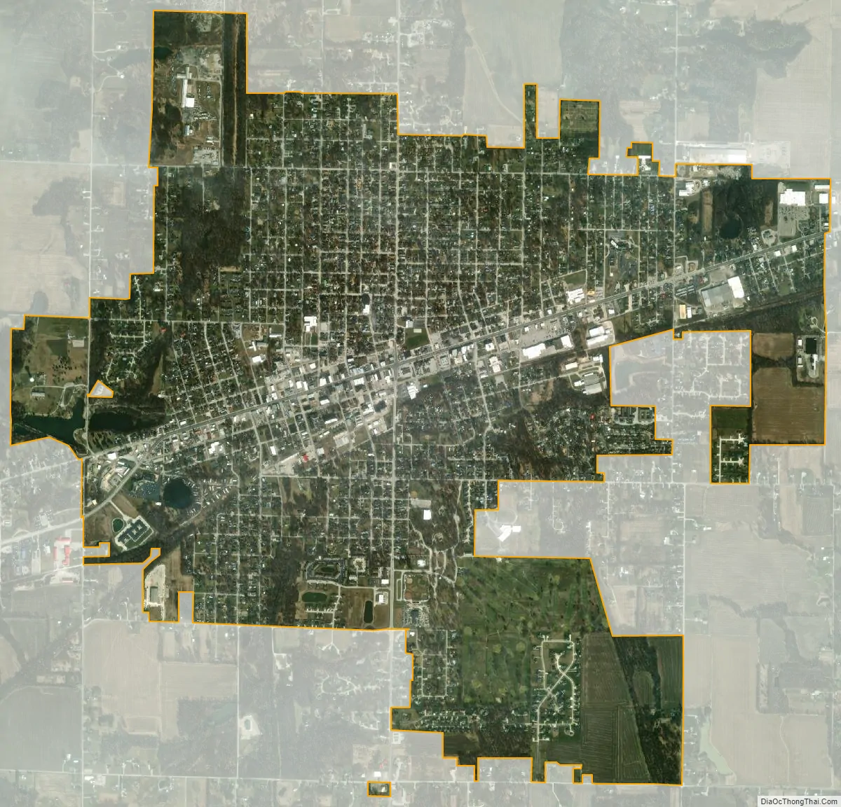
Brazil city Satellite Map
Geography
Brazil is located at 39°31′30″N 87°7′39″W / 39.52500°N 87.12750°W / 39.52500; -87.12750 (39.525000, -87.127500).
According to the 2010 census, Brazil has a total area of 3.058 square miles (7.92 km), of which 3.03 square miles (7.85 km) (or 99.08%) is land and 0.028 square miles (0.07 km) (or 0.92%) is water.
Brazil experiences warm, even hot and humid summers and cold winters as part of the humid continental climate.
See also
Map of Indiana State and its subdivision:- Adams
- Allen
- Bartholomew
- Benton
- Blackford
- Boone
- Brown
- Carroll
- Cass
- Clark
- Clay
- Clinton
- Crawford
- Daviess
- De Kalb
- Dearborn
- Decatur
- Delaware
- Dubois
- Elkhart
- Fayette
- Floyd
- Fountain
- Franklin
- Fulton
- Gibson
- Grant
- Greene
- Hamilton
- Hancock
- Harrison
- Hendricks
- Henry
- Howard
- Huntington
- Jackson
- Jasper
- Jay
- Jefferson
- Jennings
- Johnson
- Knox
- Kosciusko
- LaGrange
- Lake
- Lake Michigan
- LaPorte
- Lawrence
- Madison
- Marion
- Marshall
- Martin
- Miami
- Monroe
- Montgomery
- Morgan
- Newton
- Noble
- Ohio
- Orange
- Owen
- Parke
- Perry
- Pike
- Porter
- Posey
- Pulaski
- Putnam
- Randolph
- Ripley
- Rush
- Saint Joseph
- Scott
- Shelby
- Spencer
- Starke
- Steuben
- Sullivan
- Switzerland
- Tippecanoe
- Tipton
- Union
- Vanderburgh
- Vermillion
- Vigo
- Wabash
- Warren
- Warrick
- Washington
- Wayne
- Wells
- White
- Whitley
- Alabama
- Alaska
- Arizona
- Arkansas
- California
- Colorado
- Connecticut
- Delaware
- District of Columbia
- Florida
- Georgia
- Hawaii
- Idaho
- Illinois
- Indiana
- Iowa
- Kansas
- Kentucky
- Louisiana
- Maine
- Maryland
- Massachusetts
- Michigan
- Minnesota
- Mississippi
- Missouri
- Montana
- Nebraska
- Nevada
- New Hampshire
- New Jersey
- New Mexico
- New York
- North Carolina
- North Dakota
- Ohio
- Oklahoma
- Oregon
- Pennsylvania
- Rhode Island
- South Carolina
- South Dakota
- Tennessee
- Texas
- Utah
- Vermont
- Virginia
- Washington
- West Virginia
- Wisconsin
- Wyoming