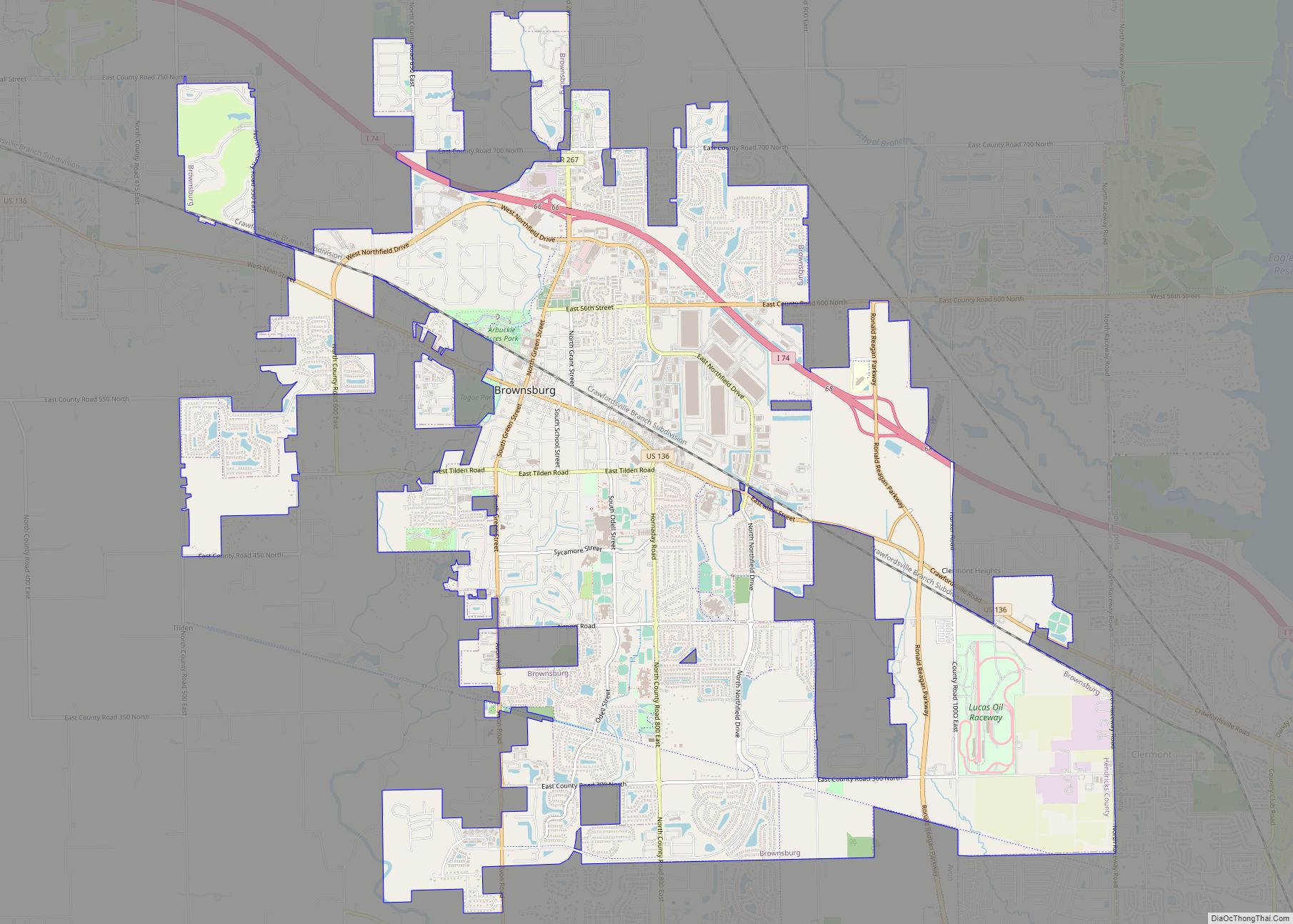
Brownsburg is a town in Hendricks County, Indiana, United States. The population was recorded to be 21,285 residents at the 2010 Census. As of 2019 the estimated population was recorded to be 27,001 residents. In 2020 the population was recorded as 28,973 residents.
| Name: | Brownsburg town |
|---|---|
| LSAD Code: | 43 |
| LSAD Description: | town (suffix) |
| State: | Indiana |
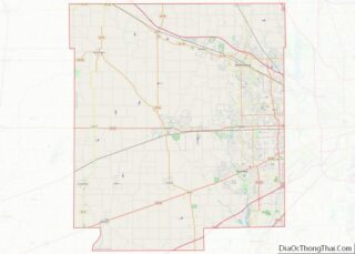
| County: | Hendricks County |
| Elevation: | 879 ft (268 m) |
| Total Area: | 16.35 sq mi (42.36 km²) |
| Land Area: | 16.27 sq mi (42.13 km²) |
| Water Area: | 0.09 sq mi (0.22 km²) |
| Total Population: | 28,973 |
| Population Density: | 1,780.98/sq mi (687.63/km²) |
| ZIP code: | 46112 |
| Area code: | 317 |
| FIPS code: | 1808416 |
| GNISfeature ID: | 0431646 |
| Website: | www.brownsburg.org |
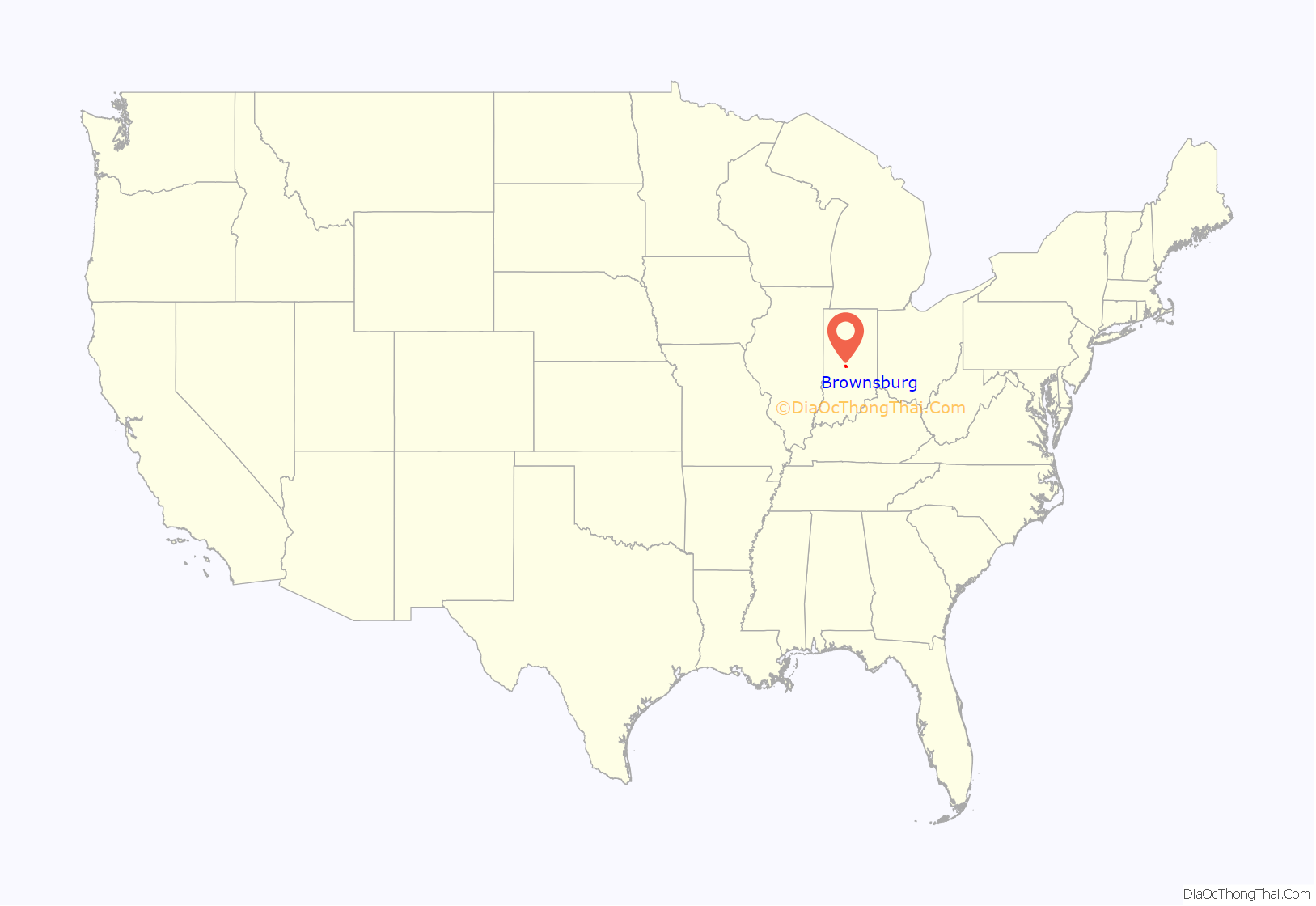
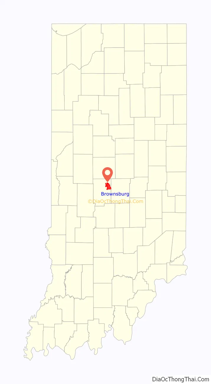
Online Interactive Map
Click on ![]() to view map in "full screen" mode.
to view map in "full screen" mode.
Brownsburg location map. Where is Brownsburg town?
History
Brownsburg was first settled in 1824 by James B. Brown. When he arrived, the area was a dense, unbroken stretch of wilderness. Delaware Indians lived in what is now called Lincoln Township, along White Lick Creek, which was then called “Wa-pe-ke-way” or “White Salt”.
Four years later, the first log schoolhouse was built in Brown Township. Once a stagecoach line was established along a road built in 1820 connecting to Indianapolis, more settlers arrived. William Harris settled in the area north of what is now Main Street, selling sections of woods to incoming pioneers. This gave the town its original name of Harrisburg in 1835. A post office was established in 1836 under the name of Harrisburg but was later changed to Brownsburg, since the name Harrisburg was being used by a post office in another Indiana county.
From 1840 to 1870, Brownsburg tripled in size, increased from six to sixteen acres, and added its first church. The town’s first election was held in 1848. In 1863, it was divided into Brown Township and Lincoln Township.
In 1985, part of the movie Hoosiers was filmed in the former College Avenue Gym.
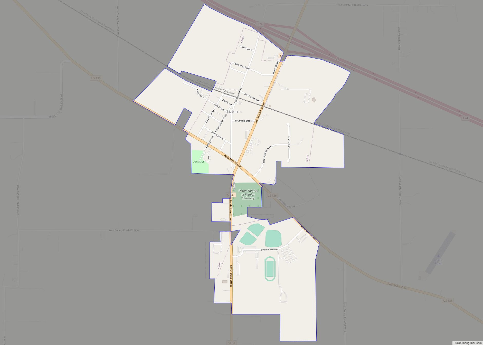
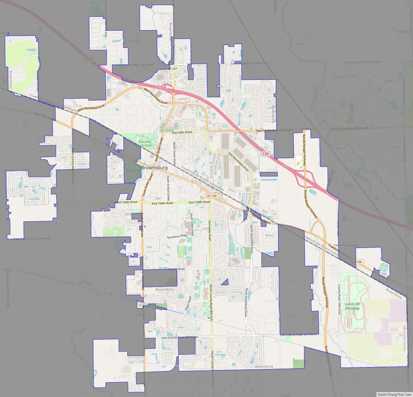
Brownsburg Road Map
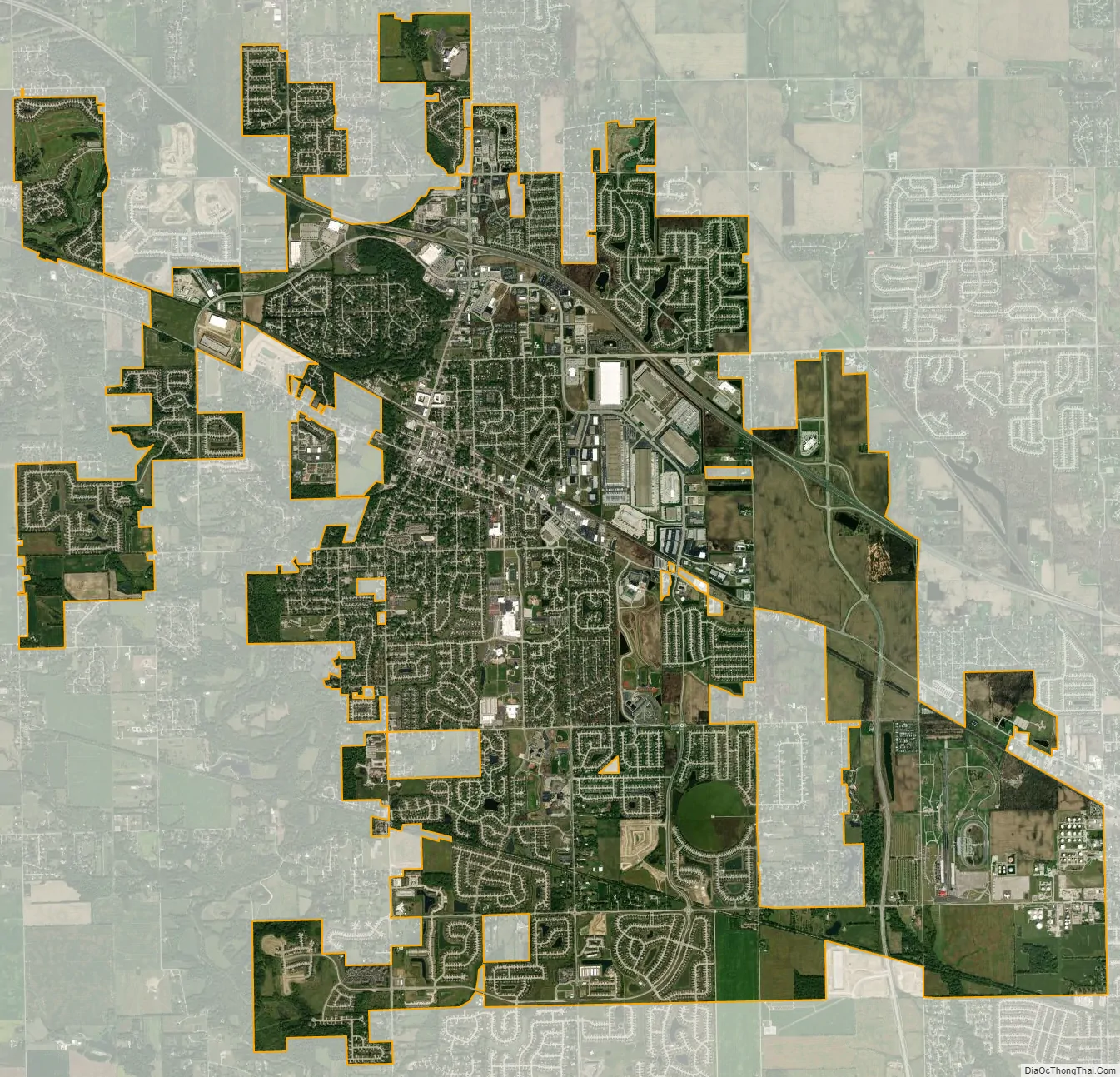
Brownsburg city Satellite Map
Geography
According to the 2010 census, Brownsburg has a total area of 11.16 square miles (28.90 km), of which 11.08 square miles (28.70 km) (or 99.28%) is land and 0.08 square miles (0.21 km) (or 0.72%) is water. White Lick Creek, a tributary of the White River, flows from north to south through the town, passing just west of the town center.
See also
Map of Indiana State and its subdivision:- Adams
- Allen
- Bartholomew
- Benton
- Blackford
- Boone
- Brown
- Carroll
- Cass
- Clark
- Clay
- Clinton
- Crawford
- Daviess
- De Kalb
- Dearborn
- Decatur
- Delaware
- Dubois
- Elkhart
- Fayette
- Floyd
- Fountain
- Franklin
- Fulton
- Gibson
- Grant
- Greene
- Hamilton
- Hancock
- Harrison
- Hendricks
- Henry
- Howard
- Huntington
- Jackson
- Jasper
- Jay
- Jefferson
- Jennings
- Johnson
- Knox
- Kosciusko
- LaGrange
- Lake
- Lake Michigan
- LaPorte
- Lawrence
- Madison
- Marion
- Marshall
- Martin
- Miami
- Monroe
- Montgomery
- Morgan
- Newton
- Noble
- Ohio
- Orange
- Owen
- Parke
- Perry
- Pike
- Porter
- Posey
- Pulaski
- Putnam
- Randolph
- Ripley
- Rush
- Saint Joseph
- Scott
- Shelby
- Spencer
- Starke
- Steuben
- Sullivan
- Switzerland
- Tippecanoe
- Tipton
- Union
- Vanderburgh
- Vermillion
- Vigo
- Wabash
- Warren
- Warrick
- Washington
- Wayne
- Wells
- White
- Whitley
- Alabama
- Alaska
- Arizona
- Arkansas
- California
- Colorado
- Connecticut
- Delaware
- District of Columbia
- Florida
- Georgia
- Hawaii
- Idaho
- Illinois
- Indiana
- Iowa
- Kansas
- Kentucky
- Louisiana
- Maine
- Maryland
- Massachusetts
- Michigan
- Minnesota
- Mississippi
- Missouri
- Montana
- Nebraska
- Nevada
- New Hampshire
- New Jersey
- New Mexico
- New York
- North Carolina
- North Dakota
- Ohio
- Oklahoma
- Oregon
- Pennsylvania
- Rhode Island
- South Carolina
- South Dakota
- Tennessee
- Texas
- Utah
- Vermont
- Virginia
- Washington
- West Virginia
- Wisconsin
- Wyoming