Map of Coushatta town
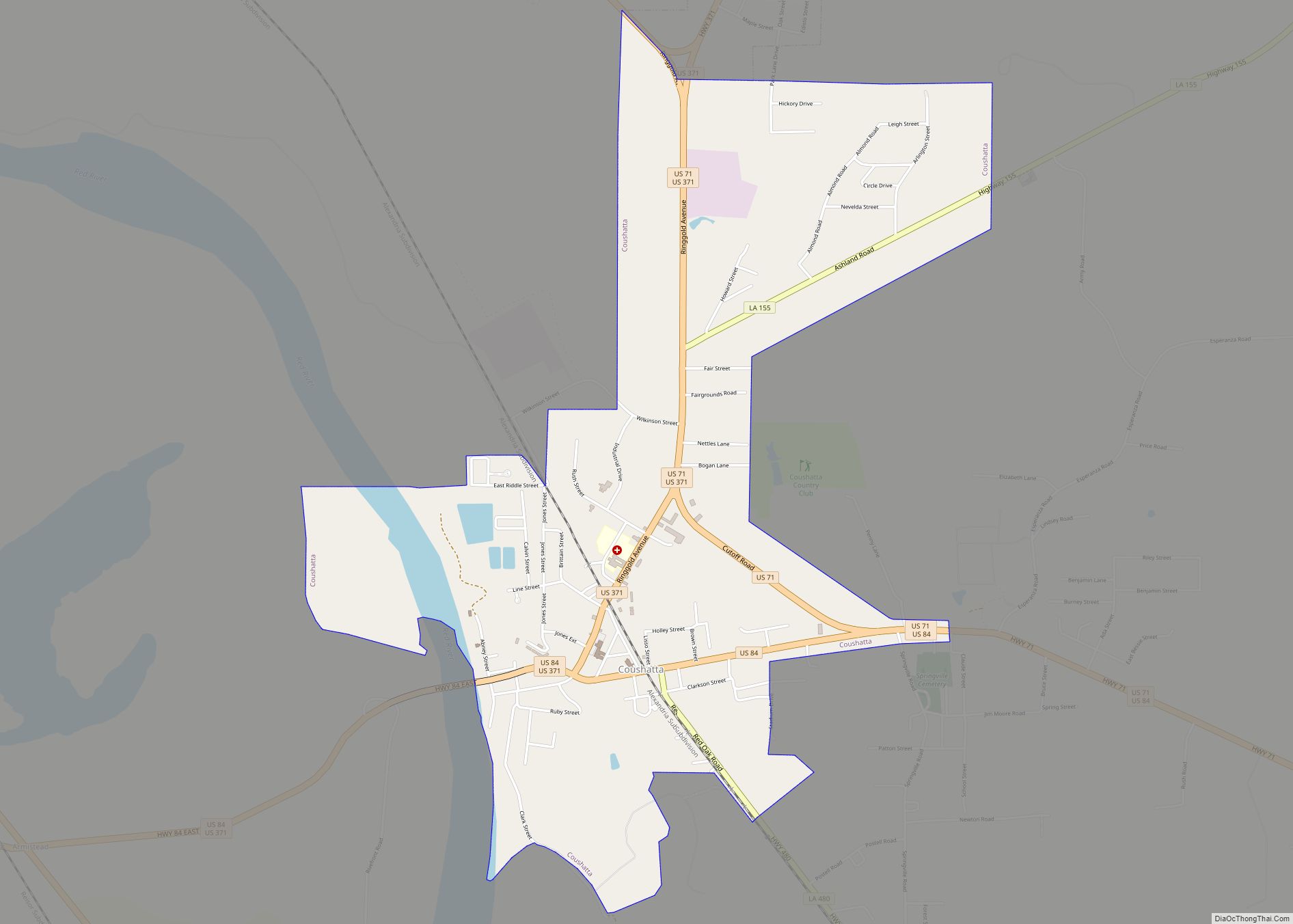
Coushatta is a town in, and the parish seat of, rural Red River Parish in north Louisiana, United States. It is situated on the east bank of the Red River. The community is approximately 45 miles south of Shreveport on U.S. Highway 71. The population, 2,299 at the 2000 census, is nearly two-thirds African American, ... Read more
Map of Coushatta town
Map of Cullen town
Cullen is a town just south of Springhill in northern Webster Parish, Louisiana, United States. The population was 1,163 at the 2010 census. It is part of the Minden Micropolitan Statistical Area. Bobby Ray Washington, the former mayor of Cullen, served as president and vice president of the Louisiana Municipal Association. He resigned from office ... Read more
Map of Cullen town
Map of Crowley city, Louisiana
Crowley (Local pronunciation: /ˈkræli/) is a city in, and the parish seat of, Acadia Parish in the U.S. state of Louisiana. At the 2020 United States census, Crowley had a population of 11,710. Crowley is the principal city of the Crowley micropolitan statistical area, which includes all of Acadia Parish. It is also part of ... Read more
Map of Crowley city, Louisiana
Map of Crescent CDP, Louisiana
Crescent is an unincorporated community and census-designated place in Iberville Parish, Louisiana, United States. Its population was 959 as of the 2010 census. Crescent CDP overview: Name: Crescent CDP LSAD Code: 57 LSAD Description: CDP (suffix) State: Louisiana County: Iberville Parish Elevation: 13 ft (4 m) Total Area: 1.71 sq mi (4.42 km²) Land Area: 1.67 sq mi (4.31 km²) Water Area: 0.04 sq mi ... Read more
Map of Crescent CDP, Louisiana
Map of Cut Off CDP
Cut Off (historically named La Coupe) is a census-designated place (CDP) on the Bayou Lafourche in Lafourche Parish, Louisiana, United States. The population was 5,533 in 2020. It is part of the Houma–Bayou Cane–Thibodaux metropolitan statistical area. Cut Off’s ZIP code is 70345, the area code is 985 and local telephone prefixes are 325, 632 ... Read more
Map of Cut Off CDP
Map of Delhi town, Louisiana
Delhi (/ˈdɛl.haɪ/), originally called Deerfield, is a town in Richland Parish, Louisiana, United States. As of the 2020 census, the town population was 2,622. Delhi town overview: Name: Delhi town LSAD Code: 43 LSAD Description: town (suffix) State: Louisiana County: Richland Parish Elevation: 89 ft (27 m) Total Area: 2.94 sq mi (7.62 km²) Land Area: 2.87 sq mi (7.44 km²) Water Area: ... Read more
Map of Delhi town, Louisiana
Map of Delcambre town
Delcambre is a town in Iberia and Vermilion parishes in the U.S. state of Louisiana, located 9 miles (14 km) east of Abbeville on Louisiana Highway 14 in the Cajun Heartland of Acadiana. Bayou Carlin, also known as the Delcambre Canal, passes through the town and is home for much of the local fishing industry. The ... Read more
Map of Delcambre town
Map of DeQuincy city
DeQuincy is the northernmost city in Calcasieu Parish, Louisiana, United States. The population was 3,235 at the 2010 census. DeQuincy is part of the Lake Charles metropolitan statistical area. DeQuincy city overview: Name: DeQuincy city LSAD Code: 25 LSAD Description: city (suffix) State: Louisiana County: Calcasieu Parish Elevation: 79 ft (24 m) Total Area: 3.19 sq mi (8.27 km²) Land ... Read more
Map of DeQuincy city
Map of Denham Springs city
Denham Springs is a city in Livingston Parish, Louisiana, United States. The 2010 U.S. census placed the population at 10,215, up from 8,757 at the 2000 U. S. census. At the 2020 United States census, 9,286 people lived in the city. The city is the largest area of commercial and residential development in Livingston Parish. ... Read more
Map of Denham Springs city
Map of Delta village, Louisiana
Delta is a village in Madison Parish, Louisiana, United States. The population was 239 at the 2000 census. It is part of the Tallulah Micropolitan Statistical Area. As the birthplace of African-American entrepreneur Madam C.J. Walker, the first American woman to become a millionaire by her own business achievements, it has been included as one ... Read more
Map of Delta village, Louisiana
Map of Destrehan CDP
Destrehan is a census-designated place (CDP) in St. Charles Parish, Louisiana, United States. At the 2020 census, its population was 11,340. Destrehan CDP overview: Name: Destrehan CDP LSAD Code: 57 LSAD Description: CDP (suffix) State: Louisiana County: St. Charles Parish Elevation: 10 ft (3 m) Total Area: 6.98 sq mi (18.07 km²) Land Area: 5.97 sq mi (15.46 km²) Water Area: 1.01 sq mi (2.61 km²) ... Read more
Map of Destrehan CDP
Map of Des Allemands CDP
Des Allemands is an unincorporated community and census-designated place (CDP) in Lafourche and St. Charles parishes in the southeastern part of the U.S. state of Louisiana. The population was 2,179 at the 2020 census. The town, known as the “Catfish Capital of the Universe”, is along the Bayou des Allemands, which is the boundary of ... Read more
Map of Des Allemands CDP