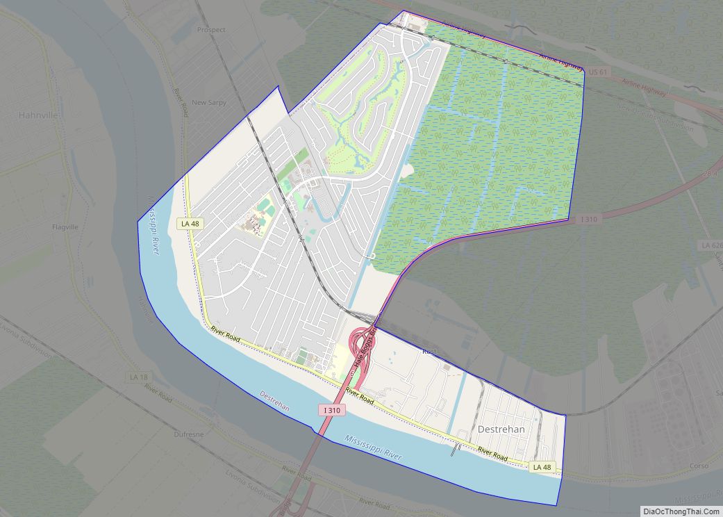
Destrehan is a census-designated place (CDP) in St. Charles Parish, Louisiana, United States. At the 2020 census, its population was 11,340.
| Name: | Destrehan CDP |
|---|---|
| LSAD Code: | 57 |
| LSAD Description: | CDP (suffix) |
| State: | Louisiana |
| County: | St. Charles Parish |
| Elevation: | 10 ft (3 m) |
| Total Area: | 6.98 sq mi (18.07 km²) |
| Land Area: | 5.97 sq mi (15.46 km²) |
| Water Area: | 1.01 sq mi (2.61 km²) |
| Total Population: | 11,340 |
| Population Density: | 1,900.45/sq mi (733.71/km²) |
| Area code: | 985 |
| FIPS code: | 2220820 |
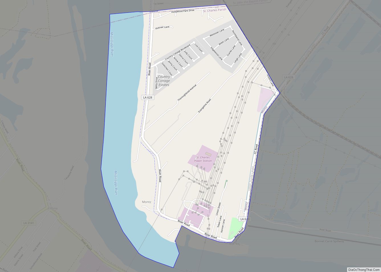
Online Interactive Map
Click on ![]() to view map in "full screen" mode.
to view map in "full screen" mode.
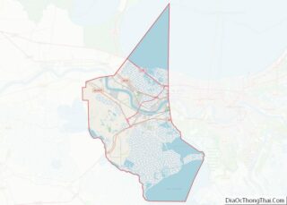
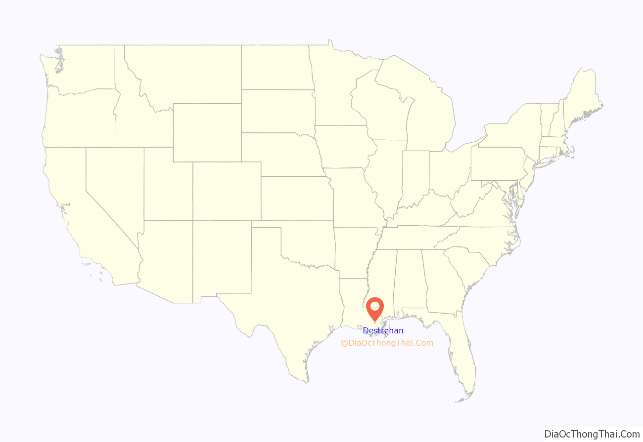
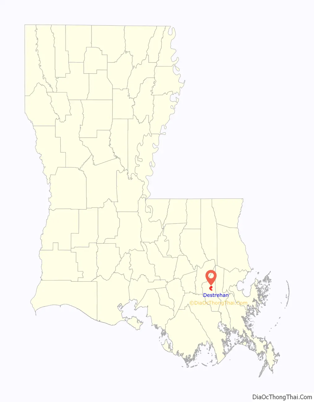
Destrehan location map. Where is Destrehan CDP?
History
George Prince tragedy
Before the Hale Boggs Memorial Bridge was completed connecting the communities of Destrehan and Luling, automobile ferries connected the towns. On October 20, 1976, one of these ferries, the George Prince, was struck by a tanker and capsized as it crossed the Mississippi River resulting in the MV George Prince ferry disaster. Seventy-eight passengers and crew died.
Gary Tyler case
Destrehan was briefly notorious in 1974 for the case of Gary Tyler, a 17 year old black student who was accused by local officials of the murder of 13 year old white student and the wounding of another, on a day of violent protests by white students at Destrehan High School. Many observers believe his conviction and trial were unfair and flawed. He was convicted and sentenced to prison. He was released from prison in 2016.
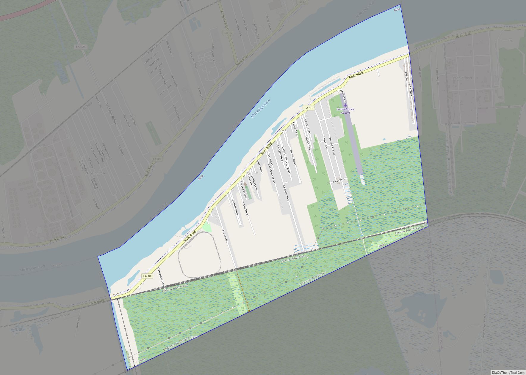
Destrehan Road Map

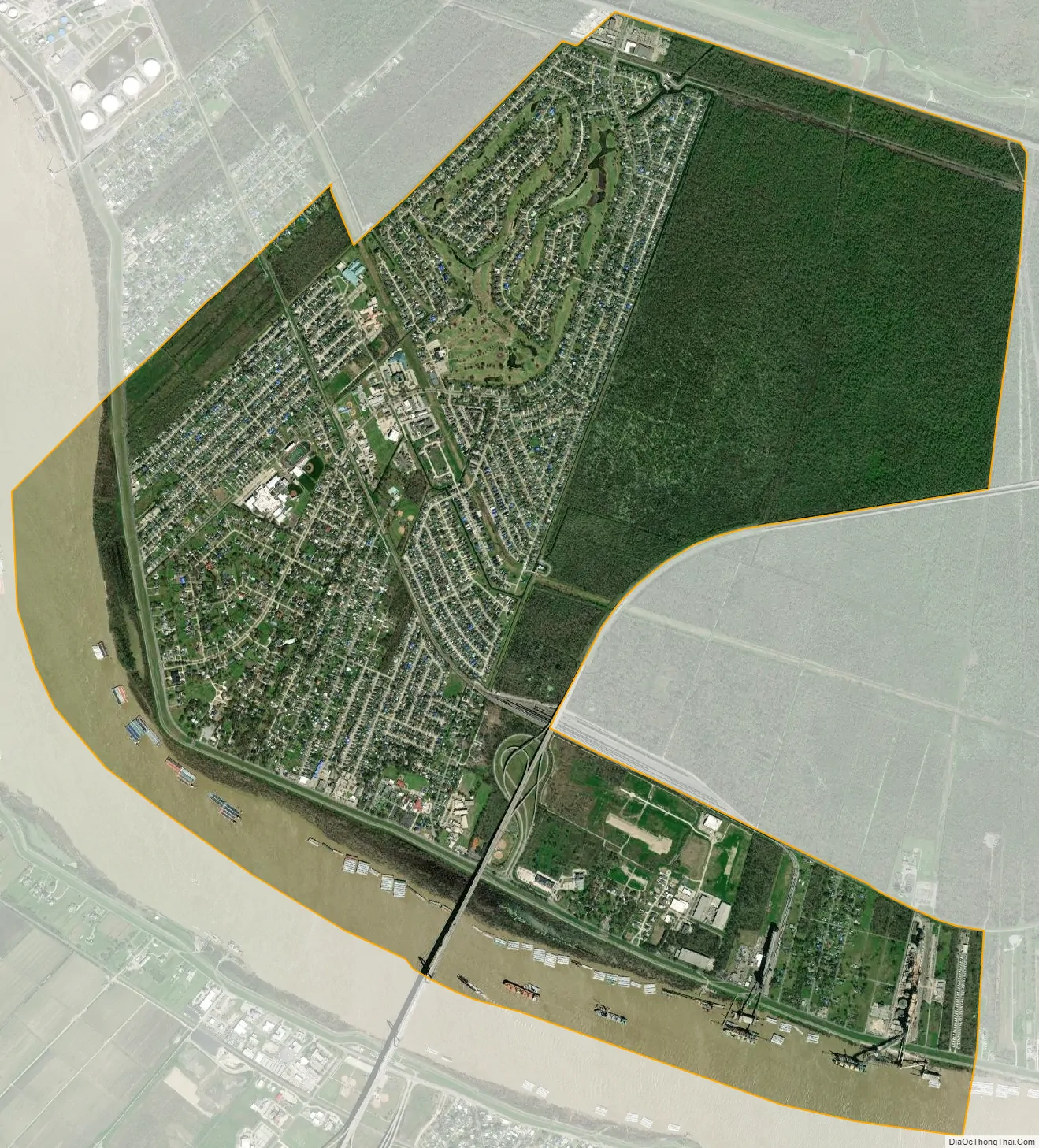
Destrehan city Satellite Map
Geography
Destrehan is located at 29°57′44″N 90°22′9″W / 29.96222°N 90.36917°W / 29.96222; -90.36917 (29.962307, -90.369160).
According to the United States Census Bureau, the CDP has a total area of 7.9 square miles (20 km), of which 6.9 square miles (18 km) are land and 1.0-square-mile (2.6 km) (12.41%) is water.
See also
Map of Louisiana State and its subdivision:- Acadia
- Allen
- Ascension
- Assumption
- Avoyelles
- Beauregard
- Bienville
- Bossier
- Caddo
- Calcasieu
- Caldwell
- Cameron
- Catahoula
- Claiborne
- Concordia
- De Soto
- East Baton Rouge
- East Carroll
- East Feliciana
- Evangeline
- Franklin
- Grant
- Iberia
- Iberville
- Jackson
- Jefferson
- Jefferson Davis
- La Salle
- Lafayette
- Lafourche
- Lincoln
- Livingston
- Madison
- Morehouse
- Natchitoches
- Orleans
- Ouachita
- Plaquemines
- Pointe Coupee
- Rapides
- Red River
- Richland
- Sabine
- Saint Bernard
- Saint Charles
- Saint Helena
- Saint James
- Saint John the Baptist
- Saint Landry
- Saint Martin
- Saint Mary
- Saint Tammany
- Tangipahoa
- Tensas
- Terrebonne
- Union
- Vermilion
- Vernon
- Washington
- Webster
- West Baton Rouge
- West Carroll
- West Feliciana
- Winn
- Alabama
- Alaska
- Arizona
- Arkansas
- California
- Colorado
- Connecticut
- Delaware
- District of Columbia
- Florida
- Georgia
- Hawaii
- Idaho
- Illinois
- Indiana
- Iowa
- Kansas
- Kentucky
- Louisiana
- Maine
- Maryland
- Massachusetts
- Michigan
- Minnesota
- Mississippi
- Missouri
- Montana
- Nebraska
- Nevada
- New Hampshire
- New Jersey
- New Mexico
- New York
- North Carolina
- North Dakota
- Ohio
- Oklahoma
- Oregon
- Pennsylvania
- Rhode Island
- South Carolina
- South Dakota
- Tennessee
- Texas
- Utah
- Vermont
- Virginia
- Washington
- West Virginia
- Wisconsin
- Wyoming