Crowley (Local pronunciation: /ˈkræli/) is a city in, and the parish seat of, Acadia Parish in the U.S. state of Louisiana. At the 2020 United States census, Crowley had a population of 11,710. Crowley is the principal city of the Crowley micropolitan statistical area, which includes all of Acadia Parish. It is also part of the larger Lafayette–Acadiana combined statistical area.
| Name: | Crowley city |
|---|---|
| LSAD Code: | 25 |
| LSAD Description: | city (suffix) |
| State: | Louisiana |
| County: | Acadia Parish |
| Incorporated: | 1887 |
| Elevation: | 20 ft (6 m) |
| Total Area: | 5.85 sq mi (15.16 km²) |
| Land Area: | 5.85 sq mi (15.15 km²) |
| Water Area: | 0.00 sq mi (0.00 km²) |
| Total Population: | 11,710 |
| Population Density: | 2,001.37/sq mi (772.70/km²) |
| ZIP code: | 70526 |
| Area code: | 337 |
| FIPS code: | 2218650 |
| Website: | crowley-la.com |
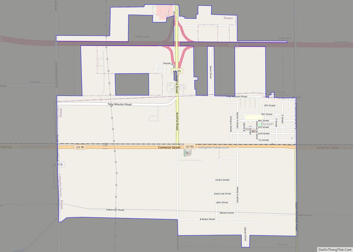
Online Interactive Map
Click on ![]() to view map in "full screen" mode.
to view map in "full screen" mode.
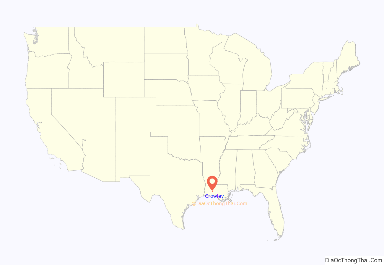
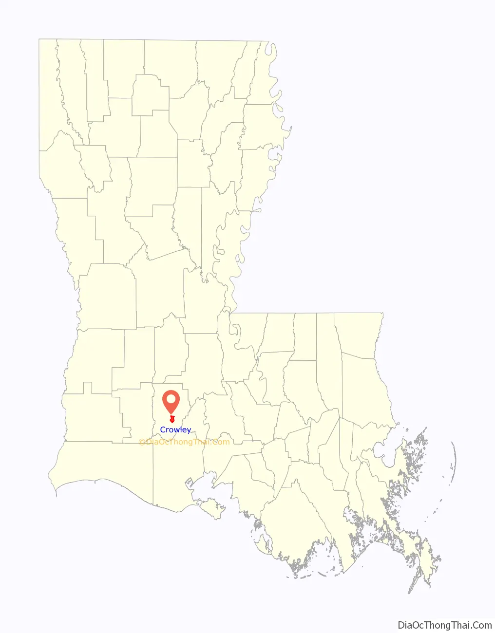
Crowley location map. Where is Crowley city?
History
Crowley was founded in 1886 by C.C. Duson and W.W. Duson. Incorporated in 1887, W.W. Duson, General Manager of Southwest Louisiana Land Company, plotted and developed Crowley. W.W. Duson’s daughter, Maime Duson, married Percy Lee Lawrence, who founded the First National Bank of Crowley. The 7-story building was once the tallest building between Houston and New Orleans. They lived with their three children, P.L. Jr., Pattee, and Jack at 219 East 2nd Street. The house was burned down in a fire a few years later.
The town was named after Pat Crowley, an Irish railroad owner who brought the railroad depot to W.W. Duson’s land. Descendants of founder W.W. Duson continue to live in Crowley.
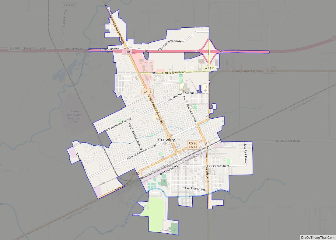
Crowley Road Map
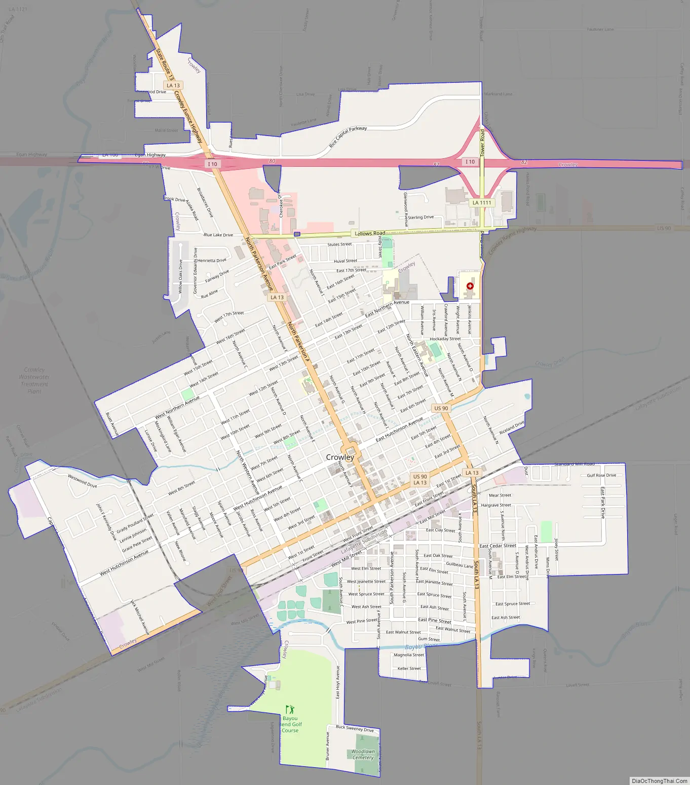
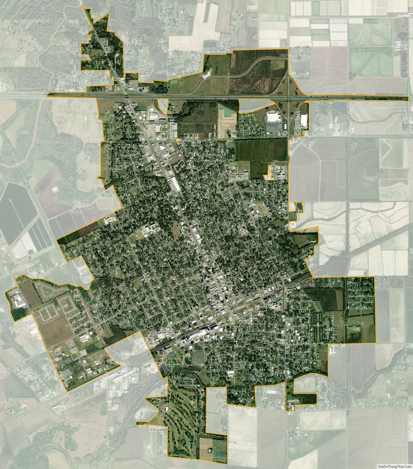
Crowley city Satellite Map
Geography
According to the United States Census Bureau, the city has a total area of 4.9 square miles (13 km), all land.
Louisiana Highway 13 passes through the city with Kaplan, which is located in Vermilion Parish, being located 19 miles southeast and Eunice, located in both Acadia and St. Landry parishes, is located 20 miles north. The city of Rayne is located 9 miles east of Crowley via U.S. Highway 90 and I-10. The city of Jennings is located 17 miles west via U.S. Highway 90 and I-10.
Climate
See also
Map of Louisiana State and its subdivision:- Acadia
- Allen
- Ascension
- Assumption
- Avoyelles
- Beauregard
- Bienville
- Bossier
- Caddo
- Calcasieu
- Caldwell
- Cameron
- Catahoula
- Claiborne
- Concordia
- De Soto
- East Baton Rouge
- East Carroll
- East Feliciana
- Evangeline
- Franklin
- Grant
- Iberia
- Iberville
- Jackson
- Jefferson
- Jefferson Davis
- La Salle
- Lafayette
- Lafourche
- Lincoln
- Livingston
- Madison
- Morehouse
- Natchitoches
- Orleans
- Ouachita
- Plaquemines
- Pointe Coupee
- Rapides
- Red River
- Richland
- Sabine
- Saint Bernard
- Saint Charles
- Saint Helena
- Saint James
- Saint John the Baptist
- Saint Landry
- Saint Martin
- Saint Mary
- Saint Tammany
- Tangipahoa
- Tensas
- Terrebonne
- Union
- Vermilion
- Vernon
- Washington
- Webster
- West Baton Rouge
- West Carroll
- West Feliciana
- Winn
- Alabama
- Alaska
- Arizona
- Arkansas
- California
- Colorado
- Connecticut
- Delaware
- District of Columbia
- Florida
- Georgia
- Hawaii
- Idaho
- Illinois
- Indiana
- Iowa
- Kansas
- Kentucky
- Louisiana
- Maine
- Maryland
- Massachusetts
- Michigan
- Minnesota
- Mississippi
- Missouri
- Montana
- Nebraska
- Nevada
- New Hampshire
- New Jersey
- New Mexico
- New York
- North Carolina
- North Dakota
- Ohio
- Oklahoma
- Oregon
- Pennsylvania
- Rhode Island
- South Carolina
- South Dakota
- Tennessee
- Texas
- Utah
- Vermont
- Virginia
- Washington
- West Virginia
- Wisconsin
- Wyoming