Map of Turkey Creek village, Louisiana
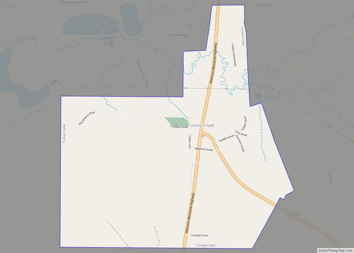
Turkey Creek is a village in Evangeline Parish, Louisiana, United States. The population was 441 at the 2010 census, up from 356 in 2000. Turkey Creek village overview: Name: Turkey Creek village LSAD Code: 47 LSAD Description: village (suffix) State: Louisiana County: Evangeline Parish Elevation: 128 ft (39 m) Total Area: 2.48 sq mi (6.42 km²) Land Area: 2.48 sq mi (6.42 km²) ... Read more
Map of Turkey Creek village, Louisiana
Map of Ventress CDP
Ventress is a census-designated place located in Pointe Coupee Parish, Louisiana, United States, along the northeastern end of the False River. The population of the area is approximately 1,100. It is home to the Hunter Fabre Post 248 American Legion Hall on Legion Road (Louisiana Highway 413). The zip code is 70783. Ventress CDP overview: ... Read more
Map of Ventress CDP
Map of Venice CDP, Louisiana
Venice is an unincorporated community and census-designated place in Plaquemines Parish, Louisiana, United States. As of the 2020 census, its population was 162. It is 77 miles (124 km) south of New Orleans on the west bank of the Mississippi River at 29°16′37″N 89°21′17″W / 29.27694°N 89.35472°W / 29.27694; -89.35472. It is the last community down ... Read more
Map of Venice CDP, Louisiana
Map of Varnado village
Varnado is a village in Washington Parish, Louisiana, United States. The population was 1,461 at the 2010 census. It is part of the Bogalusa Micropolitan Statistical Area. Varnado village overview: Name: Varnado village LSAD Code: 47 LSAD Description: village (suffix) State: Louisiana County: Washington Parish Elevation: 128 ft (39 m) Total Area: 0.85 sq mi (2.20 km²) Land Area: 0.85 sq mi ... Read more
Map of Varnado village
Map of Vienna town, Louisiana
Vienna is a town in Lincoln Parish, Louisiana, United States. The population was 483 in 2020. During the American Civil War, Confederate troops drilled at a new camp established in 1862 in Vienna. Later in the war, a parolee camp was established at Vienna. Vienna town overview: Name: Vienna town LSAD Code: 43 LSAD Description: ... Read more
Map of Vienna town, Louisiana
Map of Vienna Bend CDP
Vienna Bend is an unincorporated community and census-designated place (CDP) in Natchitoches Parish, Louisiana, United States. The population was 1,251 at the 2010 census. Vienna Bend CDP overview: Name: Vienna Bend CDP LSAD Code: 57 LSAD Description: CDP (suffix) State: Louisiana County: Natchitoches Parish Elevation: 112 ft (34 m) Total Area: 2.20 sq mi (5.71 km²) Land Area: 2.16 sq mi (5.59 km²) ... Read more
Map of Vienna Bend CDP
Map of Vidalia town, Louisiana
Vidalia is the largest city and the parish seat of Concordia Parish, Louisiana, United States. The population was 4,299 as of the 2010 census. Vidalia is located on the west bank of the Mississippi River. The city of Natchez, Mississippi, lies on the opposite bank of the river, connected by the Natchez–Vidalia Bridge, carrying U.S. ... Read more
Map of Vidalia town, Louisiana
Map of Vinton town, Louisiana
Vinton is a town in Calcasieu Parish, Louisiana, United States. The population was 3,400 in 2020. It is part of the Lake Charles metropolitan statistical area. Vinton town overview: Name: Vinton town LSAD Code: 43 LSAD Description: town (suffix) State: Louisiana County: Calcasieu Parish Elevation: 16 ft (5 m) Total Area: 5.15 sq mi (13.33 km²) Land Area: 5.10 sq mi (13.22 km²) ... Read more
Map of Vinton town, Louisiana
Map of Ville Platte city
Ville Platte is the largest city in, and the parish seat of, Evangeline Parish, Louisiana, United States. The population was 7,430 at the 2010 census, down from 8,145 in 2000. The city’s name is of French origin, roughly translating to “flat town”, in reference to its relatively flat topography in contrast to the more hilly ... Read more
Map of Ville Platte city
Map of Village St. George CDP
Village St. George is a census-designated place (CDP) in East Baton Rouge Parish, Louisiana, United States. The population was 7,104 at the 2010 census. It is part of the Baton Rouge Metropolitan Statistical Area. It is in the proposed City of St. George. Village St. George CDP overview: Name: Village St. George CDP LSAD Code: ... Read more
Map of Village St. George CDP
Map of Waggaman CDP
Waggaman is a census-designated place and unincorporated community in Jefferson Parish, Louisiana, United States. Waggaman is on the West Bank of the Mississippi River, within the New Orleans–Metairie–Kenner metropolitan statistical area. The population was 9,835 at the 2020 census. The area was named for U.S. Senator George Augustus Waggaman (1782–1843). Waggaman CDP overview: Name: Waggaman ... Read more
Map of Waggaman CDP
Map of Vivian town, Louisiana
Vivian is a town in Caddo Parish, Louisiana, United States and is home to the Red Bud Festival. The population was 3,671 at the 2010 census, down from 4,031 in 2000. According to 2020 census data, Vivian is now the fourth-largest municipality in Caddo Parish by population (after Blanchard, Greenwood, and Shreveport). Vivian town overview: ... Read more
Map of Vivian town, Louisiana