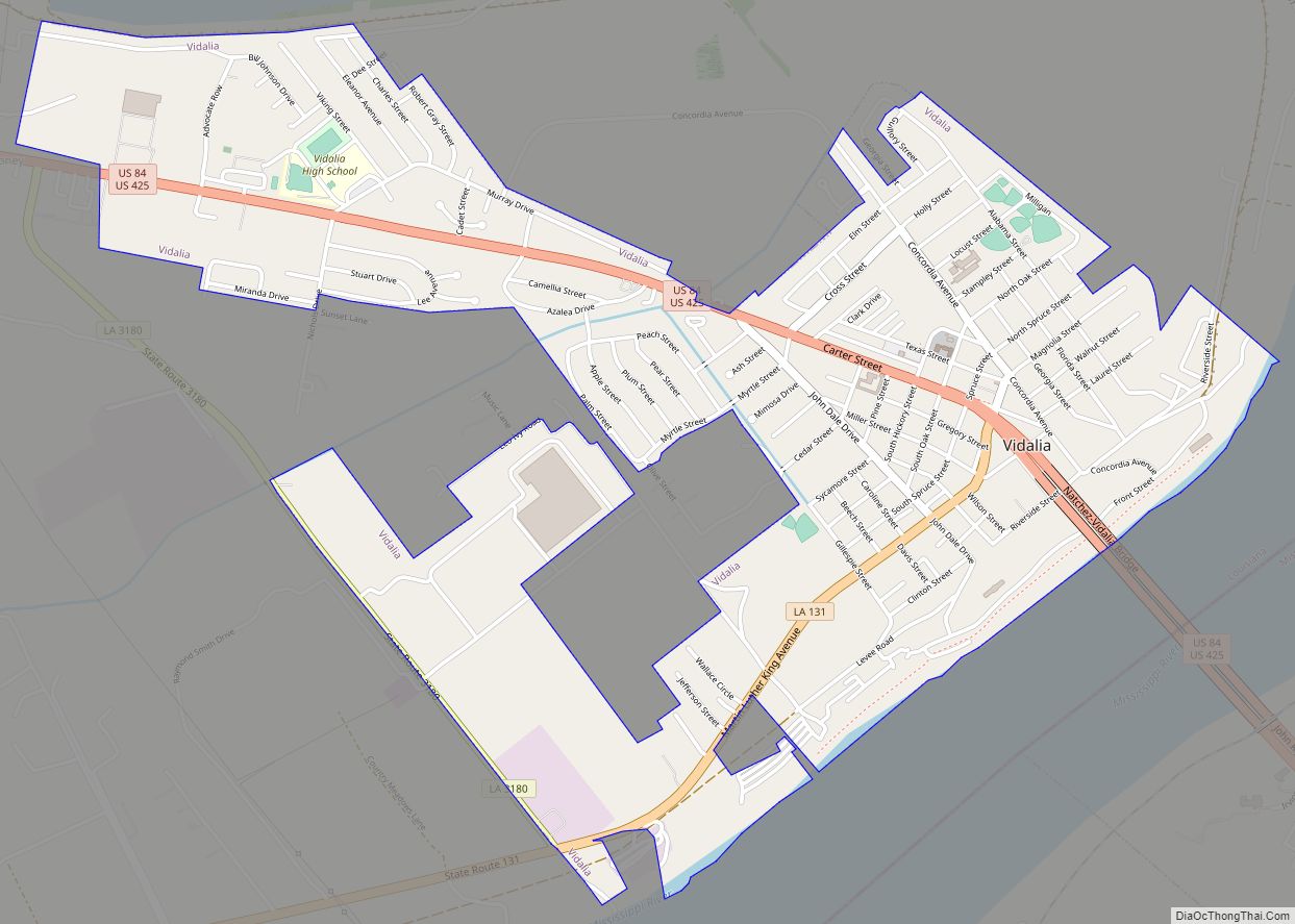
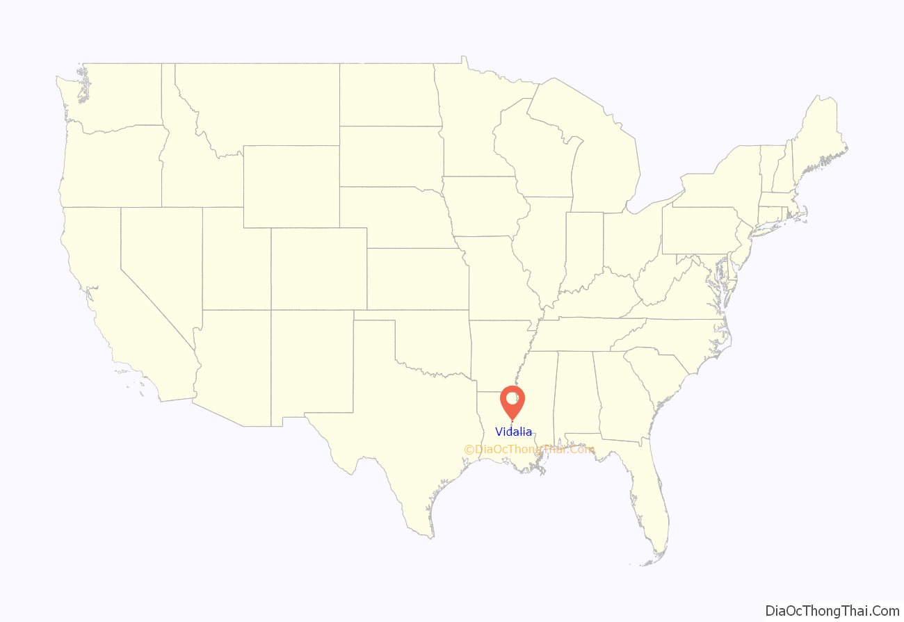
Vidalia is the largest city and the parish seat of Concordia Parish, Louisiana, United States. The population was 4,299 as of the 2010 census.
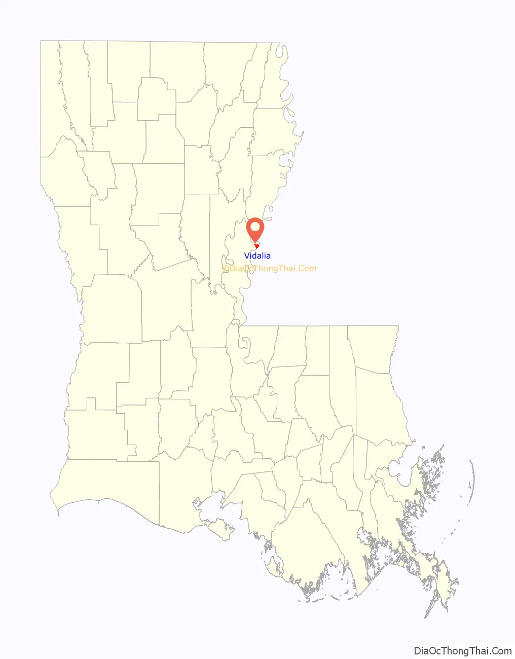
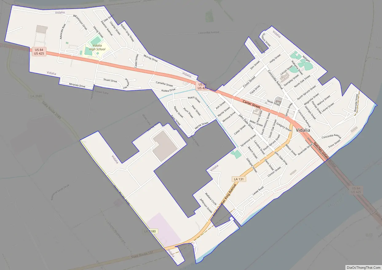
Vidalia is located on the west bank of the Mississippi River.
The city of Natchez, Mississippi, lies on the opposite bank of the river, connected by the Natchez–Vidalia Bridge, carrying U.S. Routes 65, 84, and 425.
| Name: | Vidalia town |
|---|---|
| LSAD Code: | 43 |
| LSAD Description: | town (suffix) |
| State: | Louisiana |
| County: | Concordia Parish |
| Elevation: | 65 ft (20 m) |
| Total Area: | 2.59 sq mi (6.72 km²) |
| Land Area: | 2.59 sq mi (6.72 km²) |
| Water Area: | 0.00 sq mi (0.00 km²) |
| Total Population: | 4,027 |
| Population Density: | 1,552.43/sq mi (599.36/km²) |
| ZIP code: | 71373 |
| FIPS code: | 2278470 |
| Website: | cityofvidaliala.com |
Online Interactive Map
Click on ![]() to view map in "full screen" mode.
to view map in "full screen" mode.
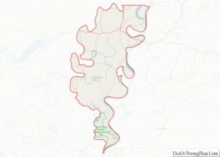
Vidalia location map. Where is Vidalia town?
History
Vidalia was founded by Don José Vidal, when he was secretary to Manuel Gayoso de Lemos, the Spanish Governor of the Natchez District from 1792 to 1797. This was in a brief period of Spanish rule of former French territory west of the Mississippi River. Napoleon took it back and he sold it to the United States in the Louisiana Purchase of 1803.
In 1811 the Orleans Territorial legislature changed the name of the city to Vidalia after the founder. Vidal had donated land along the river to the city, where it later constructed its civic buildings. He also donated land for the first school in Concordia Parish.
The Great Sandbar Duel, featuring Jim Bowie, was a formal one-on-one duel that erupted into a violent brawl involving multiple combatants on September 19, 1827. It is a regional legend still told by local residents.
Vidalia is home to Louisiana’s first hydroelectric power plant and the largest prefabricated power plant in the world. A total of 41 countries and 21 states collaborated in this historic endeavor, the Sidney A. Murray, Jr. Hydroelectric Station, located in the southern portion of Concordia Parish. The power plant began operation in 1990. The office is located on Texas Street in town.
Hyram Copeland, a Democrat, was repeatedly re-elected; he served as mayor of Vidalia from 1992 to 2016. He is a 2013 inductee of the Louisiana Political Museum and Hall of Fame.
Vidalia Road Map
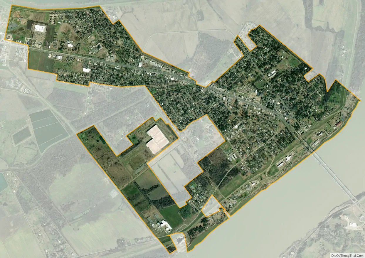
Vidalia city Satellite Map
Geography
According to the United States Census Bureau, the city has a total area of 2.6 square miles (6.7 km), all land.
See also
Map of Louisiana State and its subdivision:- Acadia
- Allen
- Ascension
- Assumption
- Avoyelles
- Beauregard
- Bienville
- Bossier
- Caddo
- Calcasieu
- Caldwell
- Cameron
- Catahoula
- Claiborne
- Concordia
- De Soto
- East Baton Rouge
- East Carroll
- East Feliciana
- Evangeline
- Franklin
- Grant
- Iberia
- Iberville
- Jackson
- Jefferson
- Jefferson Davis
- La Salle
- Lafayette
- Lafourche
- Lincoln
- Livingston
- Madison
- Morehouse
- Natchitoches
- Orleans
- Ouachita
- Plaquemines
- Pointe Coupee
- Rapides
- Red River
- Richland
- Sabine
- Saint Bernard
- Saint Charles
- Saint Helena
- Saint James
- Saint John the Baptist
- Saint Landry
- Saint Martin
- Saint Mary
- Saint Tammany
- Tangipahoa
- Tensas
- Terrebonne
- Union
- Vermilion
- Vernon
- Washington
- Webster
- West Baton Rouge
- West Carroll
- West Feliciana
- Winn
- Alabama
- Alaska
- Arizona
- Arkansas
- California
- Colorado
- Connecticut
- Delaware
- District of Columbia
- Florida
- Georgia
- Hawaii
- Idaho
- Illinois
- Indiana
- Iowa
- Kansas
- Kentucky
- Louisiana
- Maine
- Maryland
- Massachusetts
- Michigan
- Minnesota
- Mississippi
- Missouri
- Montana
- Nebraska
- Nevada
- New Hampshire
- New Jersey
- New Mexico
- New York
- North Carolina
- North Dakota
- Ohio
- Oklahoma
- Oregon
- Pennsylvania
- Rhode Island
- South Carolina
- South Dakota
- Tennessee
- Texas
- Utah
- Vermont
- Virginia
- Washington
- West Virginia
- Wisconsin
- Wyoming