Ville Platte is the largest city in, and the parish seat of, Evangeline Parish, Louisiana, United States. The population was 7,430 at the 2010 census, down from 8,145 in 2000. The city’s name is of French origin, roughly translating to “flat town”, in reference to its relatively flat topography in contrast to the more hilly terrain north of the area.
| Name: | Ville Platte city |
|---|---|
| LSAD Code: | 25 |
| LSAD Description: | city (suffix) |
| State: | Louisiana |
| County: | Evangeline Parish |
| Founded: | 1824 |
| Elevation: | 72 ft (22 m) |
| Total Area: | 4.02 sq mi (10.40 km²) |
| Land Area: | 4.02 sq mi (10.40 km²) |
| Water Area: | 0.00 sq mi (0.00 km²) |
| Total Population: | 6,303 |
| Population Density: | 1,569.08/sq mi (605.85/km²) |
| ZIP code: | 70586 |
| Area code: | 337 |
| FIPS code: | 2278715 |
| Website: | www.cityofvilleplatte.com |
Online Interactive Map
Click on ![]() to view map in "full screen" mode.
to view map in "full screen" mode.
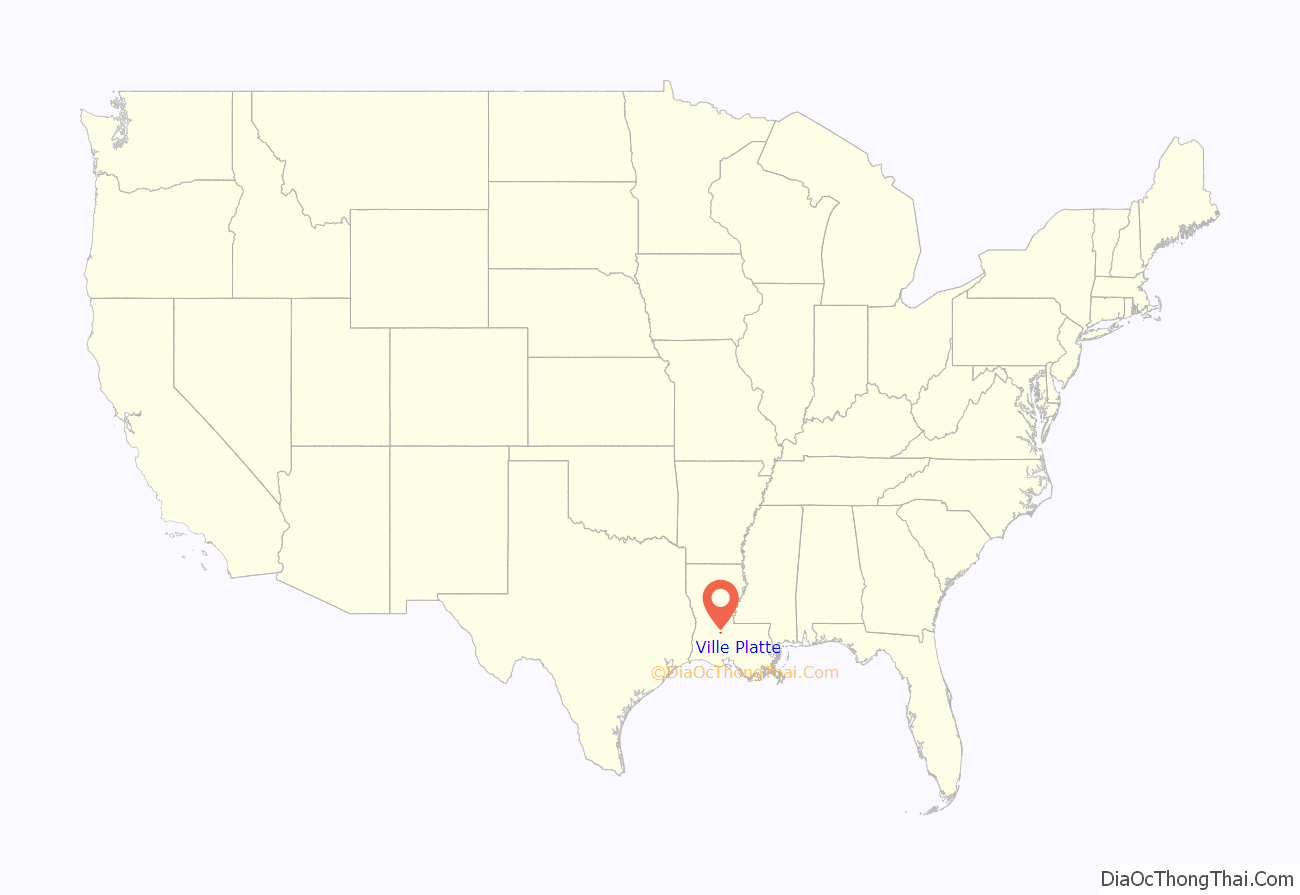
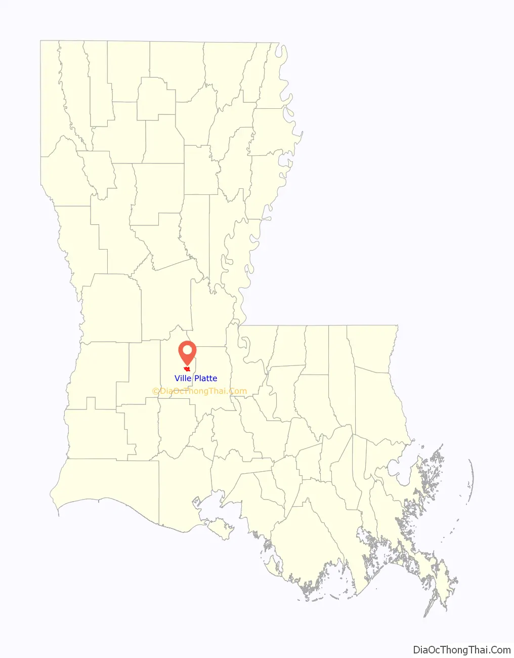
Ville Platte location map. Where is Ville Platte city?
History
The area around Ville Platte appears to have been first settled during the last half of the eighteenth century, when Louisiana was under Spanish rule. The earliest record of settlement in the immediate area of Ville Platte was in the 1780s.
Popular legend states the founder of Ville Platte was Marcellin Garand, an adjutant major in the Army of the French Empire during the reign of Napoleon. In 1824, Garand obtained one of the first two lots that were platted in what is now Ville Platte, with the second being obtained by a Doctor Robert Windex. Those lots were obtained from the estate of William O’Donegan. This appears to be the actual beginning of, or the founding of, the present town of Ville Platte.
The first post office in Ville Platte was established in 1842 with Marcellin Garand as postmaster from 1842 to 1848.
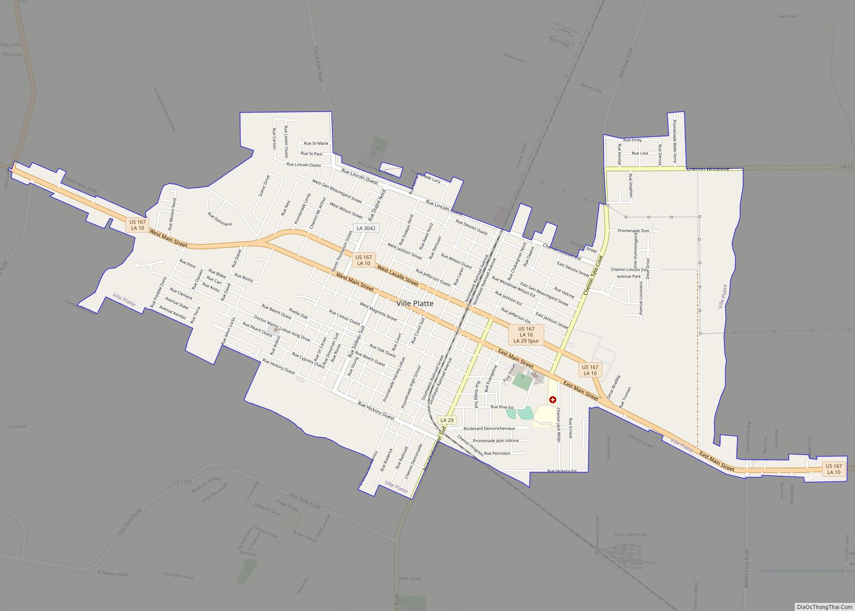
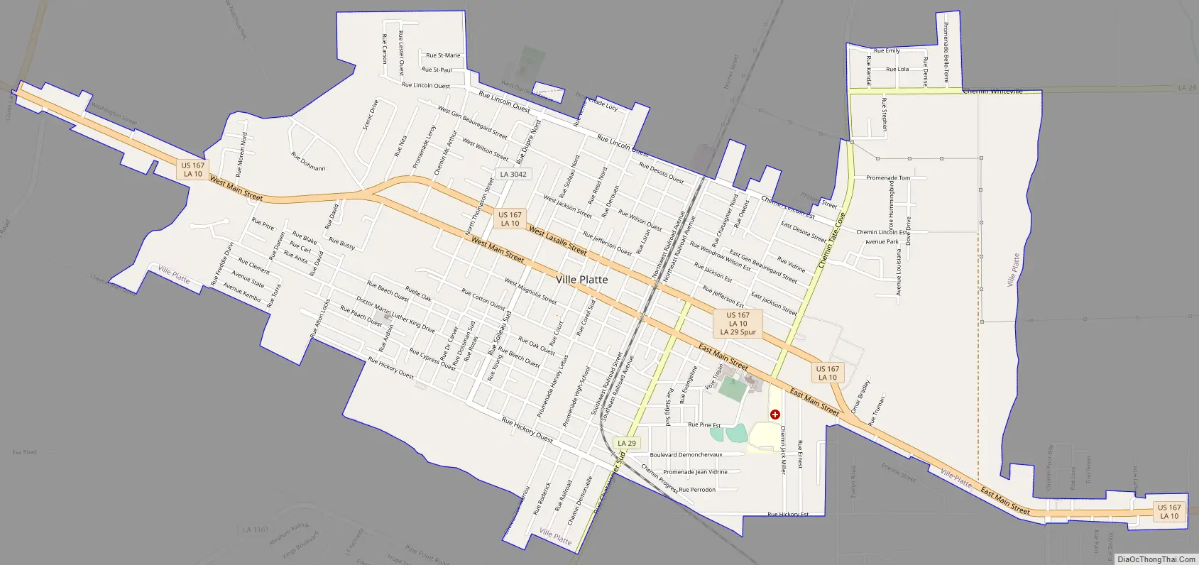
Ville Platte Road Map
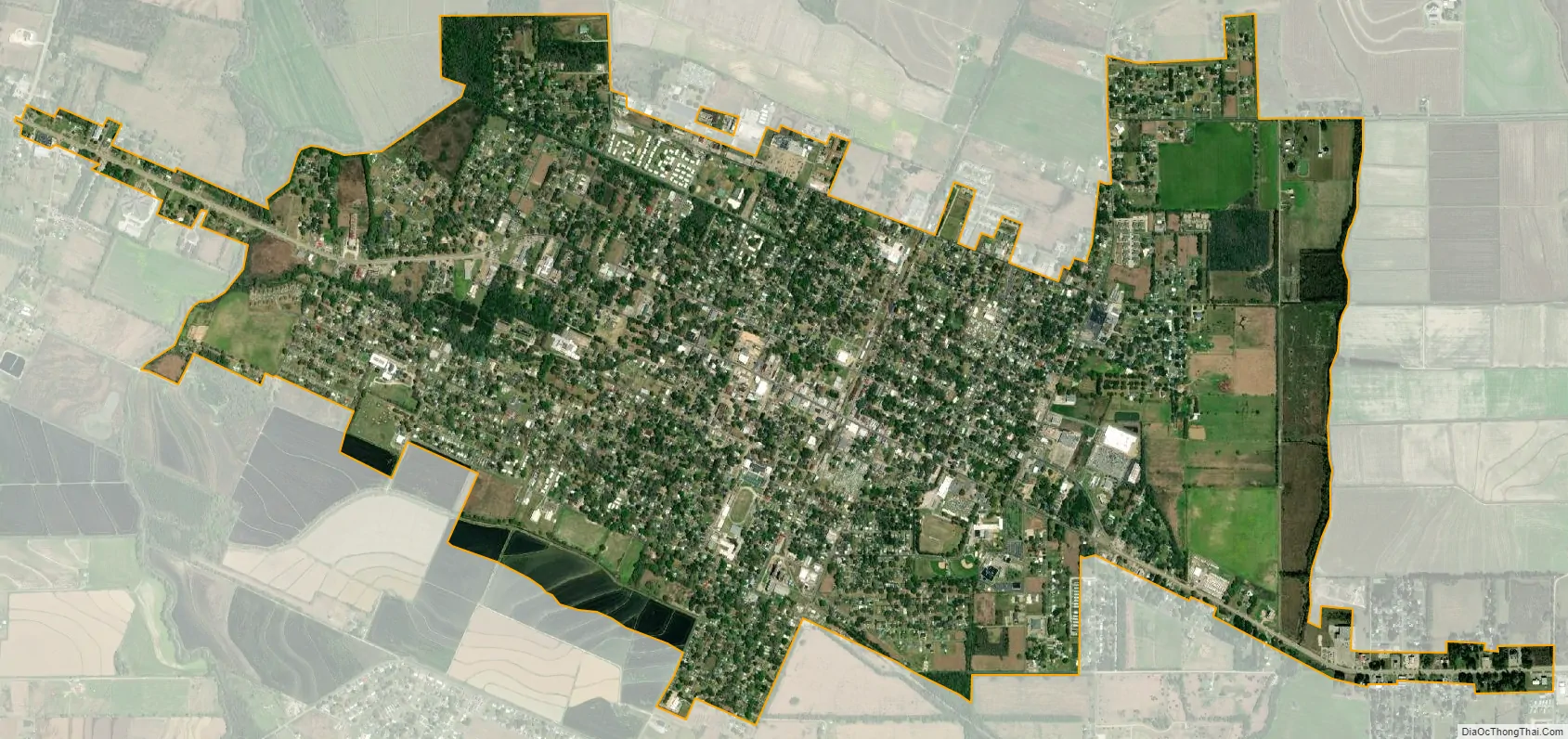
Ville Platte city Satellite Map
Geography
Ville Platte is located in eastern Evangeline Parish at 30°41′21″N 92°16′39″W / 30.68917°N 92.27750°W / 30.68917; -92.27750 (30.689140, -92.277534).
According to the United States Census Bureau, Ville Platte has a total area of 4.0 square miles (10.4 km), of which 0.25 acres (0.001 km), or 0.01%, is water.
U.S. Route 167 passes through the city as Main Street (eastbound) and Lasalle Street (westbound). The highway leads southeast 17 miles (27 km) to Opelousas and north 52 miles (84 km) to Alexandria. Louisiana Highway 10 passes through the city in tandem with US 167 but leads northwest 28 miles (45 km) to Oakdale.
Chicot State Park, Louisiana’s largest state park, is located 8 miles (13 km) north of Ville Platte. The park covers 6,400 acres (26 km) of rolling hills and water and has large numbers of deer, raccoon, and other wildlife.
See also
Map of Louisiana State and its subdivision:- Acadia
- Allen
- Ascension
- Assumption
- Avoyelles
- Beauregard
- Bienville
- Bossier
- Caddo
- Calcasieu
- Caldwell
- Cameron
- Catahoula
- Claiborne
- Concordia
- De Soto
- East Baton Rouge
- East Carroll
- East Feliciana
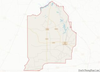
- Evangeline
- Franklin
- Grant
- Iberia
- Iberville
- Jackson
- Jefferson
- Jefferson Davis
- La Salle
- Lafayette
- Lafourche
- Lincoln
- Livingston
- Madison
- Morehouse
- Natchitoches
- Orleans
- Ouachita
- Plaquemines
- Pointe Coupee
- Rapides
- Red River
- Richland
- Sabine
- Saint Bernard
- Saint Charles
- Saint Helena
- Saint James
- Saint John the Baptist
- Saint Landry
- Saint Martin
- Saint Mary
- Saint Tammany
- Tangipahoa
- Tensas
- Terrebonne
- Union
- Vermilion
- Vernon
- Washington
- Webster
- West Baton Rouge
- West Carroll
- West Feliciana
- Winn
- Alabama
- Alaska
- Arizona
- Arkansas
- California
- Colorado
- Connecticut
- Delaware
- District of Columbia
- Florida
- Georgia
- Hawaii
- Idaho
- Illinois
- Indiana
- Iowa
- Kansas
- Kentucky
- Louisiana
- Maine
- Maryland
- Massachusetts
- Michigan
- Minnesota
- Mississippi
- Missouri
- Montana
- Nebraska
- Nevada
- New Hampshire
- New Jersey
- New Mexico
- New York
- North Carolina
- North Dakota
- Ohio
- Oklahoma
- Oregon
- Pennsylvania
- Rhode Island
- South Carolina
- South Dakota
- Tennessee
- Texas
- Utah
- Vermont
- Virginia
- Washington
- West Virginia
- Wisconsin
- Wyoming