Map of Townville borough
Townville is a borough in Crawford County, Pennsylvania, United States. The population was 328 at the 2020 census, up from 323 at the 2010 census. Townville borough overview: Name: Townville borough LSAD Code: 21 LSAD Description: borough (suffix) State: Pennsylvania County: Crawford County Founded: 1831 Total Area: 0.51 sq mi (1.32 km²) Land Area: 0.51 sq mi (1.32 km²) Water Area: ... Read more
Map of Townville borough
Map of Tower City borough, Pennsylvania
Tower City is a borough in Schuylkill County, Pennsylvania, United States. The population was 1,346 at the 2010 census. Tower City borough overview: Name: Tower City borough LSAD Code: 21 LSAD Description: borough (suffix) State: Pennsylvania County: Schuylkill County Incorporated: 1892 Total Area: 0.32 sq mi (0.81 km²) Land Area: 0.32 sq mi (0.81 km²) Water Area: 0.00 sq mi (0.00 km²) Total Population: ... Read more
Map of Tower City borough, Pennsylvania
Map of Towanda borough, Pennsylvania
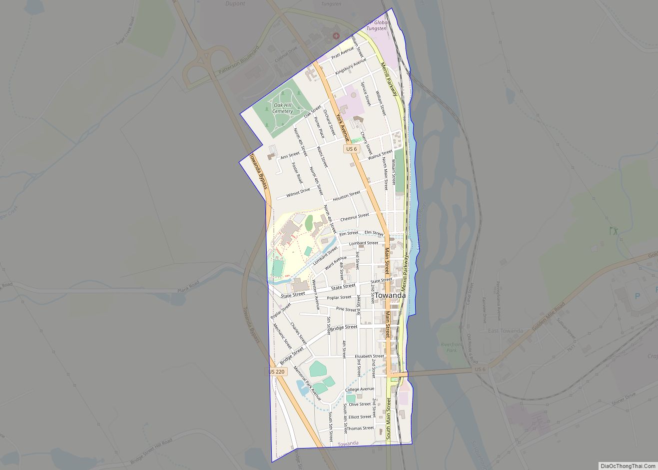
Towanda is a borough and the county seat of Bradford County in the U.S. state of Pennsylvania. It is part of Northeastern Pennsylvania and is located 66 miles (106 km) northwest of Wilkes-Barre, on the Susquehanna River. The name means “burial ground” in the Algonquian language. As of the 2020 census, the population of Towanda was ... Read more
Map of Towanda borough, Pennsylvania
Map of Towamensing Trails CDP
Towamensing Trails is a census-designated place (CDP) in Penn Forest Township, Carbon County, Pennsylvania, United States. It is part of Northeastern Pennsylvania. The community is located directly south of the village of Albrightsville in the southern part of the Poconos, bordered by Pennsylvania Route 903 on the northwest, separating it from Albrightsville, and by Pennsylvania ... Read more
Map of Towamensing Trails CDP
Map of Toughkenamon CDP
Toughkenamon is a census-designated place (CDP) in New Garden Township, Chester County, Pennsylvania, United States. The population was 1,492 at the 2010 census. Toughkenamon CDP overview: Name: Toughkenamon CDP LSAD Code: 57 LSAD Description: CDP (suffix) State: Pennsylvania County: Chester County Elevation: 338 ft (103 m) Total Area: 2.1 sq mi (5 km²) Land Area: 2.1 sq mi (5 km²) Water Area: 0.0 sq mi ... Read more
Map of Toughkenamon CDP
Map of Topton borough
Topton is a borough in Berks County, Pennsylvania, United States. The population was 2,069 at the 2010 census. Topton borough overview: Name: Topton borough LSAD Code: 21 LSAD Description: borough (suffix) State: Pennsylvania County: Berks County Elevation: 486 ft (148 m) Total Area: 0.69 sq mi (1.80 km²) Land Area: 0.69 sq mi (1.79 km²) Water Area: 0.00 sq mi (0.00 km²) Total Population: 2,069 Population ... Read more
Map of Topton borough
Map of Toftrees CDP
Toftrees is a census-designated place in Patton Township, Centre County, Pennsylvania, United States. It is located 3.5 miles (5.6 km) northwest of the center of State College on the north side of Interstate 99/U.S. Route 322. The hilltop community surrounds the Toftrees Golf Resort. As of the 2010 census, the population of the community was 2,053. ... Read more
Map of Toftrees CDP
Map of Titusville city, Pennsylvania
Titusville is a city in the far eastern corner of Crawford County, Pennsylvania, United States. The population was 5,262 at the 2020 census. Titusville is known as the birthplace of the American oil industry and for a number of years was the leading oil-producing region in the world. It was also notable for its lumber ... Read more
Map of Titusville city, Pennsylvania
Map of Trevose CDP
Trevose is a census-designated place within both Bensalem and Lower Southampton townships in Bucks County, Pennsylvania, United States. Trevose was formerly part of Feasterville-Trevose, but was split into two separate CDPs for the 2010 census. U.S. 1 runs through the town as well as the Pennsylvania Turnpike, but Trevose’s main road is Brownsville Road, which ... Read more
Map of Trevose CDP
Map of Trevorton CDP
Trevorton is a census-designated place (CDP) in Zerbe Township, Northumberland County, Pennsylvania, United States. The population was 1,834 at the 2010 census. Trevorton CDP overview: Name: Trevorton CDP LSAD Code: 57 LSAD Description: CDP (suffix) State: Pennsylvania County: Northumberland County Total Area: 4.26 sq mi (11.04 km²) Land Area: 4.26 sq mi (11.04 km²) Water Area: 0.00 sq mi (0.00 km²) Total Population: 1,759 ... Read more
Map of Trevorton CDP
Map of Tresckow CDP
Tresckow, formerly known as Dutchtown, is an unincorporated community and census-designated place (CDP) in Carbon County, Pennsylvania, United States. It is part of Northeastern Pennsylvania and is located west of Junedale and Beaver Meadows, which share the same road network. The community has deep roots in the anthracite coal mining and transportation industries. Tresckow CDP ... Read more
Map of Tresckow CDP
Map of Tremont borough, Pennsylvania
Tremont is a borough in Schuylkill County, Pennsylvania, United States. Situated in the eastern section of Tremont Township, it was incorporated as a borough in 1866, around the same time that a water system was erected in the community. The population was one thousand six hundred and seventy-two at the time of the 2020 census. ... Read more
Map of Tremont borough, Pennsylvania