Titusville is a city in the far eastern corner of Crawford County, Pennsylvania, United States. The population was 5,262 at the 2020 census. Titusville is known as the birthplace of the American oil industry and for a number of years was the leading oil-producing region in the world. It was also notable for its lumber industry, including 17 sawmills, as well as its plastic and toolmaking industries. It is part of the Meadville micropolitan area.
| Name: | Titusville city |
|---|---|
| LSAD Code: | 25 |
| LSAD Description: | city (suffix) |
| State: | Pennsylvania |
| County: | Crawford County |
| Total Area: | 2.90 sq mi (7.51 km²) |
| Land Area: | 2.90 sq mi (7.51 km²) |
| Water Area: | 0.00 sq mi (0.00 km²) |
| Total Population: | 5,262 |
| Population Density: | 1,778.3/sq mi (686.62/km²) |
| ZIP code: | 16354 |
| Area code: | 814 |
| FIPS code: | 4276904 |
| Website: | www.cityoftitusvillepa.gov |
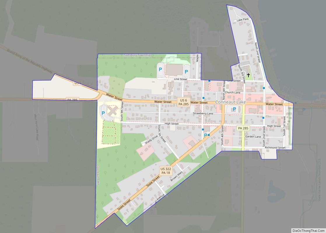
Online Interactive Map
Click on ![]() to view map in "full screen" mode.
to view map in "full screen" mode.
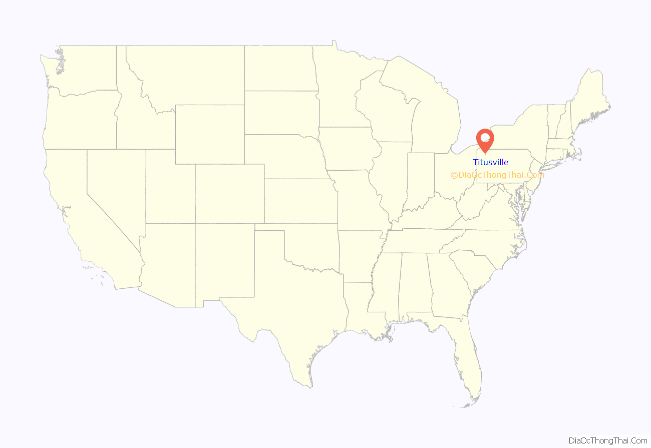
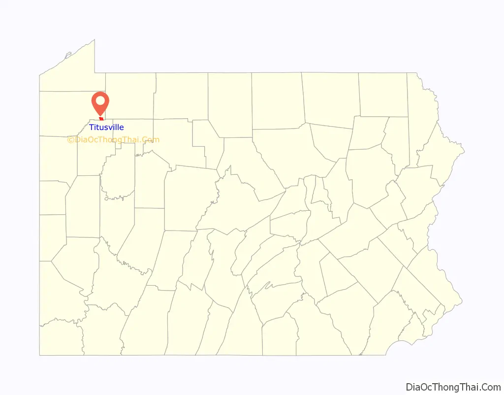
Titusville location map. Where is Titusville city?
History
The area was first settled in 1796 by Jonathan Titus. Within 14 years, others bought and improved land lying near his, along the banks of what is now Oil Creek. Titus named the village Edinburg(h), but as it grew, the settlers began to call the hamlet Titusville. The village was incorporated as a borough in 1849. It was a slow-growing community until the 1850s, when petroleum was discovered in the region.
Oil was known to exist there, but there was no practical way to extract it. Its main use at that time had been as a medicine for both animals and humans. In the late 1850s, the Seneca Oil Company (formerly the Pennsylvania Rock Oil Company) sent Col. Edwin L. Drake to start drilling on a piece of leased land just south of Titusville, near what is now Oil Creek State Park. In the summer of 1859, Drake hired a salt well driller, William A. Smith. They had many difficulties, but on August 27, at the site of an oil spring just south of Titusville, they finally drilled a well that could be commercially successful.
Teamsters were needed immediately to transport the oil to markets. In 1862, the Oil Creek & Titusville Railroad was built between Titusville and Corry, where the product was transferred to larger east-west railroad lines. In 1865, pipelines were laid directly to the line and the demand for teamsters practically ended. The next year the railroad line was extended south to Petroleum Centre and Oil City. The Union & Titusville Railroad was built in 1865. That line became part of the Philadelphia and Erie Railroad in 1871. That fall, President Ulysses S. Grant visited Titusville to view the important region.
Other oil-related businesses were quickly established. Eight refineries were built between 1862 and 1868. Drilling tools were needed and several iron works were built. Titusville grew from 250 residents to 10,000 almost overnight and in 1866, it incorporated as a city. In 1871, the first oil exchange in the United States was established there. The exchange moved from the city, but returned in 1881 in a new, brick building, before being dissolved in 1897.
The first oil millionaire was Jonathan Watson, a resident of Titusville. He owned the land where Drake’s well was drilled. He had been a partner in a lumber business prior to the success of the well. At one time it was said that Titusville had more millionaires per capita than anywhere else in the world.
One resident of note was Franklin S. Tarbell, whose large Italianate home still stands. He first moved a few miles south in Venango County and established a wooden stock tank business. About 10 miles (16 km) south-east of Titusville was another oil boom city, Pithole. Oil was discovered in a rolling meadow there in January 1865 and, by September 1865, the population was 15,000. But the oil soon ran dry and within four years the city was nearly deserted. Tarbell moved to Titusville in 1870. His daughter, Ida Minerva Tarbell, grew up amidst the sounds and smells of the oil industry. She became an accomplished writer and published a series of articles about the business practices of the Standard Oil Company and its president, John D. Rockefeller, which sparked legislative action in Congress concerning monopolies.
Fire was always a significant concern around oil and one of the worst blazes was on June 11, 1880. It came to be known as “Black Friday”, when almost 300,000 barrels (48,000 m) of oil burned after an oil tank was hit by lightning. The fire raged for three days until it finally was brought under control. The destroyed oil was valued at $2 million, but there was no loss of life. Another fire occurred on June 5, 1892, when Oil Creek flooded and a tank of petroleum ether overturned. The petroleum ether ignited and, in the ensuing explosions, 60 men, women and children died. Another lightning strike in 1894 resulted in 27,000 barrels (4,300,000 liters) of oil being lost in a fire.
Oil production in Pennsylvania peaked in 1891, after which other industries became established in Titusville. The iron and steel industries dominated the town in the early twentieth century, with lumber eventually reclaiming its former pre-eminence. Oil still has some relevance, however. Charter Plastics, now located in a building that once manufactured pressure vessels, stationary engines and boilers for the oil industry, uses oil in its production processes.
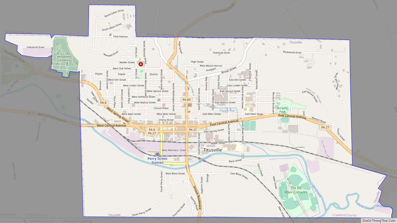
Titusville Road Map
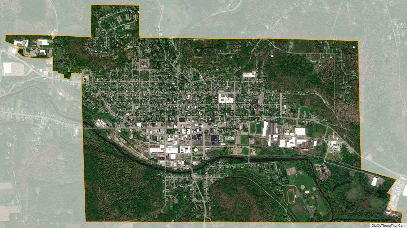
Titusville city Satellite Map
Geography
Titusville is located at 41°38′N 79°40′W / 41.633°N 79.667°W / 41.633; -79.667 (41.629, −79.674).
According to the United States Census Bureau, the city has a total area of 2.9 square miles (7.5 km), all land.
Located 44.4 miles south of Erie, Pennsylvania
83.6 miles North of Pittsburgh, Pennsylvania
122.9 Miles East of Cleveland, Ohio
120.5 Miles South of Buffalo, New York
78.2 Miles North East of Youngstown, Ohio
Climate
Natural features
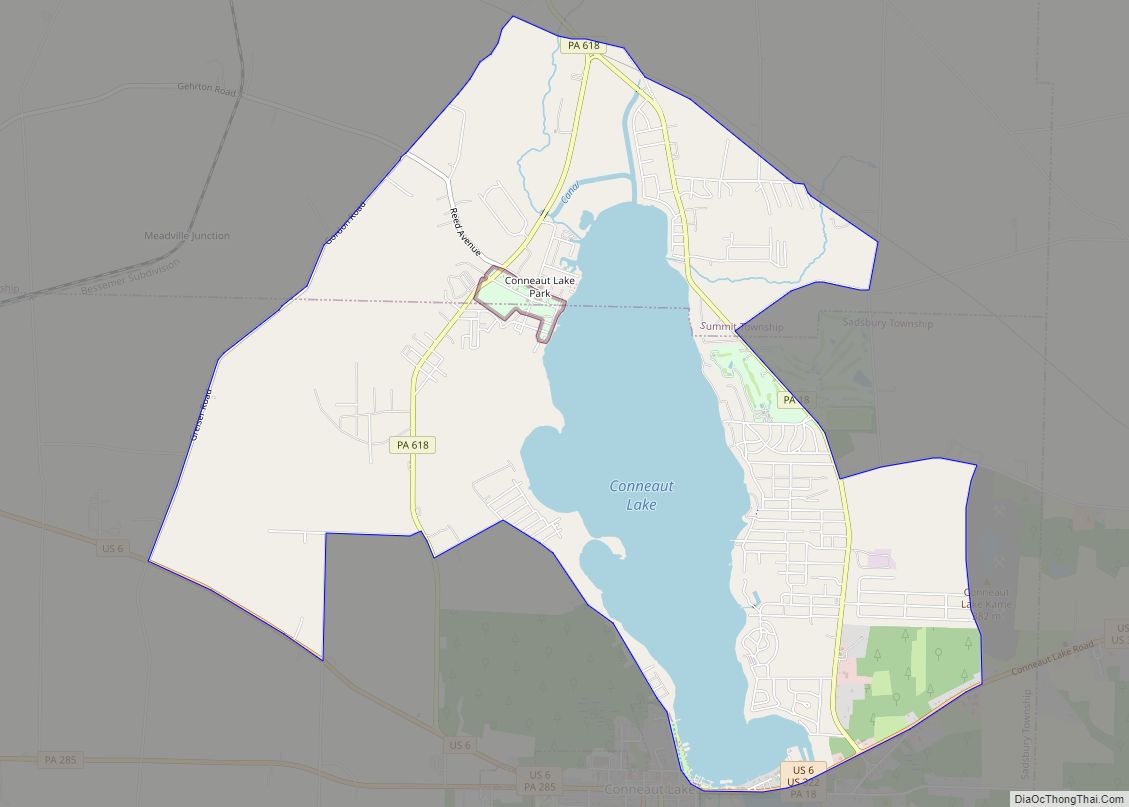
The City of Titusville is located in the southeastern Corner of Crawford County in the Pittsburgh High Plateau. The city is drained by Oil Creek, a south-flowing tributary of the Allegheny River, and two tributaries to Oil Creek, Pine Creek, and Church Run. The lowest elevation in the City of Titusville is 1,150 ft (350 m) where Oil Creek flows south of out of the city. The highest elevation is 1,650 ft (500 m) on a high point at the northeastern corner of the city.
See also
Map of Pennsylvania State and its subdivision:- Adams
- Allegheny
- Armstrong
- Beaver
- Bedford
- Berks
- Blair
- Bradford
- Bucks
- Butler
- Cambria
- Cameron
- Carbon
- Centre
- Chester
- Clarion
- Clearfield
- Clinton
- Columbia
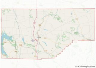
- Crawford
- Cumberland
- Dauphin
- Delaware
- Elk
- Erie
- Fayette
- Forest
- Franklin
- Fulton
- Greene
- Huntingdon
- Indiana
- Jefferson
- Juniata
- Lackawanna
- Lancaster
- Lawrence
- Lebanon
- Lehigh
- Luzerne
- Lycoming
- Mc Kean
- Mercer
- Mifflin
- Monroe
- Montgomery
- Montour
- Northampton
- Northumberland
- Perry
- Philadelphia
- Pike
- Potter
- Schuylkill
- Snyder
- Somerset
- Sullivan
- Susquehanna
- Tioga
- Union
- Venango
- Warren
- Washington
- Wayne
- Westmoreland
- Wyoming
- York
- Alabama
- Alaska
- Arizona
- Arkansas
- California
- Colorado
- Connecticut
- Delaware
- District of Columbia
- Florida
- Georgia
- Hawaii
- Idaho
- Illinois
- Indiana
- Iowa
- Kansas
- Kentucky
- Louisiana
- Maine
- Maryland
- Massachusetts
- Michigan
- Minnesota
- Mississippi
- Missouri
- Montana
- Nebraska
- Nevada
- New Hampshire
- New Jersey
- New Mexico
- New York
- North Carolina
- North Dakota
- Ohio
- Oklahoma
- Oregon
- Pennsylvania
- Rhode Island
- South Carolina
- South Dakota
- Tennessee
- Texas
- Utah
- Vermont
- Virginia
- Washington
- West Virginia
- Wisconsin
- Wyoming