Map of Lake Latonka CDP
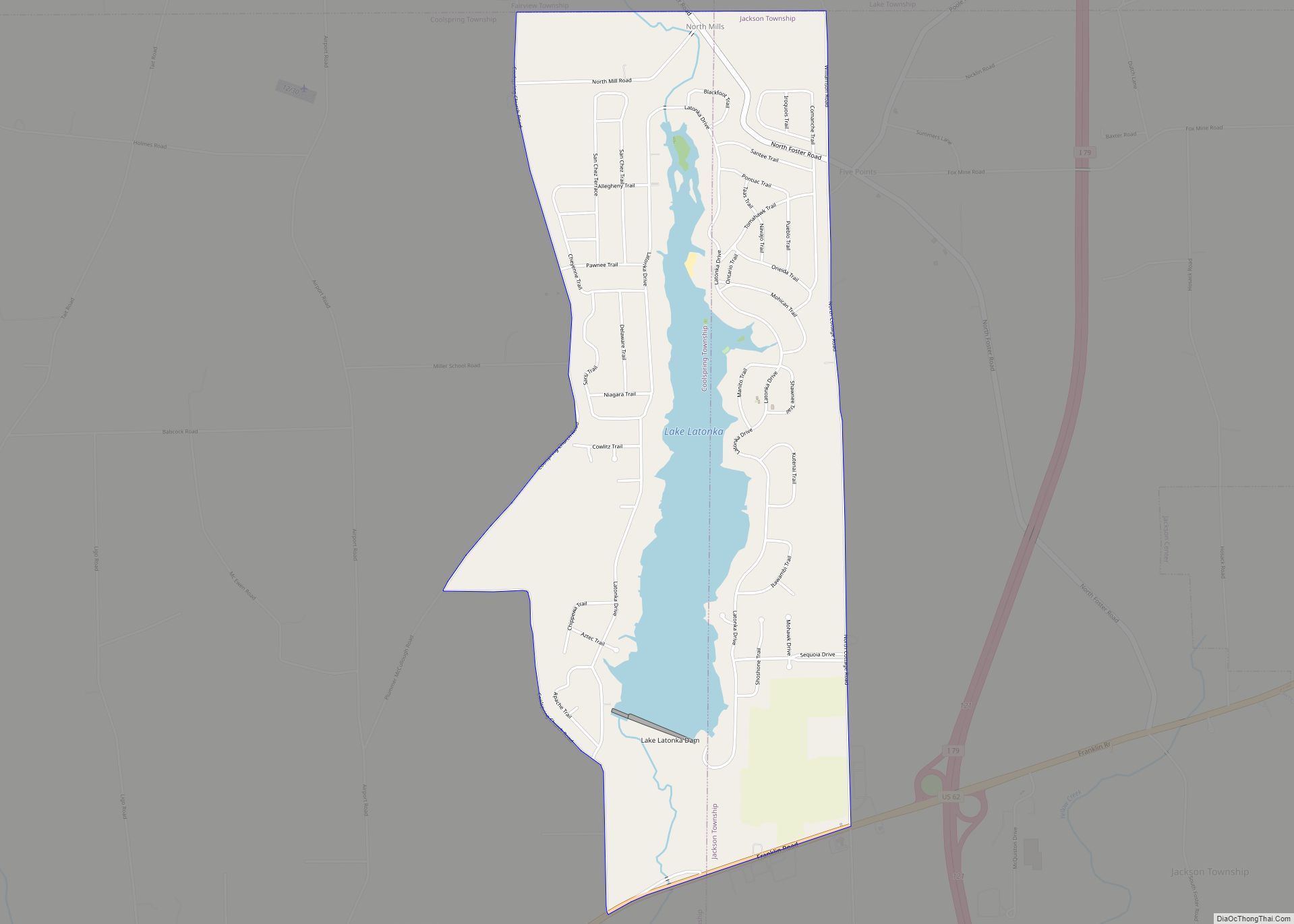
Lake Latonka is a census-designated place in Coolspring and Jackson Townships in Mercer County, Pennsylvania, United States. It surrounds the Lake Latonka reservoir. The population was 951 at the 2020 census. It is part of the Youngstown–Warren metropolitan area. Lake Latonka CDP overview: Name: Lake Latonka CDP LSAD Code: 57 LSAD Description: CDP (suffix) State: ... Read more
Map of Lake Latonka CDP
Map of Lake Heritage CDP
Lake Heritage is a census-designated place (CDP) in Adams County, Pennsylvania, United States. Its population was 2,158 at the 2020 census. Lake Heritage CDP overview: Name: Lake Heritage CDP LSAD Code: 57 LSAD Description: CDP (suffix) State: Pennsylvania County: Adams County Elevation: 500 ft (200 m) Total Area: 2.08 sq mi (5.39 km²) Land Area: 1.85 sq mi (4.80 km²) Water Area: 0.23 sq mi ... Read more
Map of Lake Heritage CDP
Map of Langhorne Manor borough
Langhorne Manor is a borough in Bucks County, Pennsylvania. The population was 1,422 at the 2010 census, a 55.6% increase from the 2000 census. The mayor of Langhorne Manor is Bob Byrne. Langhorne Manor borough overview: Name: Langhorne Manor borough LSAD Code: 21 LSAD Description: borough (suffix) State: Pennsylvania County: Bucks County Elevation: 220 ft (70 m) ... Read more
Map of Langhorne Manor borough
Map of Langeloth CDP
Langeloth is a census-designated place in Smith Township, Washington County, Pennsylvania. Langeloth has been assigned the ZIP code 15054. As of the 2010 census, the population was 717 residents. Langeloth began as a coal mining company town. Langeloth Metallurgical Company, now a unit of Centerra Gold, is the town’s largest employer. It was the birthplace ... Read more
Map of Langeloth CDP
Map of Lanesboro borough, Pennsylvania
Lanesboro is a borough in Susquehanna County, Pennsylvania, United States. The population was 485 at the 2020 census. Lanesboro borough overview: Name: Lanesboro borough LSAD Code: 21 LSAD Description: borough (suffix) State: Pennsylvania County: Susquehanna County Total Area: 2.68 sq mi (6.95 km²) Land Area: 2.62 sq mi (6.78 km²) Water Area: 0.06 sq mi (0.17 km²) Total Population: 508 Population Density: 194.12/sq mi (74.94/km²) ... Read more
Map of Lanesboro borough, Pennsylvania
Map of Landisville CDP
Landisville is an unincorporated community and census-designated place (CDP) in East Hempfield Township, Lancaster County, Pennsylvania, United States. As of the 2010 census the population was 1,893. The community was once part of the Salunga-Landisville CDP, before splitting into two separate CDPs for the 2010 census, the other being Salunga. Landisville CDP overview: Name: Landisville ... Read more
Map of Landisville CDP
Map of Landisburg borough
Landisburg is a borough in Perry County, Pennsylvania, United States. The population was 220 at the 2010 census. It is part of the Harrisburg–Carlisle Metropolitan Statistical Area. Landisburg borough overview: Name: Landisburg borough LSAD Code: 21 LSAD Description: borough (suffix) State: Pennsylvania County: Perry County Incorporated: 1831 Total Area: 0.07 sq mi (0.19 km²) Land Area: 0.07 sq mi (0.19 km²) ... Read more
Map of Landisburg borough
Map of Laporte borough, Pennsylvania
Laporte is a borough and the county seat of Sullivan County, Pennsylvania, United States. The population was 320 at the 2020 census. It is the county seat of Sullivan County. Laporte is surrounded by Laporte Township. It was named for John Laporte. It is the smallest county seat in Pennsylvania by population (as of the ... Read more
Map of Laporte borough, Pennsylvania
Map of Lansford borough, Pennsylvania
Lansford is a county-border borough (town) in Carbon County, Pennsylvania, United States. It is part of Northeastern Pennsylvania. It is located 37 miles (60 km) northwest of Allentown and 19 miles south of Hazleton in the Panther Creek Valley about 72 miles (116 km) from Philadelphia and abutting the cross-county sister-city of Coaldale in Schuylkill County. The ... Read more
Map of Lansford borough, Pennsylvania
Map of Lansdowne borough, Pennsylvania
Lansdowne is a borough in Delaware County, Pennsylvania, United States, located 6 miles (10 km) southwest of Center City Philadelphia. It was named for the Marquess of Lansdowne. As of the 2010 census, the borough had a population of 10,620. Lansdowne grew quickly in the early part of the twentieth century, when a railroad stop was ... Read more
Map of Lansdowne borough, Pennsylvania
Map of Lansdale borough
Lansdale is a borough in Montgomery County, Pennsylvania, United States. It is a densely-populated commuter town, with many residents traveling daily to Philadelphia using SEPTA Regional Rail’s Lansdale/Doylestown Line. In 1900, 2,754 people lived here; in 1910, 3,551; and in 1940, 9,316 people were inhabitants of Lansdale. The population was 18,773 at the 2020 census. ... Read more
Map of Lansdale borough
Map of Langhorne borough
Langhorne Borough is a borough in Bucks County, Pennsylvania. The population was 1,622 at the time of the 2010 census. The mailing address “Langhorne” is used for Langhorne Borough, but it is also used broadly to describe the majority of surrounding Middletown Township, which for the most part uses Langhorne’s ZIP code of 19047. Sesame ... Read more
Map of Langhorne borough