Landisburg is a borough in Perry County, Pennsylvania, United States. The population was 220 at the 2010 census. It is part of the Harrisburg–Carlisle Metropolitan Statistical Area.
| Name: | Landisburg borough |
|---|---|
| LSAD Code: | 21 |
| LSAD Description: | borough (suffix) |
| State: | Pennsylvania |
| County: | Perry County |
| Incorporated: | 1831 |
| Total Area: | 0.07 sq mi (0.19 km²) |
| Land Area: | 0.07 sq mi (0.19 km²) |
| Water Area: | 0.00 sq mi (0.00 km²) |
| Total Population: | 221 |
| Population Density: | 3,112.68/sq mi (1,193.48/km²) |
| Area code: | 717 |
| FIPS code: | 4241272 |
Online Interactive Map
Click on ![]() to view map in "full screen" mode.
to view map in "full screen" mode.
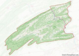
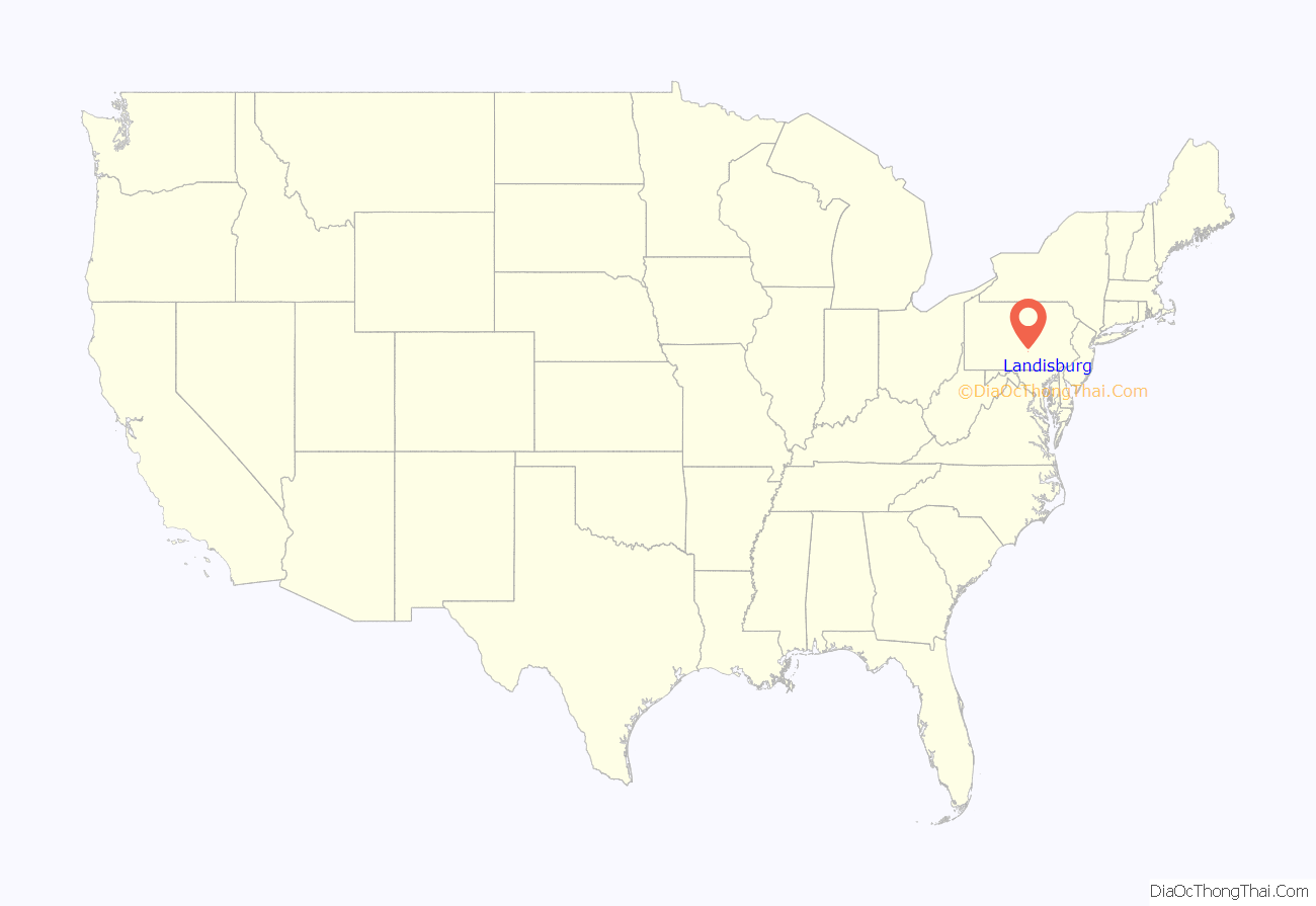
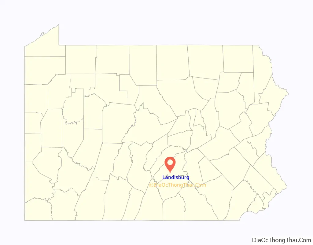
Landisburg location map. Where is Landisburg borough?
History
Landisburg was platted in 1793. The community was named for its founder, James Landis.
The Dunbar-Creigh House was added to the National Register of Historic Places in 1980.
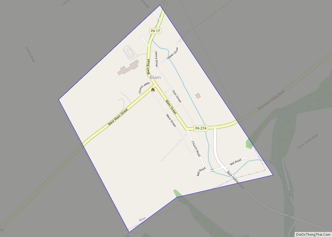
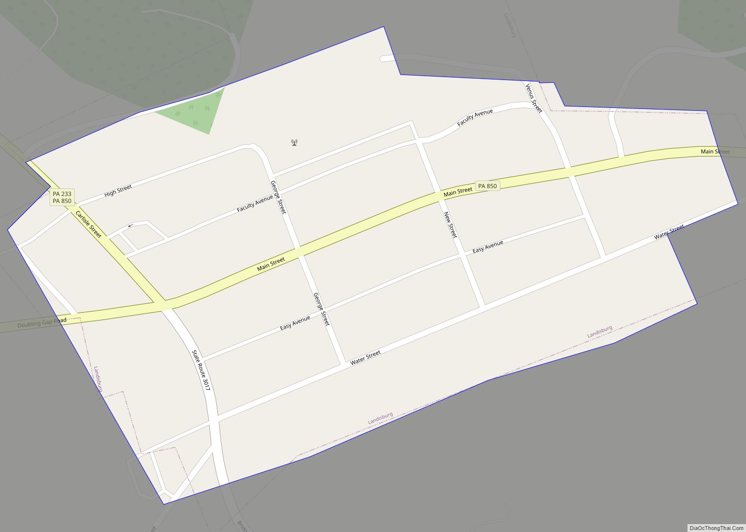
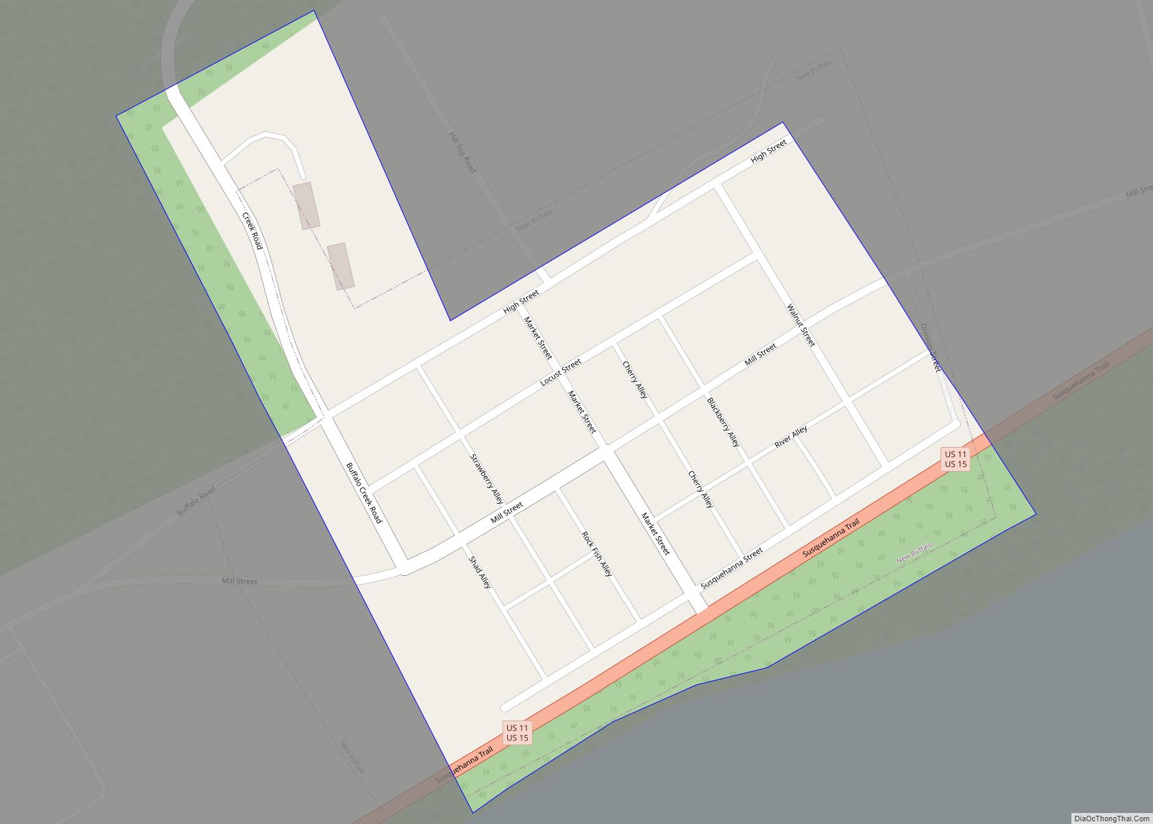
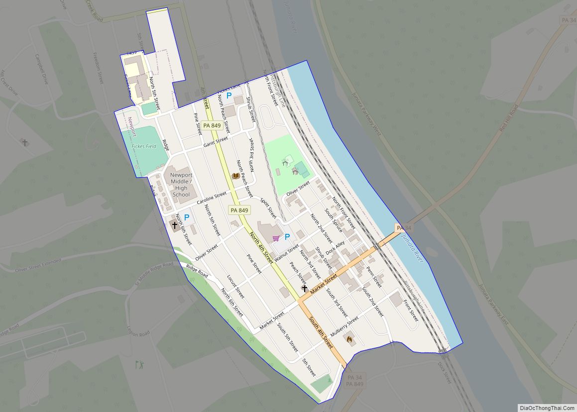
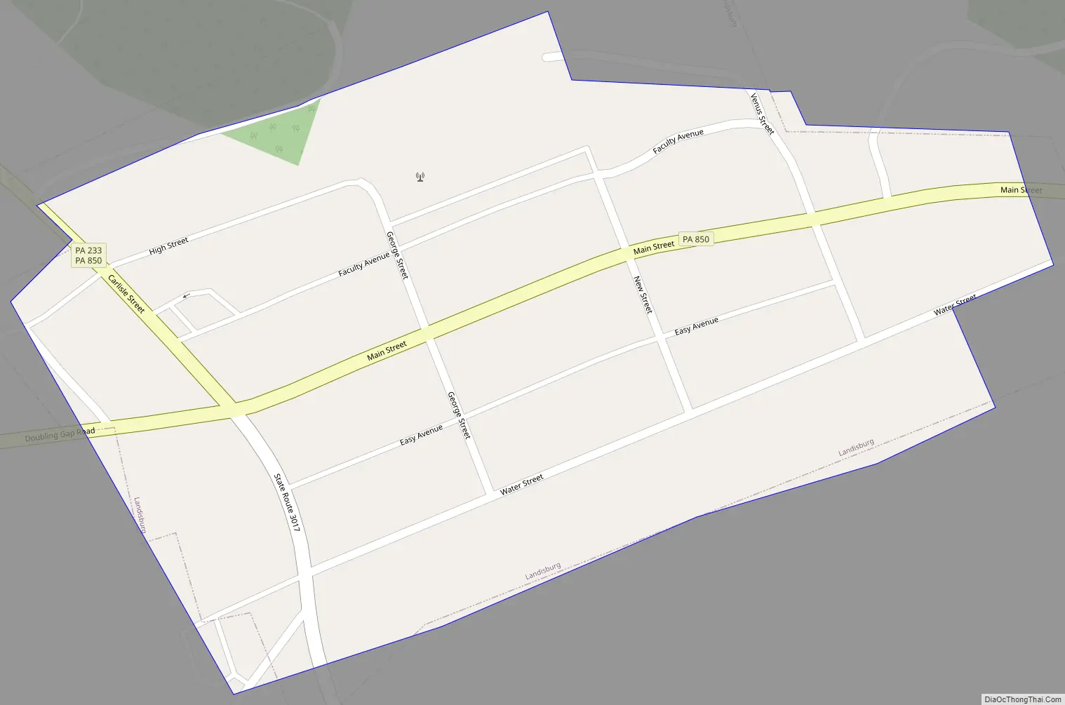
Landisburg Road Map
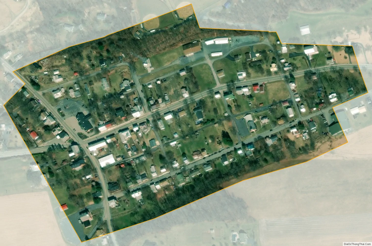
Landisburg city Satellite Map
Geography
Landisburg is located at 40°20′32″N 77°18′25″W / 40.34222°N 77.30694°W / 40.34222; -77.30694 (40.342339, -77.307038).
According to the United States Census Bureau, the borough has a total area of 0.1 square miles (0.26 km), all land.
See also
Map of Pennsylvania State and its subdivision:- Adams
- Allegheny
- Armstrong
- Beaver
- Bedford
- Berks
- Blair
- Bradford
- Bucks
- Butler
- Cambria
- Cameron
- Carbon
- Centre
- Chester
- Clarion
- Clearfield
- Clinton
- Columbia
- Crawford
- Cumberland
- Dauphin
- Delaware
- Elk
- Erie
- Fayette
- Forest
- Franklin
- Fulton
- Greene
- Huntingdon
- Indiana
- Jefferson
- Juniata
- Lackawanna
- Lancaster
- Lawrence
- Lebanon
- Lehigh
- Luzerne
- Lycoming
- Mc Kean
- Mercer
- Mifflin
- Monroe
- Montgomery
- Montour
- Northampton
- Northumberland
- Perry
- Philadelphia
- Pike
- Potter
- Schuylkill
- Snyder
- Somerset
- Sullivan
- Susquehanna
- Tioga
- Union
- Venango
- Warren
- Washington
- Wayne
- Westmoreland
- Wyoming
- York
- Alabama
- Alaska
- Arizona
- Arkansas
- California
- Colorado
- Connecticut
- Delaware
- District of Columbia
- Florida
- Georgia
- Hawaii
- Idaho
- Illinois
- Indiana
- Iowa
- Kansas
- Kentucky
- Louisiana
- Maine
- Maryland
- Massachusetts
- Michigan
- Minnesota
- Mississippi
- Missouri
- Montana
- Nebraska
- Nevada
- New Hampshire
- New Jersey
- New Mexico
- New York
- North Carolina
- North Dakota
- Ohio
- Oklahoma
- Oregon
- Pennsylvania
- Rhode Island
- South Carolina
- South Dakota
- Tennessee
- Texas
- Utah
- Vermont
- Virginia
- Washington
- West Virginia
- Wisconsin
- Wyoming