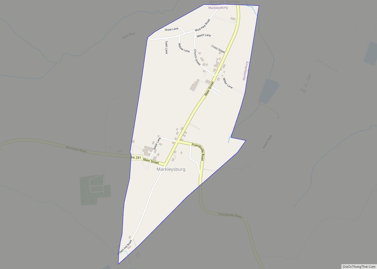
Map of Masontown borough, Pennsylvania
Masontown is a borough in Fayette County, Pennsylvania, United States. It is part of the Pittsburgh Metro Area. The population of the borough was 3,274 at the 2020 census. It is served by the Albert Gallatin Area School District. Masontown is a small crossroads for the rural portions of western Fayette County, and it contains ... Read more
Map of Masontown borough, Pennsylvania
Map of Marysville borough, Pennsylvania
Marysville is a borough in Perry County, Pennsylvania, United States. The population was 2,652 at the 2020 census. It is part of the Harrisburg–Carlisle Metropolitan Statistical Area. The borough was settled in 1755, incorporated as the Borough of Haley in 1866, and re-incorporated as the Borough of Marysville in 1867. Marysville borough overview: Name: Marysville ... Read more
Map of Marysville borough, Pennsylvania
Map of McConnellstown CDP
McConnellstown is a census-designated place in Walker Township, Huntingdon County, Pennsylvania, United States. Due to its long name, the village is often nicknamed “Mactown”. The population of McConnellstown was 1,194 as of the 2010 census. McConnellstown CDP overview: Name: McConnellstown CDP LSAD Code: 57 LSAD Description: CDP (suffix) State: Pennsylvania County: Huntingdon County Elevation: 709 ft ... Read more
Map of McConnellstown CDP
Map of McConnellsburg borough
McConnellsburg is a borough in Fulton County, Pennsylvania, United States. The population was 1,150 at the 2020 census. It is the county seat of Fulton County. McConnellsburg borough overview: Name: McConnellsburg borough LSAD Code: 21 LSAD Description: borough (suffix) State: Pennsylvania County: Fulton County Founded: 1786-04-20 Elevation: 892 ft (272 m) Total Area: 0.35 sq mi (0.90 km²) Land Area: ... Read more
Map of McConnellsburg borough
Map of McClure borough, Pennsylvania
McClure is a borough in Snyder County, Pennsylvania, United States. The population was 889 at the 2020 census. The town is named for the 19th century Pennsylvania politician and journalist Alexander Kelly McClure. McClure owes its origin to the building of the Sunbury and Lewistown Railroad, that at one time ran through the center of ... Read more
Map of McClure borough, Pennsylvania
Map of McAlisterville CDP
McAlisterville is an unincorporated community and census-designated place (CDP) in Fayette Township, Juniata County, Pennsylvania, United States. The population was 971 at the 2010 census. McAlisterville CDP overview: Name: McAlisterville CDP LSAD Code: 57 LSAD Description: CDP (suffix) State: Pennsylvania County: Juniata County Elevation: 636 ft (194 m) Total Area: 1.75 sq mi (4.55 km²) Land Area: 1.75 sq mi (4.55 km²) Water ... Read more
Map of McAlisterville CDP
Map of McAdoo borough
McAdoo is a borough and coal town in Schuylkill County, Pennsylvania, United States, 5 miles (8.0 km) south of Hazleton and seven miles north of Tamaqua. McAdoo contains the picturesque Silver Brook Meadow. In the past, anthracite coal mining and a shirt factory, the McAdoo Manufacturing Company, provided gainful employment to the populace. The population was ... Read more
Map of McAdoo borough
Map of Maytown CDP, Pennsylvania
Maytown is an unincorporated community and census-designated place (CDP) in Lancaster County, Pennsylvania, United States. The population was 4,098 at the 2020 census. Maytown CDP overview: Name: Maytown CDP LSAD Code: 57 LSAD Description: CDP (suffix) State: Pennsylvania County: Lancaster County Elevation: 460 ft (140 m) Total Area: 3.68 sq mi (9.53 km²) Land Area: 3.68 sq mi (9.53 km²) Water Area: 0.00 sq mi ... Read more
Map of Maytown CDP, Pennsylvania
Map of Mayfield borough, Pennsylvania
Mayfield is a borough in Lackawanna County, Pennsylvania, United States, approximately 14 miles (23 km) northeast of Scranton. In the past, it contained a silk mill and a coal mining industry. The population was 1,763 at the 2020 census. Mayfield borough overview: Name: Mayfield borough LSAD Code: 21 LSAD Description: borough (suffix) State: Pennsylvania County: Lackawanna ... Read more
Map of Mayfield borough, Pennsylvania
Map of Mattawana CDP
Mattawana is a census-designated place located in Bratton Township, Mifflin County in the state of Pennsylvania, United States on the east bank of the Juniata River. The community is located near the junction of U.S. Route 522 and Pennsylvania Route 103, across the river from the borough of McVeytown. As of the 2010 census the ... Read more
Map of Mattawana CDP
Map of Mather CDP, Pennsylvania
Mather is an unincorporated community and census-designated place in Morgan Township, Greene County, Pennsylvania, United States. The community is located 1 mile (1.6 km) northwest of the borough of Jefferson, near Pennsylvania Route 188. It is 5 miles (8 km) northeast of Waynesburg, the Greene County seat. According to the 2010 census, the population of Mather was ... Read more
Map of Mather CDP, Pennsylvania
Map of Matamoras borough, Pennsylvania
Matamoras is a borough in Pike County, Pennsylvania, United States. The population was 2,362 at the 2020 census. It is the easternmost municipality of any kind in Pennsylvania. Matamoras is part of the New York–Newark–Jersey City, NY–NJ–PA Metropolitan Statistical Area, as well as the larger New York–Newark, NY–NJ–CT–PA Combined Statistical Area. Matamoras borough overview: Name: ... Read more
Map of Matamoras borough, Pennsylvania