McConnellsburg is a borough in Fulton County, Pennsylvania, United States. The population was 1,150 at the 2020 census. It is the county seat of Fulton County.
| Name: | McConnellsburg borough |
|---|---|
| LSAD Code: | 21 |
| LSAD Description: | borough (suffix) |
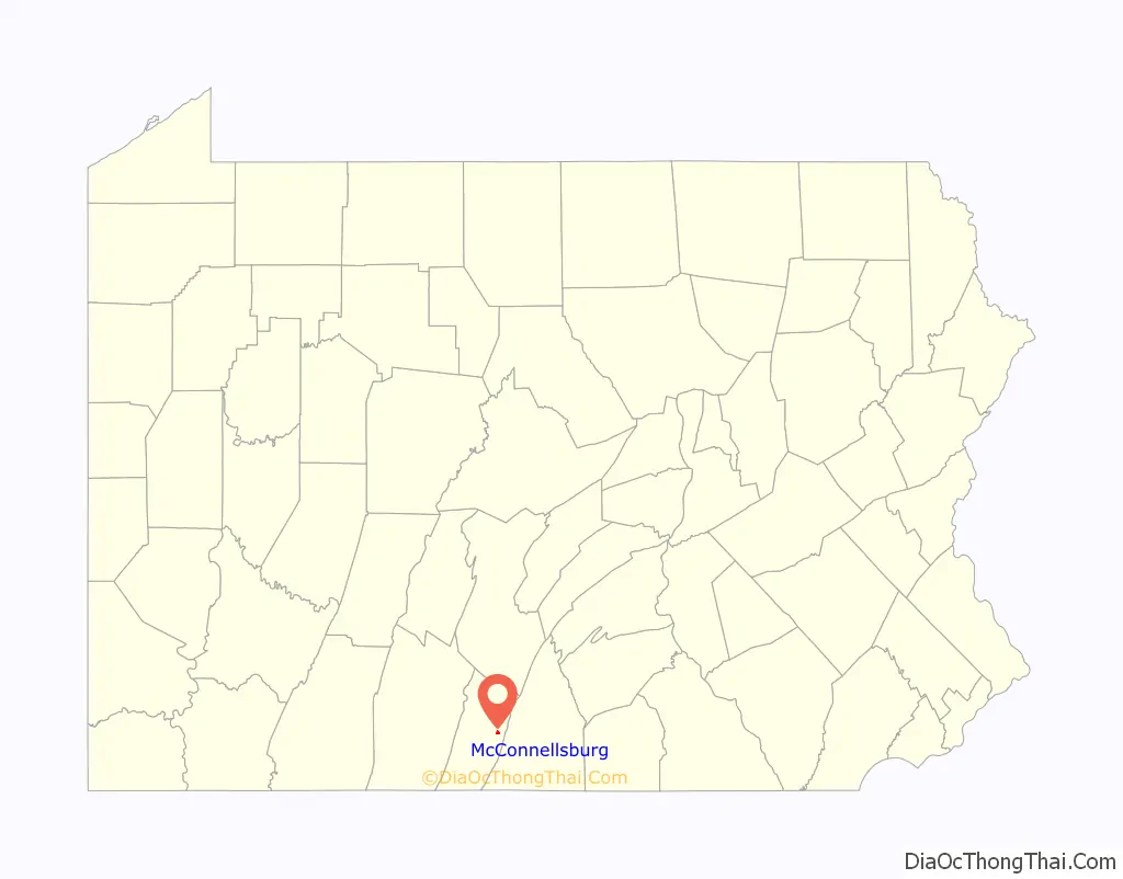
| State: | Pennsylvania |
| County: | Fulton County |
| Founded: | 1786-04-20 |
| Elevation: | 892 ft (272 m) |
| Total Area: | 0.35 sq mi (0.90 km²) |
| Land Area: | 0.35 sq mi (0.90 km²) |
| Water Area: | 0.00 sq mi (0.00 km²) |
| Total Population: | 1,151 |
| Population Density: | 3,317.00/sq mi (1,279.31/km²) |
| ZIP code: | 17233 |
| FIPS code: | 4246000 |
Online Interactive Map
Click on ![]() to view map in "full screen" mode.
to view map in "full screen" mode.
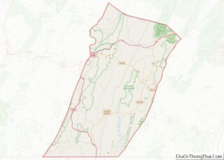
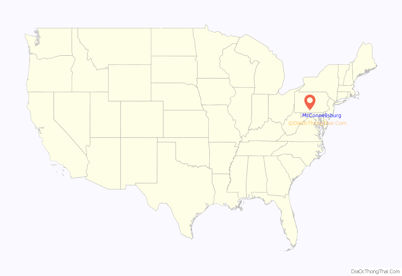
McConnellsburg location map. Where is McConnellsburg borough?
History
The McConnellsburg Historic District was recognized by the United States Department of the Interior in 1993 when it was listed in the National Register of Historic Places. The district consists of 144 structures that contribute to its historic character. Of notable meaning are the numerous taverns, inns, automotive garages and other travel-related structures still in existence today, which includes the Fulton House, the Fulton County Courthouse, and the log cabin of Daniel McConnell, who laid out the borough on April 20, 1786. It was further incorporated on March 26, 1814.
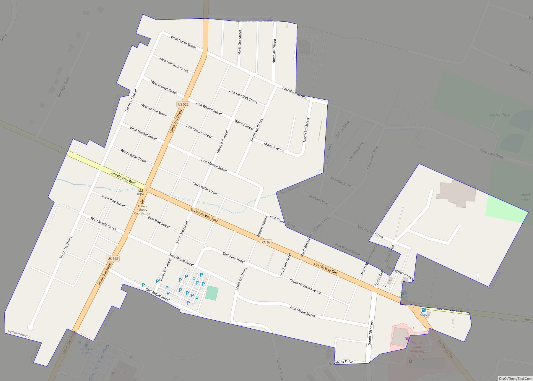
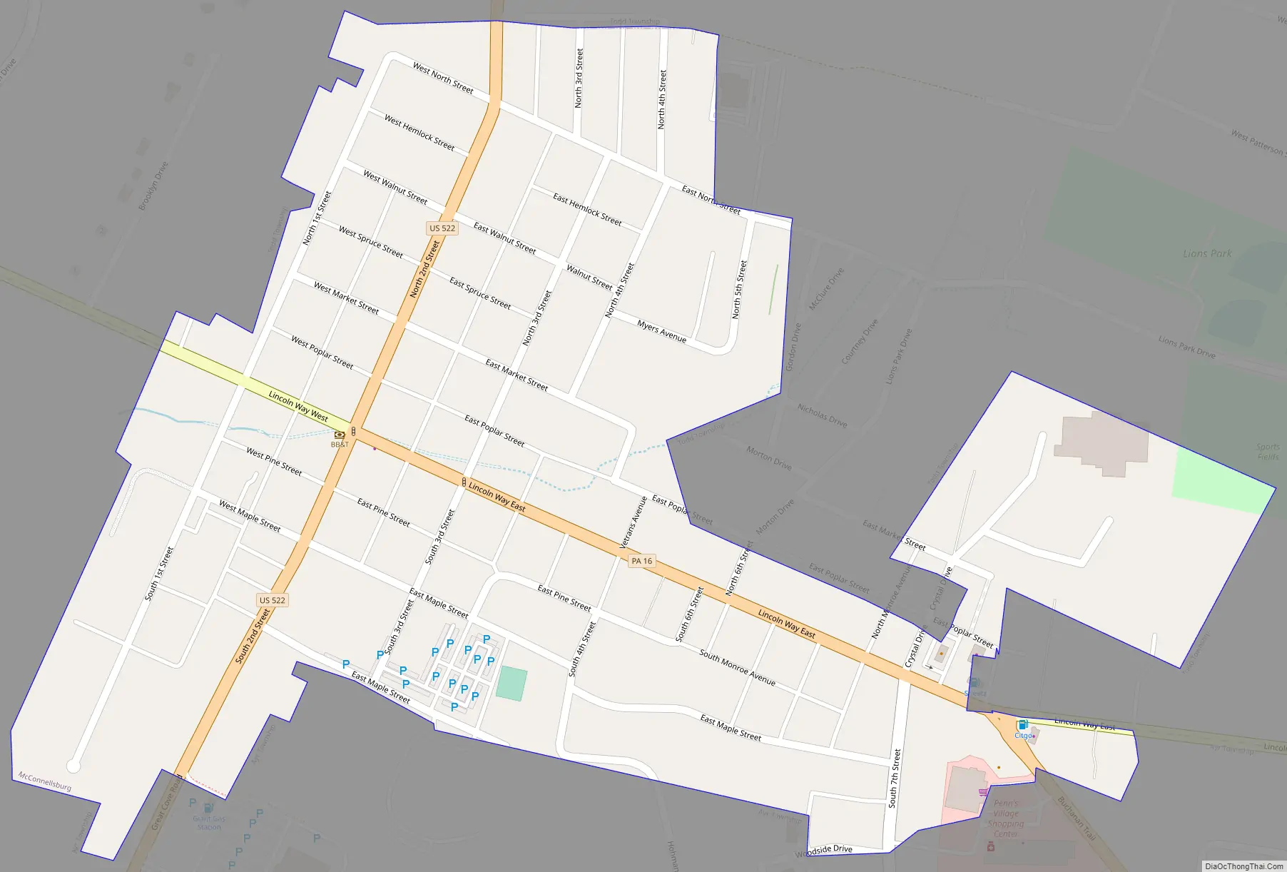
McConnellsburg Road Map
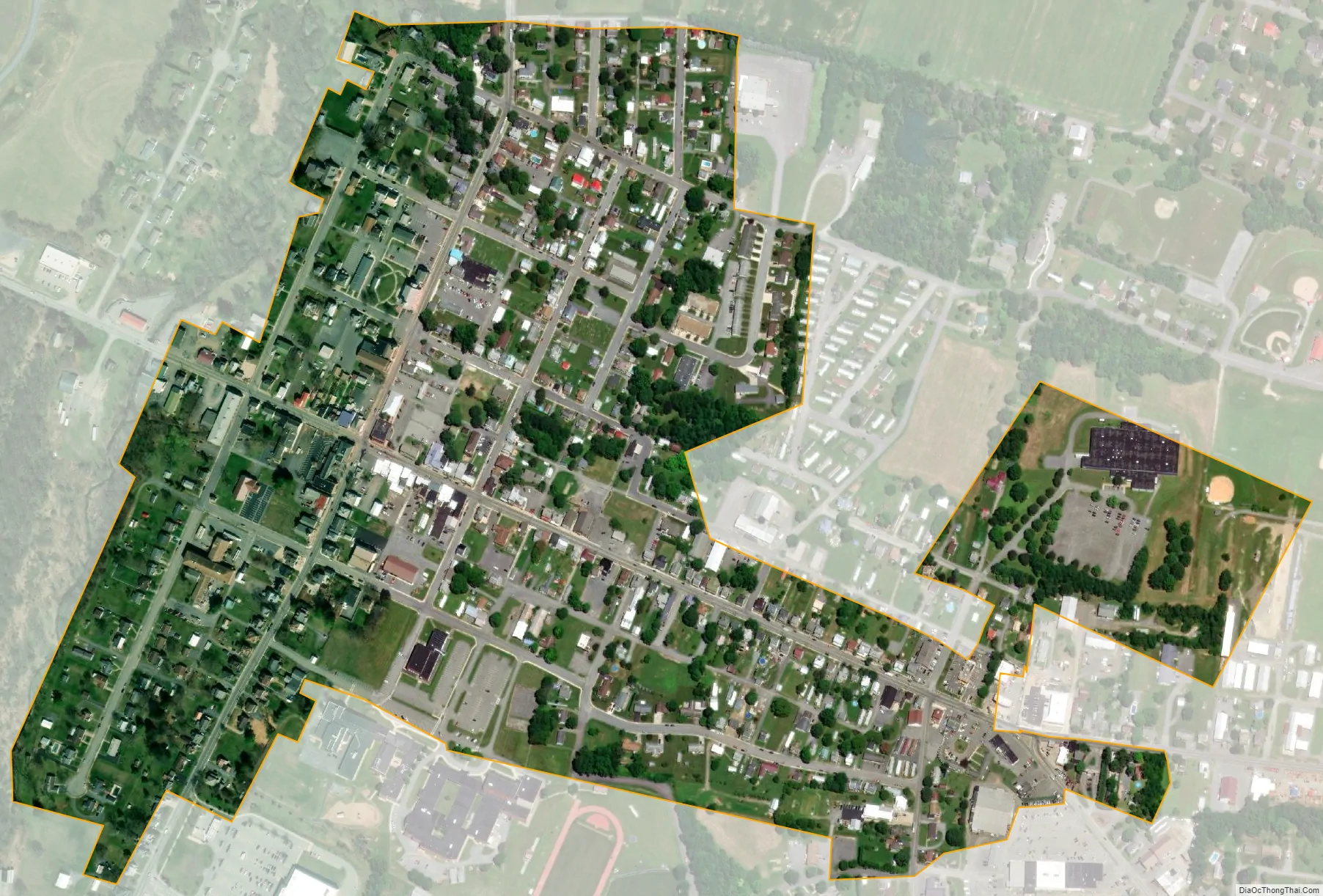
McConnellsburg city Satellite Map
Geography
McConnellsburg is located in eastern Fulton County at 39°55′58″N 77°59′46″W / 39.93278°N 77.99611°W / 39.93278; -77.99611 (39.932673, -77.995986).
According to the United States Census Bureau, the borough has a total area of 0.35 square miles (0.9 km), all land. The elevation in the center of town is 896 feet (273 m) above sea level.
The borough is located in the Ridge and Valley section of the Appalachian Mountains in southern Pennsylvania. It is situated in a 2-mile-wide (3 km) valley between Tuscarora Mountain to the east and Little Scrub Ridge and Meadow Grounds Mountain to the west.
U.S. Route 522 passes north–south through the center of town as Second Street. The main east–west street through the town center is Lincoln Way, or old U.S. Route 30 (the Lincoln Highway). U.S. Route 30 now bypasses the borough on a limited access highway to the north. The west end of Pennsylvania Route 16 is in McConnellsburg, following Lincoln Way and then the Buchanan Trail southeast out of town.
Via US 522 it is 24 miles (39 km) south to Hancock, Maryland, and 9 miles (14 km) north to the Pennsylvania Turnpike. US 30 leads east 21 miles (34 km) to Chambersburg and 19 miles (31 km) west to Breezewood. PA 16 leads southeast 10 miles (16 km) to Mercersburg and 20 miles (32 km) to Greencastle.
See also
Map of Pennsylvania State and its subdivision:- Adams
- Allegheny
- Armstrong
- Beaver
- Bedford
- Berks
- Blair
- Bradford
- Bucks
- Butler
- Cambria
- Cameron
- Carbon
- Centre
- Chester
- Clarion
- Clearfield
- Clinton
- Columbia
- Crawford
- Cumberland
- Dauphin
- Delaware
- Elk
- Erie
- Fayette
- Forest
- Franklin
- Fulton
- Greene
- Huntingdon
- Indiana
- Jefferson
- Juniata
- Lackawanna
- Lancaster
- Lawrence
- Lebanon
- Lehigh
- Luzerne
- Lycoming
- Mc Kean
- Mercer
- Mifflin
- Monroe
- Montgomery
- Montour
- Northampton
- Northumberland
- Perry
- Philadelphia
- Pike
- Potter
- Schuylkill
- Snyder
- Somerset
- Sullivan
- Susquehanna
- Tioga
- Union
- Venango
- Warren
- Washington
- Wayne
- Westmoreland
- Wyoming
- York
- Alabama
- Alaska
- Arizona
- Arkansas
- California
- Colorado
- Connecticut
- Delaware
- District of Columbia
- Florida
- Georgia
- Hawaii
- Idaho
- Illinois
- Indiana
- Iowa
- Kansas
- Kentucky
- Louisiana
- Maine
- Maryland
- Massachusetts
- Michigan
- Minnesota
- Mississippi
- Missouri
- Montana
- Nebraska
- Nevada
- New Hampshire
- New Jersey
- New Mexico
- New York
- North Carolina
- North Dakota
- Ohio
- Oklahoma
- Oregon
- Pennsylvania
- Rhode Island
- South Carolina
- South Dakota
- Tennessee
- Texas
- Utah
- Vermont
- Virginia
- Washington
- West Virginia
- Wisconsin
- Wyoming