McConnellstown is a census-designated place in Walker Township, Huntingdon County, Pennsylvania, United States. Due to its long name, the village is often nicknamed “Mactown”. The population of McConnellstown was 1,194 as of the 2010 census.
| Name: | McConnellstown CDP |
|---|---|
| LSAD Code: | 57 |
| LSAD Description: | CDP (suffix) |
| State: | Pennsylvania |
| County: | Huntingdon County |
| Elevation: | 709 ft (216 m) |
| Total Area: | 3.27 sq mi (8.47 km²) |
| Land Area: | 3.27 sq mi (8.47 km²) |
| Water Area: | 0.00 sq mi (0.00 km²) |
| Total Population: | 1,208 |
| Population Density: | 369.42/sq mi (142.65/km²) |
| ZIP code: | 16660 |
| FIPS code: | 4246016 |
| GNISfeature ID: | 1180656 |
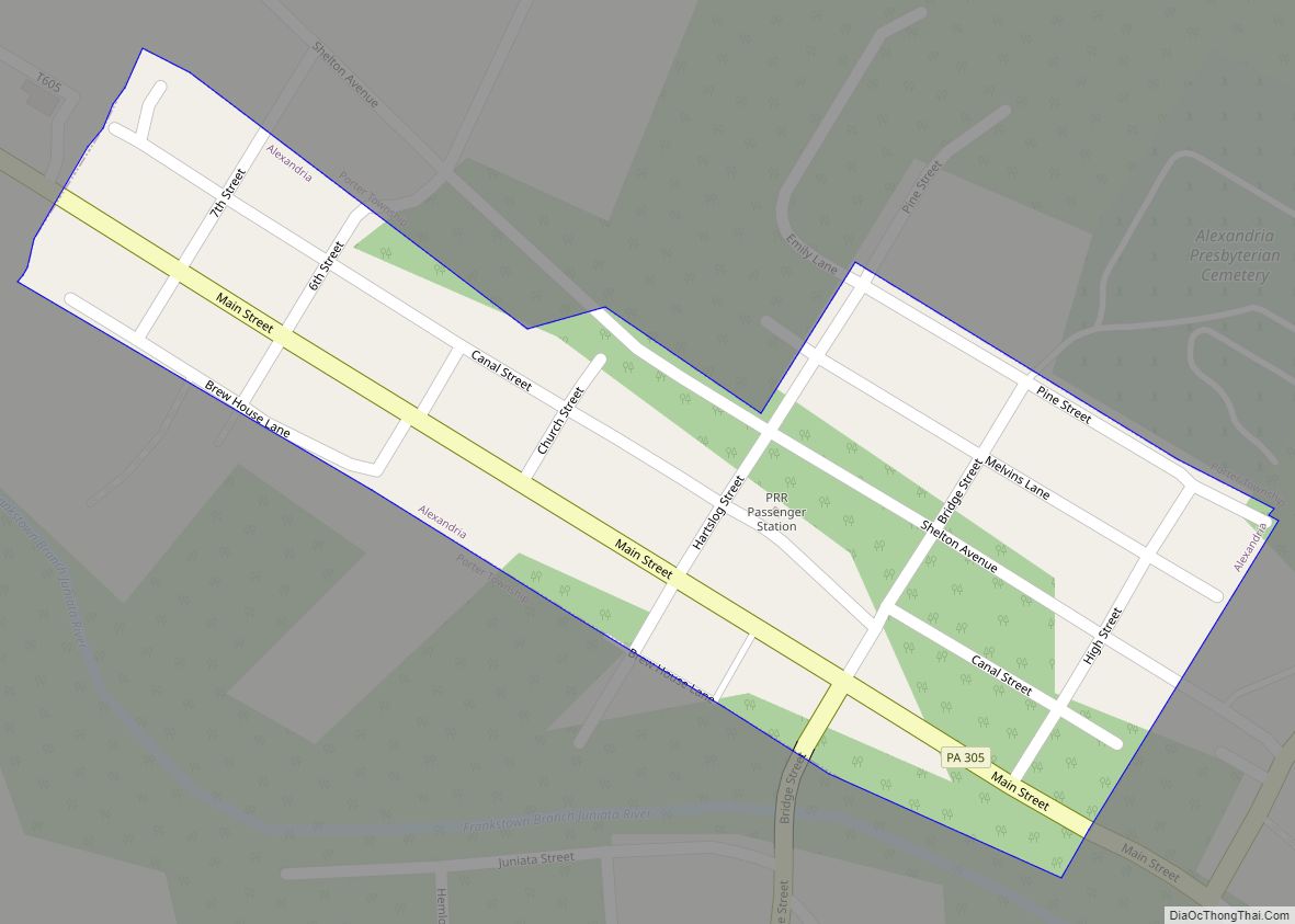
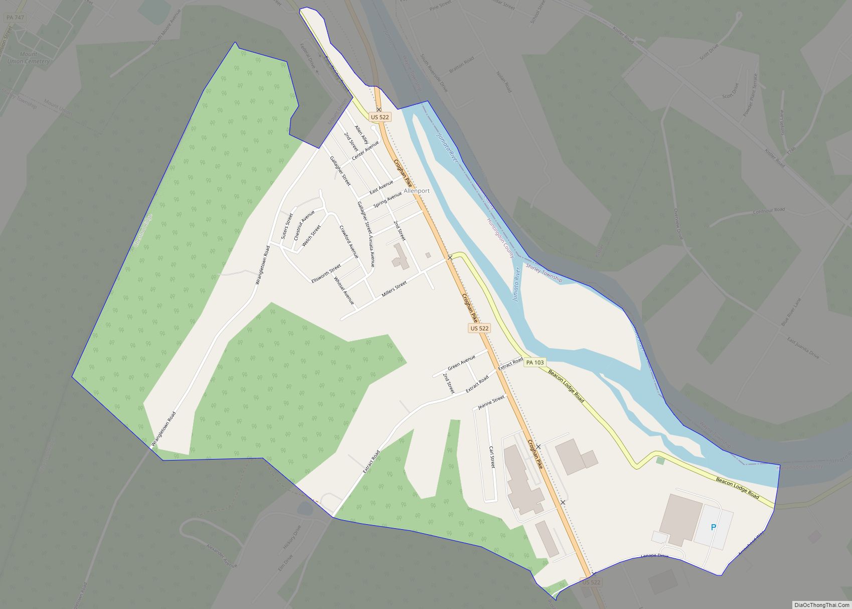
Online Interactive Map
Click on ![]() to view map in "full screen" mode.
to view map in "full screen" mode.
McConnellstown location map. Where is McConnellstown CDP?


McConnellstown Road Map

McConnellstown city Satellite Map

Geography
The community is in central Huntingdon County, in the northeastern part of Walker Township. It is bordered to the northeast by Smithfield Township. The CDP occupies the Woodcock Valley and is bordered to the southwest and southeast by Crooked Creek, a tributary of the Juniata River.
Pennsylvania Route 26 runs the length of the community, leading northeast 5 miles (8 km) to Huntingdon, the county seat, and southwest 7 miles (11 km) to Marklesburg.
According to the U.S. Census Bureau, the CDP has an area of 3.2 square miles (8.3 km), all land.
See also
Map of Pennsylvania State and its subdivision:- Adams
- Allegheny
- Armstrong
- Beaver
- Bedford
- Berks
- Blair
- Bradford
- Bucks
- Butler
- Cambria
- Cameron
- Carbon
- Centre
- Chester
- Clarion
- Clearfield
- Clinton
- Columbia
- Crawford
- Cumberland
- Dauphin
- Delaware
- Elk
- Erie
- Fayette
- Forest
- Franklin
- Fulton
- Greene
- Huntingdon
- Indiana
- Jefferson
- Juniata
- Lackawanna
- Lancaster
- Lawrence
- Lebanon
- Lehigh
- Luzerne
- Lycoming
- Mc Kean
- Mercer
- Mifflin
- Monroe
- Montgomery
- Montour
- Northampton
- Northumberland
- Perry
- Philadelphia
- Pike
- Potter
- Schuylkill
- Snyder
- Somerset
- Sullivan
- Susquehanna
- Tioga
- Union
- Venango
- Warren
- Washington
- Wayne
- Westmoreland
- Wyoming
- York
- Alabama
- Alaska
- Arizona
- Arkansas
- California
- Colorado
- Connecticut
- Delaware
- District of Columbia
- Florida
- Georgia
- Hawaii
- Idaho
- Illinois
- Indiana
- Iowa
- Kansas
- Kentucky
- Louisiana
- Maine
- Maryland
- Massachusetts
- Michigan
- Minnesota
- Mississippi
- Missouri
- Montana
- Nebraska
- Nevada
- New Hampshire
- New Jersey
- New Mexico
- New York
- North Carolina
- North Dakota
- Ohio
- Oklahoma
- Oregon
- Pennsylvania
- Rhode Island
- South Carolina
- South Dakota
- Tennessee
- Texas
- Utah
- Vermont
- Virginia
- Washington
- West Virginia
- Wisconsin
- Wyoming