Map of McClellanville town

Map of McClellanville town

McClellanville is a small fishing town in rural Charleston County, South Carolina, United States. The population was 1,040 at the 2010 census. It is situated on the Atlantic coast, on land surrounded by Francis Marion National Forest, and has traditionally derived its livelihood from the Atlantic Ocean and coastal marshes by fishing, shrimping and oystering. … Read more

Map of McBee town

Map of McBee town

McBee /ˈmækbi/ is a town in Chesterfield County, South Carolina, United States. As of the 2010 census, the population was 867. McBee is approximately 36 miles (58 km) northwest of Florence and 62 miles (100 km) northeast of Columbia. McBee town overview: Name: McBee town LSAD Code: 43 LSAD Description: town (suffix) State: South Carolina County: Chesterfield … Read more

Map of Mayo CDP, South Carolina

Map of Mayo CDP, South Carolina

Mayo is a census-designated place (CDP) in Spartanburg County, South Carolina, United States. The population was 1,592 at the 2010 census. Mayo CDP overview: Name: Mayo CDP LSAD Code: 57 LSAD Description: CDP (suffix) State: South Carolina County: Spartanburg County Elevation: 889 ft (271 m) Total Area: 3.04 sq mi (7.88 km²) Land Area: 3.04 sq mi (7.88 km²) Water Area: 0.00 sq mi (0.00 km²) … Read more

Map of Mayesville town

Map of Mayesville town

Mayesville is a town in Sumter County, South Carolina, United States. The population was 731 at the 2010 census, this was a decline from 1,001 in 2000. It is included in the Sumter, South Carolina Metropolitan Statistical Area. Mayesville town overview: Name: Mayesville town LSAD Code: 43 LSAD Description: town (suffix) State: South Carolina County: … Read more

Map of Mauldin city

Map of Mauldin city

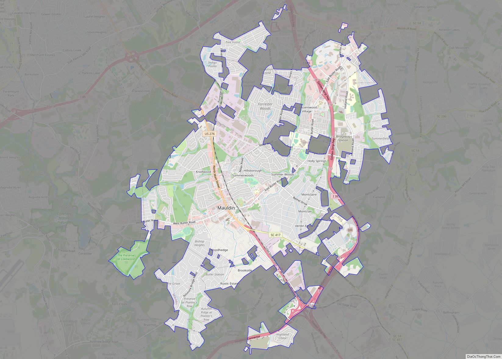
Mauldin is a city in Greenville County, South Carolina, United States. The population was 24,724 at the 2020 census. It is a principal city of the Greenville–Anderson-Mauldin Metropolitan Statistical Area. Mauldin city overview: Name: Mauldin city LSAD Code: 25 LSAD Description: city (suffix) State: South Carolina County: Greenville County Founded: 1784 Elevation: 942 ft (287 m) Land … Read more

Map of Modoc CDP, South Carolina

Map of Modoc CDP, South Carolina

Modoc is a census-designated place (CDP) in McCormick County, South Carolina, United States. The population was 256 at the 2000 census, and 218 at the 2010 census, a decline of 14.8%. The Modoc CDP was named for the Modoc indigenous tribe of Northern California, some members of which had been captured after the Modoc War. … Read more

Map of Meggett town

Map of Meggett town

Meggett is a town in Charleston County, South Carolina, United States. The population was 1,226 at the 2010 census. Meggett is part of the Charleston-North Charleston-Summerville metropolitan area. Meggett town overview: Name: Meggett town LSAD Code: 43 LSAD Description: town (suffix) State: South Carolina County: Charleston County Elevation: 10 ft (3 m) Total Area: 18.76 sq mi (48.59 km²) Land … Read more

Map of McCormick town

Map of McCormick town

McCormick is a town in McCormick County, South Carolina, United States. The population was 2,232 at the 2020 census. It is the county seat of McCormick County. The town of McCormick is named for inventor Cyrus McCormick. McCormick town overview: Name: McCormick town LSAD Code: 43 LSAD Description: town (suffix) State: South Carolina County: McCormick … Read more

Map of McConnells town

Map of McConnells town

McConnells is a town in York County, South Carolina, United States and a suburb of York. The population was 255 at the 2010 census. McConnells town overview: Name: McConnells town LSAD Code: 43 LSAD Description: town (suffix) State: South Carolina County: York County Elevation: 689 ft (210 m) Total Area: 3.42 sq mi (8.86 km²) Land Area: 3.39 sq mi (8.78 km²) Water … Read more

Map of Murrells Inlet CDP

Map of Murrells Inlet CDP

Murrells Inlet is an unincorporated area and census-designated place in Georgetown County, South Carolina, United States. The population was 7,547 at the 2010 census. It is about 13 miles south of Myrtle Beach, South Carolina and 21 miles north of Georgetown, the county seat. The community was once primarily a fishing village. It has developed … Read more

Map of Murphys Estates CDP

Map of Murphys Estates CDP

Murphys Estates (also commonly known as Murphy Village) is a census-designated place (CDP) in Edgefield County, South Carolina, part of the larger Augusta metropolitan area. The population was 1,719 as of the 2020 census. The community is notable for having the largest number of Irish Travellers in the United States. Murphys Estates CDP overview: Name: … Read more

Map of Mullins city

Map of Mullins city

Mullins is a city in Marion County, South Carolina, United States. As of the 2010 census, the city population was 4,663. Incorporated on March 4, 1872, Mullins was named after Col. William S. Mullins, who served as a representative for Marion County in the South Carolina State Legislature from 1852 to 1866. Mullins city overview: … Read more