Map of Milltown CDP, South Dakota

Map of Milltown CDP, South Dakota

Milltown is a census-designated place (CDP) in Hutchinson County, South Dakota, United States. The population was 8 at the 2020 census. Milltown was so named for the fact many of its early residents milled their supply of flour. Milltown CDP overview: Name: Milltown CDP LSAD Code: 57 LSAD Description: CDP (suffix) State: South Dakota County: … Read more

Map of Miller city, South Dakota

Map of Miller city, South Dakota

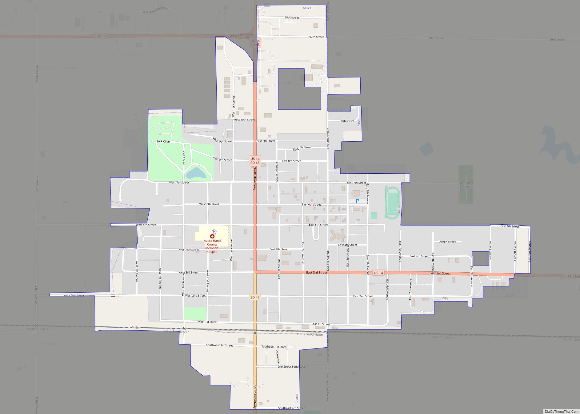
Miller is a city in and county seat of Hand County, South Dakota, United States. The population was 1,349 at the 2020 census. Miller city overview: Name: Miller city LSAD Code: 25 LSAD Description: city (suffix) State: South Dakota County: Hand County Incorporated: 1905 Elevation: 1,578 ft (481 m) Total Area: 0.99 sq mi (2.57 km²) Land Area: 0.99 sq mi (2.56 km²) … Read more

Map of Milbank city

Map of Milbank city

Milbank is a city in Grant County, South Dakota, United States, located along the South Fork of the Whetstone River. The population was 3,544 at the 2020 census. It is the county seat of Grant County. Milbank is the birthplace of American Legion Baseball. The program was created in Milbank in 1925 and is now … Read more

Map of Midland town, South Dakota

Map of Midland town, South Dakota

Midland is a rural small town in the southeastern corner of Haakon County, South Dakota, United States. The population was 112 at the 2020 census. Midland town overview: Name: Midland town LSAD Code: 43 LSAD Description: town (suffix) State: South Dakota County: Haakon County Founded: 1890 Elevation: 1,880 ft (573 m) Total Area: 0.34 sq mi (0.89 km²) Land Area: … Read more

Map of Menno city

Map of Menno city

Menno is a city in Hutchinson County, South Dakota, United States. The population was 614 at the 2020 census. Menno was laid out in 1879. Menno city overview: Name: Menno city LSAD Code: 25 LSAD Description: city (suffix) State: South Dakota County: Hutchinson County Incorporated: 1910 Elevation: 1,329 ft (405 m) Total Area: 0.52 sq mi (1.35 km²) Land Area: … Read more

Map of Mellette city

Map of Mellette city

Mellette is a city in Spink County, South Dakota, United States. The population was 199 at the 2020 census. Mellette was laid out in 1881, and named in honor of Governor Arthur C. Mellette. Mellette city overview: Name: Mellette city LSAD Code: 25 LSAD Description: city (suffix) State: South Dakota County: Spink County Incorporated: 1908 … Read more

Map of Meadow View Addition CDP

Map of Meadow View Addition CDP

Meadow View Addition is an unincorporated community and census-designated place in Minnehaha County, South Dakota, United States. Its population was 531 as of the 2020 census. The community is located on South Dakota Highway 115, north of Sioux Falls. Meadow View Addition CDP overview: Name: Meadow View Addition CDP LSAD Code: 57 LSAD Description: CDP … Read more

Map of Mound City town, South Dakota

Map of Mound City town, South Dakota

Mound City is a town in and the county seat of Campbell County, South Dakota, United States. The population was 69 at the 2020 census. Mound City town overview: Name: Mound City town LSAD Code: 43 LSAD Description: town (suffix) State: South Dakota County: Campbell County Elevation: 1,722 ft (525 m) Total Area: 0.13 sq mi (0.33 km²) Land Area: … Read more

Map of Morristown town, South Dakota

Map of Morristown town, South Dakota

Morristown is a town in Corson County, South Dakota, United States. The population was 67 at the 2010 census. Morristown town overview: Name: Morristown town LSAD Code: 43 LSAD Description: town (suffix) State: South Dakota County: Corson County Incorporated: 1910 Elevation: 2,254 ft (687 m) Total Area: 0.35 sq mi (0.91 km²) Land Area: 0.35 sq mi (0.91 km²) Water Area: 0.00 sq mi (0.00 km²) … Read more

Map of Morningside CDP, South Dakota

Map of Morningside CDP, South Dakota

Morningside is a census-designated place (CDP) in Beadle County, South Dakota, United States. The population was 70 at the 2020 census. Morningside CDP overview: Name: Morningside CDP LSAD Code: 57 LSAD Description: CDP (suffix) State: South Dakota County: Beadle County Elevation: 1,275 ft (389 m) Total Area: 0.53 sq mi (1.36 km²) Land Area: 0.52 sq mi (1.34 km²) Water Area: 0.01 sq mi (0.02 km²) … Read more

Map of Montrose city, South Dakota

Map of Montrose city, South Dakota

Montrose is a city in McCook County, South Dakota, United States. The population was 468 at the 2020 census. Montrose city overview: Name: Montrose city LSAD Code: 25 LSAD Description: city (suffix) State: South Dakota County: McCook County Elevation: 1,470 ft (448 m) Total Area: 0.42 sq mi (1.09 km²) Land Area: 0.42 sq mi (1.09 km²) Water Area: 0.00 sq mi (0.00 km²) Total Population: … Read more

Map of Monroe town, South Dakota

Map of Monroe town, South Dakota

Monroe is a town in Turner County, South Dakota, United States. The population was 159 at the 2020 census. Monroe town overview: Name: Monroe town LSAD Code: 43 LSAD Description: town (suffix) State: South Dakota County: Turner County Incorporated: 1901 Elevation: 1,493 ft (455 m) Total Area: 0.38 sq mi (0.98 km²) Land Area: 0.38 sq mi (0.98 km²) Water Area: 0.00 sq mi (0.00 km²) … Read more