McLaughlin (Lakota: matȟó Akíčita or Makáȟleča; “Bear Soldier”) is a city in northeastern Corson County, South Dakota, United States. The population was 663 at the 2010 census. It is the largest city on the Standing Rock Indian Reservation. Most Lakȟóta speakers refer to the town as Makáȟleča or Matȟó Akíčita.
| Name: | McLaughlin city |
|---|---|
| LSAD Code: | 25 |
| LSAD Description: | city (suffix) |
| State: | South Dakota |
| County: | Corson County |
| Incorporated: | 1909 |
| Elevation: | 2,001 ft (610 m) |
| Total Area: | 0.40 sq mi (1.05 km²) |
| Land Area: | 0.40 sq mi (1.05 km²) |
| Water Area: | 0.00 sq mi (0.00 km²) |
| Total Population: | 569 |
| Population Density: | 1,408.42/sq mi (543.39/km²) |
| ZIP code: | 57642 |
| Area code: | 605 |
| FIPS code: | 4640020 |
| GNISfeature ID: | 1256396 |
Online Interactive Map
Click on ![]() to view map in "full screen" mode.
to view map in "full screen" mode.
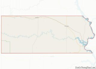
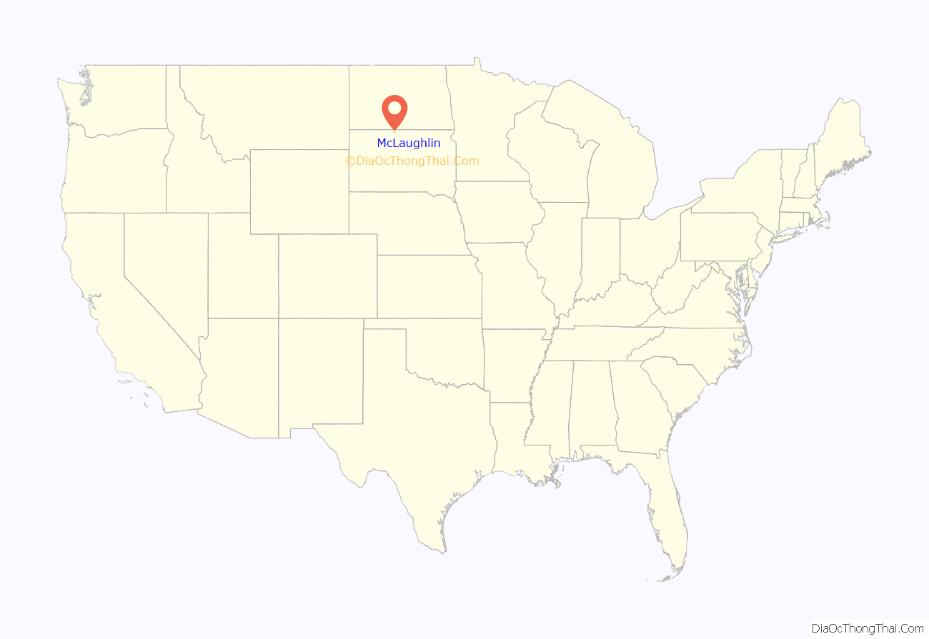
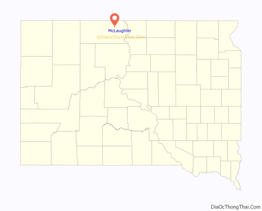
McLaughlin location map. Where is McLaughlin city?
History
The town is named after a US Indian Service Agent James McLaughlin, who supervised the Standing Rock Indian Agency from 1881 to 1895. He moved to Washington, D.C., where he was Inspector of the Bureau of Indian Affairs and Department of the Interior. After McLaughlin’s death in 1923, his body was returned here for burial.
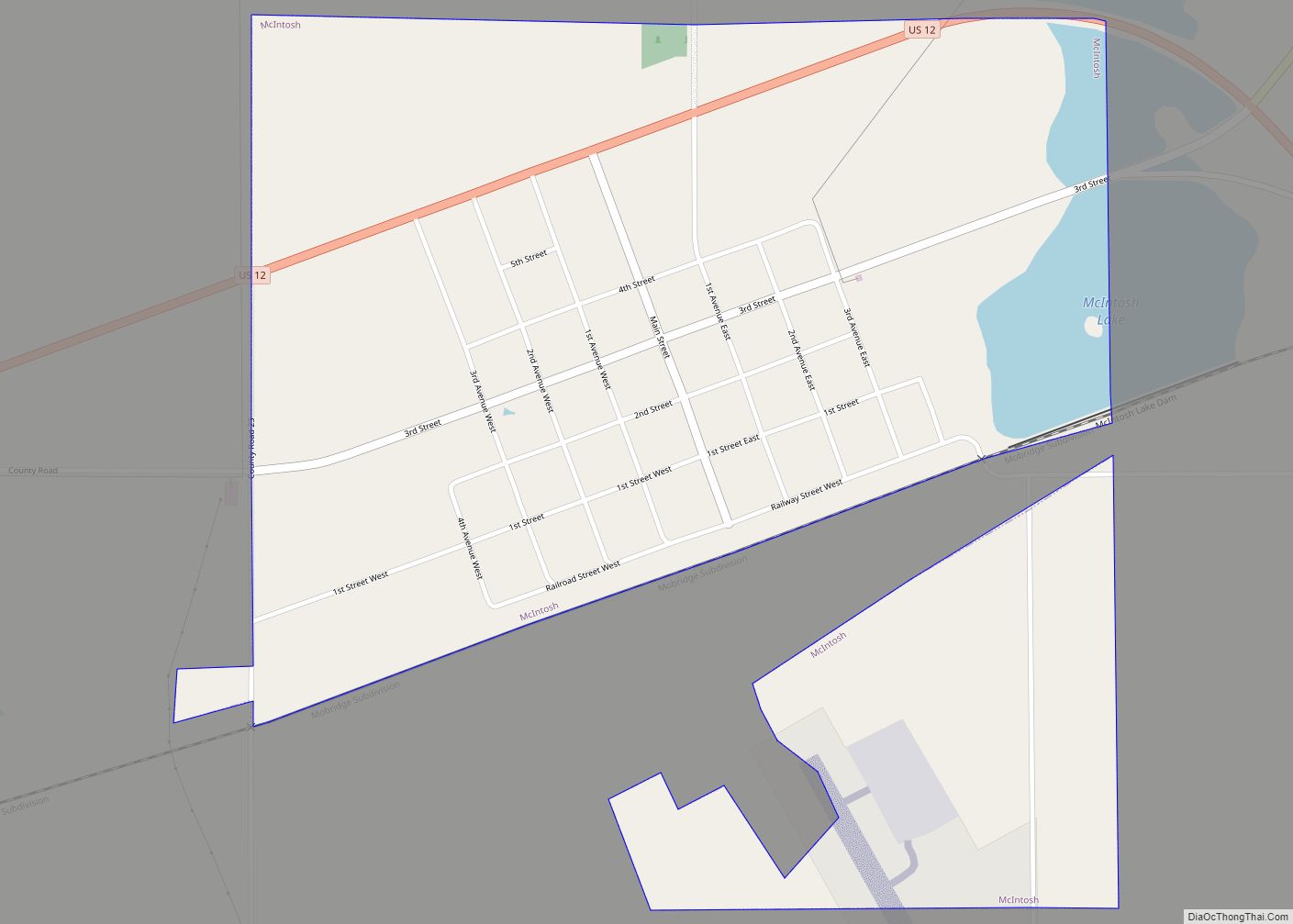
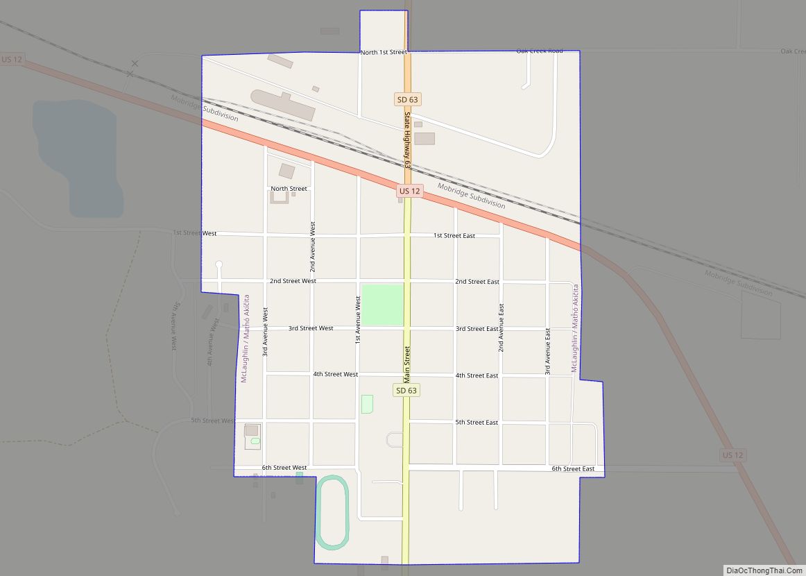
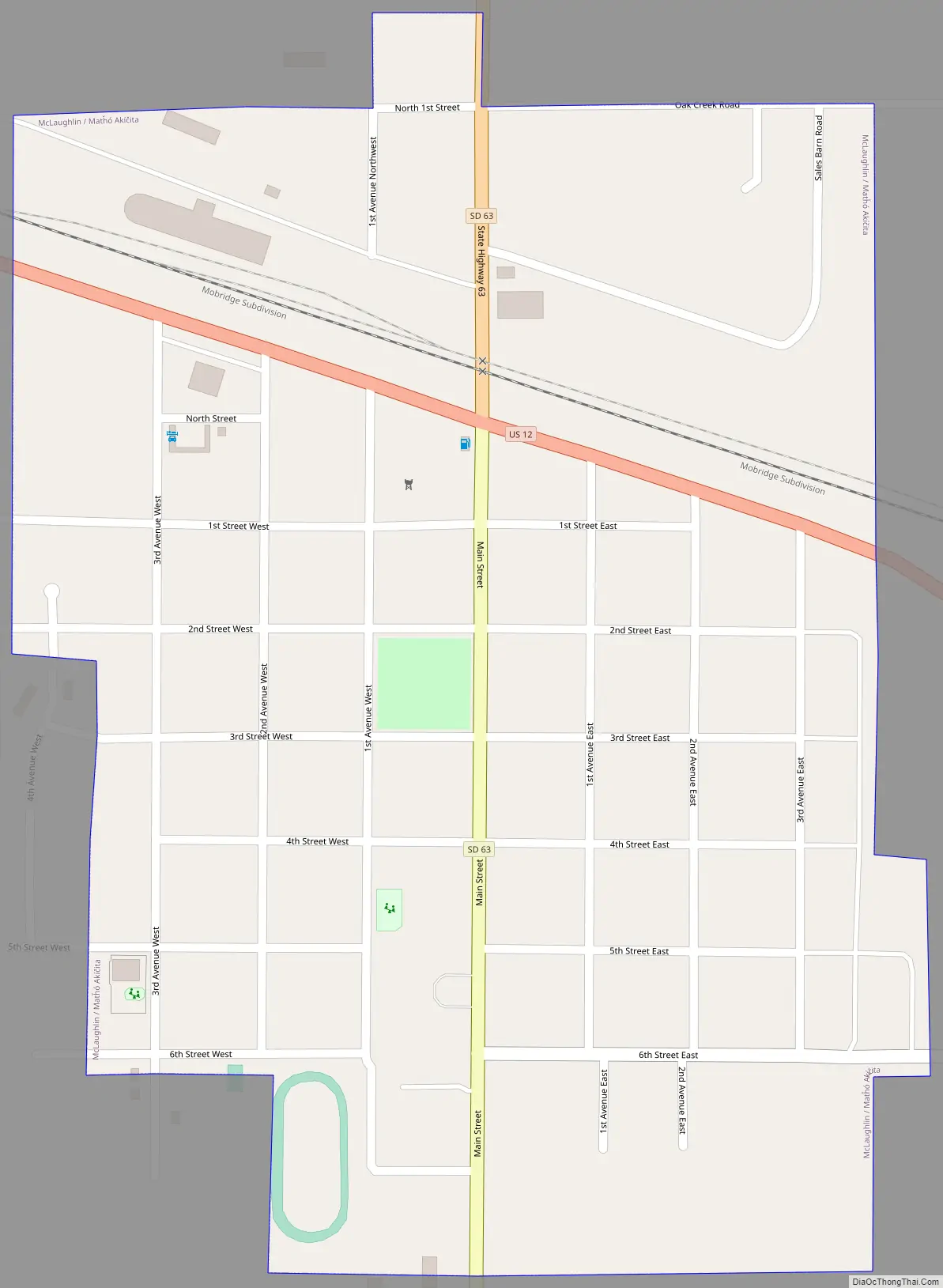
McLaughlin Road Map
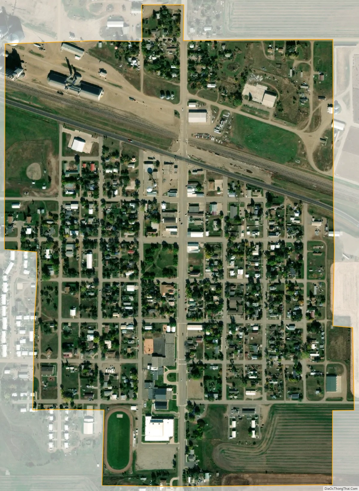
McLaughlin city Satellite Map
Geography
McLaughlin is located at 45°48′47″N 100°48′41″W / 45.81306°N 100.81139°W / 45.81306; -100.81139 (45.813029, -100.811447).
According to the United States Census Bureau, the city has a total area of 0.40 square miles (1.04 km), all land.
McLaughlin has been assigned the ZIP code 57642 and the FIPS place code 40020.
Climate
See also
Map of South Dakota State and its subdivision:- Aurora
- Beadle
- Bennett
- Bon Homme
- Brookings
- Brown
- Brule
- Buffalo
- Butte
- Campbell
- Charles Mix
- Clark
- Clay
- Codington
- Corson
- Custer
- Davison
- Day
- Deuel
- Dewey
- Douglas
- Edmunds
- Fall River
- Faulk
- Grant
- Gregory
- Haakon
- Hamlin
- Hand
- Hanson
- Harding
- Hughes
- Hutchinson
- Hyde
- Jackson
- Jerauld
- Jones
- Kingsbury
- Lake
- Lawrence
- Lincoln
- Lyman
- Marshall
- McCook
- McPherson
- Meade
- Mellette
- Miner
- Minnehaha
- Moody
- Pennington
- Perkins
- Potter
- Roberts
- Sanborn
- Shannon
- Spink
- Stanley
- Sully
- Todd
- Tripp
- Turner
- Union
- Walworth
- Yankton
- Ziebach
- Alabama
- Alaska
- Arizona
- Arkansas
- California
- Colorado
- Connecticut
- Delaware
- District of Columbia
- Florida
- Georgia
- Hawaii
- Idaho
- Illinois
- Indiana
- Iowa
- Kansas
- Kentucky
- Louisiana
- Maine
- Maryland
- Massachusetts
- Michigan
- Minnesota
- Mississippi
- Missouri
- Montana
- Nebraska
- Nevada
- New Hampshire
- New Jersey
- New Mexico
- New York
- North Carolina
- North Dakota
- Ohio
- Oklahoma
- Oregon
- Pennsylvania
- Rhode Island
- South Carolina
- South Dakota
- Tennessee
- Texas
- Utah
- Vermont
- Virginia
- Washington
- West Virginia
- Wisconsin
- Wyoming