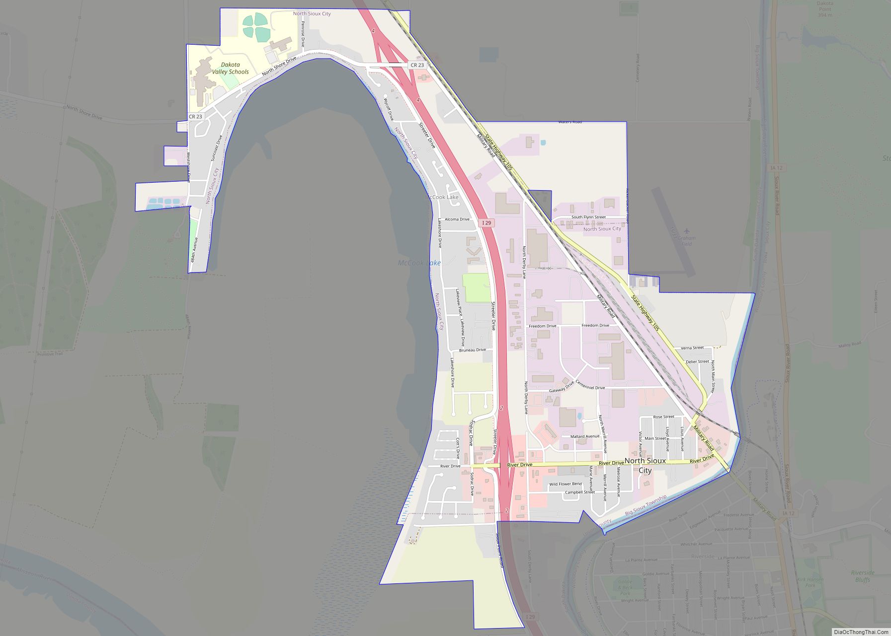
Map of Okaton CDP

Map of Okaton CDP

Okaton is a hamlet in Jones County, South Dakota, United States. As of the 2020 census, the population was 31. There are no services or businesses there; Okaton had last been the location of an old-west town exhibit, but it closed when the owner(s) died. Okaton CDP overview: Name: Okaton CDP LSAD Code: 57 LSAD … Read more

Map of Peever town

Map of Peever town

Peever is a town in Roberts County, South Dakota, United States. The population was 180 at the 2020 census. Peever was laid out in 1898, and named in honor of Thomas Henry Peever, a settler. Peever town overview: Name: Peever town LSAD Code: 43 LSAD Description: town (suffix) State: South Dakota County: Roberts County Elevation: … Read more

Map of Parmelee CDP

Map of Parmelee CDP

Parmelee also Wósoso (Lakota: wósoso; “cut meat”) is a census-designated place (CDP) in Todd County, South Dakota, United States, which lies within the Rosebud Indian Reservation. The population was 606 at the 2020 census. Parmelee CDP overview: Name: Parmelee CDP LSAD Code: 57 LSAD Description: CDP (suffix) State: South Dakota County: Todd County Elevation: 2,638 ft … Read more

Map of Parkston city

Map of Parkston city

Parkston is a city in Hutchinson County, South Dakota, United States. The population was 1,567 at the 2020 census. As of 2022, Adam Doering is the city’s current mayor. Parkston city overview: Name: Parkston city LSAD Code: 25 LSAD Description: city (suffix) State: South Dakota County: Hutchinson County Incorporated: 1886 Elevation: 1,398 ft (426 m) Total Area: … Read more

Map of Parker city, South Dakota

Map of Parker city, South Dakota

Parker is a city in Turner County, South Dakota, United States. The population was 1,194 at the 2020 census. It is the county seat of Turner County. Parker is bordered on its eastern side by South Dakota State Highway 19. Its northern side is bordered by South Dakota State Highway 44. Parker is located approximately … Read more

Map of Ortley town

Map of Ortley town

Ortley is a town in Roberts County, South Dakota, United States. The population was 50 according to the 2020 census. Ortley town overview: Name: Ortley town LSAD Code: 43 LSAD Description: town (suffix) State: South Dakota County: Roberts County Incorporated: 1906 Elevation: 1,873 ft (571 m) Total Area: 2.24 sq mi (5.81 km²) Land Area: 2.24 sq mi (5.81 km²) Water Area: 0.00 sq mi … Read more

Map of Orient town, South Dakota

Map of Orient town, South Dakota

Orient is a town in Faulk County, South Dakota, United States. The population was 51 at the 2020 census. Orient got its start in 1887 when the Milwaukee Railroad was extended into the area. Orient town overview: Name: Orient town LSAD Code: 43 LSAD Description: town (suffix) State: South Dakota County: Faulk County Founded: 1887 … Read more

Map of Onida city

Map of Onida city

Onida is a city in and the county seat of Sully County, South Dakota, United States. The population was 658 as of the 2010 census. Onida city overview: Name: Onida city LSAD Code: 25 LSAD Description: city (suffix) State: South Dakota County: Sully County Founded: 1880 Incorporated: 1883 Elevation: 1,873 ft (571 m) Total Area: 0.67 sq mi (1.74 km²) … Read more

Map of Onaka town

Map of Onaka town

Onaka (Dakota: oyanka; “place”) is a town in Faulk County, South Dakota, United States. The population was 13 at the 2020 census. Onaka town overview: Name: Onaka town LSAD Code: 43 LSAD Description: town (suffix) State: South Dakota County: Faulk County Incorporated: 1924 Elevation: 1,873 ft (571 m) Total Area: 0.27 sq mi (0.70 km²) Land Area: 0.26 sq mi (0.67 km²) Water … Read more

Map of Olivet town, South Dakota

Map of Olivet town, South Dakota

Olivet is a town in and the county seat of Hutchinson County, South Dakota. The population was 64 at the time of the 2020 census. Olivet town overview: Name: Olivet town LSAD Code: 43 LSAD Description: town (suffix) State: South Dakota County: Hutchinson County Elevation: 1,220 ft (372 m) Total Area: 0.20 sq mi (0.52 km²) Land Area: 0.20 sq mi (0.52 km²) … Read more

Map of Oldham city

Map of Oldham city

Oldham is a city in Kingsbury County, South Dakota, United States. The population was 133 at the 2010 census. Some say the city was named for Oldham Carrot, a local landowner, while others believe the name is a transfer from Oldham, England, the native home of a first settler. Oldham city overview: Name: Oldham city … Read more

Map of Piedmont city, South Dakota

Map of Piedmont city, South Dakota

Piedmont is a city in Meade County, South Dakota, United States. According to the 2020 census, its population was 971. Piedmont lies along Interstate 90 between Rapid City and Sturgis. Piedmont has been assigned the ZIP Code of 57769. Piedmont city overview: Name: Piedmont city LSAD Code: 25 LSAD Description: city (suffix) State: South Dakota … Read more