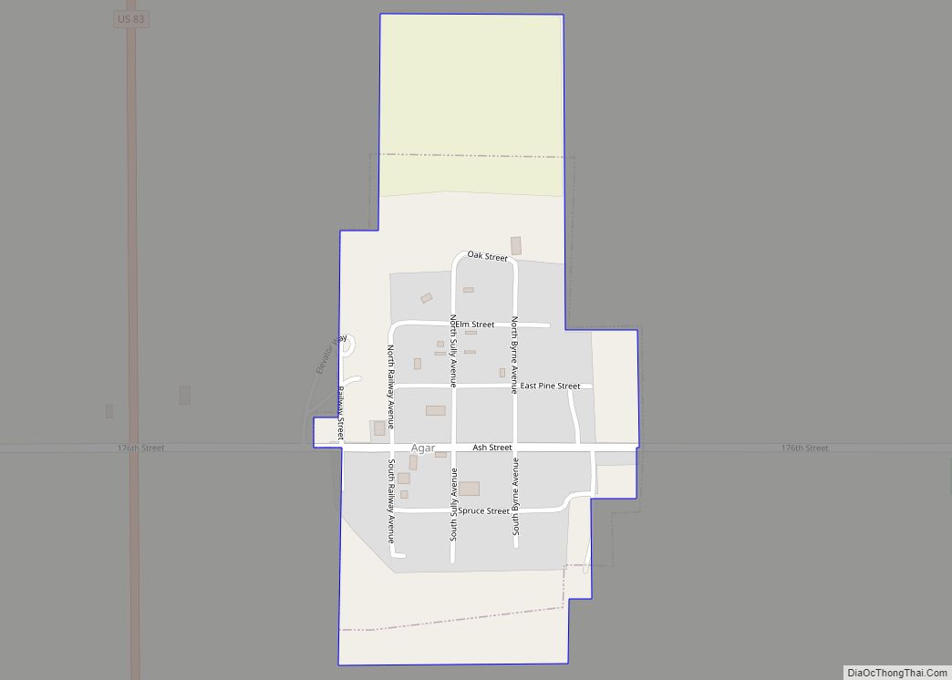
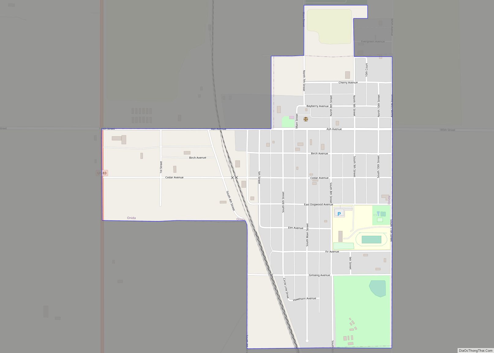
Onida is a city in and the county seat of Sully County, South Dakota, United States. The population was 658 as of the 2010 census.
| Name: | Onida city |
|---|---|
| LSAD Code: | 25 |
| LSAD Description: | city (suffix) |
| State: | South Dakota |
| County: | Sully County |
| Founded: | 1880 |
| Incorporated: | 1883 |
| Elevation: | 1,873 ft (571 m) |
| Total Area: | 0.67 sq mi (1.74 km²) |
| Land Area: | 0.67 sq mi (1.74 km²) |
| Water Area: | 0.00 sq mi (0.00 km²) |
| Total Population: | 666 |
| Population Density: | 991.07/sq mi (382.55/km²) |
| ZIP code: | 57564 |
| Area code: | 605 |
| FIPS code: | 4647180 |
| GNISfeature ID: | 1256897 |
| Website: | www.onida.org |
Online Interactive Map
Click on ![]() to view map in "full screen" mode.
to view map in "full screen" mode.
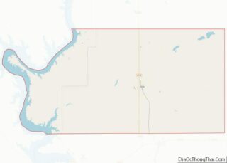
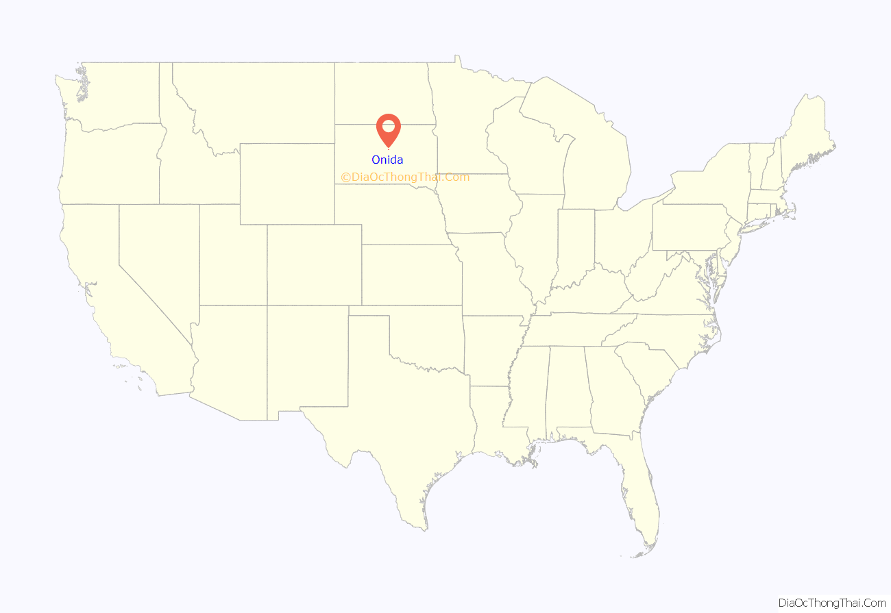
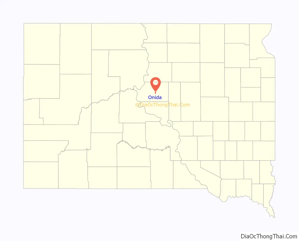
Onida location map. Where is Onida city?
History
Onida was founded in 1880 by settlers from Oneida, New York. It received its city rights in 1883.
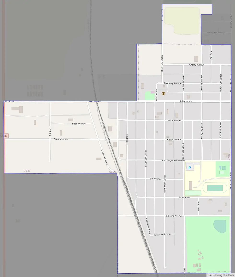
Onida Road Map
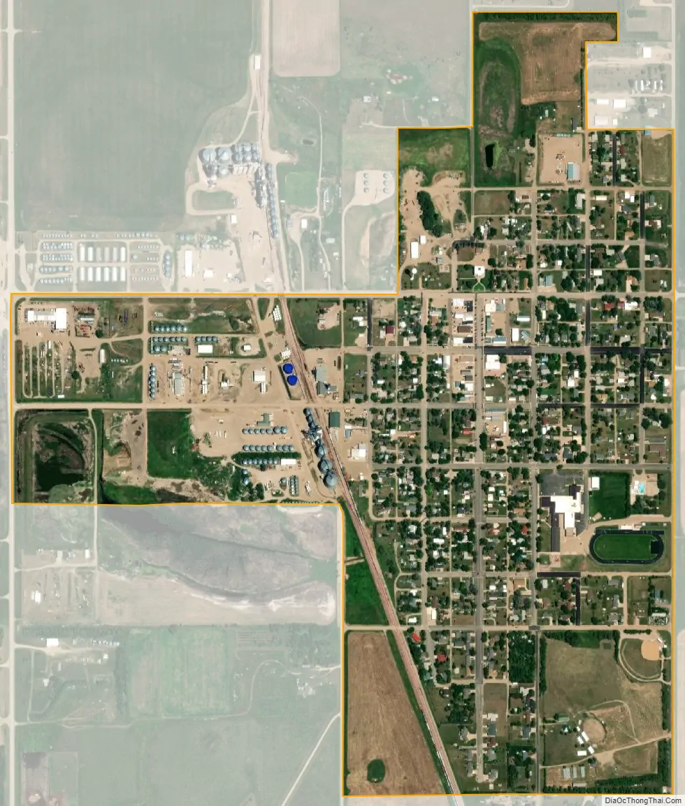
Onida city Satellite Map
Geography
Onida is located at 44°42′21″N 100°4′1″W / 44.70583°N 100.06694°W / 44.70583; -100.06694 (44.705939, -100.066851).
According to the United States Census Bureau, the city has a total area of 0.64 square miles (1.66 km), all land.
Onida has been assigned the ZIP code 57564 and the FIPS place code 47180.
Climate
See also
Map of South Dakota State and its subdivision:- Aurora
- Beadle
- Bennett
- Bon Homme
- Brookings
- Brown
- Brule
- Buffalo
- Butte
- Campbell
- Charles Mix
- Clark
- Clay
- Codington
- Corson
- Custer
- Davison
- Day
- Deuel
- Dewey
- Douglas
- Edmunds
- Fall River
- Faulk
- Grant
- Gregory
- Haakon
- Hamlin
- Hand
- Hanson
- Harding
- Hughes
- Hutchinson
- Hyde
- Jackson
- Jerauld
- Jones
- Kingsbury
- Lake
- Lawrence
- Lincoln
- Lyman
- Marshall
- McCook
- McPherson
- Meade
- Mellette
- Miner
- Minnehaha
- Moody
- Pennington
- Perkins
- Potter
- Roberts
- Sanborn
- Shannon
- Spink
- Stanley
- Sully
- Todd
- Tripp
- Turner
- Union
- Walworth
- Yankton
- Ziebach
- Alabama
- Alaska
- Arizona
- Arkansas
- California
- Colorado
- Connecticut
- Delaware
- District of Columbia
- Florida
- Georgia
- Hawaii
- Idaho
- Illinois
- Indiana
- Iowa
- Kansas
- Kentucky
- Louisiana
- Maine
- Maryland
- Massachusetts
- Michigan
- Minnesota
- Mississippi
- Missouri
- Montana
- Nebraska
- Nevada
- New Hampshire
- New Jersey
- New Mexico
- New York
- North Carolina
- North Dakota
- Ohio
- Oklahoma
- Oregon
- Pennsylvania
- Rhode Island
- South Carolina
- South Dakota
- Tennessee
- Texas
- Utah
- Vermont
- Virginia
- Washington
- West Virginia
- Wisconsin
- Wyoming