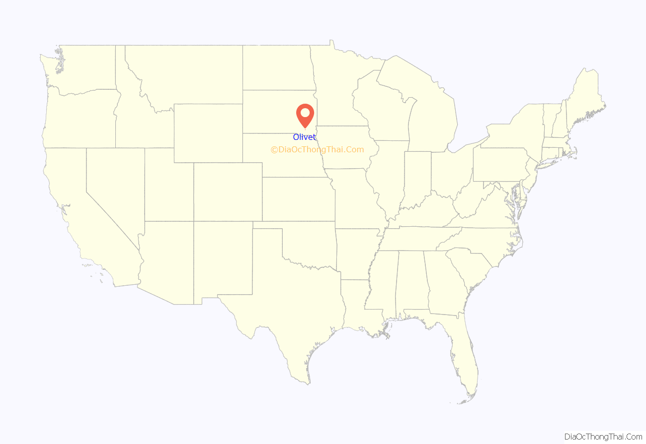
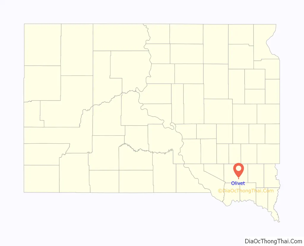
Olivet is a town in and the county seat of Hutchinson County, South Dakota. The population was 64 at the time of the 2020 census.
| Name: | Olivet town |
|---|---|
| LSAD Code: | 43 |
| LSAD Description: | town (suffix) |
| State: | South Dakota |
| County: | Hutchinson County |
| Elevation: | 1,220 ft (372 m) |
| Total Area: | 0.20 sq mi (0.52 km²) |
| Land Area: | 0.20 sq mi (0.52 km²) |
| Water Area: | 0.00 sq mi (0.00 km²) |
| Total Population: | 64 |
| Population Density: | 318.41/sq mi (122.81/km²) |
| ZIP code: | 57052 |
| Area code: | 605 |
| FIPS code: | 4646900 |
| GNISfeature ID: | 1256880 |
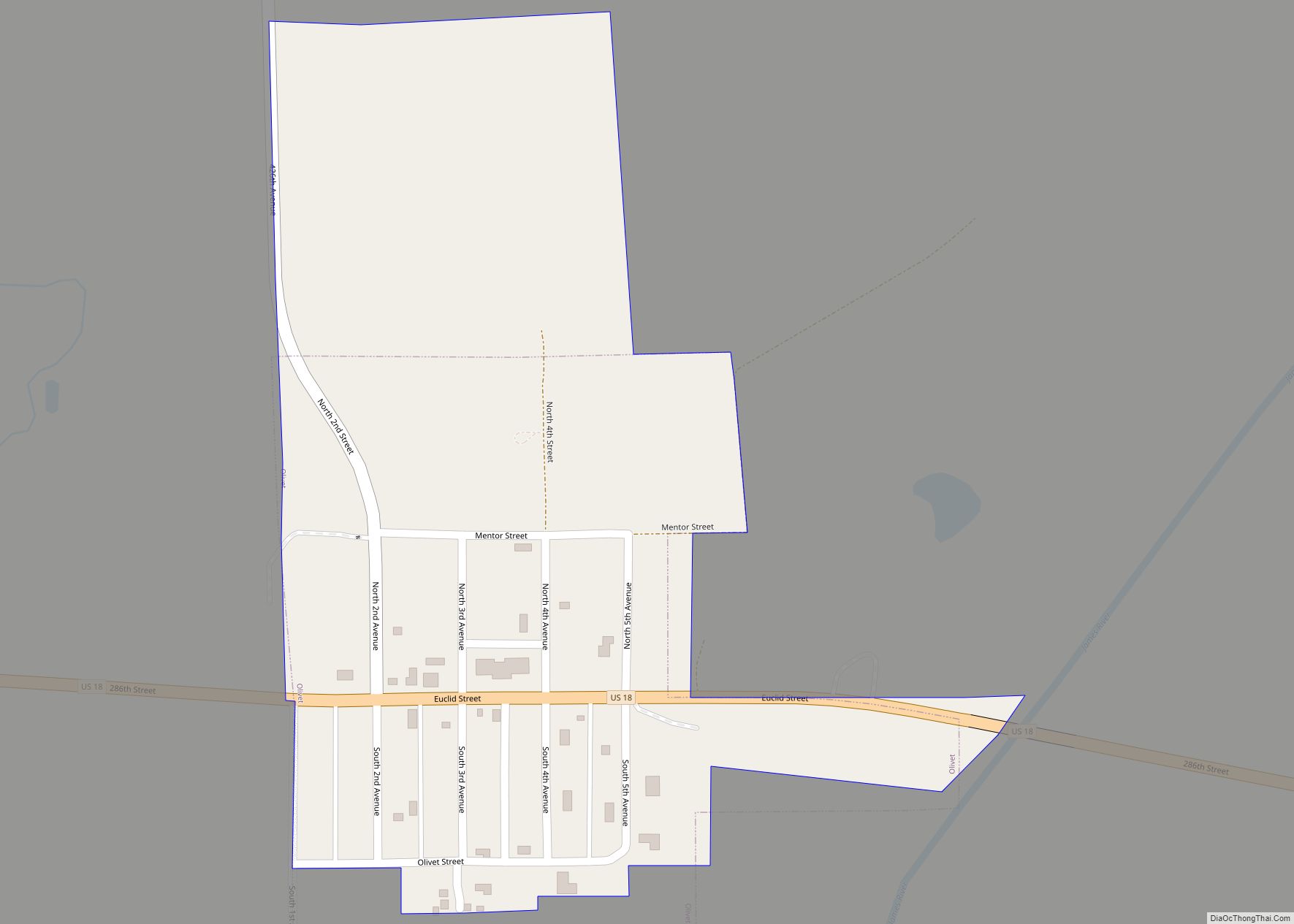
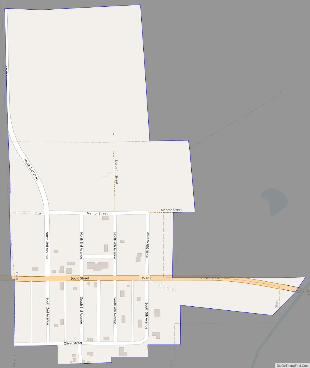
Online Interactive Map
Click on ![]() to view map in "full screen" mode.
to view map in "full screen" mode.
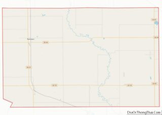
Olivet location map. Where is Olivet town?
History
Olivet was established in 1871 as the county seat. The town was named after Olivet, Michigan, the native home of first settlers. The first county courts were housed in a Methodist church; a permanent courthouse was built in 1881.
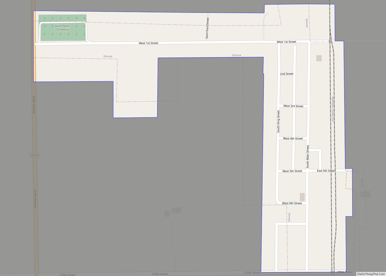
Olivet Road Map
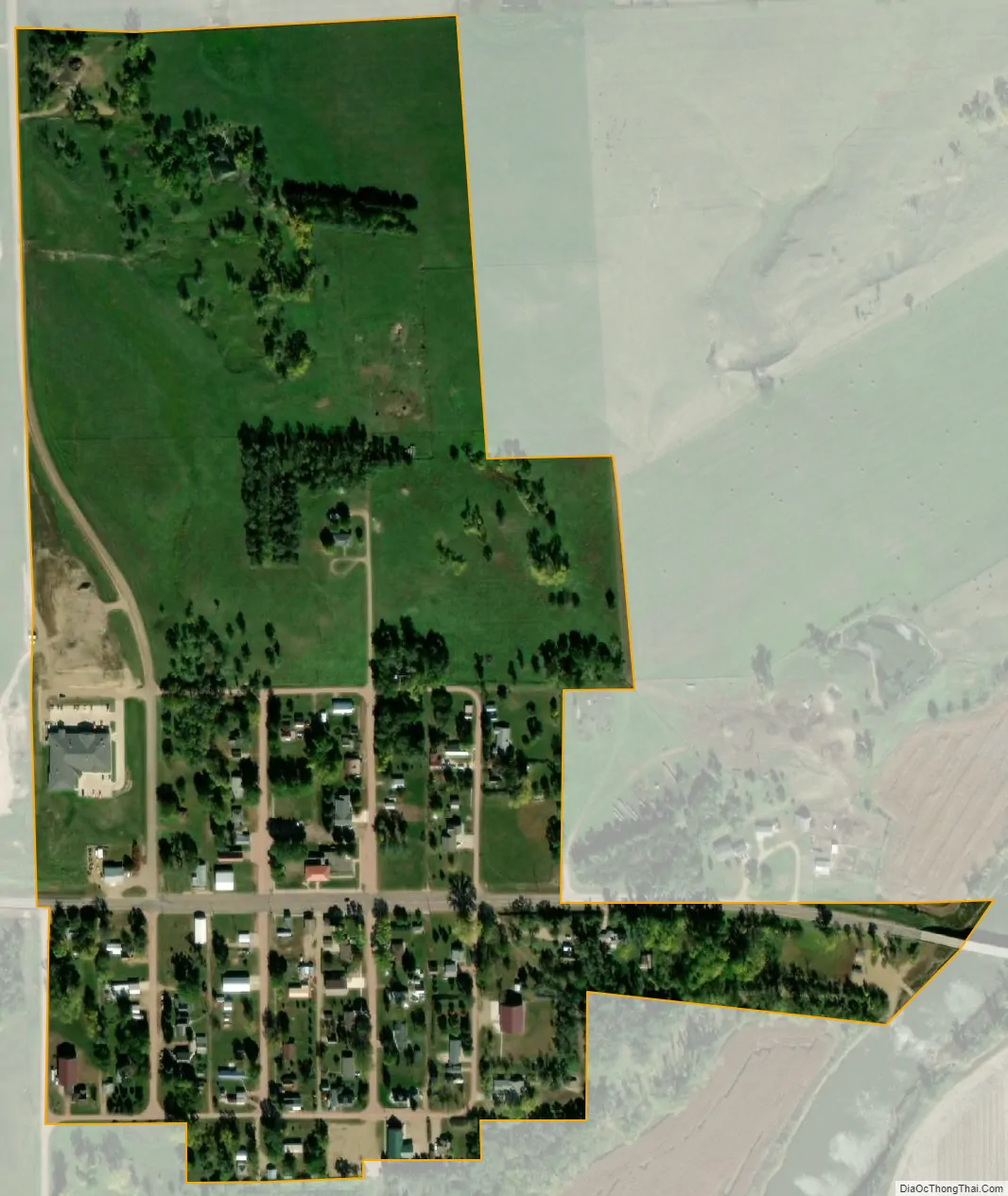
Olivet city Satellite Map
Geography
Olivet is located at 43°14′30″N 97°40′30″W / 43.24167°N 97.67500°W / 43.24167; -97.67500 (43.241660, -97.675063).
According to the United States Census Bureau, the town has a total area of 0.15 square miles (0.39 km), all land.
Olivet has been assigned the ZIP code 57052 and the FIPS place code 46900.
Olivet lies north of Lonetree Creek and is on the west bank of the James River.
See also
Map of South Dakota State and its subdivision:- Aurora
- Beadle
- Bennett
- Bon Homme
- Brookings
- Brown
- Brule
- Buffalo
- Butte
- Campbell
- Charles Mix
- Clark
- Clay
- Codington
- Corson
- Custer
- Davison
- Day
- Deuel
- Dewey
- Douglas
- Edmunds
- Fall River
- Faulk
- Grant
- Gregory
- Haakon
- Hamlin
- Hand
- Hanson
- Harding
- Hughes
- Hutchinson
- Hyde
- Jackson
- Jerauld
- Jones
- Kingsbury
- Lake
- Lawrence
- Lincoln
- Lyman
- Marshall
- McCook
- McPherson
- Meade
- Mellette
- Miner
- Minnehaha
- Moody
- Pennington
- Perkins
- Potter
- Roberts
- Sanborn
- Shannon
- Spink
- Stanley
- Sully
- Todd
- Tripp
- Turner
- Union
- Walworth
- Yankton
- Ziebach
- Alabama
- Alaska
- Arizona
- Arkansas
- California
- Colorado
- Connecticut
- Delaware
- District of Columbia
- Florida
- Georgia
- Hawaii
- Idaho
- Illinois
- Indiana
- Iowa
- Kansas
- Kentucky
- Louisiana
- Maine
- Maryland
- Massachusetts
- Michigan
- Minnesota
- Mississippi
- Missouri
- Montana
- Nebraska
- Nevada
- New Hampshire
- New Jersey
- New Mexico
- New York
- North Carolina
- North Dakota
- Ohio
- Oklahoma
- Oregon
- Pennsylvania
- Rhode Island
- South Carolina
- South Dakota
- Tennessee
- Texas
- Utah
- Vermont
- Virginia
- Washington
- West Virginia
- Wisconsin
- Wyoming