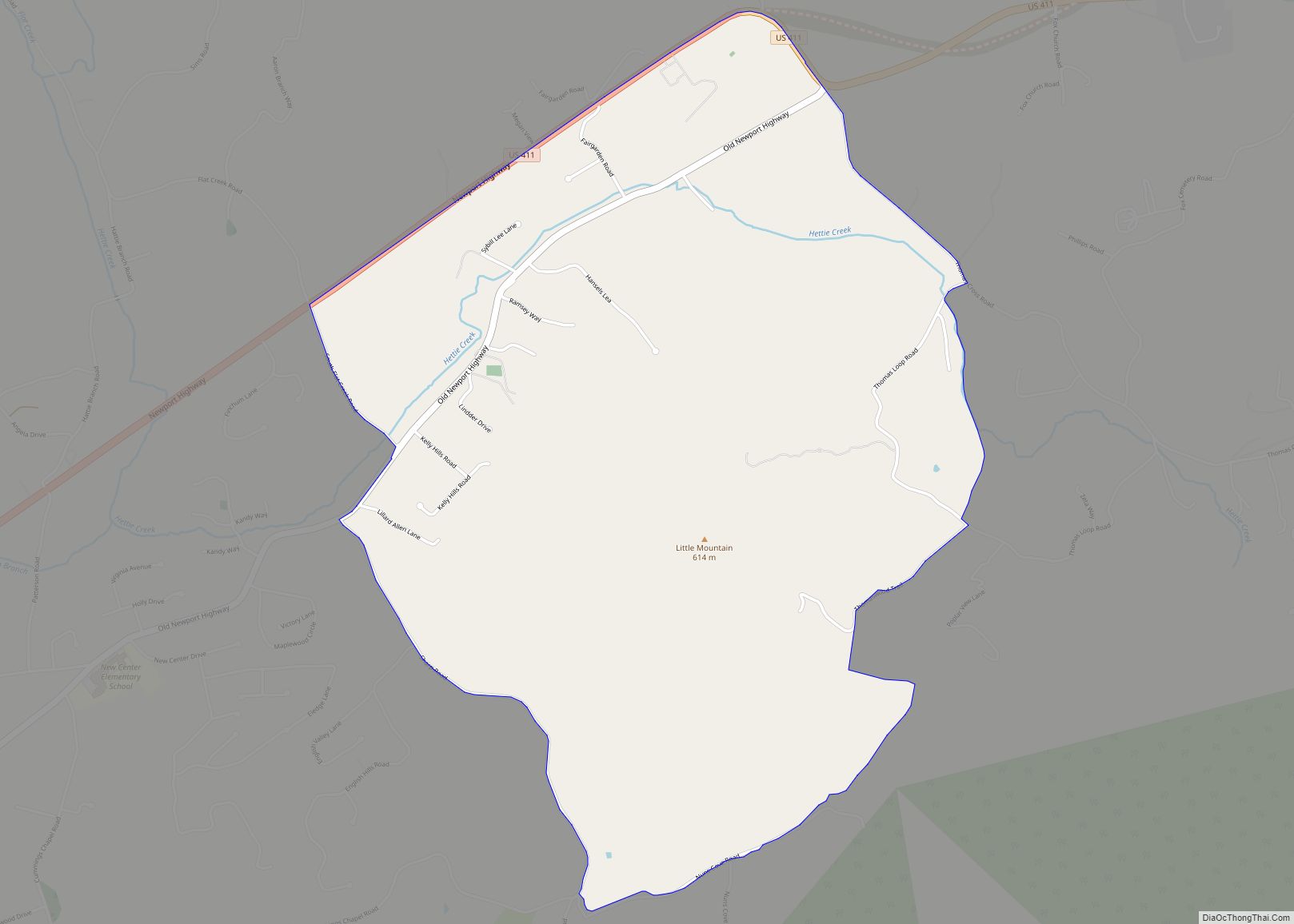
Map of Fairfield Glade CDP

Map of Fairfield Glade CDP

Fairfield Glade is a resort, retirement community and census-designated place (CDP) in Cumberland County, Tennessee, United States. The population was 9,152 at the 2020 census, up over 3,000 from the 2010 census. Fairfield Glade CDP overview: Name: Fairfield Glade CDP LSAD Code: 57 LSAD Description: CDP (suffix) State: Tennessee County: Cumberland County Elevation: 2,087 ft (636 m) … Read more

Map of Eva CDP, Tennessee

Map of Eva CDP, Tennessee

Eva is an unincorporated community and census-designated place (CDP) in Benton County, Tennessee, United States, on the western shore of the Kentucky Lake impoundment of the Tennessee River. It is the site of Nathan Bedford Forrest State Park. As of the 2010 census, its population was 293. The ZIP Code Tabulation Area for the ZIP … Read more

Map of Etowah city, Tennessee

Map of Etowah city, Tennessee

Etowah is a city in McMinn County in the U.S. state of Tennessee. The population was 3,613 at the 2020 census. Etowah city overview: Name: Etowah city LSAD Code: 25 LSAD Description: city (suffix) State: Tennessee County: McMinn County Founded: 1906 Incorporated: 1909 Elevation: 807 ft (246 m) Total Area: 2.83 sq mi (7.32 km²) Land Area: 2.83 sq mi (7.32 km²) Water … Read more

Map of Ethridge town

Map of Ethridge town

Ethridge is a town in Lawrence County, Tennessee, United States. The population was 465 at the 2010 census, down from 536 at the 2000 census. Ethridge town overview: Name: Ethridge town LSAD Code: 43 LSAD Description: town (suffix) State: Tennessee County: Lawrence County Elevation: 981 ft (299 m) Total Area: 1.15 sq mi (2.99 km²) Land Area: 1.15 sq mi (2.99 km²) Water … Read more

Map of Falling Water CDP

Map of Falling Water CDP

Falling Water is a census-designated place and unincorporated community in Hamilton County, Tennessee, United States. Its population was 1,873 as of the 2020 Census, up from 1,232 at the 2010 census. Falling Water CDP overview: Name: Falling Water CDP LSAD Code: 57 LSAD Description: CDP (suffix) State: Tennessee County: Hamilton County Elevation: 689 ft (210 m) Total … Read more

Map of Fall Branch CDP

Map of Fall Branch CDP

Fall Branch is a census-designated place (CDP) in Washington and Greene counties in the U.S. state of Tennessee. The population was 1,291 at the 2010 census. Some areas in Sullivan also use the Fall Branch ZIP code. Fall Branch is part of the Johnson City Metropolitan Statistical Area, which is a component of the Johnson … Read more

Map of Friendsville city, Tennessee

Map of Friendsville city, Tennessee

Friendsville is a city in Blount County, Tennessee, United States. Its population was 890 at the 2000 census and 913 at the 2010 census. It is included in the Knoxville, Tennessee Metropolitan Statistical Area. Friendsville city overview: Name: Friendsville city LSAD Code: 25 LSAD Description: city (suffix) State: Tennessee County: Blount County Incorporated: 1953 Elevation: … Read more

Map of Friendship city, Tennessee

Map of Friendship city, Tennessee

Friendship is a city in Crockett County, Tennessee. The population was 668 at the 2010 census. Also used to be the location of Friendship High School before it was closed for consolidation Friendship city overview: Name: Friendship city LSAD Code: 25 LSAD Description: city (suffix) State: Tennessee County: Crockett County Elevation: 400 ft (122 m) Total Area: … Read more

Map of Franklin city, Tennessee

Map of Franklin city, Tennessee

Franklin is a city in and county seat of Williamson County, Tennessee, United States. About 21 miles (34 km) south of Nashville, it is one of the principal cities of the Nashville metropolitan area and Middle Tennessee. As of 2020, its population was 83,454. It is the seventh-largest city in Tennessee. Franklin is known to be … Read more

Map of Forest Hills city, Tennessee

Map of Forest Hills city, Tennessee

Forest Hills is a city in Davidson County, Tennessee. The population was 5,038 at the 2010 census and 4,866 in a 2018 estimate. Forest Hills city overview: Name: Forest Hills city LSAD Code: 25 LSAD Description: city (suffix) State: Tennessee County: Davidson County Elevation: 653 ft (199 m) Total Area: 9.24 sq mi (23.93 km²) Land Area: 9.24 sq mi (23.92 km²) Water … Read more

Map of Flintville CDP

Map of Flintville CDP

Flintville is an unincorporated community in Lincoln County, Tennessee, United States. As of the 2010 census, its population was 627. Flintville is located approximately 10.5 miles (16.9 km) southeast of Fayetteville along Tennessee State Route 275 highway. Flintville CDP overview: Name: Flintville CDP LSAD Code: 57 LSAD Description: CDP (suffix) State: Tennessee County: Lincoln County Elevation: … Read more

Map of Flat Top Mountain CDP

Map of Flat Top Mountain CDP

Flat Top Mountain is a census-designated place in Hamilton County, Tennessee, United States. Its population was 561 at the 2020 census, up from 422 at the 2010 census. Flat Top Mountain CDP overview: Name: Flat Top Mountain CDP LSAD Code: 57 LSAD Description: CDP (suffix) State: Tennessee County: Hamilton County Elevation: 1,509 ft (460 m) Total Area: … Read more