Map of Ivanhoe city, Texas

Map of Ivanhoe city, Texas

Ivanhoe is a city in Tyler County, Texas, United States. The population was 1,327 at the 2020 census. In an election held on November 3, 2009, residents voted to incorporate the community as a “Class C” municipality by a vote of 160 to 53. In a concurrent election, Bill Preston was elected unopposed as mayor. … Read more

Map of Itasca city, Texas

Map of Itasca city, Texas

Itasca /aɪˈtæskə/ eye-TAS-kə is a city in Hill County in Northern Central Texas. As of the 2010 census, the city population was 1,644. Itasca city overview: Name: Itasca city LSAD Code: 25 LSAD Description: city (suffix) State: Texas County: Hill County Elevation: 702 ft (214 m) Total Area: 1.24 sq mi (3.21 km²) Land Area: 1.24 sq mi (3.21 km²) Water Area: 0.00 sq mi … Read more

Map of Italy town

Map of Italy town

Italy (/ˈɪtli/ IT-lee, unlike the country Italy) is a town in Ellis County, Texas, United States. Its population was 1,926 in 2020. The community was named after Italy by a settler who had visited the European country. Italy town overview: Name: Italy town LSAD Code: 43 LSAD Description: town (suffix) State: Texas County: Ellis County … Read more

Map of Iredell city

Map of Iredell city

Iredell (/ˈaɪərdɛl/ IRE-del) is a city located in Bosque County in central Texas, United States. The population was 339 at the 2010 census. Iredell city overview: Name: Iredell city LSAD Code: 25 LSAD Description: city (suffix) State: Texas County: Bosque County Elevation: 902 ft (275 m) Total Area: 0.46 sq mi (1.19 km²) Land Area: 0.45 sq mi (1.16 km²) Water Area: 0.01 sq mi … Read more

Map of Iraan city

Map of Iraan city

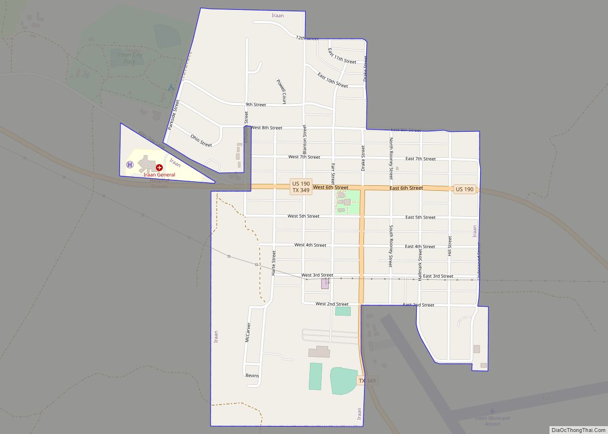
Iraan (/ˌaɪrəˈæn/ EYE-rə-AN) is a city in Pecos County, Texas, United States. Its population was 1,229 at the 2010 census. The city’s name is an amalgamation of the first names of Ira and Ann Yates, owners of the ranch land upon which the town was built. Iraan city overview: Name: Iraan city LSAD Code: 25 … Read more

Map of Iowa Park city

Map of Iowa Park city

Iowa Park is a city in Wichita County, Texas, United States. It is part of the Wichita Falls, Texas metropolitan statistical area. The population was 6,355 at the 2010 census. Iowa Park city overview: Name: Iowa Park city LSAD Code: 25 LSAD Description: city (suffix) State: Texas County: Wichita County Elevation: 1,037 ft (316 m) Total Area: … Read more

Map of Jayton city

Map of Jayton city

Jayton is a city in and the county seat of Kent County, Texas, United States. It is located in the northeastern portion of the county, and the population was 534 as of the 2010 census. Jayton city overview: Name: Jayton city LSAD Code: 25 LSAD Description: city (suffix) State: Texas County: Kent County Elevation: 2,005 ft … Read more

Map of Jasper city, Texas

Map of Jasper city, Texas

Jasper is a city in and the county seat of Jasper County, Texas, United States. Its population was 6,884 at the 2020 U.S. Census, down from 7,590 at the 2010 U.S. Census. Jasper is situated in the Deep East Texas subregion, about 40 miles (64 km) west of the Texas-Louisiana state line. Jasper (the “Butterfly Capital … Read more

Map of Jarrell city

Map of Jarrell city

Jarrell is a city in Williamson County, Texas, United States. It was incorporated as a city in 2001. The total population is 1,753 according to the 2020 census. Jarrell city overview: Name: Jarrell city LSAD Code: 25 LSAD Description: city (suffix) State: Texas County: Williamson County Elevation: 896 ft (273 m) Total Area: 2.82 sq mi (7.30 km²) Land Area: … Read more

Map of Jardin de San Julian CDP

Map of Jardin de San Julian CDP

Jardin de San Julian is a census-designated place (CDP) in Starr County, Texas, United States. This was a new CDP for the 2010 census with a population of 22. Jardin de San Julian CDP overview: Name: Jardin de San Julian CDP LSAD Code: 57 LSAD Description: CDP (suffix) State: Texas County: Starr County Total Area: … Read more

Map of Jamaica Beach city

Map of Jamaica Beach city

Jamaica Beach is a city in Galveston County, Texas, United States on Galveston Island. As of the 2010 census, the city’s population was 983. the city is bordered by Galveston to the east and west, the east bay on the north and the Gulf of Mexico to the south. Jamaica Beach city overview: Name: Jamaica … Read more

Map of Johnson City, Texas

Map of Johnson City, Texas

Johnson City is a city and the county seat of Blanco County, Texas, United States. The population was 1,656 at the 2010 census. Founded in 1879 by James P. Johnson, it was named for early settler Sam E. Johnson, Sr. Johnson City is part of the Texas-German belt region. Johnson City overview: Name: Johnson City … Read more