Jayton is a city in and the county seat of Kent County, Texas, United States. It is located in the northeastern portion of the county, and the population was 534 as of the 2010 census.
| Name: | Jayton city |
|---|---|
| LSAD Code: | 25 |
| LSAD Description: | city (suffix) |
| State: | Texas |
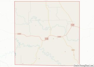
| County: | Kent County |
| Elevation: | 2,005 ft (611 m) |
| Total Area: | 1.70 sq mi (4.39 km²) |
| Land Area: | 1.70 sq mi (4.39 km²) |
| Water Area: | 0.00 sq mi (0.00 km²) |
| Total Population: | 534 |
| Population Density: | 295.82/sq mi (114.23/km²) |
| ZIP code: | 79528 |
| Area code: | 806 |
| FIPS code: | 4837468 |
| GNISfeature ID: | 1360187 |
Online Interactive Map
Click on ![]() to view map in "full screen" mode.
to view map in "full screen" mode.
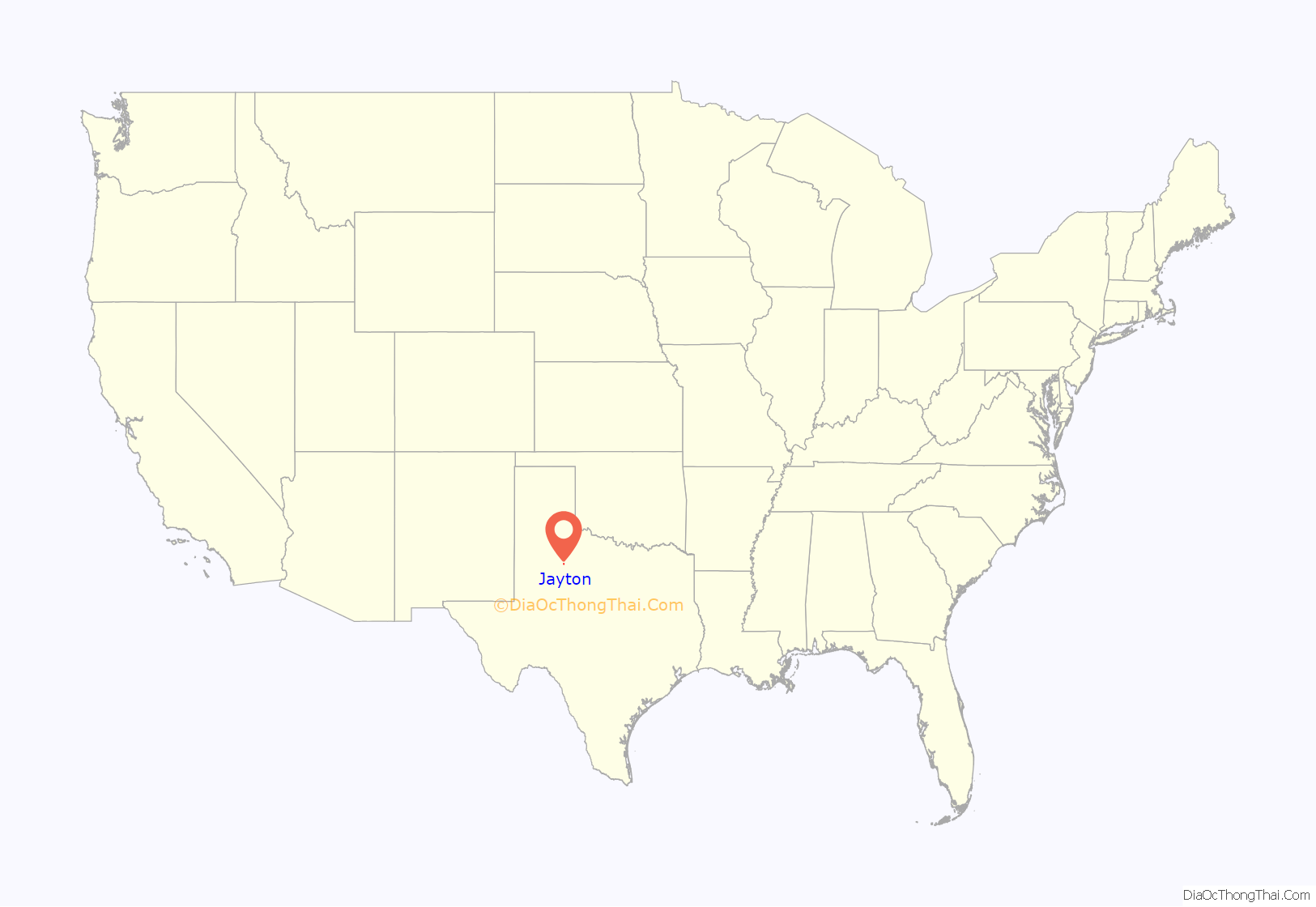
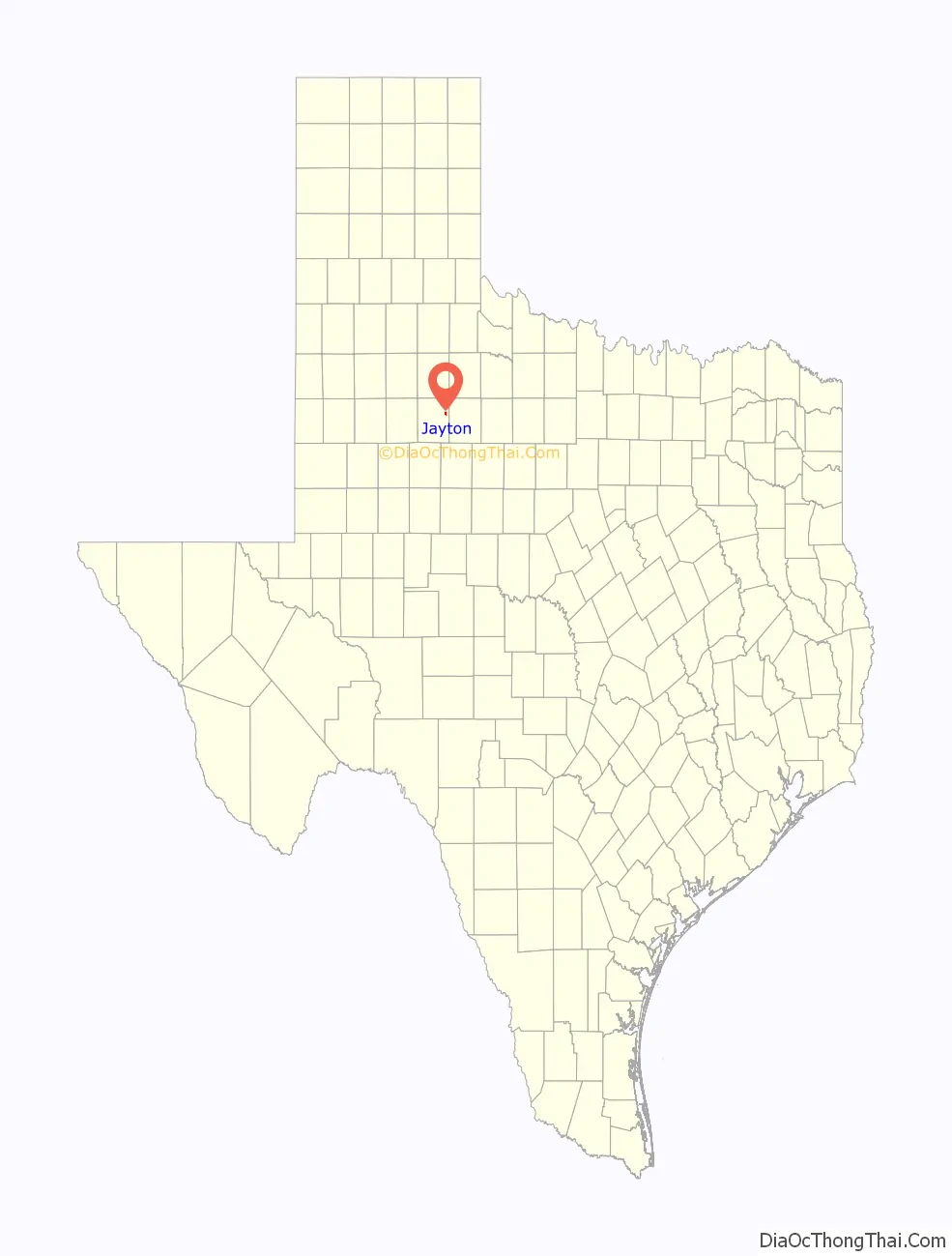
Jayton location map. Where is Jayton city?
History
Jayton’s history begins in the 1880s. Originally known as “Jay Flat”, it was established 2 miles (3 km) northeast of its present location and named after a local ranching family. A post office was granted in 1886, and Daniel Jay served as the community’s first postmaster. In 1907, the townsite was moved to its present location for improved proximity to rail service, and it was officially renamed “Jayton” later that same year. The community’s first newspaper, the Jayton Herald, was established the following year, and the city incorporated in February 1910. By 1925, Jayton was home to 750 residents.
From the community’s inception, the local economy had originally been supported mainly by the cotton industry, but the Dust Bowl of the 1930s had a dire effect on production. The community’s economy was stabilized by the discovery of oil later that same decade, and while its population never exceeded 750, Jayton remained stable throughout the Great Depression. In 1954, following a lengthy and heated court battle, the city wrested the title of county seat from the declining nearby community of Clairemont, and in 1957, a courthouse was constructed. Jayton’s population remained around 600 from the 1950s through the 1980 census before declining to 513 in 1990 and 441 in 2000, but a resurgence in the local oil industry led to a rebound, and the 2010 census counted 534 residents.
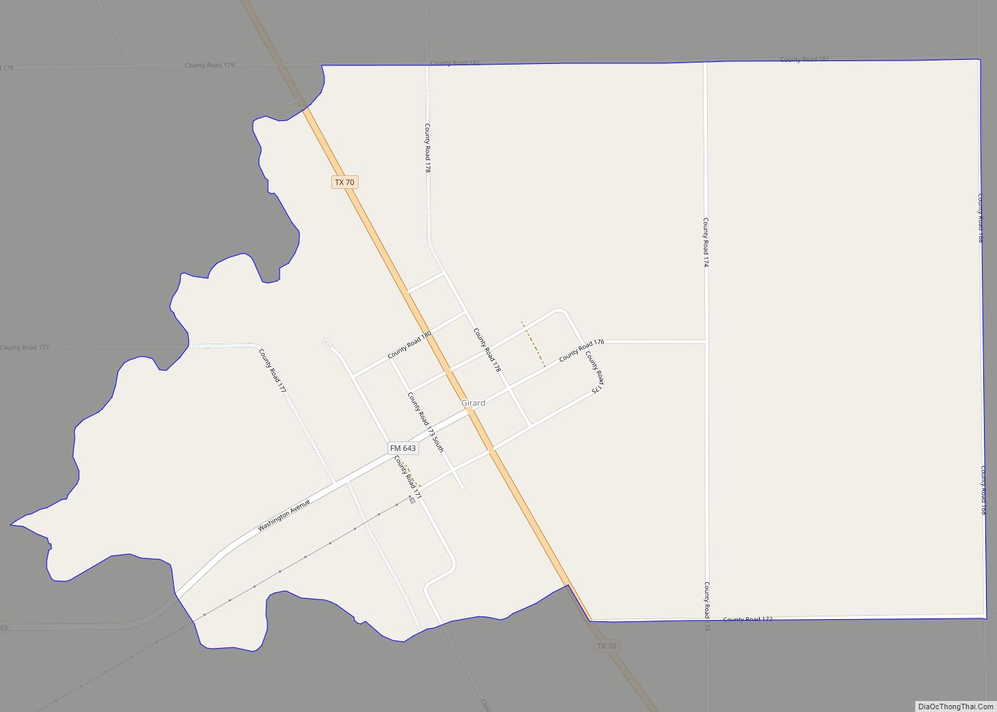
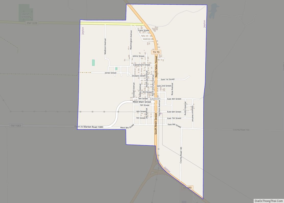
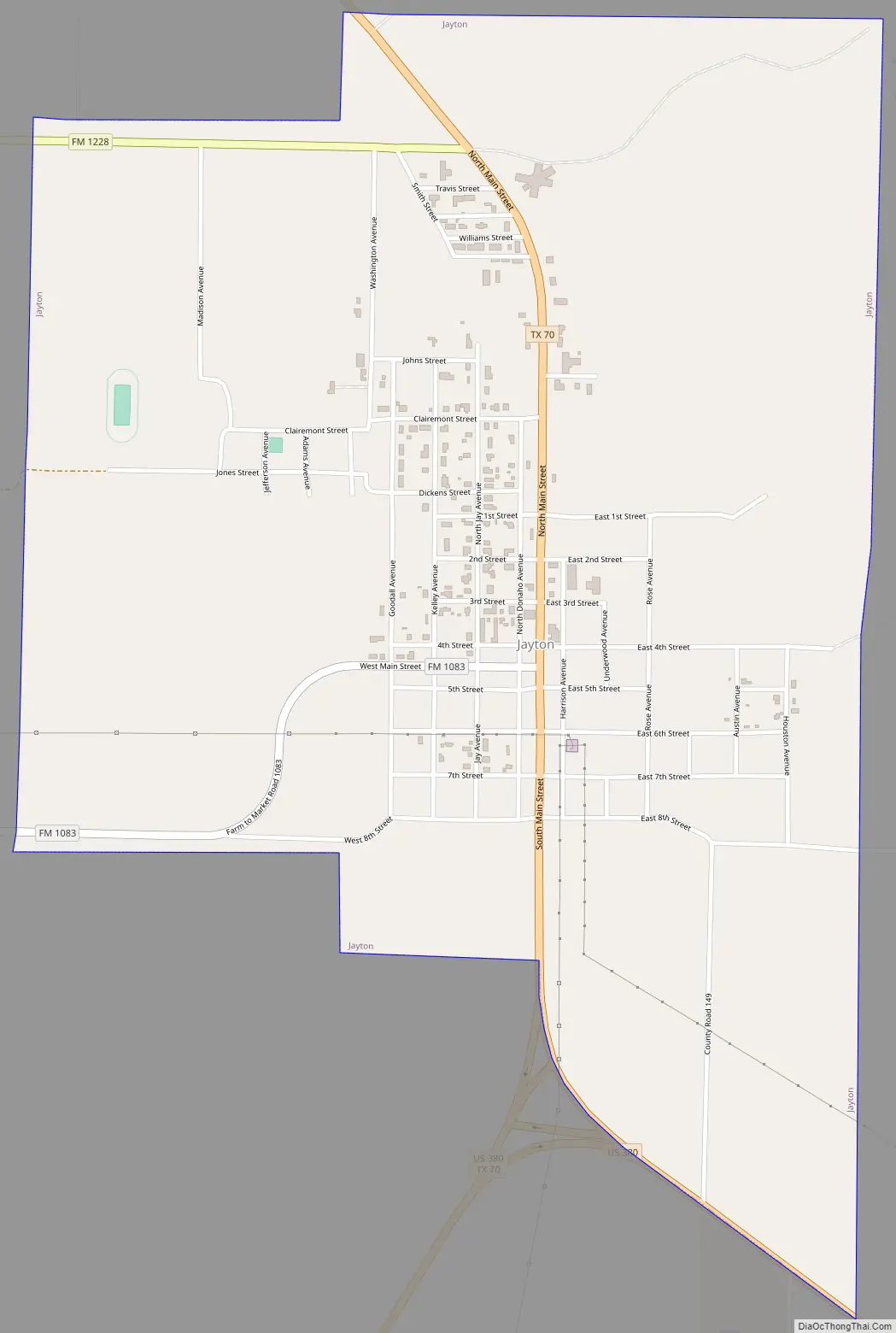
Jayton Road Map
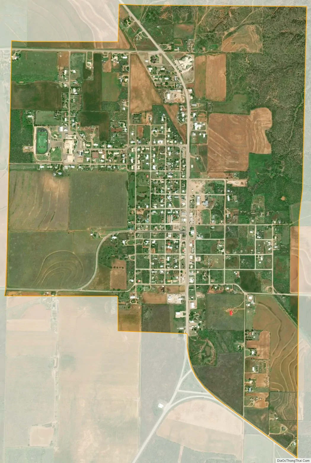
Jayton city Satellite Map
Geography
Jayton is located in eastern Kent County at 33°15′N 100°34′W / 33.250°N 100.567°W / 33.250; -100.567 (33.2493, –100.5748). U.S. Route 380 touches the southern border of the city; the highway leads southeast 24 miles (39 km) to Aspermont and southwest 13 miles (21 km) to Clairemont. Texas State Highway 70 is Jayton’s Main Street and leads northwest 24 miles (39 km) to Spur. The closest large cities are Lubbock, 93 miles (150 km) to the northwest, and Abilene, 84 miles (135 km) to the southeast.
According to the United States Census Bureau, Jayton has a total area of 1.7 square miles (4.4 km), all of it land.
Kent County Airport is south of the city. The airport has one asphalt runway 3,300 feet (1,000 m) in length. The nearest airport with commercial service is roughly 100 miles away in Lubbock.
See also
Map of Texas State and its subdivision:- Anderson
- Andrews
- Angelina
- Aransas
- Archer
- Armstrong
- Atascosa
- Austin
- Bailey
- Bandera
- Bastrop
- Baylor
- Bee
- Bell
- Bexar
- Blanco
- Borden
- Bosque
- Bowie
- Brazoria
- Brazos
- Brewster
- Briscoe
- Brooks
- Brown
- Burleson
- Burnet
- Caldwell
- Calhoun
- Callahan
- Cameron
- Camp
- Carson
- Cass
- Castro
- Chambers
- Cherokee
- Childress
- Clay
- Cochran
- Coke
- Coleman
- Collin
- Collingsworth
- Colorado
- Comal
- Comanche
- Concho
- Cooke
- Coryell
- Cottle
- Crane
- Crockett
- Crosby
- Culberson
- Dallam
- Dallas
- Dawson
- Deaf Smith
- Delta
- Denton
- Dewitt
- Dickens
- Dimmit
- Donley
- Duval
- Eastland
- Ector
- Edwards
- El Paso
- Ellis
- Erath
- Falls
- Fannin
- Fayette
- Fisher
- Floyd
- Foard
- Fort Bend
- Franklin
- Freestone
- Frio
- Gaines
- Galveston
- Garza
- Gillespie
- Glasscock
- Goliad
- Gonzales
- Gray
- Grayson
- Gregg
- Grimes
- Guadalupe
- Hale
- Hall
- Hamilton
- Hansford
- Hardeman
- Hardin
- Harris
- Harrison
- Hartley
- Haskell
- Hays
- Hemphill
- Henderson
- Hidalgo
- Hill
- Hockley
- Hood
- Hopkins
- Houston
- Howard
- Hudspeth
- Hunt
- Hutchinson
- Irion
- Jack
- Jackson
- Jasper
- Jeff Davis
- Jefferson
- Jim Hogg
- Jim Wells
- Johnson
- Jones
- Karnes
- Kaufman
- Kendall
- Kenedy
- Kent
- Kerr
- Kimble
- King
- Kinney
- Kleberg
- Knox
- La Salle
- Lamar
- Lamb
- Lampasas
- Lavaca
- Lee
- Leon
- Liberty
- Limestone
- Lipscomb
- Live Oak
- Llano
- Loving
- Lubbock
- Lynn
- Madison
- Marion
- Martin
- Mason
- Matagorda
- Maverick
- McCulloch
- McLennan
- McMullen
- Medina
- Menard
- Midland
- Milam
- Mills
- Mitchell
- Montague
- Montgomery
- Moore
- Morris
- Motley
- Nacogdoches
- Navarro
- Newton
- Nolan
- Nueces
- Ochiltree
- Oldham
- Orange
- Palo Pinto
- Panola
- Parker
- Parmer
- Pecos
- Polk
- Potter
- Presidio
- Rains
- Randall
- Reagan
- Real
- Red River
- Reeves
- Refugio
- Roberts
- Robertson
- Rockwall
- Runnels
- Rusk
- Sabine
- San Augustine
- San Jacinto
- San Patricio
- San Saba
- Schleicher
- Scurry
- Shackelford
- Shelby
- Sherman
- Smith
- Somervell
- Starr
- Stephens
- Sterling
- Stonewall
- Sutton
- Swisher
- Tarrant
- Taylor
- Terrell
- Terry
- Throckmorton
- Titus
- Tom Green
- Travis
- Trinity
- Tyler
- Upshur
- Upton
- Uvalde
- Val Verde
- Van Zandt
- Victoria
- Walker
- Waller
- Ward
- Washington
- Webb
- Wharton
- Wheeler
- Wichita
- Wilbarger
- Willacy
- Williamson
- Wilson
- Winkler
- Wise
- Wood
- Yoakum
- Young
- Zapata
- Zavala
- Alabama
- Alaska
- Arizona
- Arkansas
- California
- Colorado
- Connecticut
- Delaware
- District of Columbia
- Florida
- Georgia
- Hawaii
- Idaho
- Illinois
- Indiana
- Iowa
- Kansas
- Kentucky
- Louisiana
- Maine
- Maryland
- Massachusetts
- Michigan
- Minnesota
- Mississippi
- Missouri
- Montana
- Nebraska
- Nevada
- New Hampshire
- New Jersey
- New Mexico
- New York
- North Carolina
- North Dakota
- Ohio
- Oklahoma
- Oregon
- Pennsylvania
- Rhode Island
- South Carolina
- South Dakota
- Tennessee
- Texas
- Utah
- Vermont
- Virginia
- Washington
- West Virginia
- Wisconsin
- Wyoming