Jefferson is a city in Marion County, in the U.S. state of Texas‘s northeastern region. With a population of 1,875 at the 2020 United States census, it is the county seat of Marion.
| Name: | Jefferson city |
|---|---|
| LSAD Code: | 25 |
| LSAD Description: | city (suffix) |
| State: | Texas |
| County: | Marion County |
| Founded: | 1841 |
| Elevation: | 194 ft (59 m) |
| Total Area: | 4.48 sq mi (11.59 km²) |
| Land Area: | 4.45 sq mi (11.52 km²) |
| Water Area: | 0.03 sq mi (0.07 km²) |
| Total Population: | 1,875 |
| Population Density: | 420/sq mi (160/km²) |
| ZIP code: | 75657 |
| Area code: | 903 |
| FIPS code: | 4837528 |
| GNISfeature ID: | 1338692 |
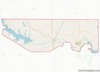
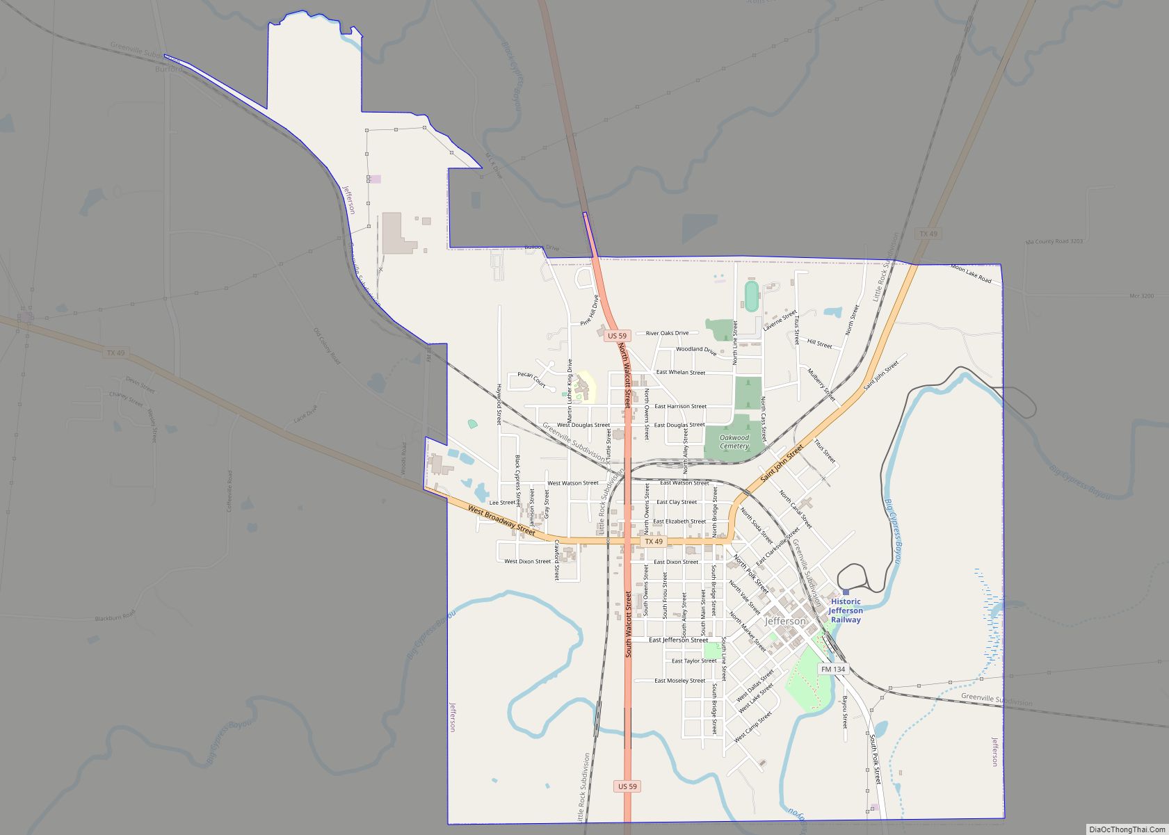
Online Interactive Map
Click on ![]() to view map in "full screen" mode.
to view map in "full screen" mode.
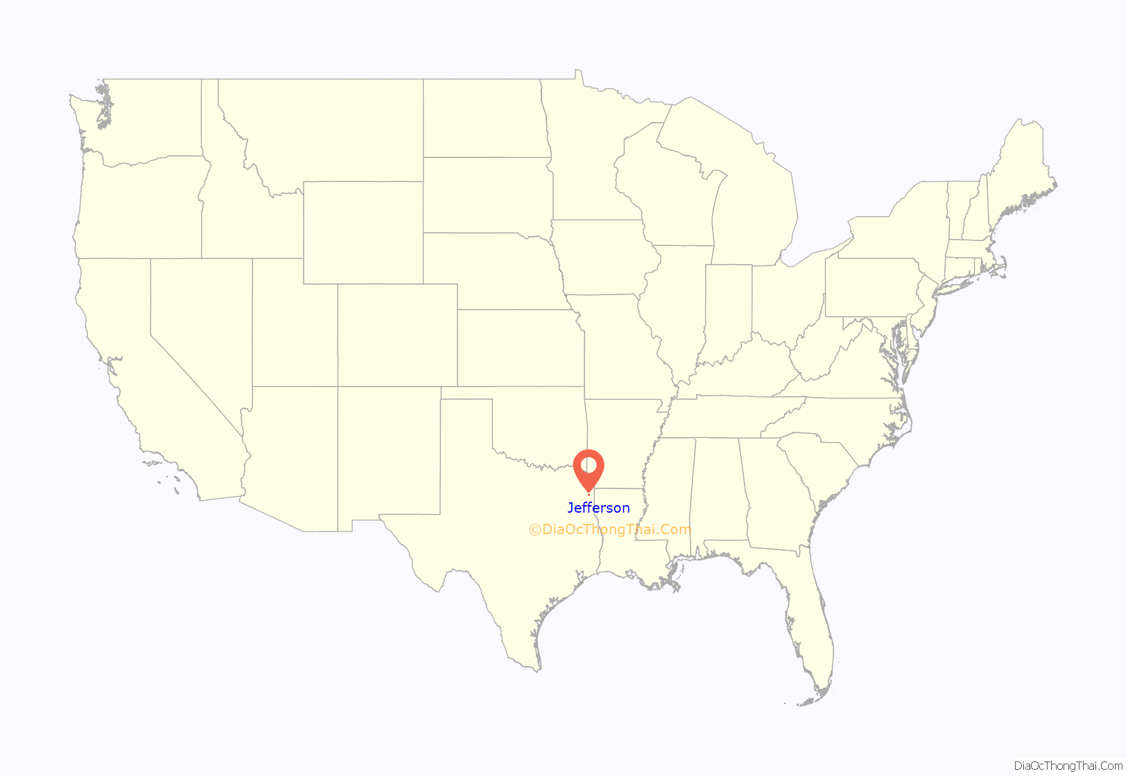
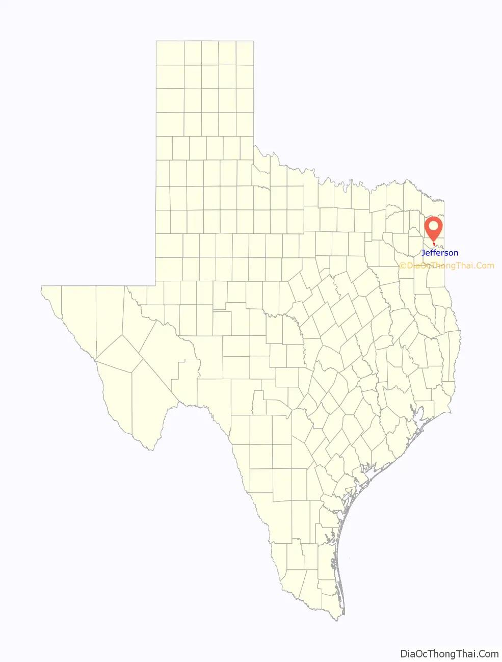
Jefferson location map. Where is Jefferson city?
History
Almost every commercial building and house on the main arterial road in Jefferson has a historic marker.
Early records indicate that Jefferson was founded around 1841 on land ceded from the Caddo Indians. At that time, a log jam more than 100 miles long existed on the Red River north of present Natchitoches, Louisiana. The Indians said that this log jam, known as the Great Red River Raft, had always existed.
The Red River Raft (or Great Raft) acted as a dam on the river and raised the level of Caddo Lake and the Red River several feet. This rise of Caddo Lake and the corresponding rise in the Big Cypress Bayou at Jefferson permitted commercial riverboat travel to Jefferson from ports such as St. Louis and New Orleans via the Mississippi and Red Rivers.
Jefferson was one of the most important ports in Texas between 1845 and 1872. The town reached its peak population just a few years after the Civil War and is reported to have exceeded 30,000. During this time, Jefferson was the sixth-largest town in Texas.
There were attempts over the years to remove the raft and permit the normal flow of the Red River, but these attempts were unsuccessful until the discovery of nitroglycerin. In 1873, using nitroglycerin, the Army Corps of Engineers was finally able to clear the raft from the Red River. This lowered the level of Caddo Lake and Big Cypress to the extent that riverboat traffic to Jefferson was no longer commercially feasible. At the peak of river traffic, Jefferson had a population of over 7,000. A few years later, it had dropped to a little over 3,000.
The Sterne Fountain was given to the city in 1913 to honor the contribution of Jacob and Ernestine Sterne, a Jewish couple who settled in Jefferson before the Civil War and became prominent citizens who managed the post office and were involved in numerous civic and cultural projects. The fountain includes a statue of Hebe, the Greek goddess of Youth, by Giuseppe Moretti.
One of the legends related to Jefferson referred to Jay Gould, the railroad magnate. The legend goes that Gould wanted to bring his railroad through Jefferson but the town leaders refused because they had the river traffic. Gould said that “grass would grow in the streets” without the railroad. Gould credited with supporting the removal of the Red River Raft and the subsequent decline of Jefferson as a river port. Much of this tale is fiction. Townspeople obtained Gould’s railcar and it is displayed as a tourist attraction in downtown Jefferson.
Since 2000, Jefferson has been the location for the Pulpwood Queens Book Club Girlfriend Weekend’s annual conference, attracting authors from all around the country. Home of the famous TJ Blackburn Syrup Works since 1927.
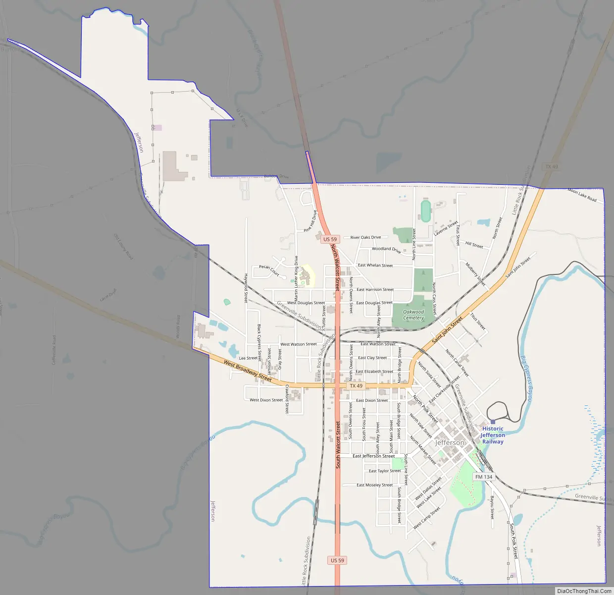
Jefferson Road Map
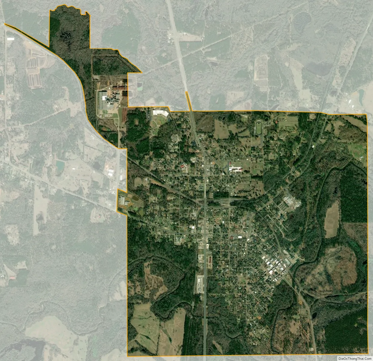
Jefferson city Satellite Map
Geography
According to the United States Census Bureau, the city has a total area of 4.4 square miles (11 km), of which, 4.3 square miles (11 km) of it is land and 0.1 square miles (0.26 km) of it (1.58%) is water.
Climate
The climate in this area is characterized by hot, humid summers and generally mild to cool winters. According to the Köppen Climate Classification system, Jefferson has a humid subtropical climate, abbreviated “Cfa” on climate maps.
See also
Map of Texas State and its subdivision:- Anderson
- Andrews
- Angelina
- Aransas
- Archer
- Armstrong
- Atascosa
- Austin
- Bailey
- Bandera
- Bastrop
- Baylor
- Bee
- Bell
- Bexar
- Blanco
- Borden
- Bosque
- Bowie
- Brazoria
- Brazos
- Brewster
- Briscoe
- Brooks
- Brown
- Burleson
- Burnet
- Caldwell
- Calhoun
- Callahan
- Cameron
- Camp
- Carson
- Cass
- Castro
- Chambers
- Cherokee
- Childress
- Clay
- Cochran
- Coke
- Coleman
- Collin
- Collingsworth
- Colorado
- Comal
- Comanche
- Concho
- Cooke
- Coryell
- Cottle
- Crane
- Crockett
- Crosby
- Culberson
- Dallam
- Dallas
- Dawson
- Deaf Smith
- Delta
- Denton
- Dewitt
- Dickens
- Dimmit
- Donley
- Duval
- Eastland
- Ector
- Edwards
- El Paso
- Ellis
- Erath
- Falls
- Fannin
- Fayette
- Fisher
- Floyd
- Foard
- Fort Bend
- Franklin
- Freestone
- Frio
- Gaines
- Galveston
- Garza
- Gillespie
- Glasscock
- Goliad
- Gonzales
- Gray
- Grayson
- Gregg
- Grimes
- Guadalupe
- Hale
- Hall
- Hamilton
- Hansford
- Hardeman
- Hardin
- Harris
- Harrison
- Hartley
- Haskell
- Hays
- Hemphill
- Henderson
- Hidalgo
- Hill
- Hockley
- Hood
- Hopkins
- Houston
- Howard
- Hudspeth
- Hunt
- Hutchinson
- Irion
- Jack
- Jackson
- Jasper
- Jeff Davis
- Jefferson
- Jim Hogg
- Jim Wells
- Johnson
- Jones
- Karnes
- Kaufman
- Kendall
- Kenedy
- Kent
- Kerr
- Kimble
- King
- Kinney
- Kleberg
- Knox
- La Salle
- Lamar
- Lamb
- Lampasas
- Lavaca
- Lee
- Leon
- Liberty
- Limestone
- Lipscomb
- Live Oak
- Llano
- Loving
- Lubbock
- Lynn
- Madison
- Marion
- Martin
- Mason
- Matagorda
- Maverick
- McCulloch
- McLennan
- McMullen
- Medina
- Menard
- Midland
- Milam
- Mills
- Mitchell
- Montague
- Montgomery
- Moore
- Morris
- Motley
- Nacogdoches
- Navarro
- Newton
- Nolan
- Nueces
- Ochiltree
- Oldham
- Orange
- Palo Pinto
- Panola
- Parker
- Parmer
- Pecos
- Polk
- Potter
- Presidio
- Rains
- Randall
- Reagan
- Real
- Red River
- Reeves
- Refugio
- Roberts
- Robertson
- Rockwall
- Runnels
- Rusk
- Sabine
- San Augustine
- San Jacinto
- San Patricio
- San Saba
- Schleicher
- Scurry
- Shackelford
- Shelby
- Sherman
- Smith
- Somervell
- Starr
- Stephens
- Sterling
- Stonewall
- Sutton
- Swisher
- Tarrant
- Taylor
- Terrell
- Terry
- Throckmorton
- Titus
- Tom Green
- Travis
- Trinity
- Tyler
- Upshur
- Upton
- Uvalde
- Val Verde
- Van Zandt
- Victoria
- Walker
- Waller
- Ward
- Washington
- Webb
- Wharton
- Wheeler
- Wichita
- Wilbarger
- Willacy
- Williamson
- Wilson
- Winkler
- Wise
- Wood
- Yoakum
- Young
- Zapata
- Zavala
- Alabama
- Alaska
- Arizona
- Arkansas
- California
- Colorado
- Connecticut
- Delaware
- District of Columbia
- Florida
- Georgia
- Hawaii
- Idaho
- Illinois
- Indiana
- Iowa
- Kansas
- Kentucky
- Louisiana
- Maine
- Maryland
- Massachusetts
- Michigan
- Minnesota
- Mississippi
- Missouri
- Montana
- Nebraska
- Nevada
- New Hampshire
- New Jersey
- New Mexico
- New York
- North Carolina
- North Dakota
- Ohio
- Oklahoma
- Oregon
- Pennsylvania
- Rhode Island
- South Carolina
- South Dakota
- Tennessee
- Texas
- Utah
- Vermont
- Virginia
- Washington
- West Virginia
- Wisconsin
- Wyoming