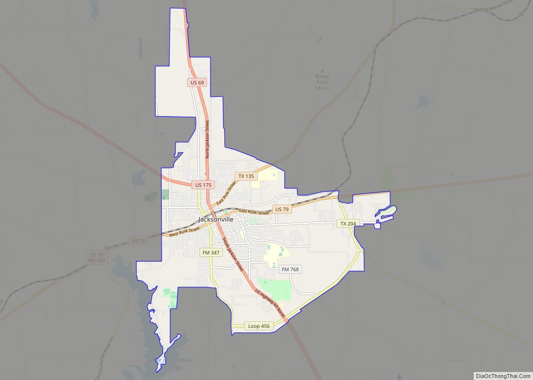
Jacksonville is a city located in Cherokee County, Texas, United States. The population was 13,997 at the 2020 U.S. census. It is the principal city of the Jacksonville micropolitan statistical area, which includes all of Cherokee County.
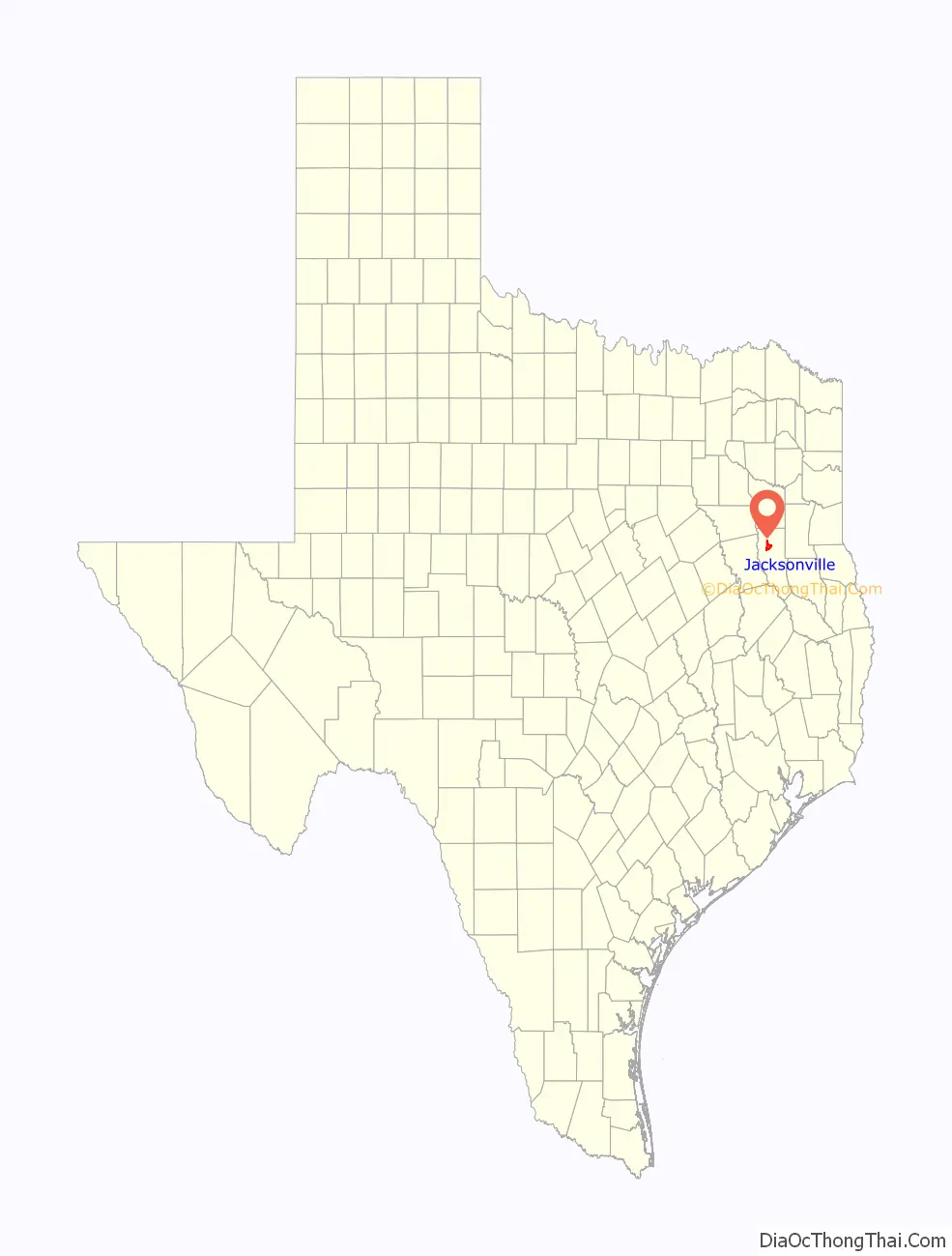
Jacksonville is located in East Texas, north of the county seat, Rusk, and south of Tyler, in Smith County.
Area production and shipping of tomatoes gained the town the title “Tomato Capital of the World”. The impressive red iron ore rock Tomato Bowl, built by Works Progress Administration workers during the Great Depression, is home to the Jacksonville High School “Fightin’ Indians” football and soccer teams. Annual events include the “Tops in Texas Rodeo” held in May and the “Tomato Fest” celebration in June.
| Name: | Jacksonville city |
|---|---|
| LSAD Code: | 25 |
| LSAD Description: | city (suffix) |
| State: | Texas |
| County: | Cherokee County |
| Elevation: | 522 ft (159 m) |
| Total Area: | 14.20 sq mi (36.77 km²) |
| Land Area: | 14.19 sq mi (36.75 km²) |
| Water Area: | 0.01 sq mi (0.02 km²) |
| Total Population: | 13,997 |
| Population Density: | 1,043.97/sq mi (403.09/km²) |
| ZIP code: | 75766 |
| Area code: | 430, 903 |
| FIPS code: | 4837216 |
| Website: | http://www.jacksonvilletx.org |
Online Interactive Map
Click on ![]() to view map in "full screen" mode.
to view map in "full screen" mode.
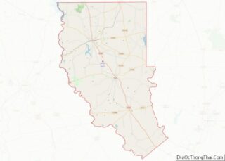
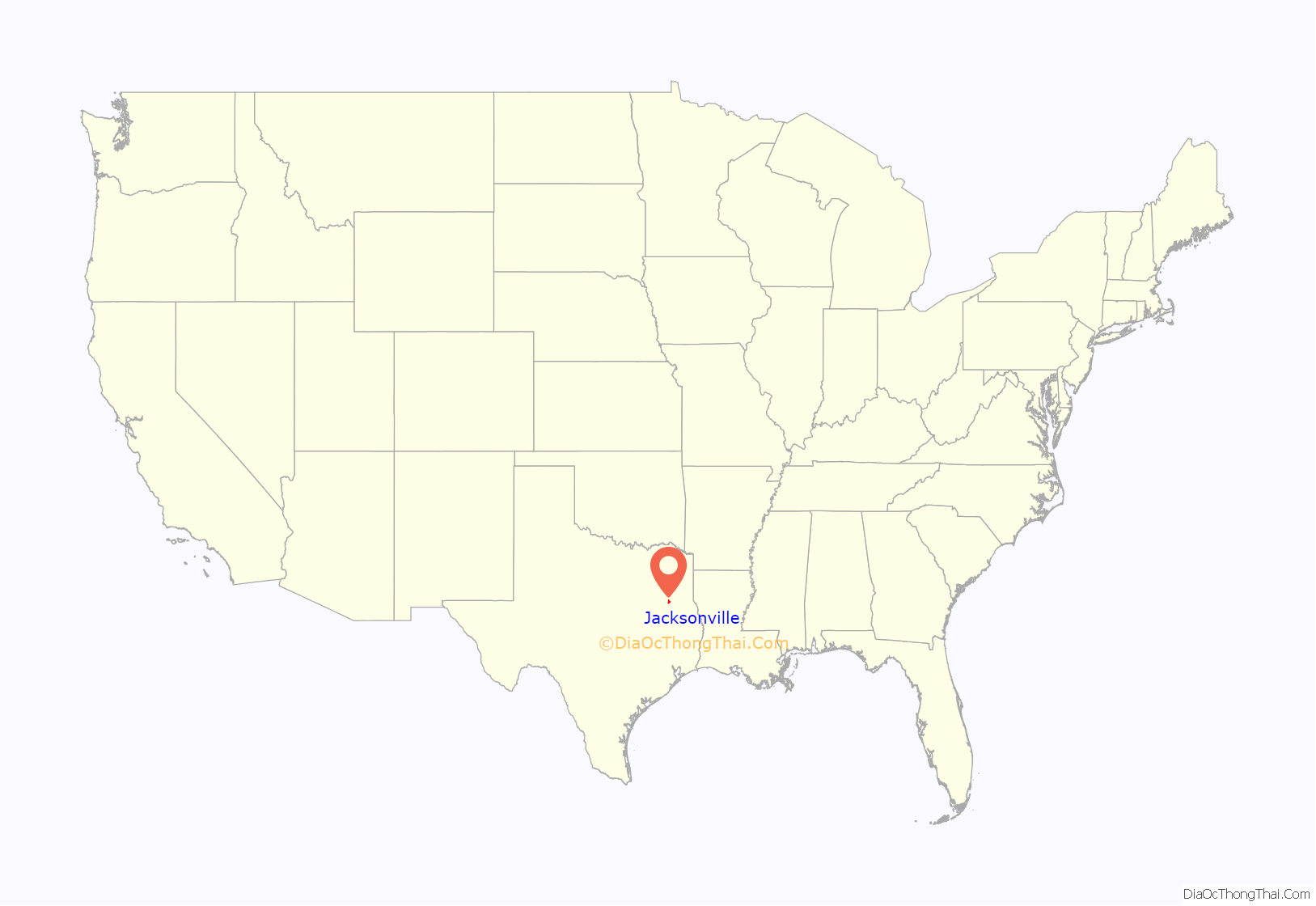
Jacksonville location map. Where is Jacksonville city?
History
Jacksonville began in 1847 as the town of Gum Creek. Jackson Smith built a home and blacksmith shop in the area, and became postmaster in 1848, when a post office was authorized. Shortly afterward, Dr. William Jackson established an office near Smith’s shop. When the townsite was laid out in 1850, the name Jacksonville was chosen in honor of these two men. The name of the post office was changed from Gum Creek to Jacksonville in June 1850.
Despite never having organized unions in any Walmart stores before, meatcutters working at the Jacksonville Walmart voted in favor of organizing under the wing of the United Food and Commercial Workers union in February 2000. During a flurry of subsequent legal actions, Walmart discontinued store-level meatcutting and started shipping in pre-packaged/pre-frozen meat to their stores. When all the hearings and appeals were exhausted, it was decided that the local meatcutters didn’t embody the characteristics of a group that could bargain since they weren’t specialized. Even now, there is no one in the Jacksonville meat department to make special cuts of meat or any union presence there.
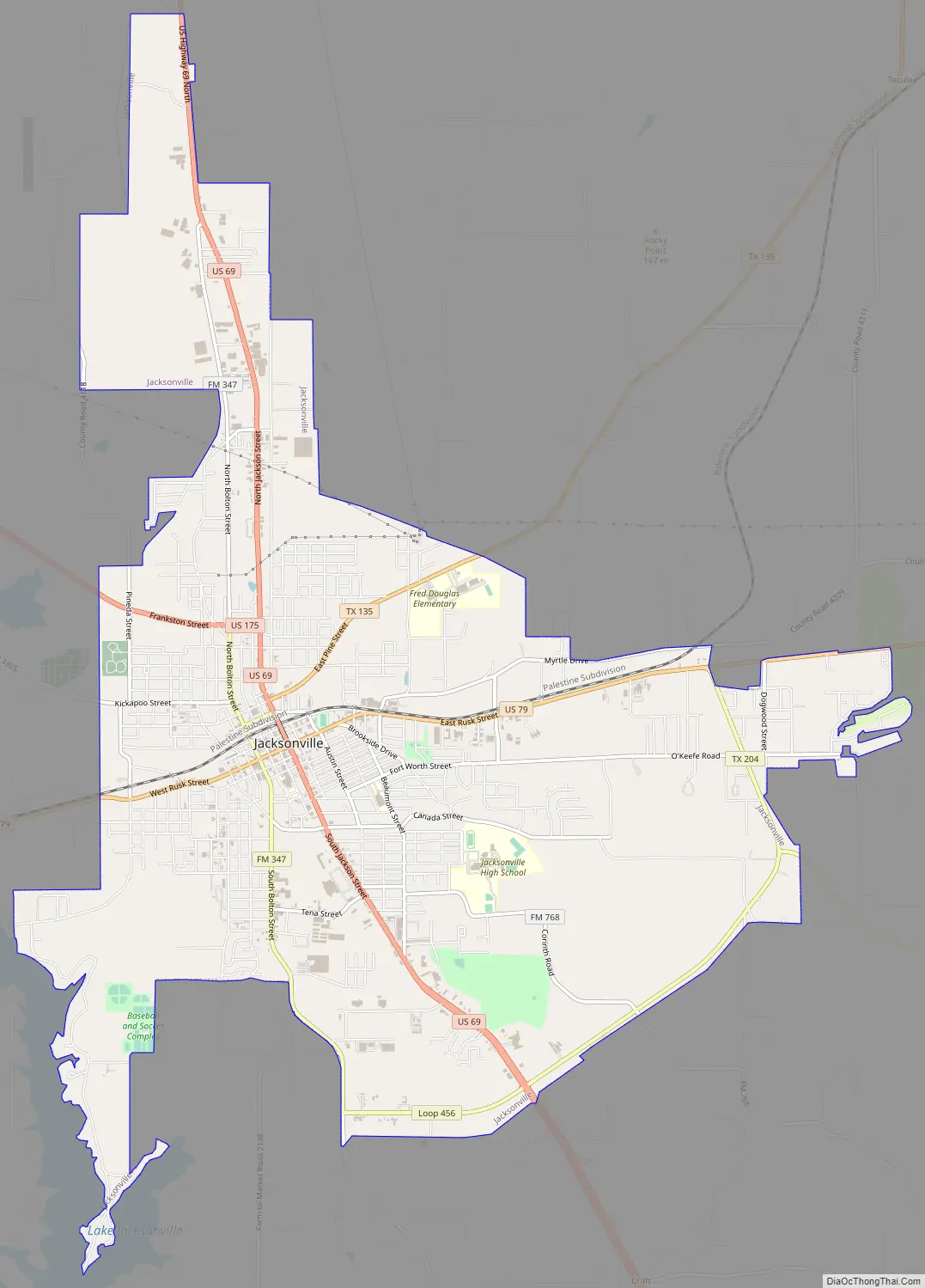
Jacksonville Road Map
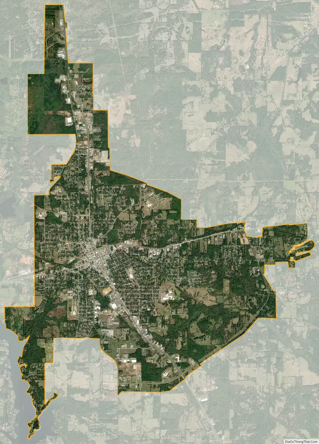
Jacksonville city Satellite Map
Geography
Jacksonville is located a 31°57′49″N 95°16′07″W / 31.963525°N 95.268629°W / 31.963525; -95.268629.
According to the United States Census Bureau, the city has a total area of 14.1 square miles (37 km), of which 14.1 square miles (37 km) is land and 0.07% is water.
Lake Jacksonville
Lake Jacksonville is three miles (5 km) southwest of Jacksonville. It is the city’s primary water source. It is a popular location for recreation and residences. It was created in 1957 and the city expected it to take years to fill with water from the surrounding creeks. But, with an unusually rainy season, the lake reached full capacity in a year.
- Lake characteristics
Climate
With records only dating to 1953, Jacksonville was one a few Texas locations to have its all time low occur during the 2021 Texas power crisis cold snap in February 2021.
See also
Map of Texas State and its subdivision:- Anderson
- Andrews
- Angelina
- Aransas
- Archer
- Armstrong
- Atascosa
- Austin
- Bailey
- Bandera
- Bastrop
- Baylor
- Bee
- Bell
- Bexar
- Blanco
- Borden
- Bosque
- Bowie
- Brazoria
- Brazos
- Brewster
- Briscoe
- Brooks
- Brown
- Burleson
- Burnet
- Caldwell
- Calhoun
- Callahan
- Cameron
- Camp
- Carson
- Cass
- Castro
- Chambers
- Cherokee
- Childress
- Clay
- Cochran
- Coke
- Coleman
- Collin
- Collingsworth
- Colorado
- Comal
- Comanche
- Concho
- Cooke
- Coryell
- Cottle
- Crane
- Crockett
- Crosby
- Culberson
- Dallam
- Dallas
- Dawson
- Deaf Smith
- Delta
- Denton
- Dewitt
- Dickens
- Dimmit
- Donley
- Duval
- Eastland
- Ector
- Edwards
- El Paso
- Ellis
- Erath
- Falls
- Fannin
- Fayette
- Fisher
- Floyd
- Foard
- Fort Bend
- Franklin
- Freestone
- Frio
- Gaines
- Galveston
- Garza
- Gillespie
- Glasscock
- Goliad
- Gonzales
- Gray
- Grayson
- Gregg
- Grimes
- Guadalupe
- Hale
- Hall
- Hamilton
- Hansford
- Hardeman
- Hardin
- Harris
- Harrison
- Hartley
- Haskell
- Hays
- Hemphill
- Henderson
- Hidalgo
- Hill
- Hockley
- Hood
- Hopkins
- Houston
- Howard
- Hudspeth
- Hunt
- Hutchinson
- Irion
- Jack
- Jackson
- Jasper
- Jeff Davis
- Jefferson
- Jim Hogg
- Jim Wells
- Johnson
- Jones
- Karnes
- Kaufman
- Kendall
- Kenedy
- Kent
- Kerr
- Kimble
- King
- Kinney
- Kleberg
- Knox
- La Salle
- Lamar
- Lamb
- Lampasas
- Lavaca
- Lee
- Leon
- Liberty
- Limestone
- Lipscomb
- Live Oak
- Llano
- Loving
- Lubbock
- Lynn
- Madison
- Marion
- Martin
- Mason
- Matagorda
- Maverick
- McCulloch
- McLennan
- McMullen
- Medina
- Menard
- Midland
- Milam
- Mills
- Mitchell
- Montague
- Montgomery
- Moore
- Morris
- Motley
- Nacogdoches
- Navarro
- Newton
- Nolan
- Nueces
- Ochiltree
- Oldham
- Orange
- Palo Pinto
- Panola
- Parker
- Parmer
- Pecos
- Polk
- Potter
- Presidio
- Rains
- Randall
- Reagan
- Real
- Red River
- Reeves
- Refugio
- Roberts
- Robertson
- Rockwall
- Runnels
- Rusk
- Sabine
- San Augustine
- San Jacinto
- San Patricio
- San Saba
- Schleicher
- Scurry
- Shackelford
- Shelby
- Sherman
- Smith
- Somervell
- Starr
- Stephens
- Sterling
- Stonewall
- Sutton
- Swisher
- Tarrant
- Taylor
- Terrell
- Terry
- Throckmorton
- Titus
- Tom Green
- Travis
- Trinity
- Tyler
- Upshur
- Upton
- Uvalde
- Val Verde
- Van Zandt
- Victoria
- Walker
- Waller
- Ward
- Washington
- Webb
- Wharton
- Wheeler
- Wichita
- Wilbarger
- Willacy
- Williamson
- Wilson
- Winkler
- Wise
- Wood
- Yoakum
- Young
- Zapata
- Zavala
- Alabama
- Alaska
- Arizona
- Arkansas
- California
- Colorado
- Connecticut
- Delaware
- District of Columbia
- Florida
- Georgia
- Hawaii
- Idaho
- Illinois
- Indiana
- Iowa
- Kansas
- Kentucky
- Louisiana
- Maine
- Maryland
- Massachusetts
- Michigan
- Minnesota
- Mississippi
- Missouri
- Montana
- Nebraska
- Nevada
- New Hampshire
- New Jersey
- New Mexico
- New York
- North Carolina
- North Dakota
- Ohio
- Oklahoma
- Oregon
- Pennsylvania
- Rhode Island
- South Carolina
- South Dakota
- Tennessee
- Texas
- Utah
- Vermont
- Virginia
- Washington
- West Virginia
- Wisconsin
- Wyoming