Iraan (/ˌaɪrəˈæn/ EYE-rə-AN) is a city in Pecos County, Texas, United States. Its population was 1,229 at the 2010 census. The city’s name is an amalgamation of the first names of Ira and Ann Yates, owners of the ranch land upon which the town was built.
| Name: | Iraan city |
|---|---|
| LSAD Code: | 25 |
| LSAD Description: | city (suffix) |
| State: | Texas |
| County: | Pecos County |
| Elevation: | 2,221 ft (677 m) |
| Total Area: | 0.62 sq mi (1.60 km²) |
| Land Area: | 0.62 sq mi (1.60 km²) |
| Water Area: | 0.00 sq mi (0.00 km²) |
| Total Population: | 1,229 |
| Population Density: | 1,980.55/sq mi (764.95/km²) |
| ZIP code: | 79744 |
| Area code: | 432 |
| FIPS code: | 4836128 |
| GNISfeature ID: | 1360022 |
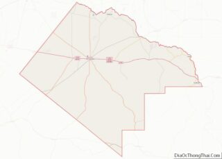
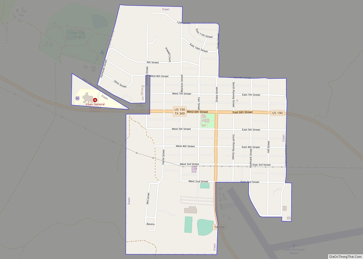
Online Interactive Map
Click on ![]() to view map in "full screen" mode.
to view map in "full screen" mode.
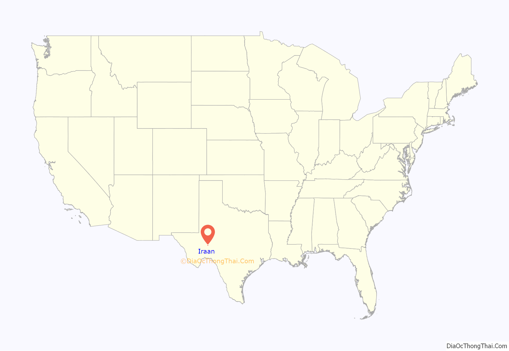
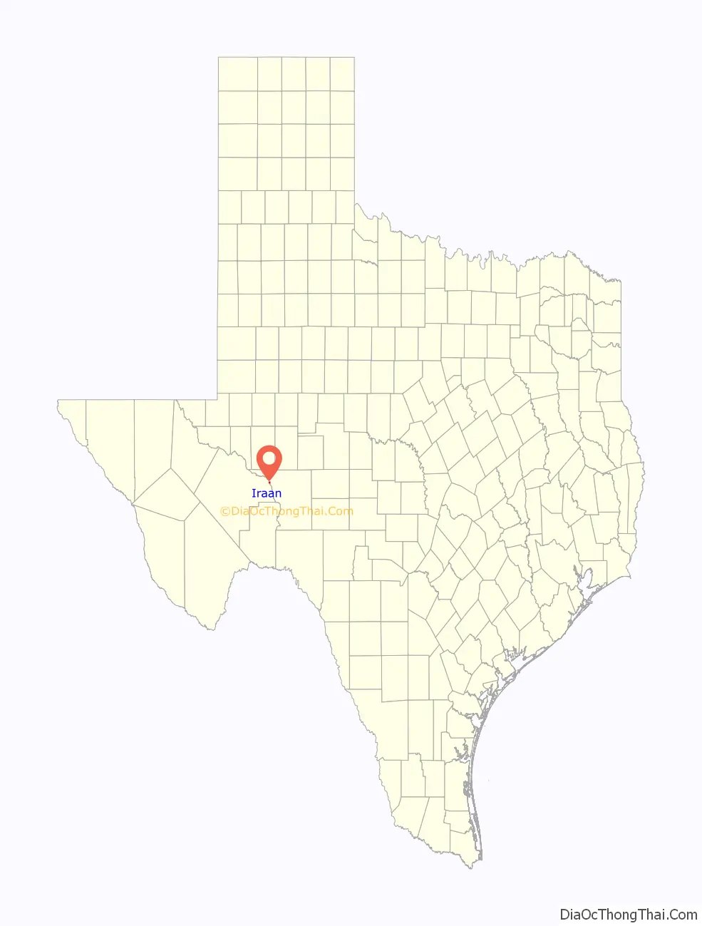
Iraan location map. Where is Iraan city?
History
Iraan was an oil boom town, and it developed quickly after the discovery of the gigantic Yates Oil Field, which is adjacent to the town on the southwest. The oil field was discovered in 1926, and the first buildings in town were basic housing and infrastructure for workers on the field, all built by the Big Lake Oil Company, which became Plymouth Oil Company, which was purchased by the Ohio Oil Company, then purchased by Marathon Oil Company, and owned today by Kinder Morgan. By 1927, the town included a school, and the post office appeared in 1928. The population of the town in 1930 was about 1,600. About 3 mi (5 km) south of Iraan was the oil boomtown of Redbarn, which appeared almost immediately after discovery of the oil field, before Iraan itself. It was a collection of tents and shanties in the immediate vicinity of Ira Yates’s ranch. Yates donated 152 acres (0.62 km) of his ranch to the town of Iraan to encourage further development there, and in 1952, the town of Redbarn, which never had a permanent population more than 75, was finally abandoned.
One of Iraan’s most famous residents was V.T. Hamlin, the creator of the comic strip Alley Oop. Originally from Iowa, he worked in Iraan during the oil boom period of the late 1920s, and he either got the idea for the strip or created its earliest drafts there; the strip was first published in 1932 in Des Moines. He moved back to Iowa in 1929 and later to Florida. A park in Iraan is named after the strip.
In 2021, Jason Rybolt, the CEO of Iraan General Hospital, stated that Iraan had a 42% positivity rate of COVID-19. Rosa Flores and Ashley Killough of CNN described the town as being hard hit by the COVID-19 pandemic in Texas in 2021.
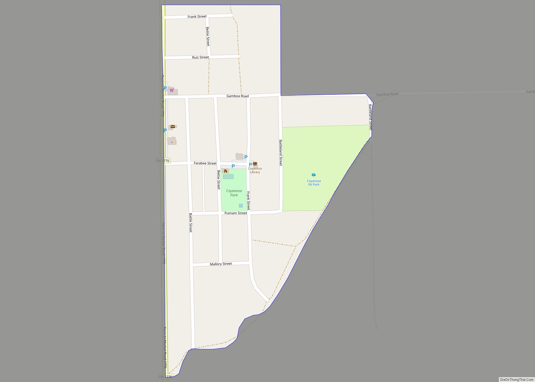
Iraan Road Map
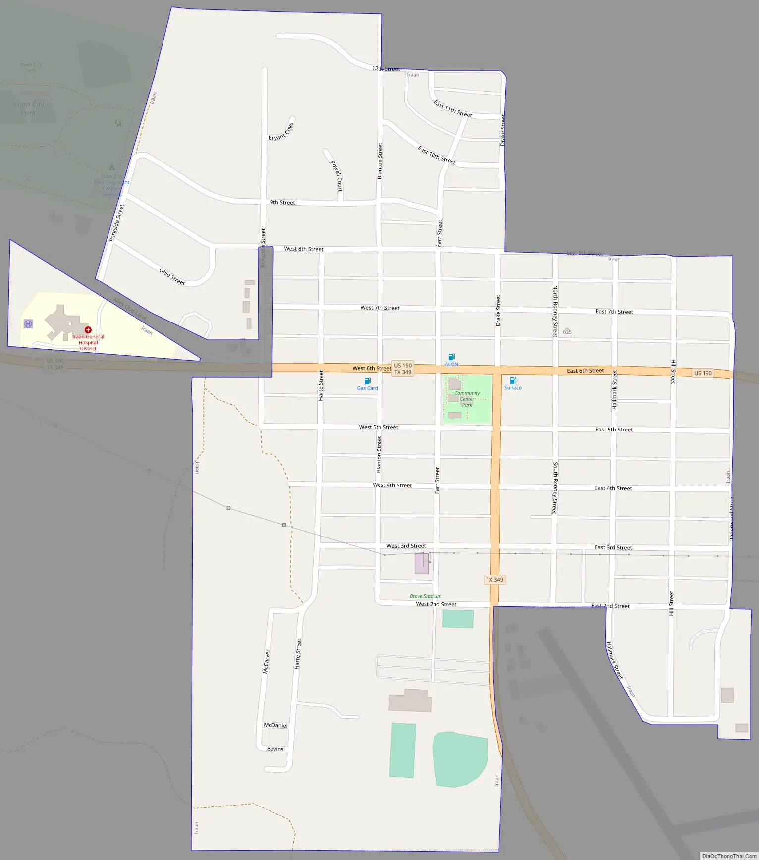
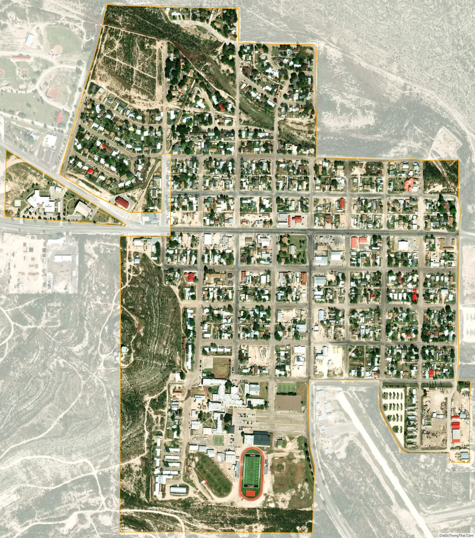
Iraan city Satellite Map
Geography
Iraan is located at 30°54′49″N 101°53′55″W / 30.91361°N 101.89861°W / 30.91361; -101.89861 (30.913511, –101.898614). According to the United States Census Bureau, the city has a total area of 0.6 square miles (1.6 km), all land. State Highway 349 and U.S. Highway 190 converge at Iraan. The Pecos River loops around the town to the north and east.
Climate
According to the Köppen climate classification system, Iraan has a semiarid climate, BSk on climate maps.
See also
Map of Texas State and its subdivision:- Anderson
- Andrews
- Angelina
- Aransas
- Archer
- Armstrong
- Atascosa
- Austin
- Bailey
- Bandera
- Bastrop
- Baylor
- Bee
- Bell
- Bexar
- Blanco
- Borden
- Bosque
- Bowie
- Brazoria
- Brazos
- Brewster
- Briscoe
- Brooks
- Brown
- Burleson
- Burnet
- Caldwell
- Calhoun
- Callahan
- Cameron
- Camp
- Carson
- Cass
- Castro
- Chambers
- Cherokee
- Childress
- Clay
- Cochran
- Coke
- Coleman
- Collin
- Collingsworth
- Colorado
- Comal
- Comanche
- Concho
- Cooke
- Coryell
- Cottle
- Crane
- Crockett
- Crosby
- Culberson
- Dallam
- Dallas
- Dawson
- Deaf Smith
- Delta
- Denton
- Dewitt
- Dickens
- Dimmit
- Donley
- Duval
- Eastland
- Ector
- Edwards
- El Paso
- Ellis
- Erath
- Falls
- Fannin
- Fayette
- Fisher
- Floyd
- Foard
- Fort Bend
- Franklin
- Freestone
- Frio
- Gaines
- Galveston
- Garza
- Gillespie
- Glasscock
- Goliad
- Gonzales
- Gray
- Grayson
- Gregg
- Grimes
- Guadalupe
- Hale
- Hall
- Hamilton
- Hansford
- Hardeman
- Hardin
- Harris
- Harrison
- Hartley
- Haskell
- Hays
- Hemphill
- Henderson
- Hidalgo
- Hill
- Hockley
- Hood
- Hopkins
- Houston
- Howard
- Hudspeth
- Hunt
- Hutchinson
- Irion
- Jack
- Jackson
- Jasper
- Jeff Davis
- Jefferson
- Jim Hogg
- Jim Wells
- Johnson
- Jones
- Karnes
- Kaufman
- Kendall
- Kenedy
- Kent
- Kerr
- Kimble
- King
- Kinney
- Kleberg
- Knox
- La Salle
- Lamar
- Lamb
- Lampasas
- Lavaca
- Lee
- Leon
- Liberty
- Limestone
- Lipscomb
- Live Oak
- Llano
- Loving
- Lubbock
- Lynn
- Madison
- Marion
- Martin
- Mason
- Matagorda
- Maverick
- McCulloch
- McLennan
- McMullen
- Medina
- Menard
- Midland
- Milam
- Mills
- Mitchell
- Montague
- Montgomery
- Moore
- Morris
- Motley
- Nacogdoches
- Navarro
- Newton
- Nolan
- Nueces
- Ochiltree
- Oldham
- Orange
- Palo Pinto
- Panola
- Parker
- Parmer
- Pecos
- Polk
- Potter
- Presidio
- Rains
- Randall
- Reagan
- Real
- Red River
- Reeves
- Refugio
- Roberts
- Robertson
- Rockwall
- Runnels
- Rusk
- Sabine
- San Augustine
- San Jacinto
- San Patricio
- San Saba
- Schleicher
- Scurry
- Shackelford
- Shelby
- Sherman
- Smith
- Somervell
- Starr
- Stephens
- Sterling
- Stonewall
- Sutton
- Swisher
- Tarrant
- Taylor
- Terrell
- Terry
- Throckmorton
- Titus
- Tom Green
- Travis
- Trinity
- Tyler
- Upshur
- Upton
- Uvalde
- Val Verde
- Van Zandt
- Victoria
- Walker
- Waller
- Ward
- Washington
- Webb
- Wharton
- Wheeler
- Wichita
- Wilbarger
- Willacy
- Williamson
- Wilson
- Winkler
- Wise
- Wood
- Yoakum
- Young
- Zapata
- Zavala
- Alabama
- Alaska
- Arizona
- Arkansas
- California
- Colorado
- Connecticut
- Delaware
- District of Columbia
- Florida
- Georgia
- Hawaii
- Idaho
- Illinois
- Indiana
- Iowa
- Kansas
- Kentucky
- Louisiana
- Maine
- Maryland
- Massachusetts
- Michigan
- Minnesota
- Mississippi
- Missouri
- Montana
- Nebraska
- Nevada
- New Hampshire
- New Jersey
- New Mexico
- New York
- North Carolina
- North Dakota
- Ohio
- Oklahoma
- Oregon
- Pennsylvania
- Rhode Island
- South Carolina
- South Dakota
- Tennessee
- Texas
- Utah
- Vermont
- Virginia
- Washington
- West Virginia
- Wisconsin
- Wyoming