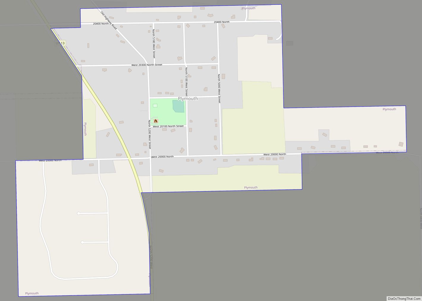
Map of Marysvale town

Map of Marysvale town

Marysvale is a town in Piute County, Utah, United States. The population was 408 at the 2010 census. Marysvale is a trail head for the Paiute ATV Trail. Marysvale town overview: Name: Marysvale town LSAD Code: 43 LSAD Description: town (suffix) State: Utah County: Piute County Incorporated: 1913 Elevation: 5,863 ft (1,787 m) Total Area: 17.99 sq mi (46.60 km²) … Read more

Map of Marriott-Slaterville city

Map of Marriott-Slaterville city

Marriott-Slaterville is a city in Weber County, Utah, United States. The population was 1,701 at the 2010 census. It is part of the Ogden–Clearfield, Utah Metropolitan Statistical Area. The city was incorporated in July 1999, in a merger of the previously unincorporated communities of Marriott and Slaterville. Marriott-Slaterville city overview: Name: Marriott-Slaterville city LSAD Code: … Read more

Map of Marion CDP, Utah

Map of Marion CDP, Utah

Marion is a census-designated place in Summit County, Utah, United States. The population was 685, according to the 2010 census. Marion CDP overview: Name: Marion CDP LSAD Code: 57 LSAD Description: CDP (suffix) State: Utah County: Summit County Elevation: 6,443 ft (1,964 m) Total Area: 5.8 sq mi (15 km²) Land Area: 5.8 sq mi (15 km²) Water Area: 0.0 sq mi (0 km²) Total Population: … Read more

Map of Mapleton city, Utah

Map of Mapleton city, Utah

Mapleton is a city in Utah County, Utah, United States. It is part of the Provo–Orem Metropolitan Statistical Area. The population was 11,365 at the 2020 census. Mapleton city overview: Name: Mapleton city LSAD Code: 25 LSAD Description: city (suffix) State: Utah County: Utah County Incorporated: September 3, 1901 (town) April 1, 1948 (city) Elevation: … Read more

Map of Mantua town, Utah

Map of Mantua town, Utah

Mantua (/ˈmæntəweɪ/ MAN-tə-way or /ˈmænəweɪ/ MAN-ə-way) is a town on the eastern edge Box Elder County, Utah, United States. The population of the town was 687 at the 2010 census. Mantua town overview: Name: Mantua town LSAD Code: 43 LSAD Description: town (suffix) State: Utah County: Box Elder County Incorporated: 1911 Elevation: 5,200 ft (1,600 m) Total … Read more

Map of Manti city

Map of Manti city

Manti (/ˈmæntaɪ/ MAN-ty) is a city in and the county seat of Sanpete County, Utah, United States. The population was 3,276 at the 2010 United States Census. Manti city overview: Name: Manti city LSAD Code: 25 LSAD Description: city (suffix) State: Utah County: Sanpete County Founded: 1849 Incorporated: 1851 Elevation: 5,611 ft (1,710 m) Total Area: 3.15 sq mi … Read more

Map of Manila town, Utah

Map of Manila town, Utah

Manila is a small city located on the northern edge of Daggett County, Utah, United States, just south of the Wyoming border. The town is at the junction of State Route 43 and State Route 44, and is the county seat of Daggett County. Nearby sites include the Flaming Gorge National Recreation Area and the … Read more

Map of Magna metro township

Map of Magna metro township

Magna (/ˈmæɡnə/ MAG-nə) is a metro township in Salt Lake County, Utah, United States. The current population of the township stands at 29,251 according to the 2020 census, a 10.4% increase over 26,505 in 2010. Magna metro township overview: Name: Magna metro township LSAD Code: 35 LSAD Description: metro township State: Utah County: Salt Lake … Read more

Map of Maeser CDP

Map of Maeser CDP

Maeser (/ˈmeɪzər/ MAY-zər) is a census-designated place (CDP) in Uintah County, Utah, United States. The population was 2,855 at the 2000 census, a small increase over the 1990 figure of 2,598. The village is named after Karl Maeser, an educator. Maeser CDP overview: Name: Maeser CDP LSAD Code: 57 LSAD Description: CDP (suffix) State: Utah … Read more

Map of Lynndyl town

Map of Lynndyl town

Lynndyl is a town in Millard County, Utah, United States. The population was 106 at the 2010 census. Lynndyl town overview: Name: Lynndyl town LSAD Code: 43 LSAD Description: town (suffix) State: Utah County: Millard County Founded: 1907 Incorporated: 1945 Elevation: 4,787 ft (1,459 m) Total Area: 3.12 sq mi (8.08 km²) Land Area: 3.12 sq mi (8.08 km²) Water Area: 0.00 sq mi (0.00 km²) … Read more

Map of Mexican Hat CDP

Map of Mexican Hat CDP

Mexican Hat is a census-designated place (CDP) in Utah in the United States. It is on the San Juan River on the northern edge of the Navajo Nation’s borders in south-central San Juan County. The population was 31 in the 2010 census, a sharp decline from the previous two censuses. Mexican Hat CDP overview: Name: … Read more

Map of Mendon city, Utah

Map of Mendon city, Utah

Mendon (/ˈmɛndən/ MEN-dən) is a city in Cache County, Utah, United States. The population was 1,282 at the 2010 census. It is included in the Logan, Utah-Idaho Metropolitan Statistical Area. Mendon city overview: Name: Mendon city LSAD Code: 25 LSAD Description: city (suffix) State: Utah County: Cache County Elevation: 4,495 ft (1,370 m) Total Area: 1.43 sq mi (3.71 km²) … Read more