Pleasant Grove, originally named Battle Creek, is a city in Utah County, Utah, United States, known as “Utah’s City of Trees”. It is part of the Provo–Orem Metropolitan Statistical Area. The population was 37,726 at the 2020 Census.
| Name: | Pleasant Grove city |
|---|---|
| LSAD Code: | 25 |
| LSAD Description: | city (suffix) |
| State: | Utah |
| County: | Utah County |
| Incorporated: | January 18, 1855 |
| Elevation: | 4,623 ft (1,409 m) |
| Total Area: | 9.18 sq mi (23.77 km²) |
| Land Area: | 9.18 sq mi (23.77 km²) |
| Water Area: | 0.00 sq mi (0.00 km²) |
| Total Population: | 37,726 |
| Population Density: | 4,100/sq mi (1,600/km²) |
| ZIP code: | 84062 |
| Area code: | 385, 801 |
| FIPS code: | 4960930 |
| GNISfeature ID: | 1444479 |
| Website: | www.plgrove.org |
Online Interactive Map
Click on ![]() to view map in "full screen" mode.
to view map in "full screen" mode.
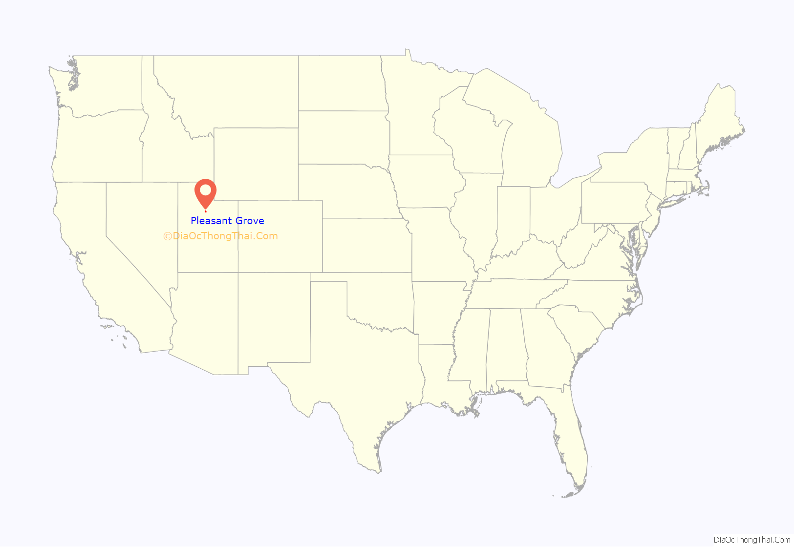
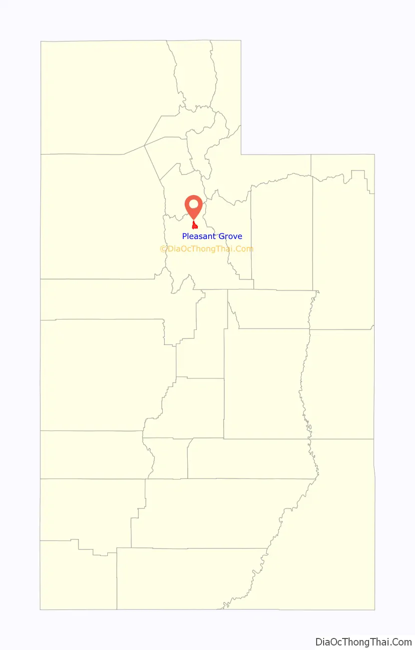
Pleasant Grove location map. Where is Pleasant Grove city?
History
Settlement and incorporation
On July 19, 1850, William H. Adams, John Mercer and Philo T. Farnsworth, Mormon pioneers sent by Brigham Young, arrived at the area now known as Pleasant Grove and staked out farms in what is now the southwest corner of the city. A small community was established September 13, 1850, consisting of George S. Clark and his wife, Susannah Dalley Clark, Richard and Ann Elizabeth Sheffer Clark, John Greenleaf Holman and Nancy Clark Holman, Lewis Harvey and his wife Lucinda Clark Harvey, Johnathan Harvey and Sarah Herbert Harvey, Charles Price and wife and child, Widow Harriet Marler and children, John Wilson, Ezekiel Holman, and possibly one or two others, relatives of those mentioned. Of note, William Fletcher and Anne Hawley Reynolds in 1852 brought Ellis Reynolds Shipp to live, which Shipp became the legendary MD, Obstetrician, and Pediatrician, through the young women’s midwife training program of Dr. Richards and Eliza Snow, beginning her training in young women’s MIA in Pleasant Grove. Pleasant Grove was officially incorporated as a town January 18, 1855, by which time the settlement had grown to 623 people.
Early relations with Native Americans
The original name of the city was Battle Creek. It was named for a massacre which took place there in 1849 between Mormon settlers and a small band of Ute Indians, wherein all the male Utes were massacred when Brigham Young believed the natives had stolen some of his horses (which were found before the attack on the Utes occurred). The settlers later decided they needed a more uplifting name and began calling their town Pleasant Grove after a grove of cottonwood trees located between Battle Creek and Grove Creek, near the current-day intersection of Locust Avenue and Battle Creek Drive. A monument with a plaque describing this battle is located at Kiwanis Park, at the mouth of Battle Creek Canyon.
During the Walker Indian War in the 1850s, citizens built a fort with walls two or three feet thick and six feet tall that occupied an area the size of sixteen city blocks. The settlers in the area at the time built homes inside the fort. While the fort no longer stands, memorial cornerstones were erected by local historians. The northeast monument was erected near the intersection of 100 North and 300 East streets. The northwest monument was erected four blocks west of that point at 100 West Street and the southeast monument erected four blocks south at 300 South Street. The southwest monument would have been located near 300 South 100 West, the area is now occupied by a large parking lot and retail store.
Recent events
This city was one of the filming locations for Universal’s 1995 film Gold Diggers: The Secret of Bear Mountain. Also some filming of Stephen King’s “The Stand”.
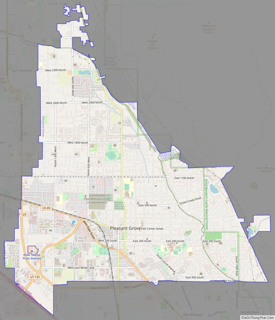
Pleasant Grove Road Map
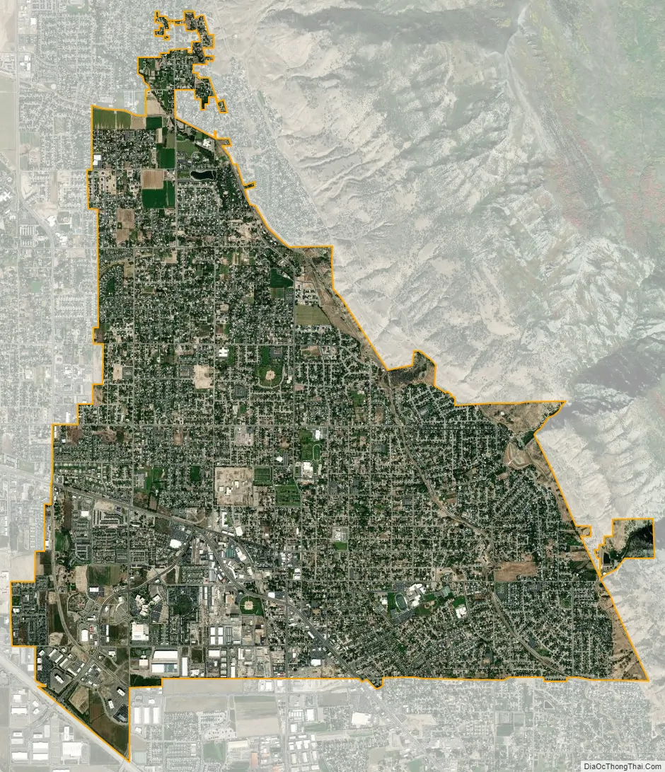
Pleasant Grove city Satellite Map
Geography
According to the United States Census Bureau, the city has a total area of 9.2 square miles (23.7 km), all land. Sloping off the Mt. Timpanogos bench, Pleasant Grove is represented by a large, white hillside letter “G” just above the city. A small distance south on Battle Creek Canyon is the creek of the same name and 50 feet (15 m) tall Battle Creek Falls.
Climate
Pleasant Grove’s climate features cold winters and hot, dry summers. Under the Köppen climate classification, Pleasant Grove has a hot-summer Mediterranean climate (Csa).
See also
Map of Utah State and its subdivision: Map of other states:- Alabama
- Alaska
- Arizona
- Arkansas
- California
- Colorado
- Connecticut
- Delaware
- District of Columbia
- Florida
- Georgia
- Hawaii
- Idaho
- Illinois
- Indiana
- Iowa
- Kansas
- Kentucky
- Louisiana
- Maine
- Maryland
- Massachusetts
- Michigan
- Minnesota
- Mississippi
- Missouri
- Montana
- Nebraska
- Nevada
- New Hampshire
- New Jersey
- New Mexico
- New York
- North Carolina
- North Dakota
- Ohio
- Oklahoma
- Oregon
- Pennsylvania
- Rhode Island
- South Carolina
- South Dakota
- Tennessee
- Texas
- Utah
- Vermont
- Virginia
- Washington
- West Virginia
- Wisconsin
- Wyoming


