Alderson is a town in Greenbrier and Monroe counties in the U.S. state of West Virginia, on both sides of the Greenbrier River. The population was 975 at the 2020 census.
| Name: | Alderson town |
|---|---|
| LSAD Code: | 43 |
| LSAD Description: | town (suffix) |
| State: | West Virginia |
| County: | Greenbrier County, Monroe County |
| Elevation: | 1,549 ft (472 m) |
| Total Area: | 0.95 sq mi (2.47 km²) |
| Land Area: | 0.89 sq mi (2.31 km²) |
| Water Area: | 0.06 sq mi (0.16 km²) |
| Total Population: | 975 |
| Population Density: | 1,258.39/sq mi (485.96/km²) |
| ZIP code: | 24910 |
| Area code: | 304 |
| FIPS code: | 5400772 |
| GNISfeature ID: | 2390700 |
| Website: | aldersonwv.org |
Online Interactive Map
Click on ![]() to view map in "full screen" mode.
to view map in "full screen" mode.
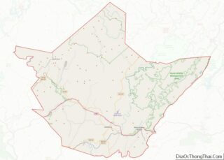
Alderson location map. Where is Alderson town?


History
Alderson is a community located along the Greenbrier River in Greenbrier County and Monroe County, incorporated in 1881. Alderson was originally settled in 1777 by “Elder” John Alderson, a frontier missionary for whom the town is named, who organized the first Baptist church in the Greenbrier Valley. In 1763, the nearby Muddy Creek settlements were destroyed by Shawnee Indians under Chief Cornstalk. Alderson is the location of the Federal Reformatory for Women, opened in 1927, the first federal prison for women. During the early 1900s, Alderson became a hub of higher education in the state. It was home to three separate institutions of higher education, including the Alderson Academy and Junior College, which eventually was integrated into Alderson-Broaddus College in 1932.
The Alexander McVeigh Miller House in Greenbrier County is listed on the National Register of Historic Places, as is Sunset Hill in Monroe County. The Alderson Bridge and Alderson Historic District are located in both counties.
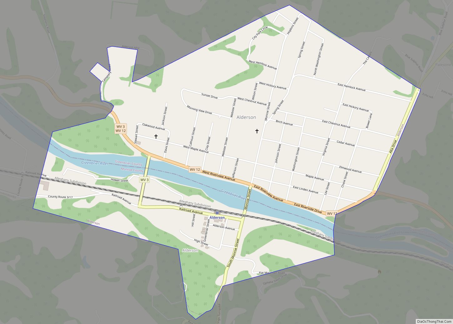
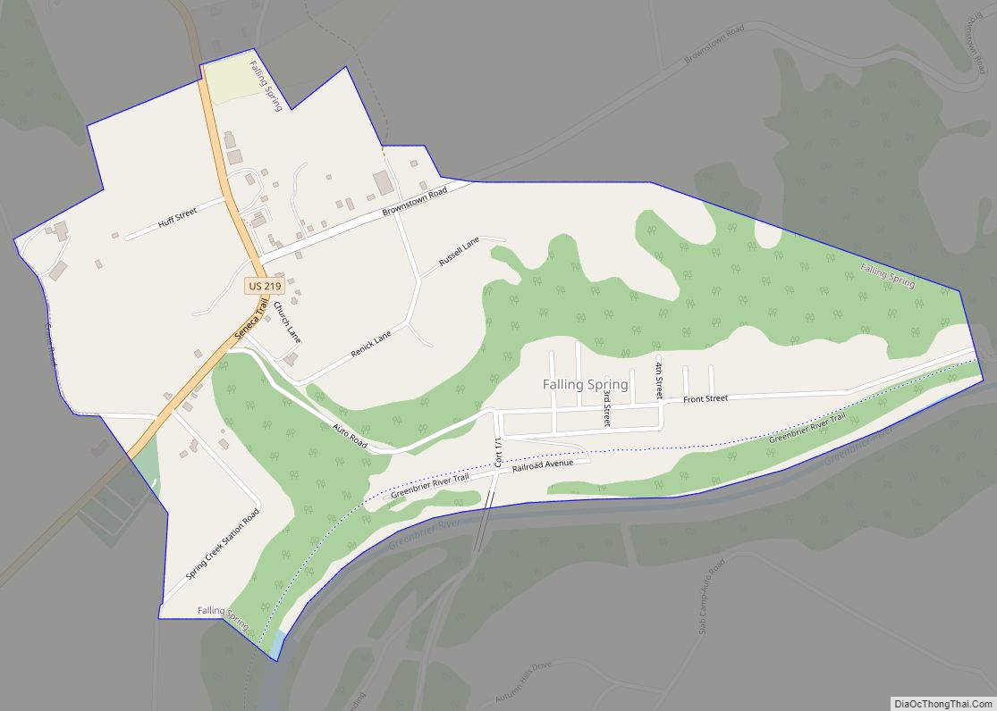
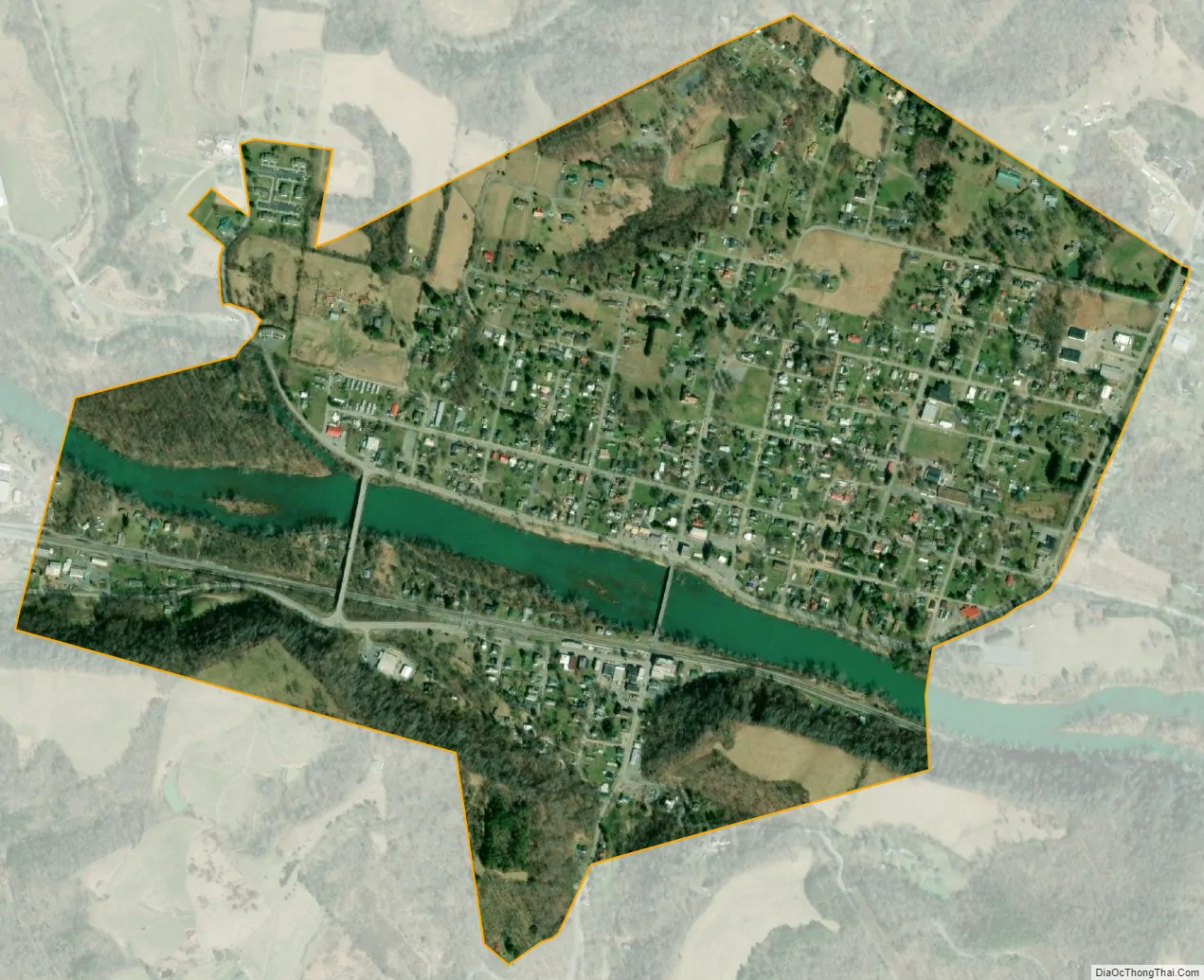
Alderson Road Map

Alderson city Satellite Map
Geography
According to the United States Census Bureau, the town has a total area of 0.95 square miles (2.46 km), of which 0.89 square miles (2.31 km) is land and 0.06 square miles (0.16 km) is water.
See also
Map of West Virginia State and its subdivision:- Barbour
- Berkeley
- Boone
- Braxton
- Brooke
- Cabell
- Calhoun
- Clay
- Doddridge
- Fayette
- Gilmer
- Grant
- Greenbrier
- Hampshire
- Hancock
- Hardy
- Harrison
- Jackson
- Jefferson
- Kanawha
- Lewis
- Lincoln
- Logan
- Marion
- Marshall
- Mason
- McDowell
- Mercer
- Mineral
- Mingo
- Monongalia
- Monroe
- Morgan
- Nicholas
- Ohio
- Pendleton
- Pleasants
- Pocahontas
- Preston
- Putnam
- Raleigh
- Randolph
- Ritchie
- Roane
- Summers
- Taylor
- Tucker
- Tyler
- Upshur
- Wayne
- Webster
- Wetzel
- Wirt
- Wood
- Wyoming
- Alabama
- Alaska
- Arizona
- Arkansas
- California
- Colorado
- Connecticut
- Delaware
- District of Columbia
- Florida
- Georgia
- Hawaii
- Idaho
- Illinois
- Indiana
- Iowa
- Kansas
- Kentucky
- Louisiana
- Maine
- Maryland
- Massachusetts
- Michigan
- Minnesota
- Mississippi
- Missouri
- Montana
- Nebraska
- Nevada
- New Hampshire
- New Jersey
- New Mexico
- New York
- North Carolina
- North Dakota
- Ohio
- Oklahoma
- Oregon
- Pennsylvania
- Rhode Island
- South Carolina
- South Dakota
- Tennessee
- Texas
- Utah
- Vermont
- Virginia
- Washington
- West Virginia
- Wisconsin
- Wyoming