Map of Leon town, West Virginia
Leon is a town in Mason County, West Virginia, United States, situated along the Kanawha River. The population was 137 at the 2020 census. It is part of the Point Pleasant, WV–OH Micropolitan Statistical Area. Leon town overview: Name: Leon town LSAD Code: 43 LSAD Description: town (suffix) State: West Virginia County: Mason County Elevation: ... Read more
Map of Leon town, West Virginia
Map of Lavalette CDP
Lavalette is a census-designated place (CDP) in Wayne County, West Virginia, in the United States. As of the 2010 census, its population was 1,073. Lavalette is located at the intersection of West Virginia Route 152 and West Virginia Route 75, eight miles south of Huntington. The town is near Beech Fork Lake, a popular location ... Read more
Map of Lavalette CDP
Map of Lashmeet CDP
Lashmeet is a census-designated place (CDP) in western Mercer County, West Virginia, United States. It lies along West Virginia Route 10 northwest of the city of Princeton, the county seat of Mercer County. Its elevation is 2,539 feet (774 m). Although Lashmeet is unincorporated, it has a post office, with the ZIP code of 24733. As of ... Read more
Map of Lashmeet CDP
Map of Kingwood city
Kingwood is a city in and the county seat of Preston County, West Virginia, United States. The population was 2,980 at the 2020 census. The city sits within the Allegheny Mountains above the Cheat River valley. It is part of the Morgantown metropolitan area. Kingwood city overview: Name: Kingwood city LSAD Code: 25 LSAD Description: ... Read more
Map of Kingwood city
Map of Kincaid CDP, West Virginia
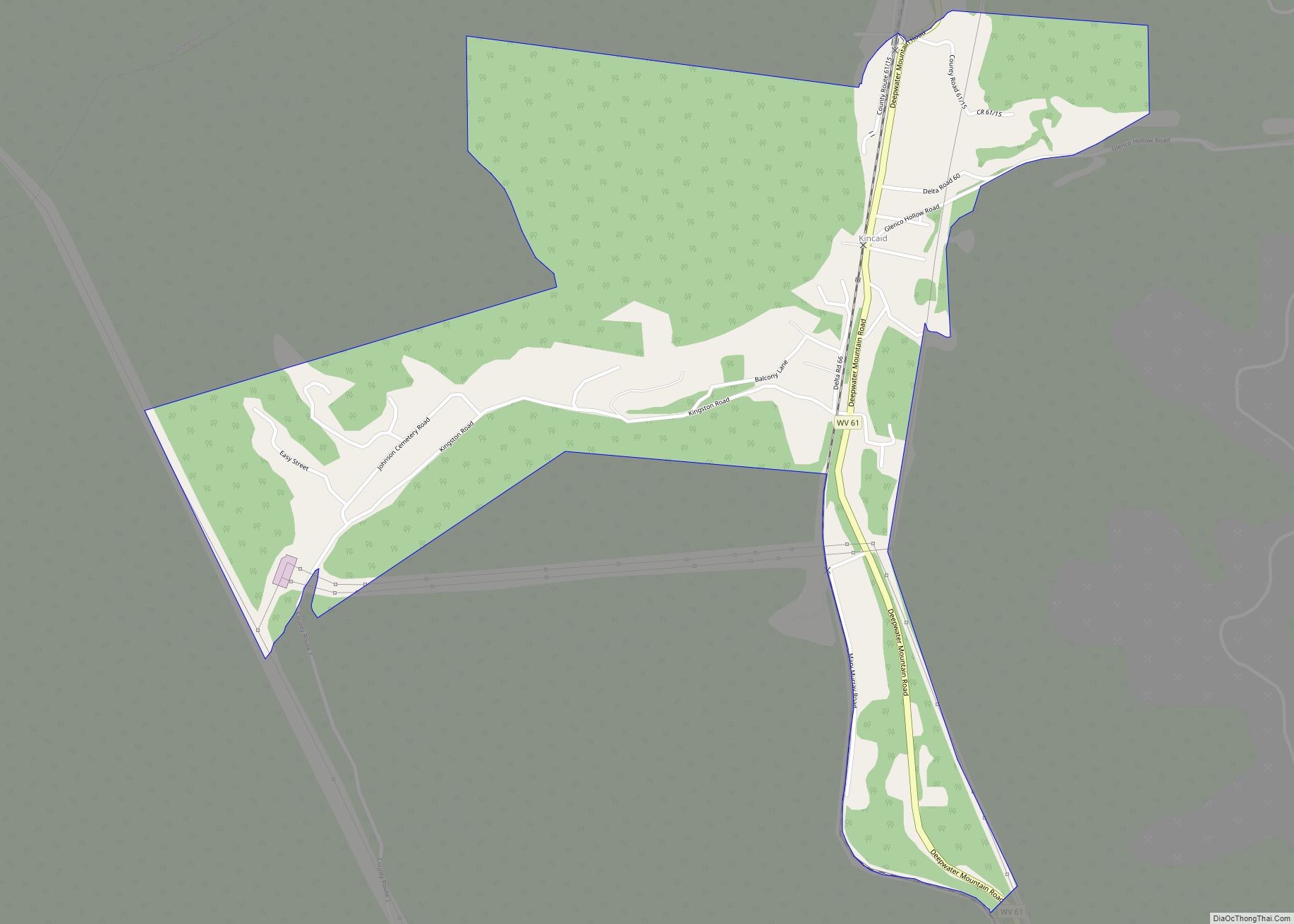
Kincaid is a census-designated place (CDP) in Fayette County, West Virginia, United States. As of the 2010 census, its population was 260. Kincaid is located on West Virginia Route 61,8 miles (13 km) northwest of Oak Hill. Kincaid has a post office with ZIP code 25119. The community was established in 1878. Kincaid CDP overview: Name: ... Read more
Map of Kincaid CDP, West Virginia
Map of Kimberly CDP, West Virginia
Kimberly is a census-designated place (CDP) in Fayette County, West Virginia, United States. It is located along Armstrong Creek shortly before it enters the Kanawha River. As of the 2010 census, its population was 287. It is in zip code 25118. Kimberly CDP overview: Name: Kimberly CDP LSAD Code: 57 LSAD Description: CDP (suffix) State: ... Read more
Map of Kimberly CDP, West Virginia
Map of McConnell CDP
McConnell is an unincorporated community and census-designated place (CDP) in Logan County, West Virginia, United States, on the Guyandotte River. As of the 2010 census, its population was 514. It was established in 1933. The community was named after one Mr. McConnell, a railroad promoter. McConnell CDP overview: Name: McConnell CDP LSAD Code: 57 LSAD ... Read more
Map of McConnell CDP
Map of Maybeury CDP
Maybeury is a census-designated place (CDP) in McDowell County, West Virginia, United States, located on U.S. Route 52 between Northfork and Bramwell. As of the 2010 census, its population was 234. Maybeury was built by Shamokin Coal & Coke Co. circa 1890, and it was named for coal operators James May and William Beury. Maybeury ... Read more
Map of Maybeury CDP
Map of Lubeck CDP
Lubeck is a census-designated place (CDP) in Wood County, West Virginia, United States. It is part of the Parkersburg–Marietta–Vienna, WV-OH Metropolitan Statistical Area. The population was 1,311 at the 2010 census. Though first named Watertown, postmaster Theodore Frederick Henry Slevogt in 1856 changed the name to Lubeck after his hometown in Germany. Lubeck CDP overview: ... Read more
Map of Lubeck CDP
Map of Matoaka town
Matoaka is a census-designated place in Mercer County, West Virginia, United States. The population was 227 at the 2010 census. It is part of the Bluefield, WV-VA micropolitan area which has a population of 107,578. This town is named for Chief Powhatan’s daughter Matoaka who was better known by her nickname “Pocahontas”. Matoaka became an ... Read more
Map of Matoaka town
Map of Logan city, West Virginia
Logan is a city in Logan County, West Virginia, United States, along the Guyandotte River. The population was 1,438 at the 2020 census. It is the county seat of Logan County. Logan city overview: Name: Logan city LSAD Code: 25 LSAD Description: city (suffix) State: West Virginia County: Logan County Elevation: 679 ft (207 m) Total Area: ... Read more
Map of Logan city, West Virginia
Map of Matewan town
Matewan (/ˈmeɪtwɒn/) is a town in Mingo County, West Virginia, United States at the confluence of the Tug Fork River and Mate Creek. The population was 499 at the 2010 census. The Norfolk Southern Railway’s Pocahontas District passes through the town. It was a center of bitter labor coal mining labor conflict in the early ... Read more
Map of Matewan town