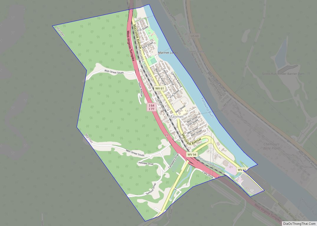
Map of MacArthur CDP
MacArthur is a census-designated place (CDP) in Raleigh County, West Virginia, United States. Originally, it was named Hollywood and renamed MacArthur after General of the Army Douglas MacArthur in 1942. The population was 1,500 at the 2010 census. MacArthur CDP overview: Name: MacArthur CDP LSAD Code: 57 LSAD Description: CDP (suffix) State: West Virginia County: ... Read more
Map of MacArthur CDP
Map of Mabscott town
Mabscott is a town in Raleigh County, West Virginia, United States. The population was 1,333 at the 2020 census. The town’s name is a contraction of the name Mabel Scott, wife of local coal operator Cyrus H. Scott. Mabscott town overview: Name: Mabscott town LSAD Code: 43 LSAD Description: town (suffix) State: West Virginia County: ... Read more
Map of Mabscott town
Map of McConnell CDP
McConnell is an unincorporated community and census-designated place (CDP) in Logan County, West Virginia, United States, on the Guyandotte River. As of the 2010 census, its population was 514. It was established in 1933. The community was named after one Mr. McConnell, a railroad promoter. McConnell CDP overview: Name: McConnell CDP LSAD Code: 57 LSAD ... Read more
Map of McConnell CDP
Map of Maybeury CDP
Maybeury is a census-designated place (CDP) in McDowell County, West Virginia, United States, located on U.S. Route 52 between Northfork and Bramwell. As of the 2010 census, its population was 234. Maybeury was built by Shamokin Coal & Coke Co. circa 1890, and it was named for coal operators James May and William Beury. Maybeury ... Read more
Map of Maybeury CDP
Map of Lubeck CDP
Lubeck is a census-designated place (CDP) in Wood County, West Virginia, United States. It is part of the Parkersburg–Marietta–Vienna, WV-OH Metropolitan Statistical Area. The population was 1,311 at the 2010 census. Though first named Watertown, postmaster Theodore Frederick Henry Slevogt in 1856 changed the name to Lubeck after his hometown in Germany. Lubeck CDP overview: ... Read more
Map of Lubeck CDP
Map of Matoaka town
Matoaka is a census-designated place in Mercer County, West Virginia, United States. The population was 227 at the 2010 census. It is part of the Bluefield, WV-VA micropolitan area which has a population of 107,578. This town is named for Chief Powhatan’s daughter Matoaka who was better known by her nickname “Pocahontas”. Matoaka became an ... Read more
Map of Matoaka town
Map of Logan city, West Virginia
Logan is a city in Logan County, West Virginia, United States, along the Guyandotte River. The population was 1,438 at the 2020 census. It is the county seat of Logan County. Logan city overview: Name: Logan city LSAD Code: 25 LSAD Description: city (suffix) State: West Virginia County: Logan County Elevation: 679 ft (207 m) Total Area: ... Read more
Map of Logan city, West Virginia
Map of Matewan town
Matewan (/ˈmeɪtwɒn/) is a town in Mingo County, West Virginia, United States at the confluence of the Tug Fork River and Mate Creek. The population was 499 at the 2010 census. The Norfolk Southern Railway’s Pocahontas District passes through the town. It was a center of bitter labor coal mining labor conflict in the early ... Read more
Map of Matewan town
Map of Masontown town, West Virginia
Masontown is a town in western Preston County, West Virginia, United States. The population was 510 at the 2020 census. It is part of the Morgantown metropolitan area. Masontown town overview: Name: Masontown town LSAD Code: 43 LSAD Description: town (suffix) State: West Virginia County: Preston County Elevation: 1,801 ft (549 m) Total Area: 0.28 sq mi (0.72 km²) Land ... Read more
Map of Masontown town, West Virginia
Map of Monaville CDP
Monaville is an unincorporated community and census-designated place (CDP) in Logan County, West Virginia, United States. As of the 2010 census, its population was 309. Monaville CDP overview: Name: Monaville CDP LSAD Code: 57 LSAD Description: CDP (suffix) State: West Virginia County: Logan County Elevation: 712 ft (217 m) Total Area: 0.464 sq mi (1.20 km²) Land Area: 0.457 sq mi (1.18 km²) ... Read more
Map of Monaville CDP
Map of Mitchell Heights town
Mitchell Heights is a town in Logan County, West Virginia, United States. The population was 315 at the 2020 census. The town was named for an early farm on which it was established. Mitchell Heights town overview: Name: Mitchell Heights town LSAD Code: 43 LSAD Description: town (suffix) State: West Virginia County: Logan County Elevation: ... Read more
Map of Mitchell Heights town
Map of Neibert CDP
Neibert is an unincorporated community and census-designated place (CDP) in Logan County, West Virginia, United States. Its population was 183 as of the 2010 census. Neibert CDP overview: Name: Neibert CDP LSAD Code: 57 LSAD Description: CDP (suffix) State: West Virginia County: Logan County Elevation: 718 ft (219 m) Total Area: 0.630 sq mi (1.63 km²) Land Area: 0.612 sq mi (1.59 km²) ... Read more
Map of Neibert CDP