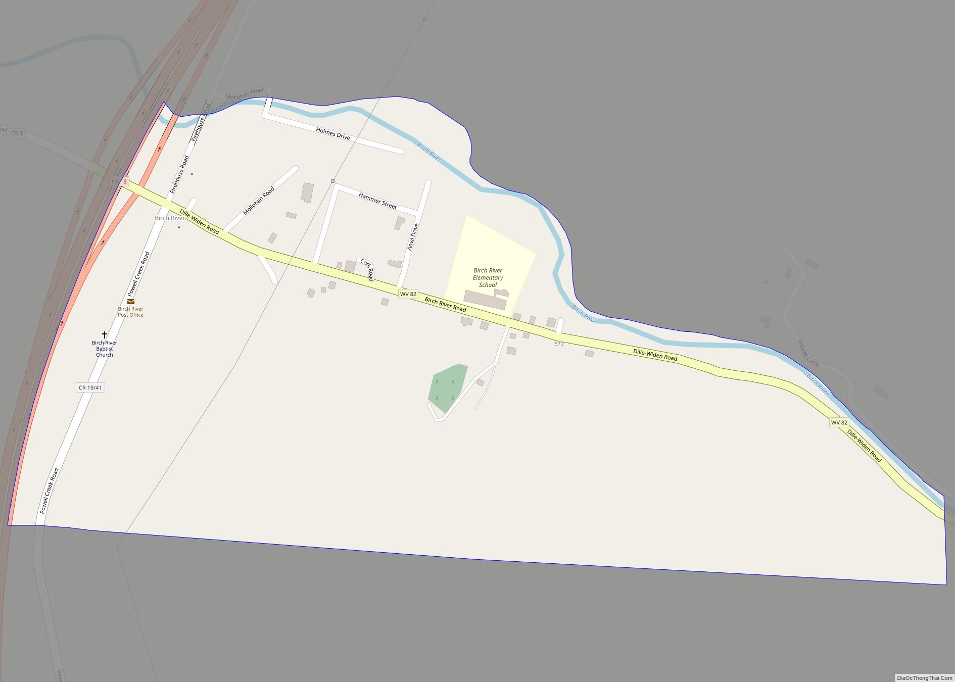
Map of Beech Bottom village

Map of Beech Bottom village

Beech Bottom is a village in Brooke County, West Virginia, United States, situated along the Ohio River. The population was 523 at the 2010 census. It is part of the Weirton–Steubenville metropolitan area. Beech Bottom village overview: Name: Beech Bottom village LSAD Code: 47 LSAD Description: village (suffix) State: West Virginia County: Brooke County Elevation: … Read more

Map of Beckley city

Map of Beckley city

Beckley is a city in and the county seat of Raleigh County, West Virginia, United States. The population was 17,286 at the 2020 census, making it the ninth-largest city in the state. It is the principal city of the Beckley metropolitan area of Southern West Virginia, home to 115,079 residents in 2020. Beckley was founded … Read more

Map of Beaver CDP, West Virginia

Map of Beaver CDP, West Virginia

Beaver is a census-designated place (C.D.P.) in Raleigh County, West Virginia, United States. The population was 1,308 at the 2010 census. Beaver CDP overview: Name: Beaver CDP LSAD Code: 57 LSAD Description: CDP (suffix) State: West Virginia County: Raleigh County Elevation: 2,156 ft (657 m) Total Area: 4.4 sq mi (11.4 km²) Land Area: 4.4 sq mi (11.4 km²) Water Area: 0.0 sq mi (0.0 km²) … Read more

Map of Beards Fork CDP

Map of Beards Fork CDP

Beards Fork is a census-designated place (CDP) and coal town in Fayette County, West Virginia, United States that was founded as a coal town. As of the 2010 census, its population was 199. Beards Fork CDP overview: Name: Beards Fork CDP LSAD Code: 57 LSAD Description: CDP (suffix) State: West Virginia County: Fayette County Elevation: … Read more

Map of Bayard town, West Virginia

Map of Bayard town, West Virginia

Bayard is a town in Grant County, West Virginia, United States. The population was 200 at the 2020 census. Bayard was incorporated in 1893 and named in honor of Thomas F. Bayard, Jr., who later became a United States senator from Delaware (1923–1929). Bayard was founded on the West Virginia Central and Pittsburgh Railroad as … Read more

Map of Bath (Berkeley Springs) town

Map of Bath (Berkeley Springs) town

Bath (Berkeley Springs) town overview: Name: Bath (Berkeley Springs) town LSAD Code: 43 LSAD Description: town (suffix) State: West Virginia County: Morgan County FIPS code: 5404876 Online Interactive Map Bath (Berkeley Springs) online map. Source: Basemap layers from Google Map, Open Street Map (OSM), Arcgisonline, Wmflabs. Boundary Data from Database of Global Administrative Areas. Bath … Read more

Map of Beverly town, West Virginia

Map of Beverly town, West Virginia

Beverly is a town in Randolph County, West Virginia, United States. Founded in 1787, it is the oldest settlement in the Tygart River Valley. It had a population of 628 at the 2020 census. Beverly was the county seat of Randolph County for over a century—from 1790 until 1899—after which the nearby settlement of Elkins … Read more

Map of Bartow CDP, West Virginia

Map of Bartow CDP, West Virginia

Bartow is a census-designated place (CDP) in Pocahontas County, West Virginia, United States. The population was 111 at the 2010 census. Bartow is situated along U.S. Route 250 and West Virginia Route 92 and on the East Fork Greenbrier River, approximately 2 miles (3.2 km) east of Durbin. It has a post office with ZIP code … Read more

Map of Bethlehem village, West Virginia

Map of Bethlehem village, West Virginia

Bethlehem is a village in Ohio County, West Virginia, United States. It is part of the Wheeling, West Virginia Metropolitan Statistical Area. The population was 2,499 at the 2010 census. Bethlehem village overview: Name: Bethlehem village LSAD Code: 47 LSAD Description: village (suffix) State: West Virginia County: Ohio County Elevation: 1,247 ft (380 m) Total Area: 3.54 sq mi … Read more

Map of Bartley CDP, West Virginia

Map of Bartley CDP, West Virginia

Bartley is a census-designated place (CDP) located in McDowell County, West Virginia, United States. It lies along the Norfolk and Western Railroad on the Dry Fork. As of the 2010 census, its population was 224. According to the Geographic Names Information System, Bartley has also been known as Bartlett and Peeryville. Bartley CDP overview: Name: … Read more

Map of Bethany town, West Virginia

Map of Bethany town, West Virginia

Bethany is a town in southern Brooke County, West Virginia, United States. The population was 756 at the 2020 census. It is part of the Weirton–Steubenville metropolitan area. It is best known as the home of Bethany College, a private liberal arts college that was the first institution of higher education in what is now … Read more

Map of Barrackville town

Map of Barrackville town

Barrackville is a town in Marion County, West Virginia, United States. The population was 1,211 at the 2020 census. Barrackville was settled beginning in 1767 by William Galloway “Indian Billy” Ice. The town was named in honor of John Barrack, an early settler. It was incorporated January 25, 1968. Barrackville town overview: Name: Barrackville town … Read more