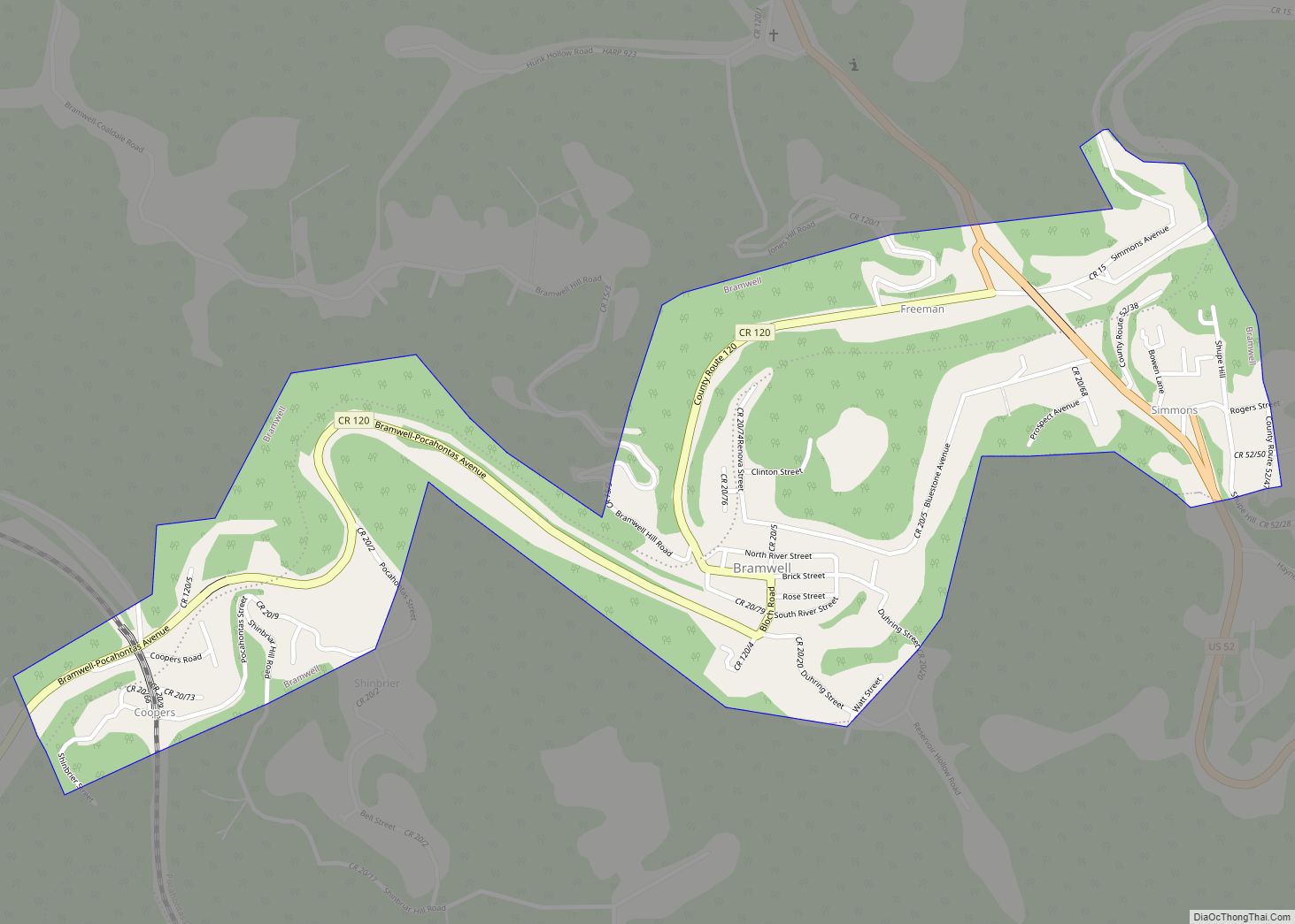
Bramwell is a town in Mercer County, West Virginia, United States, along the Bluestone River. The population was 277 at the 2020 census. It is part of the Bluefield, WV-VA micropolitan area which has a population of 107,578.
| Name: | Bramwell town |
|---|---|
| LSAD Code: | 43 |
| LSAD Description: | town (suffix) |
| State: | West Virginia |
| County: | Mercer County |
| Elevation: | 2,251 ft (686 m) |
| Total Area: | 0.58 sq mi (1.51 km²) |
| Land Area: | 0.56 sq mi (1.44 km²) |
| Water Area: | 0.03 sq mi (0.08 km²) |
| Total Population: | 277 |
| Population Density: | 607.21/sq mi (234.60/km²) |
| ZIP code: | 24715 |
| Area code: | 304, 681 |
| FIPS code: | 5409796 |
| GNISfeature ID: | 1536303 |
Online Interactive Map
Click on ![]() to view map in "full screen" mode.
to view map in "full screen" mode.
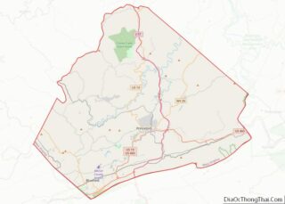
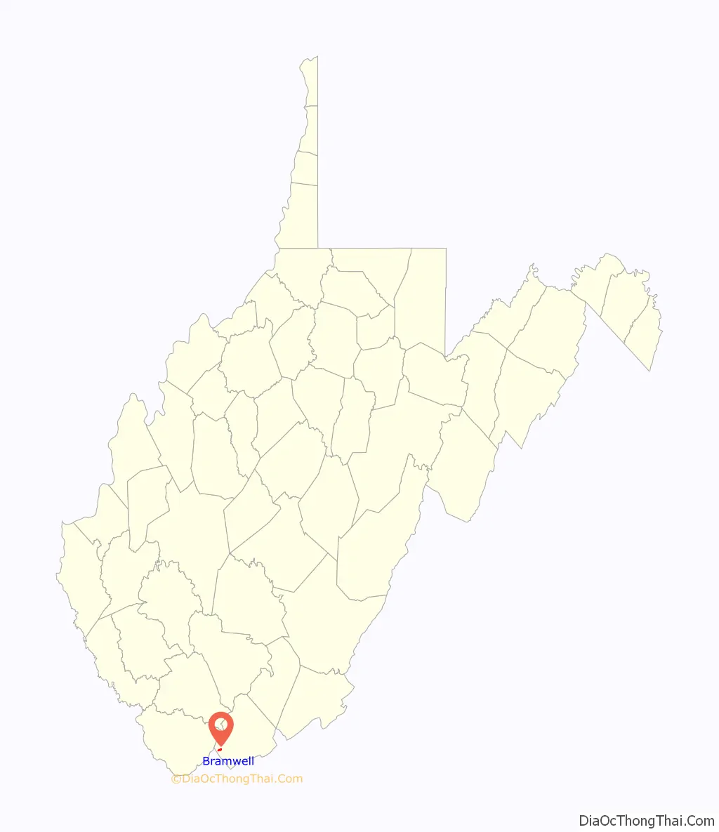
Bramwell location map. Where is Bramwell town?

History
In the 1880s the region around Bramwell began to rapidly grow as a coal mining center with several coal camps operating in the area. The town of Bramwell was officially established in 1888, and was named after J.H. Bramwell, a civil engineer. In the late 1800s the town acquired some notoriety for having the largest number of millionaires per capita in the United States. Numerous large homes were built in the town by wealthy coal operators.
On January 7, 1910, part of the downtown area was destroyed by a major fire. Twenty-one buildings were burned to the ground. In 1984, the town was named to the National Register of Historic Places by the U.S. Department of the Interior. Many of the houses are early 20th century in design. There is a museum largely devoted to the local coal and train history of the area.
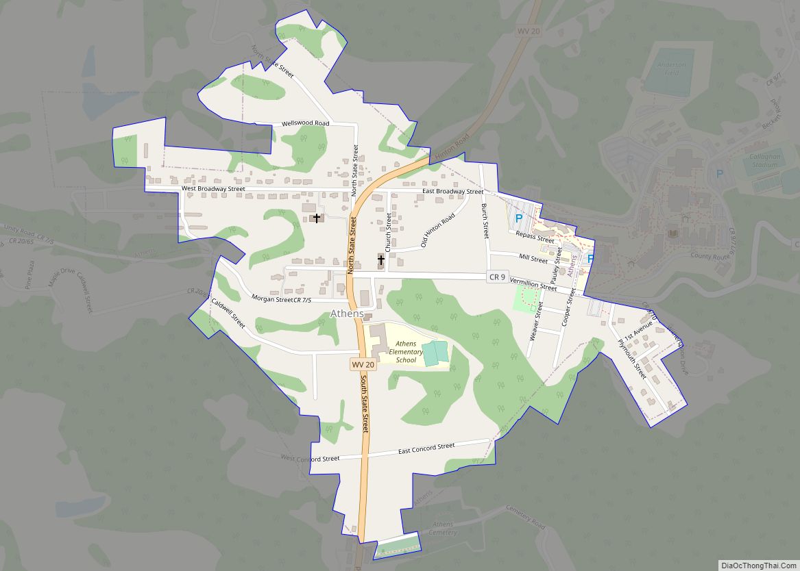
Bramwell Road Map
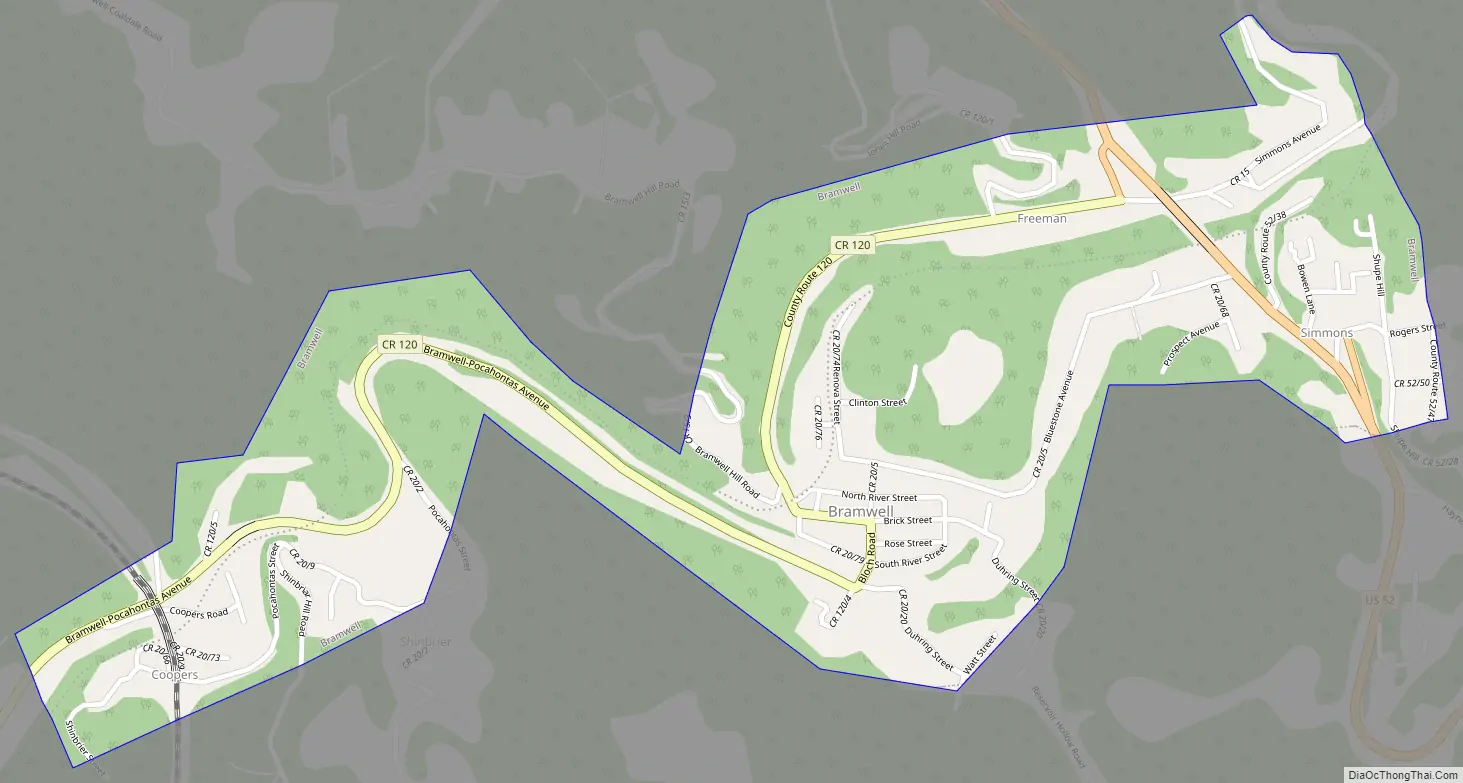
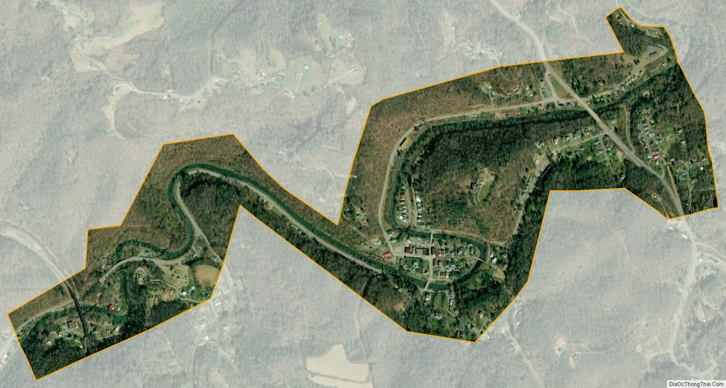
Bramwell city Satellite Map
Geography
Bramwell is located at 37°19′32″N 81°18′45″W / 37.32556°N 81.31250°W / 37.32556; -81.31250 (37.325425, -81.312474). The town is situated along the Bluestone River, just east of the Virginia-West Virginia state line. U.S. Route 52 passes through the eastern part of Bramwell, connecting the town with Bluefield to the south and Northfork the northwest. Pinnacle Rock State Park lies just southeast of Bramwell.
According to the United States Census Bureau, the town has a total area of 0.59 square miles (1.53 km), of which 0.56 square miles (1.45 km) is land and 0.03 square miles (0.08 km) is water.
Bramwell is located 0.3 miles (0.5 km) from an access point to the Pocohontas Trail system, a component of the Hatfield-McCoy trails. The Hatfield-McCoy trails include over 700 miles (1127 km) of primitive roads typically utilized by dirt bikes and All-Terrain Vehicles (ATVs). These trails are managed by the Hatfield-McCoy Regional Trail Authority.
See also
Map of West Virginia State and its subdivision:- Barbour
- Berkeley
- Boone
- Braxton
- Brooke
- Cabell
- Calhoun
- Clay
- Doddridge
- Fayette
- Gilmer
- Grant
- Greenbrier
- Hampshire
- Hancock
- Hardy
- Harrison
- Jackson
- Jefferson
- Kanawha
- Lewis
- Lincoln
- Logan
- Marion
- Marshall
- Mason
- McDowell
- Mercer
- Mineral
- Mingo
- Monongalia
- Monroe
- Morgan
- Nicholas
- Ohio
- Pendleton
- Pleasants
- Pocahontas
- Preston
- Putnam
- Raleigh
- Randolph
- Ritchie
- Roane
- Summers
- Taylor
- Tucker
- Tyler
- Upshur
- Wayne
- Webster
- Wetzel
- Wirt
- Wood
- Wyoming
- Alabama
- Alaska
- Arizona
- Arkansas
- California
- Colorado
- Connecticut
- Delaware
- District of Columbia
- Florida
- Georgia
- Hawaii
- Idaho
- Illinois
- Indiana
- Iowa
- Kansas
- Kentucky
- Louisiana
- Maine
- Maryland
- Massachusetts
- Michigan
- Minnesota
- Mississippi
- Missouri
- Montana
- Nebraska
- Nevada
- New Hampshire
- New Jersey
- New Mexico
- New York
- North Carolina
- North Dakota
- Ohio
- Oklahoma
- Oregon
- Pennsylvania
- Rhode Island
- South Carolina
- South Dakota
- Tennessee
- Texas
- Utah
- Vermont
- Virginia
- Washington
- West Virginia
- Wisconsin
- Wyoming