Buckhannon is the only incorporated city in, and the county seat of, Upshur County, West Virginia, United States, along the Buckhannon River. The population was 5,299 as of the 2020 census. The city is located 60 miles southwest of Morgantown, 115 miles northeast of the capital city of Charleston, and 140 miles south of Pittsburgh, Pennsylvania. Buckhannon is home to West Virginia Wesleyan College and the West Virginia Strawberry Festival, held annually during the third week of May. In 2023, Buckhannon will host The World Association of Marching Show Bands.
| Name: | Buckhannon city |
|---|---|
| LSAD Code: | 25 |
| LSAD Description: | city (suffix) |
| State: | West Virginia |
| County: | Upshur County |
| Elevation: | 1,430 ft (436 m) |
| Total Area: | 2.85 sq mi (7.38 km²) |
| Land Area: | 2.85 sq mi (7.38 km²) |
| Water Area: | 0.00 sq mi (0.00 km²) |
| Total Population: | 5,299 |
| Population Density: | 1,893.30/sq mi (731.03/km²) |
| ZIP code: | 26201 |
| Area code: | 304, 681 |
| FIPS code: | 5411188 |
| GNISfeature ID: | 1536594 |
| Website: | www.buckhannonwv.org |
Online Interactive Map
Click on ![]() to view map in "full screen" mode.
to view map in "full screen" mode.
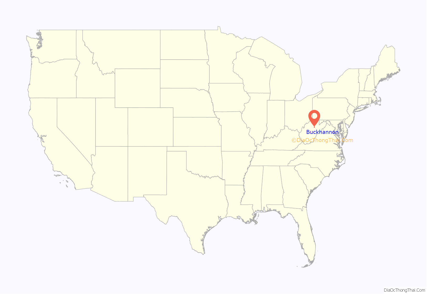
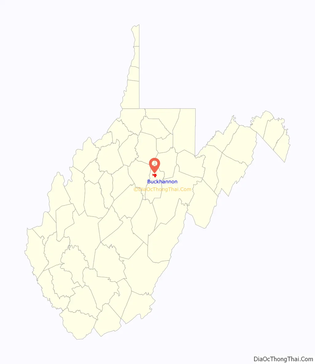
Buckhannon location map. Where is Buckhannon city?
History
According to tradition, the first settlers in the Buckhannon River Valley were brothers John and Samuel Pringle. John and Samuel were soldiers serving in the English army during the French and Indian War (Seven Years’ War) who, in 1761, deserted their posts at Fort Pitt (present-day Pittsburgh, Pennsylvania). They traveled southward and upstream along the Monongahela and Tygart Valley rivers, continuing up what is now called the Buckhannon River. John and Samuel are said to have arrived in present-day Upshur County in 1764 and took up residence in the hollow stump of an American sycamore tree. They lived there for three years, surviving off of game and fish. When they ran out of bullets in 1765, John made the journey to settlements along the South Branch Potomac River to purchase more and found out from the locals that the war was over and the brothers were no longer wanted men. After his return, they moved to the South Branch settlements. John later went to Kentucky, but Samuel returned to the river valley in 1769 with his new wife Charity Pringle (née Cutright), her brother John Jr., friends Thomas Hughes, and John and Elizabeth Jackson with their sons George and Edward. (Edward was the grandfather of Thomas “Stonewall” Jackson).
The City of Buckhannon was established on January 15, 1816, officially named for Buckongahelas (1720-1805), the legendary Lenape Chief. A statue of Buckongahelas and his fallen son, crafted by Buckhannon sculptor Ross Straight, was erected in Buckhannon West Virginia’s Jawbone Park in 2000. The city was chartered by the Virginia General Assembly in 1852, and remained part of the Commonwealth of Virginia until the secession of West Virginia on June 20, 1863 during the American Civil War. Because of its near-central geographic location, Buckhannon was long considered a prospective site for the state capital. In 1866, the legislature approved a bill including Buckhannon among the choices for capital, but officials decided the river was not wide enough to accommodate desired commerce and ultimately settled with Charleston as the state capitol.
The first courthouse was built in 1854. It served multiple functions, including as an opera house and town hall. Electricity was installed in 1891 to replace oil lamps, but the building suffered fire damage in the first six months of electrical service, eventually being razed in 1898. In its place, a Classical Revival style courthouse, designed by Charleston architect Harrison Albright, begun construction in 1899 and was completed in 1901. An annex of the same style was added in 1995. In the cornerstone of the main building is a time capsule filled with turn of the 19th century artifacts.
The Sago Mine Disaster, January 2, 2006, killed 12 and left one survivor. Officials said that a lightning strike in the coal caused the explosion. It was the worst mining disaster in the US since a 2001 disaster in Alabama killed 13 people, and the worst disaster in West Virginia since a 1968 incident that killed 78 people. National and international news crews were in the area for upwards of three days to cover rescue and recovery efforts.
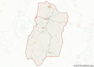
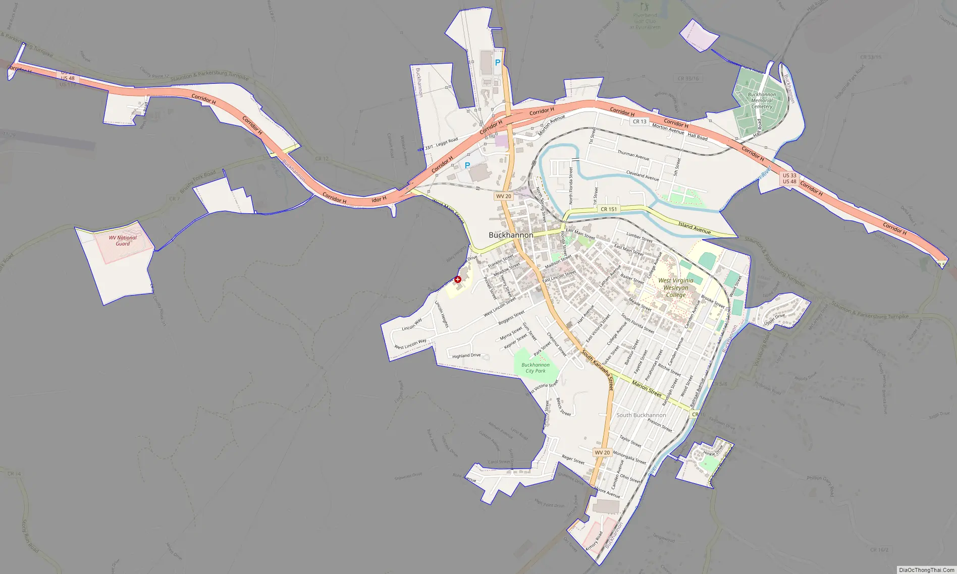
Buckhannon Road Map
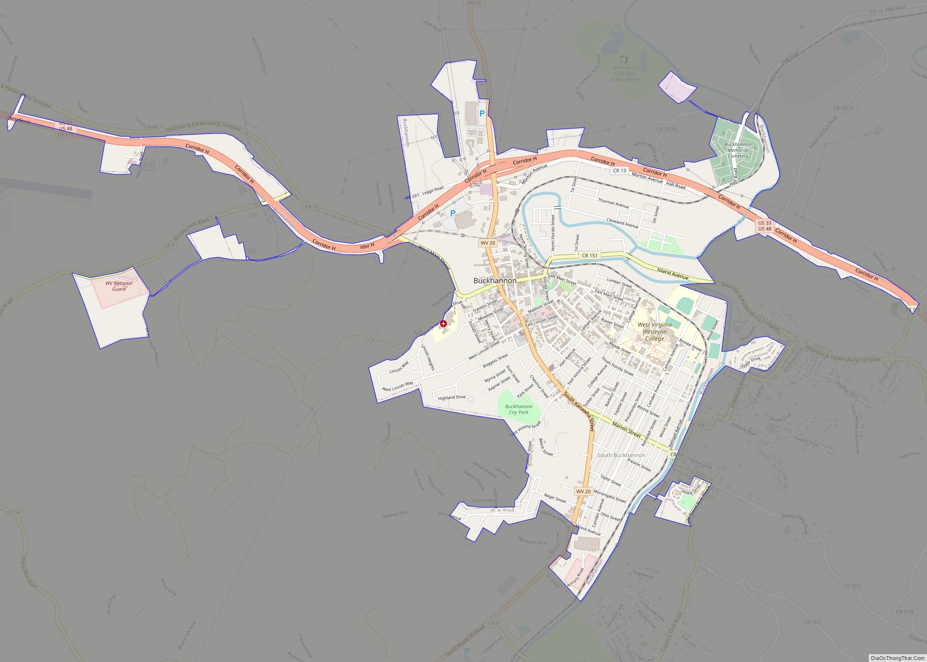
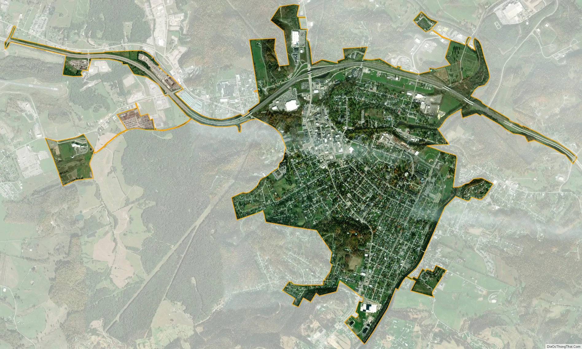
Buckhannon city Satellite Map
Geography
The city lies in the foothills of the Allegheny Mountains. It is in the Mountain Lakes tourism region.
According to the United States Census Bureau, the city has a total area of 2.83 square miles (7.33 km), all land.
Climate
The climate in this area has mild differences between highs and lows, and there is adequate rainfall year-round. According to the Köppen Climate Classification system, Buckhannon has a marine west coast climate.
See also
Map of West Virginia State and its subdivision:- Barbour
- Berkeley
- Boone
- Braxton
- Brooke
- Cabell
- Calhoun
- Clay
- Doddridge
- Fayette
- Gilmer
- Grant
- Greenbrier
- Hampshire
- Hancock
- Hardy
- Harrison
- Jackson
- Jefferson
- Kanawha
- Lewis
- Lincoln
- Logan
- Marion
- Marshall
- Mason
- McDowell
- Mercer
- Mineral
- Mingo
- Monongalia
- Monroe
- Morgan
- Nicholas
- Ohio
- Pendleton
- Pleasants
- Pocahontas
- Preston
- Putnam
- Raleigh
- Randolph
- Ritchie
- Roane
- Summers
- Taylor
- Tucker
- Tyler
- Upshur
- Wayne
- Webster
- Wetzel
- Wirt
- Wood
- Wyoming
- Alabama
- Alaska
- Arizona
- Arkansas
- California
- Colorado
- Connecticut
- Delaware
- District of Columbia
- Florida
- Georgia
- Hawaii
- Idaho
- Illinois
- Indiana
- Iowa
- Kansas
- Kentucky
- Louisiana
- Maine
- Maryland
- Massachusetts
- Michigan
- Minnesota
- Mississippi
- Missouri
- Montana
- Nebraska
- Nevada
- New Hampshire
- New Jersey
- New Mexico
- New York
- North Carolina
- North Dakota
- Ohio
- Oklahoma
- Oregon
- Pennsylvania
- Rhode Island
- South Carolina
- South Dakota
- Tennessee
- Texas
- Utah
- Vermont
- Virginia
- Washington
- West Virginia
- Wisconsin
- Wyoming