Map of Eleanor town
Eleanor is a town in Putnam County, West Virginia, United States, along the Kanawha River. Its population was 1,548 at the 2020 census. It is part of the Huntington–Ashland metropolitan area. The town, named for Eleanor Roosevelt, was established as a New Deal project in the 1930s like other Franklin D. Roosevelt towns around the ... Read more
Map of Eleanor town
Map of Falls View CDP
Falls View is a census-designated place (CDP) in Fayette County, West Virginia, United States. Falls View is located 4 miles (6.4 km) southwest of Gauley Bridge, on the north bank of the Kanawha River. As of the 2010 census, its population was 238. Falls View was established in the early 20th century as a residential village ... Read more
Map of Falls View CDP
Map of Falling Waters CDP
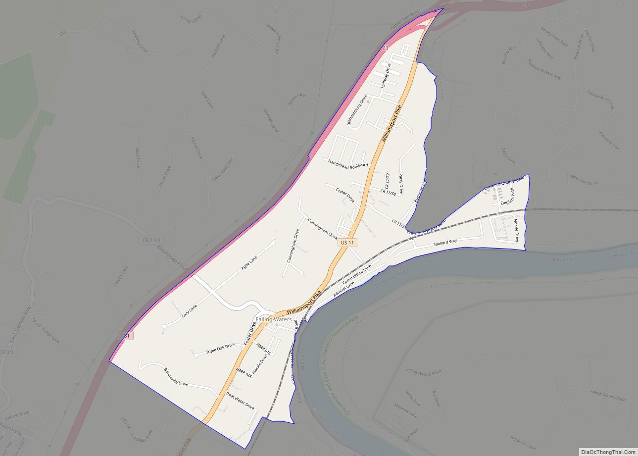
Falling Waters is a census-designated place (CDP) on the Potomac River in Berkeley County, West Virginia, United States. It is located along Williamsport Pike (US 11) north of Martinsburg. According to the 2010 census, Falling Waters has a population of 876. An 1887 Scientific American article claimed that the first U.S. railroad was built in ... Read more
Map of Falling Waters CDP
Map of Fairlea CDP
Fairlea is a census-designated place (CDP) in Greenbrier County, West Virginia, United States. The population was 1,747 at the 2010 census. Fairlea is the location of the annual West Virginia State Fair, held in August. Fairlea CDP overview: Name: Fairlea CDP LSAD Code: 57 LSAD Description: CDP (suffix) State: West Virginia County: Greenbrier County Elevation: ... Read more
Map of Fairlea CDP
Map of Franklin town, West Virginia
Franklin is a town in and the county seat of Pendleton County, West Virginia, United States. The population was 486 at the 2020 census. Franklin was established in 1794 and named for Francis Evick, an early settler. Franklin town overview: Name: Franklin town LSAD Code: 43 LSAD Description: town (suffix) State: West Virginia County: Pendleton ... Read more
Map of Franklin town, West Virginia
Map of Glen White CDP
Glen White is a census-designated place (CDP) in Raleigh County, West Virginia, United States. Glen White is located on state routes 54 and 97, 1 mile (1.6 km) southeast of Lester. Glen White had a post office (now closed) with ZIP code 25849. As of the 2010 census, its population is 266. The community derives its ... Read more
Map of Glen White CDP
Map of Glen Jean CDP
Glen Jean is a census-designated place (CDP) in Fayette County, West Virginia, United States, near Oak Hill. As of the 2010 census, its population is 210. The area had been known as White Oaks, but when the town was founded in the early 1870s the community was named for Jean McKell, the wife of landowner ... Read more
Map of Glen Jean CDP
Map of Fort Gay town
Fort Gay is a town in Wayne County, West Virginia, United States, situated along the Tug Fork and Big Sandy rivers. The town adjoins Louisa, Kentucky. The population was 677 at the 2020 census. Fort Gay town overview: Name: Fort Gay town LSAD Code: 43 LSAD Description: town (suffix) State: West Virginia County: Wayne County ... Read more
Map of Fort Gay town
Map of Glen Ferris CDP
Glen Ferris is a census-designated place (CDP) on the western bank of the Kanawha River in Fayette County, West Virginia, United States. It is situated approximately one mile south of the town of Gauley Bridge and adjacent to Kanawha Falls. The sole highway linking Glen Ferris to the area is U.S. Route 60, known also ... Read more
Map of Glen Ferris CDP
Map of Glasgow town, West Virginia
Glasgow is a town in Kanawha County, West Virginia, United States, situated along the Kanawha River. The population was 708 at the 2020 census. Glasgow was incorporated on June 20, 1920. Folk etymology derives its name from a combination of the word “glass” with the word “company” for a glass factory that was built there ... Read more
Map of Glasgow town, West Virginia
Map of Gassaway town
Gassaway is a town in Braxton County, West Virginia, United States. The population was 769 at the 2020 census. Gassaway was incorporated in 1905 and named for Henry Gassaway Davis, the Democratic Party’s nominee for Vice President of the United States in 1904. The center of population of West Virginia is located approximately 7 miles ... Read more
Map of Gassaway town
Map of Galloway CDP
Galloway is a census-designated place (CDP) and coal town in northwestern Barbour County, West Virginia, United States. It lies along West Virginia Route 76 northwest of the city of Philippi, the county seat of Barbour County. Its elevation is 1,073 feet (327 m). It has a post office with the ZIP code 26349. As of the 2010 ... Read more
Map of Galloway CDP